
Kīlauea’s summit crater, Halemaʻumaʻu, has collapsed, filled with water, turned into a lava lake and now fountains in repeated episodes. USGS forecasts the next episode, number 57, for November 21-25. The landmarks and measurements below trace how the crater and the volcano around it reached this point, from the 2018 collapse to the current recharge.
Read next on Morning Overview: A dangerous unpatched Windows exploit is now public and can hand attackers full control
Kīlauea episode 56: Six Hours of Fire
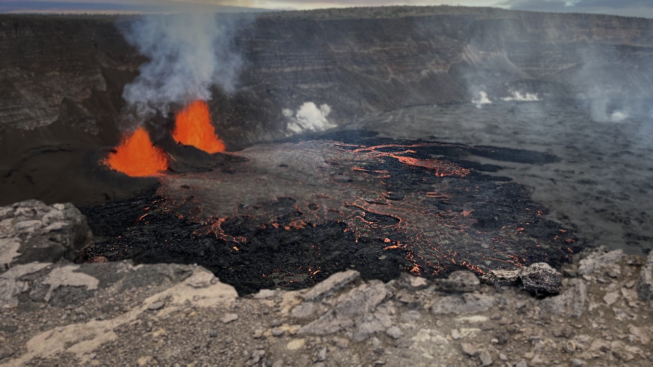
On November 5, the 56th fountaining episode ran for about six hours, according to a news report on episode 56 of the USGS update, and fountains from the north vent reached about 660 feet. That height puts the display well above the crater rim and makes it a measurable benchmark for the episodes that follow.
Each episode ends as abruptly as it starts, so the 660-foot figure describes a short burst rather than a lasting eruption. Visitors and residents treat each pulse as a discrete event, with the gap between pulses used to judge when the next one is due.
Uēkahuna: Tilt Before the Fountain
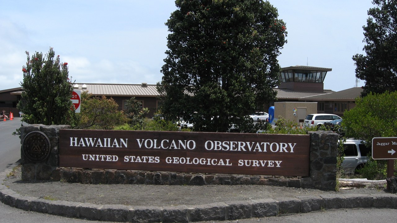
The Uēkahuna tiltmeter has recorded about 13 microradians of inflation since episode 56, which tiltmeter reading reads as a sign that magma is refilling the shallow reservoir beneath the summit. Tiltmeters measure how the ground surface tilts as the reservoir swells, so a steady climb means pressure is rebuilding.
Uēkahuna sits on the crater rim, a long-used monitoring point for the summit. Rising tilt does not set the exact hour of the next fountain, but it is the main signal behind the forecast windows that scientists publish between episodes.
Halemaʻumaʻu crater: The Crater That Sank
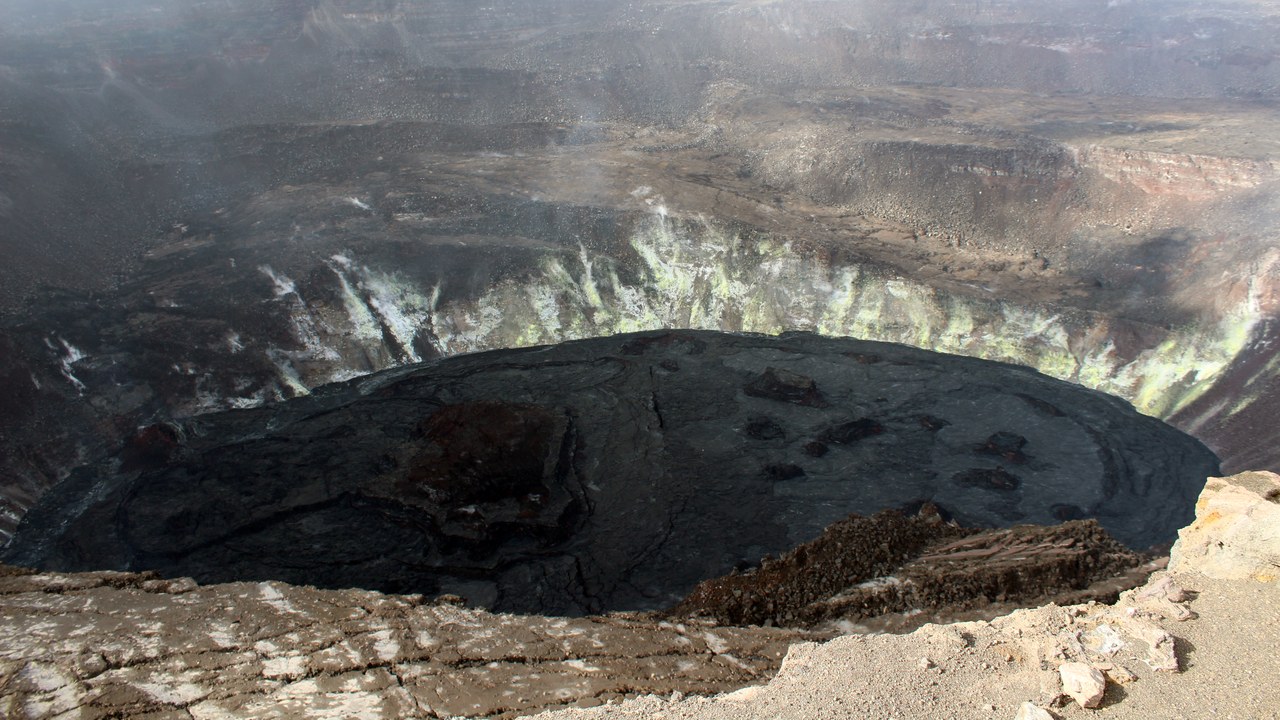
By the end of the 2018 eruption, Halemaʻumaʻu had sunk by 1,600 feet and its diameter more than doubled, as the crater sank 1,600 feet in the National Park Service account describes. The summit floor dropped as magma drained away toward the volcano’s east flank.
The collapse reshaped the summit into a far deeper and wider bowl than the one visitors knew before 2018. Today’s fountains play out on the floor of that enlarged crater, which is why the 2018 numbers frame everything that has happened since.
Halemaʻumaʻu water lake: A Lake That Lasted Over a Year
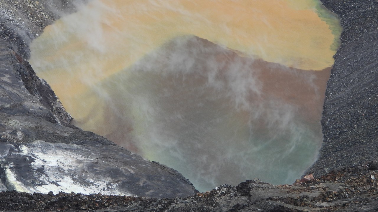
USGS scientists confirmed a growing pond of water in the crater on August 1, 2019, and it eventually reached about 160 feet deep, the first lake of water recorded at Kīlauea in modern history. It persisted until December 20, 2020, when an eruption began inside Halemaʻumaʻu and the water was soon vaporized.
Within one week of that eruption starting, the water lake had been replaced by a lava lake nearly 600 feet deep. The sequence capped a remarkable stretch at the summit, which had lost its nearly decade-old lava lake in the 2018 collapse only a year before the water appeared.
Puʻu ʻŌʻō: The Cone That Built Itself
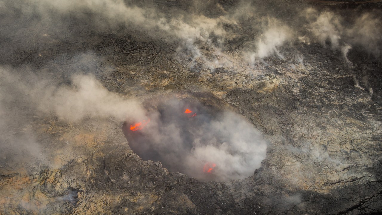
Lava fountains at the Puʻu ʻŌʻō vent quickly built up into the cone of the same name, sending flows downslope, as the Kīlauea Wikipedia entry on Kīlauea notes. The vent sits on the volcano’s east rift zone, away from the summit crater.
Puʻu ʻŌʻō was the long-running centre of activity on the flank before the 2018 collapse ended that phase. It illustrates the other side of Kīlauea’s behaviour: eruptions from the rift, as opposed to the summit episodes now in the news.
Kīlauea Iki: The 1959 Template
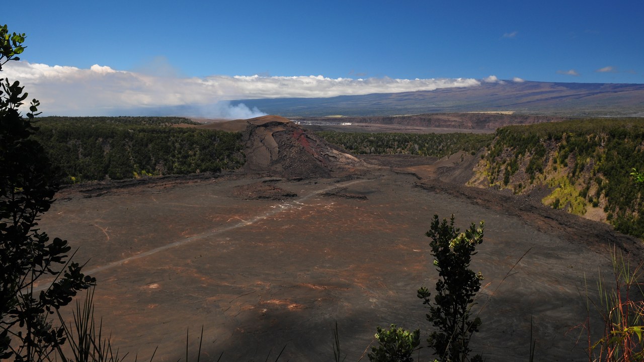
The summit’s current short bursts are very similar to the fountaining episodes at Kīlauea Iki in 1959, according to the Wikipedia’s Kīlauea entry on Kīlauea. That comparison links today’s paroxysmal pulses to a well-studied earlier eruption.
Kīlauea Iki is a crater adjacent to the main summit caldera, and its 1959 activity serves as the reference case for episodic fountaining. Readers wondering what the current pattern could look like can look to that earlier record. Kīlauea Iki sits beside the main summit caldera, and its 1959 activity remains the standard reference for episodic fountaining at Kīlauea.
Lower Puna eruption of 2018: Fissures in Lower Puna
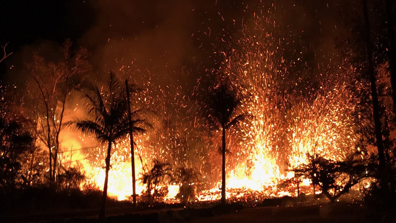
On May 3, 2018, new fissures formed and lava began erupting in lower Puna after a magnitude 5.0 earthquake earlier that day, according to the Wikipedia’s Kīlauea entry on Kīlauea. The activity moved the eruption from the summit region far down the volcano’s east rift zone.
The lower Puna eruption ran in parallel with the summit collapse described earlier, as magma left the reservoir and surfaced miles away. It remains the clearest example of how events at the summit and on the flank are connected.
Hawaiʻi Volcanoes National Park: A World Heritage Park
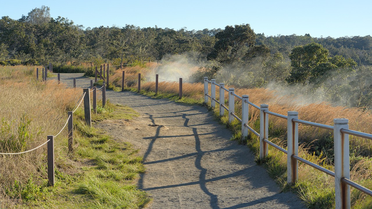
The park surrounding Kīlauea is a World Heritage Site and a major tourist destination, attracting roughly 2.6 million visitors annually according to the Kīlauea entry on Wikipedia on Kīlauea. Its trails and overlooks put large numbers of people near an active volcano.
That visitor volume explains why eruption forecasts matter beyond science. Overlooks, trails and road access can change with volcanic conditions, so checking current park notices before a trip is part of planning a visit. Park notices and USGS updates are the usual way to see which areas are open.
Pele’s hair: Glass Strands on the Wind
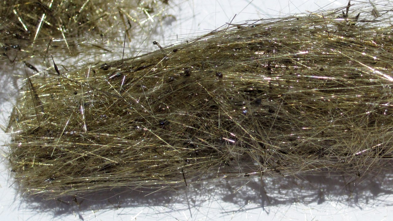
During episode 56, most tephra fell to the southwest into a closed area of the park, while fine ash and Pele’s hair, thin strands of volcanic glass, fell along Highway 11 west of the summit, Nature World News reported. One frothy fragment collected afterward was more than 20 inches long.
The strands can irritate eyes and skin and can collect in rain catchment water systems, so households on catchment are advised to check their systems after tephra falls. The park lists falling tephra among its hazards and advises visitors to bring eye protection and wear long sleeves and pants.
Episode 57 forecast: Forecast for Episode 57
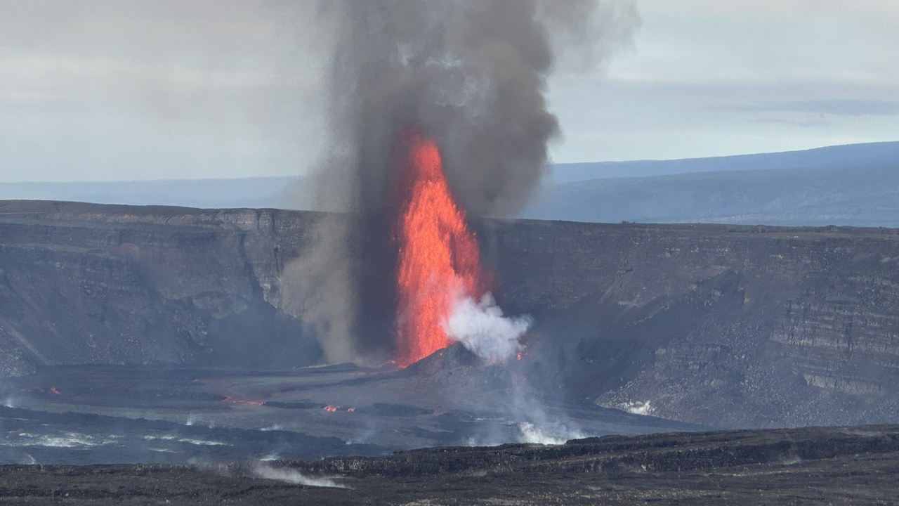
USGS forecasts the next fountaining episode for November 21-25, according to its Episode 57 forecast for Kīlauea. The 57th episode would follow the 56th on November 5 and the refilling shown by the summit tilt record.
Forecast windows are estimates that scientists revise as new tilt, gas and seismic data come in, so the episode could begin earlier or later than the range. Checking the USGS page directly gives the current status. A forecast describes likelihood over a range of days, not a promised start time, and the actual episode can begin outside that range.
More from Morning Overview
