
In June 1991 a little-known volcano on the Philippine island of Luzon produced one of the largest eruptions of the past century. Its ash buried an American air base, its mudflows kept destroying towns for years, and its summit became a lake. Here is what Mount Pinatubo’s blast left behind, from a crater lake to a church half sunk in mud.
Read next on Morning Overview: A $1 billion gas plant planned for Superior, Wisconsin, has been abandoned
Mount Pinatubo: The Mountain Few Noticed
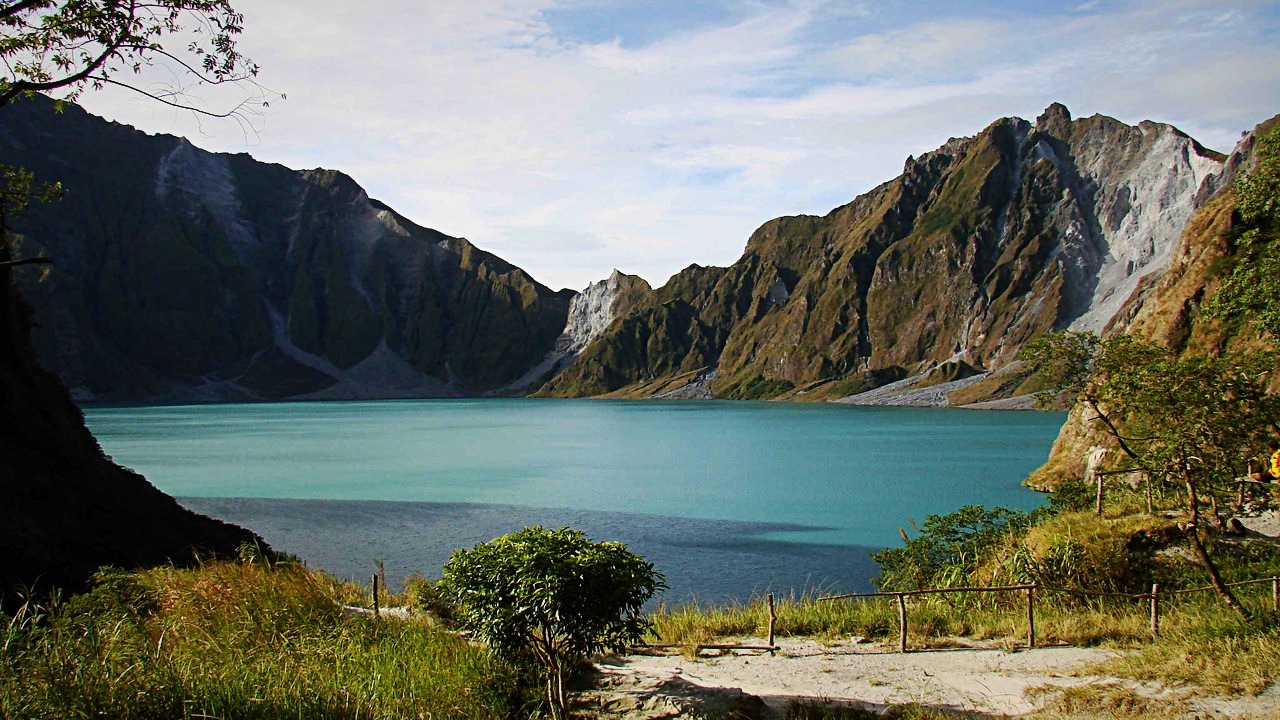
Before 1991, Mount Pinatubo barely stood out, rising only about 600 meters above nearby plains, and most people were unaware of its eruptive history. Its VEI-6 eruption on June 15, 1991 became the second-largest land eruption of the 20th century.
The blast released roughly 10 billion tonnes of magma and threw more particulate into the stratosphere than any eruption since Krakatoa in 1883. A global layer of sulfuric acid haze followed, and global temperatures dropped by about 0.5 degrees Celsius from 1991 to 1993. The eruption also coincided with Typhoon Yunya, which brought a dangerous mix of ash and rain to nearby towns.
Lake Pinatubo: A Summit Turned to Water
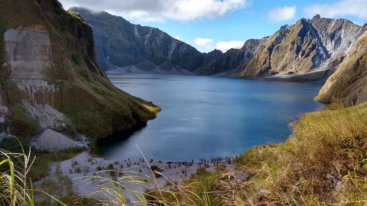
The eruption removed so much rock from beneath the volcano that its summit collapsed into a caldera about 2.5 kilometers wide. Annual monsoon rains then filled it, forming the crater lake now called Lake Pinatubo.
At first the water was hot and highly acidic, around 40 degrees Celsius with a pH as low as 2. The lake deepened by about a meter a month on average, swallowing a lava dome that had grown into an island, until fears about unstable crater walls led the government to order a controlled draining in September 2001. Workers cut a notch in the rim and drained about a quarter of the lake.
Clark Air Base: An Air Base in the Blast Zone
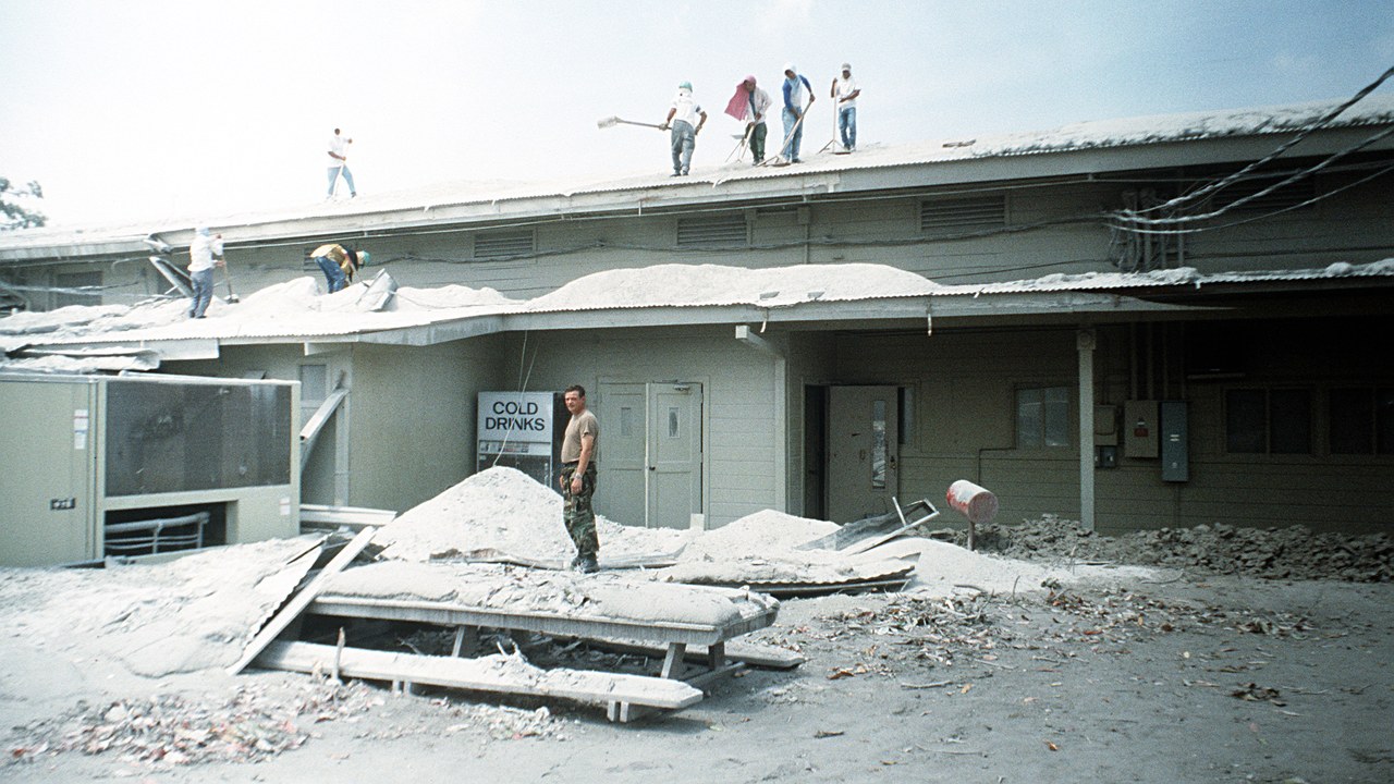
Clark Air Base sprawled over nearly 10,000 acres only 9 miles east of the summit. Early on June 10, 1991, facing a growing lava dome and rising ash emissions, 15,000 nonessential personnel and dependents were evacuated by road.
The unrest had begun with small steam explosions on April 2. A joint team from the USGS and the Philippine Institute of Volcanology and Seismology then installed seismic stations and tiltmeters and measured sulfur dioxide, giving commanders and officials time to carry out evacuations 48 hours before the catastrophic blast. Ash later blanketed buildings across the base.
Subic Bay: Shelter 25 Miles Away
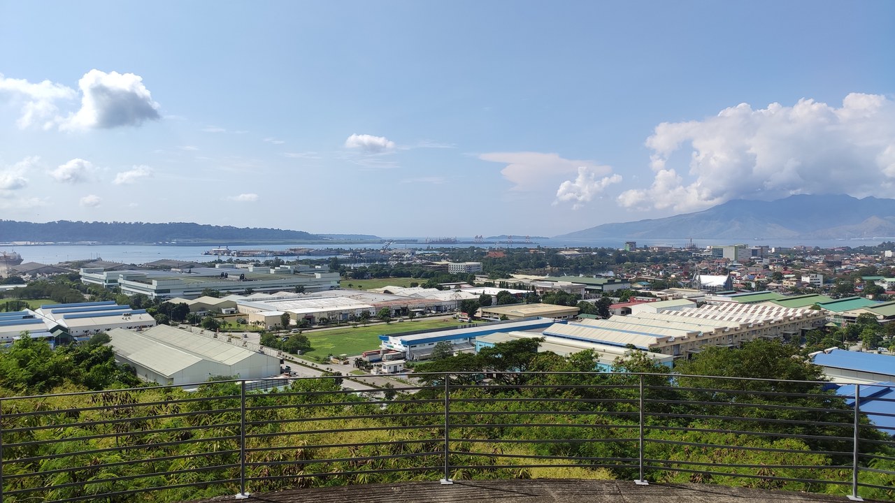
The evacuees from Clark were sent to Naval Station Subic Bay, 25 miles (40 kilometers) away, along with neighboring Naval Air Station Cubi Point.
Subic Bay lay about 37 kilometers south of Pinatubo, far enough to escape the worst of the pyroclastic surges that raced down nearby river valleys. The skies were not safe, either: at least 17 commercial jets inadvertently flew through the drifting ash cloud, sustaining about $100 million in damage, according to the USGS. The move kept thousands of people well outside the danger zone.
Novarupta: Second Only to Alaska
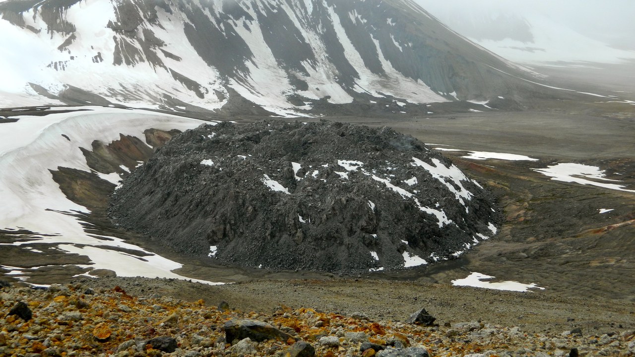
Pinatubo’s blast ranks as the second-largest terrestrial eruption of the 20th century. The only bigger one was the 1912 eruption of Novarupta in Alaska.
Pinatubo has a violent past of its own. Geologists say the modern volcano was born around 79,000 BC in cataclysmic eruptions of an ancestral mountain, estimated at five times larger than the 1991 event, and the old volcano’s walls still outline a caldera about 3.5 by 4.5 kilometers wide. In 1991, eruption columns rose more than 19 kilometers into the sky.
Lahar: Rivers of Mud
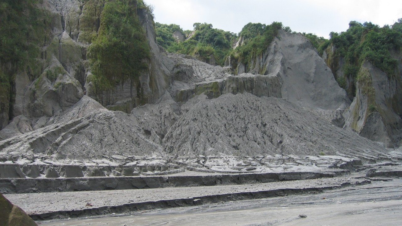
The eruption deposited more than 1 cubic mile (5 cubic kilometers) of ash and rock fragments on Pinatubo’s slopes. Within hours, heavy rains began washing the debris into the lowlands as giant, fast-moving mudflows called lahars.
Over the next four rainy seasons, lahars carried about half of those deposits off the volcano, causing even more destruction in the lowlands than the eruption itself, according to the USGS. The flows kept burying farmland and towns long after the ash had stopped falling, and they reshaped the river valleys around the mountain.
San Guillermo Parish Church (Bacolor): A Church Half Buried
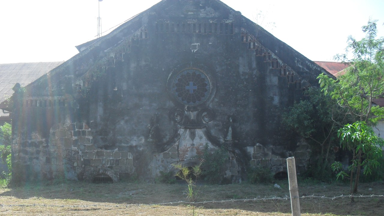
In the town of Bacolor, Pampanga, a lahar on September 3, 1995 buried San Guillermo Parish Church to half its 12-meter height and forced more than 50,000 residents to evacuate to resettlement areas.
The church, first built by Augustinian friars in 1576, stayed in use as a place of worship anyway. Only half of its original facade can still be seen above the mud. Townspeople carefully excavated the ornately carved main and side altars and restored them, along with centuries-old statues saved from the lahar.
Naval Air Station Cubi Point: Where the Evacuees Waited
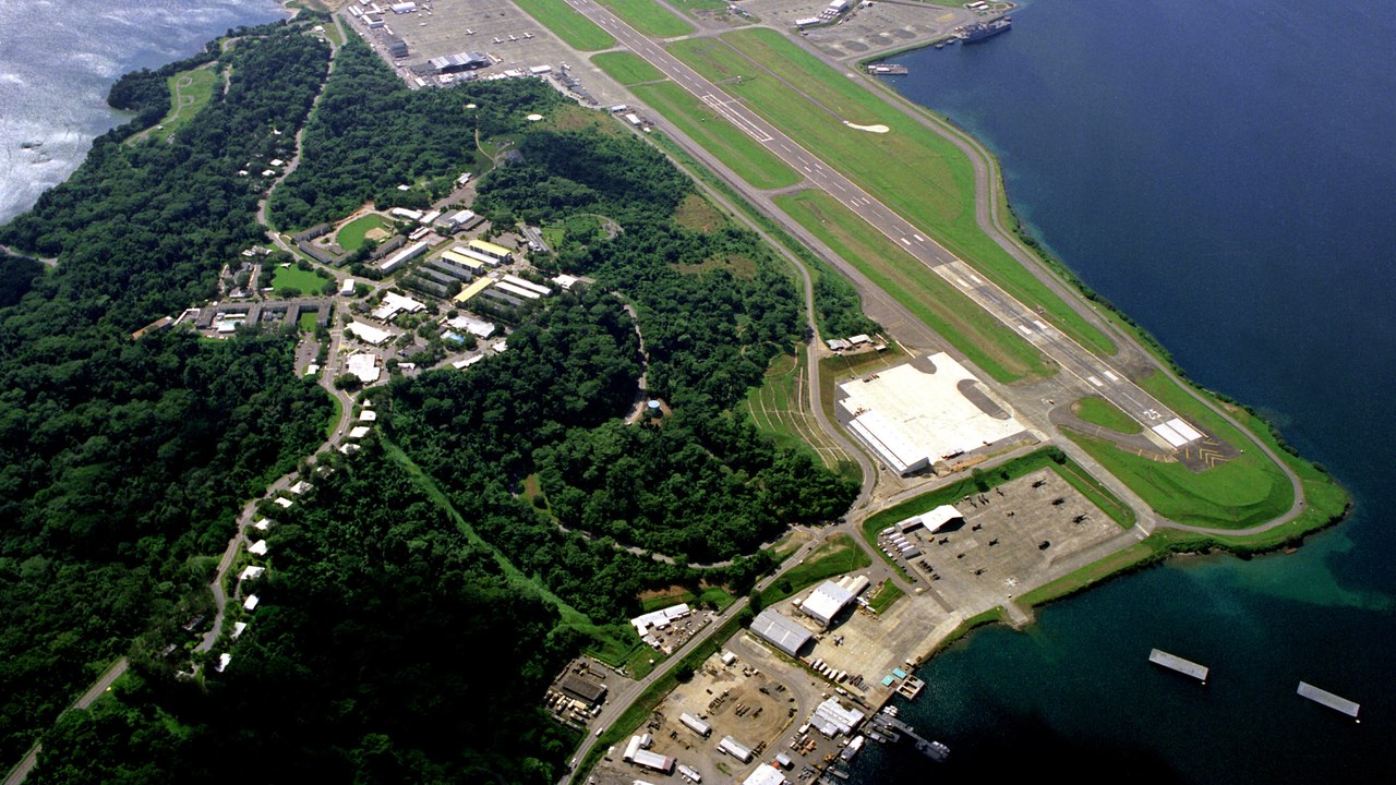
Naval Air Station Cubi Point, on Subic Bay, was one of the two bases chosen to take in Clark’s evacuees as Pinatubo built toward its climax.
Looking back in 2016, the USGS called the June 15 blast the world’s largest volcanic eruption in the past 100 years. The agency credited the joint forecasting effort with saving more than 5,000 lives and $250 million in property by giving enough warning to evacuate local residents and the American base in time. The evacuation itself had been carried out 48 hours before the first big ash eruption.
More from Morning Overview
- Zero Motorcycles unveiled an electric motorcycle targeted at under $8K and a street-legal dirt bike at EICMA
- New FCC rules on how people can stop robocalls and texts take effect Nov. 25
- Neanderthals in Spain carved a wooden object that matches nothing archaeologists have ever found
- The FAA wants $2.39 million from a flight school it says flew a Cessna about 280 times with an unapproved part
