
Dams built across major US rivers hold back reservoirs that supply drinking water, irrigation, flood control and electricity to millions of people. Some rise as sheer concrete arches through desert canyons, while others are earthen embankments stacked hundreds of feet across a mountain valley. Here are eight of the tallest dams in the United States, each built for a different river system and a different purpose.
1. Hoover Dam: Colorado River Icon
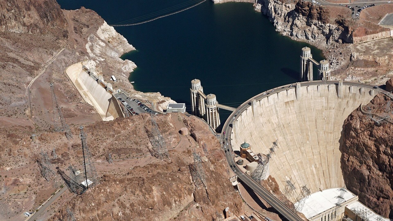
Perched on the Colorado River, Hoover Dam rises 726 feet as an arch-gravity structure that curves its concrete mass into the canyon walls on both sides. The design lets the dam lean on the surrounding rock for support rather than relying on sheer weight alone, a method the Bureau of Reclamation still highlights on its own project pages.
The dam still generates hydroelectric power and helps manage water delivery for cities and farms across the Southwest, functions that keep it central to regional infrastructure planning decades after construction. Its scale made it one of the defining engineering projects of its era, and the structure remains a benchmark other US dams are still measured against.
2. Glen Canyon Dam: Wall Behind Lake Powell
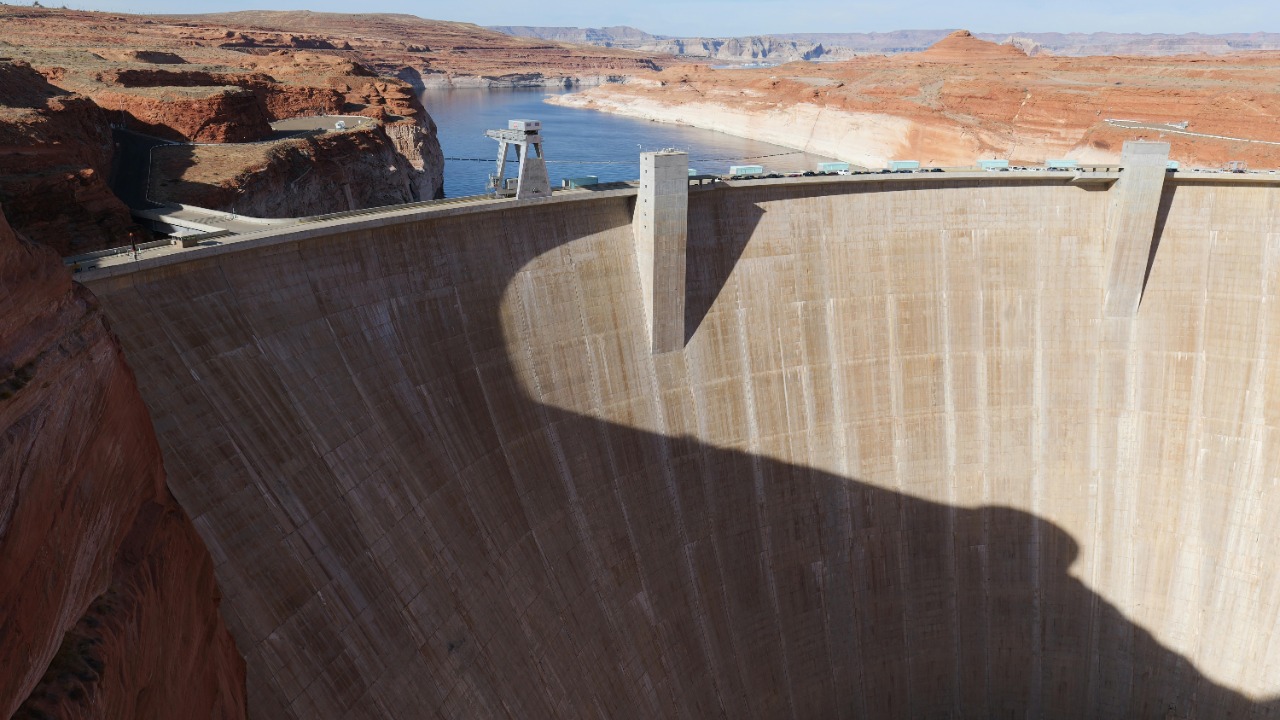
A 710-foot concrete wall across the Colorado River, Glen Canyon Dam backs up the reservoir known as Lake Powell, which spreads for miles through the surrounding red-rock canyons. The federal reclamation agency that built and still operates the dam manages it as part of a chain of Colorado River storage projects.
Boaters and anglers use the reservoir for recreation, while the dam’s hydropower plant sends electricity across a wide stretch of the Southwest. Because the structure sits far from any major city, most travelers only glimpse it while crossing the highway bridge that spans the canyon just downstream of the dam itself.
3. Oroville Dam: America’s Tallest Dam
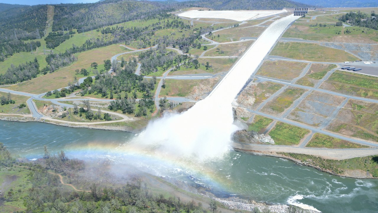
At 770 feet, Oroville Dam is the tallest dam in the United States, an earthfill embankment that spans the Feather River in Northern California. A long concrete spillway carries floodwater from the reservoir down to the river below, the same structure pictured on the dam’s Wikipedia entry.
The dam anchors California’s State Water Project, feeding a reservoir that stores water later released to farms and cities well beyond the surrounding foothills. Because the lake level swings sharply between wet and dry years, the exposed shoreline around it changes dramatically from one season to the next.
4. Dworshak Dam: Idaho’s Concrete Giant
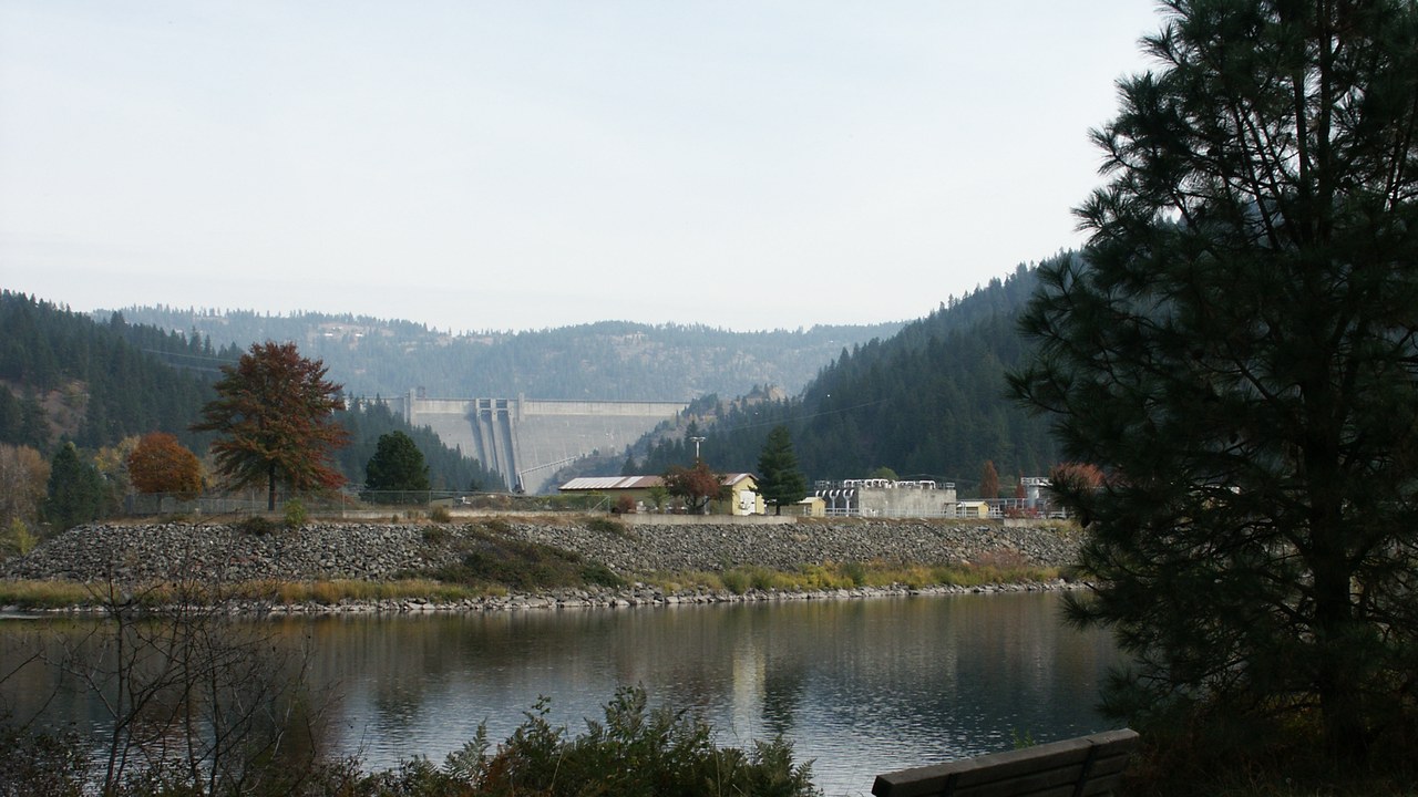
Dworshak Dam climbs 717 feet above its foundation, making it one of the tallest concrete gravity dams built anywhere in the country. Unlike an arch dam that curves against canyon walls for support, a gravity dam like this one relies on its own enormous mass of poured concrete to hold back the reservoir, a design detailed on the dam’s reference page.
The reservoir it creates winds for miles through forested hills in north-central Idaho, feeding a hydroelectric powerhouse built into the base of the dam. Because the site sits far from any major population center, most visitors come specifically for the reservoir’s fishing and boating rather than passing through on the way to somewhere else.
5. New Bullards Bar Dam: Sierra Foothills Wall
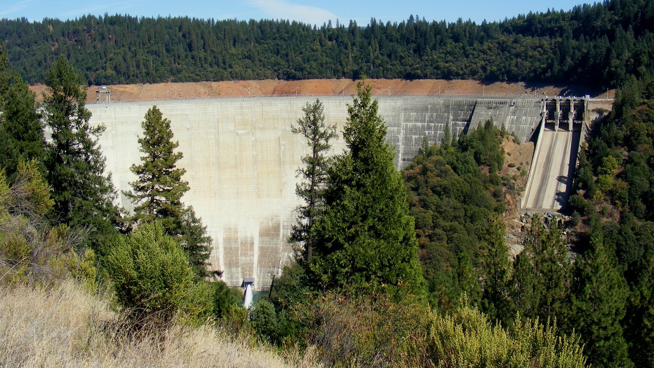
New Bullards Bar Dam reaches 645 feet above the Yuba River in the Sierra Nevada foothills of Northern California, holding back one of the region’s larger reservoirs. The lake supplies water storage and hydroelectric generation for the local water agency, a role described on the dam’s background page.
Boaters use the reservoir throughout the summer, and the dam’s powerhouse sends electricity to the regional grid whenever water levels allow it to run. Because the lake sits in a rural stretch of the Sierra foothills, it draws far fewer visitors than reservoirs closer to major highways, despite its place among the tallest dams in the state.
6. Grand Coulee Dam: Biggest Power Producer
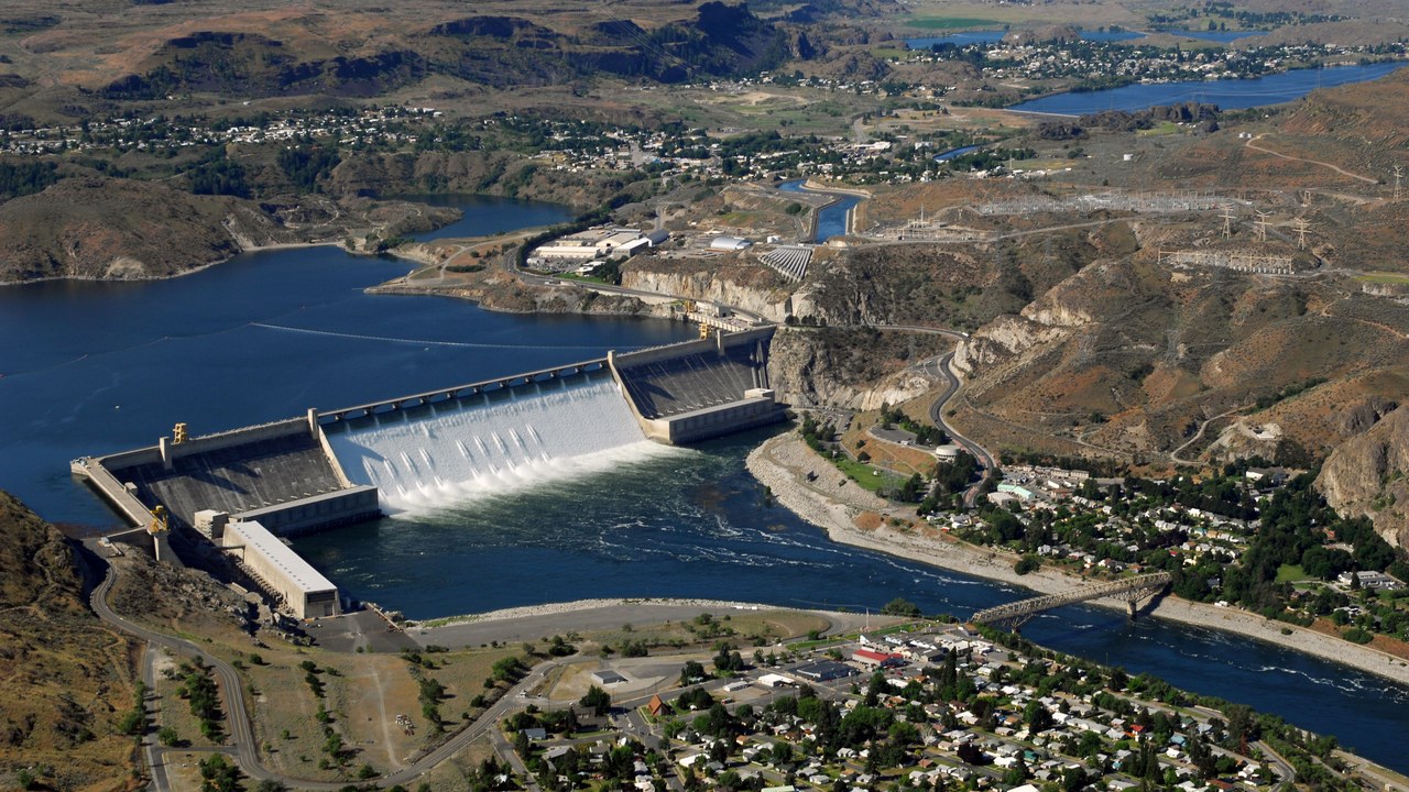
Grand Coulee Dam stands 550 feet tall on the Columbia River in Washington state, and its hydroelectric plant produces more electricity than any other power facility in the country. The dam’s scale reflects the sheer volume of water the Columbia carries compared with most other US rivers, a fact laid out on its Wikipedia page.
The dam irrigates a wide stretch of farmland in central Washington through an extensive canal system, turning what was once dry scrubland into productive cropland. Because the facility predates most modern dams by decades, its control room and generating equipment have been upgraded repeatedly to keep pace with today’s power grid.
7. Shasta Dam: Curve Over the Sacramento
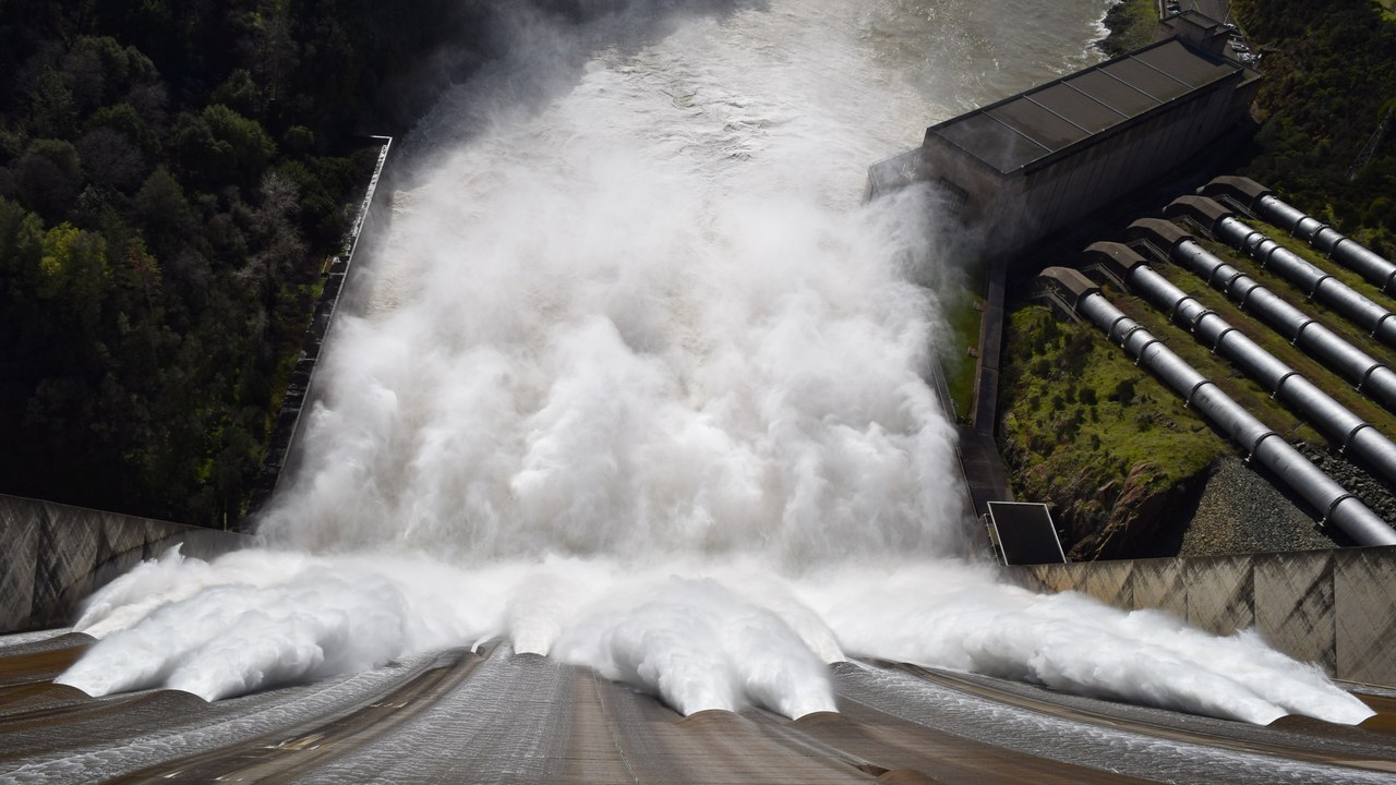
Shasta Dam spans the Sacramento River in northern California at a height of 602 feet, curving slightly so the structure resists water pressure through both its own mass and a gentle arch. The reservoir it forms, Shasta Lake, ranks among the largest in the state, a detail confirmed on the dam’s Wikipedia page.
During periods of heavy snowmelt, water released from the dam’s outlets forms a dramatic spray plume that has become one of the more photographed sights on the reservoir. The dam also anchors flood control and water supply operations for the Central Valley, releasing water downstream according to seasonal targets rather than a fixed schedule.
8. Seven Oaks Dam: Flood Control Without a Lake
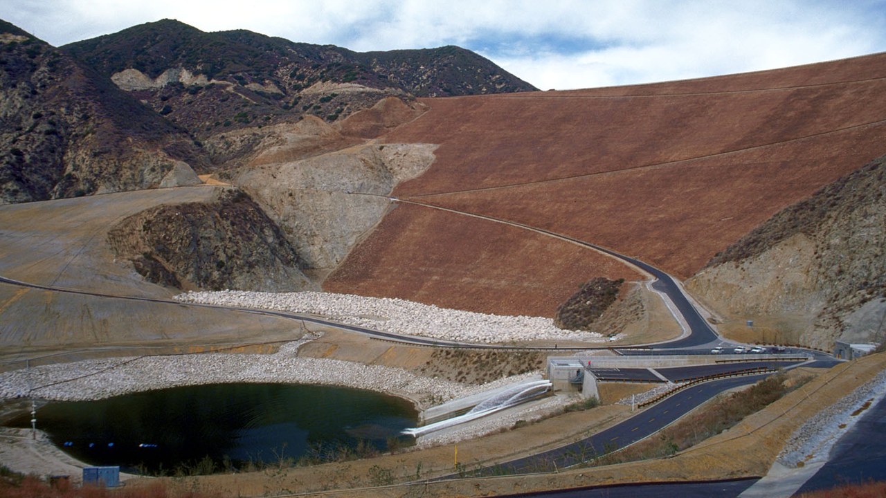
Built purely for flood control, Seven Oaks Dam measures 550 feet from base to crest in the San Bernardino Mountains foothills of Southern California, holding back storm runoff rather than storing water or generating power. Its earthen embankment and riprap-covered face protect downstream communities along the Santa Ana River during major storms, a purpose explained on the dam’s Wikipedia page.
Because the dam holds back water only during floods, its basin sits mostly dry for most of the year, and the surrounding hills stay open to hikers and off-road users when conditions allow. The design reflects a shift toward dry flood-control basins in fast-growing Southern California, where water storage mattered less than protecting downstream neighborhoods.
More from Morning Overview
- A handful of SUVs keep hitting 300,000 miles, and they share one engine trait
- Supplements now rank as the fifth-leading cause of death from liver disease.
- A study names the one SUV most likely to reach 250,000 miles
- More than 60,000 people flee the Spokane area as complex fires overrun 600 structures
