
Some landscapes look as if someone arranged them on purpose: perfect columns, giant stone balls and rocks that seem to slide across the desert by themselves. Many of them sparked fierce arguments among scientists, and a few still do. Here are ten rock landscapes that have surprised geologists, along with what researchers have learned about each one.
Read next on Morning Overview: A handful of car transmissions are so tough that mechanics say they almost never die
1. Racetrack Playa: The Rocks That Move on Their Own
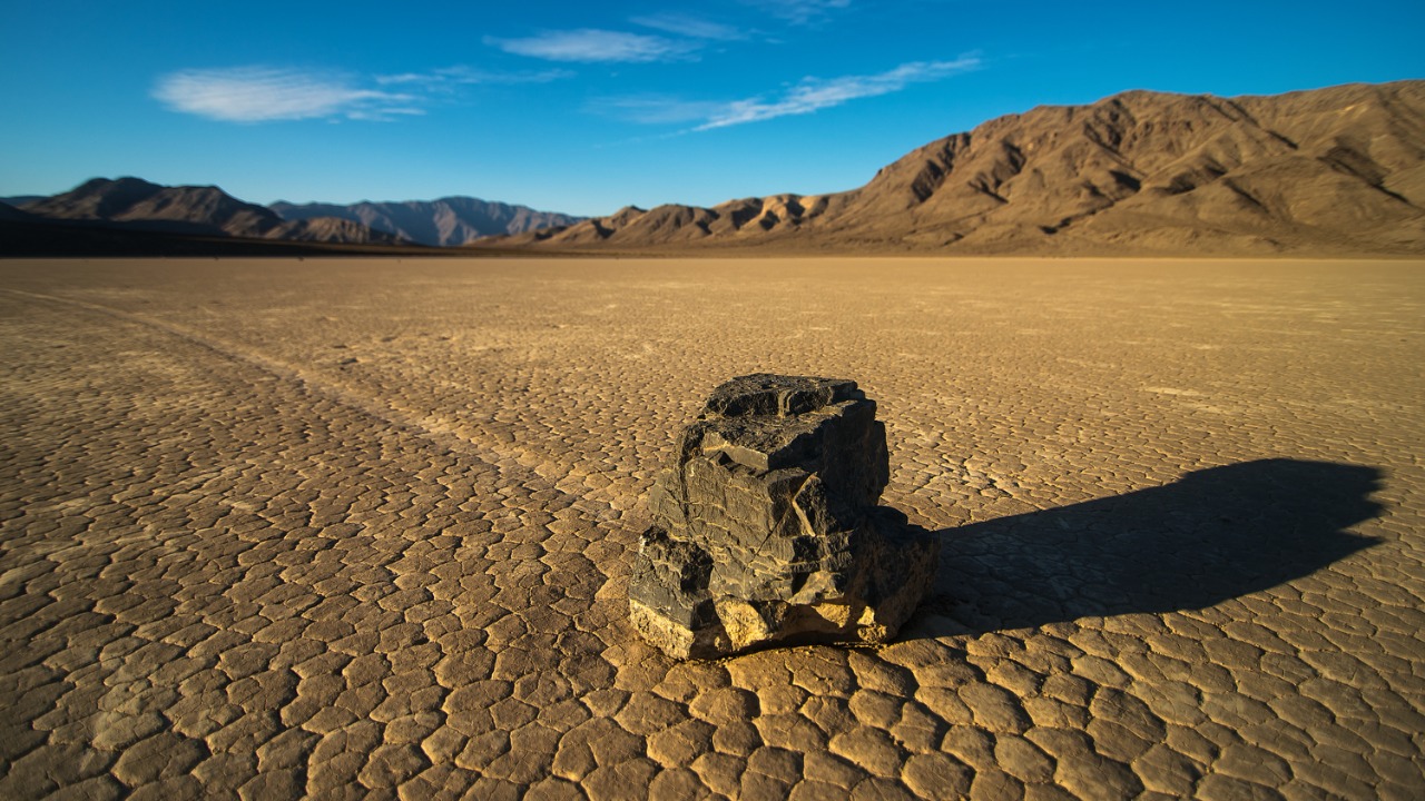
Death Valley’s Racetrack Playa is littered with rocks, some weighing as much as 700 pounds, that leave long trails as if dragged across the dry lakebed. Researchers puzzled over them from the 1940s until a team saw the stones in motion in December 2013.
The answer was a rare mix of conditions. A shallow pond froze into thin windowpane ice, which broke into floating panels on sunny days and, pushed by light winds of about 10 mph, shoved the rocks along. In one event, rocks three football fields apart moved at the same time and traveled more than 200 feet.
2. Meteor Crater: A Hole That Split the Experts
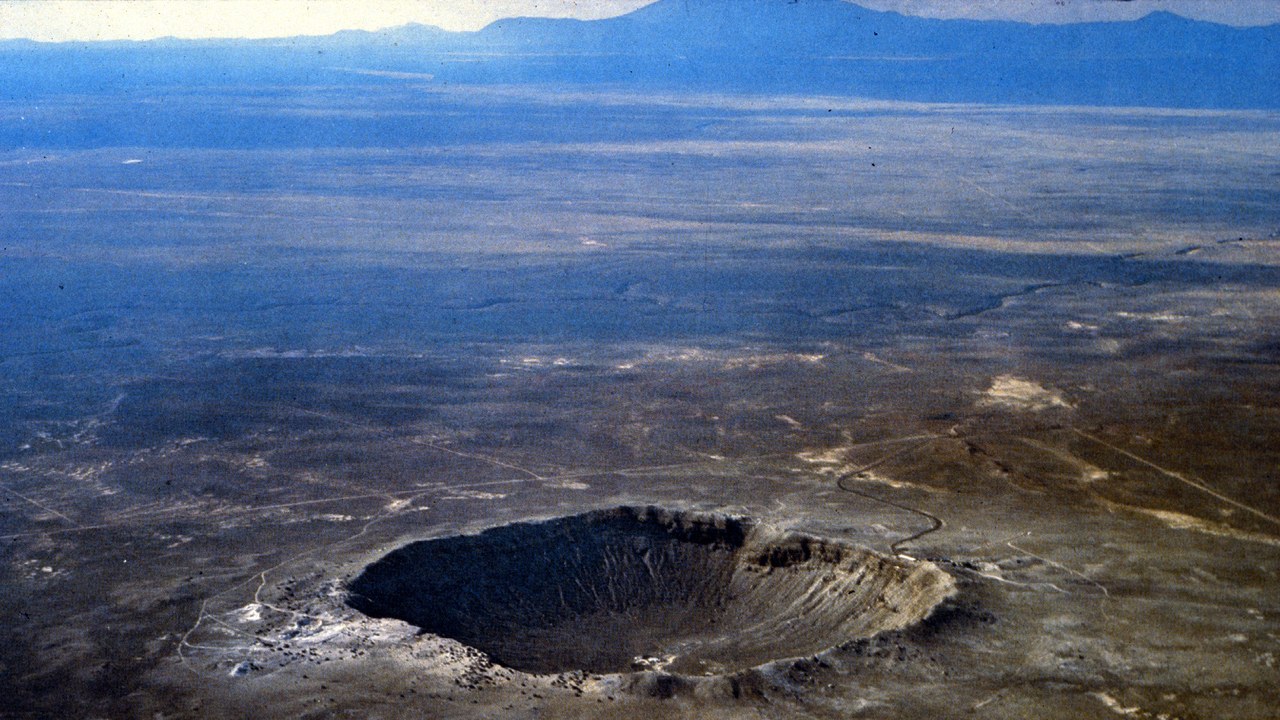
Meteor Crater, about 40 miles east of Flagstaff, Arizona, was the subject of a long and bitter debate between lawyer-turned-geologist Daniel Barringer, who argued a meteorite had blasted it out, and Grove Karl Gilbert of the U.S. Geological Survey, who disagreed.
Barringer staked his fortune on finding a buried iron mass under the crater floor that he could mine and sell, but he never did. The dispute was settled only after both men had died, when scientists reported the shock mineral coesite in the crater on July 22, 1960. The roughly 50,000-year-old crater was the first impact structure recognized on Earth.
3. Richat Structure: The Eye of the Sahara
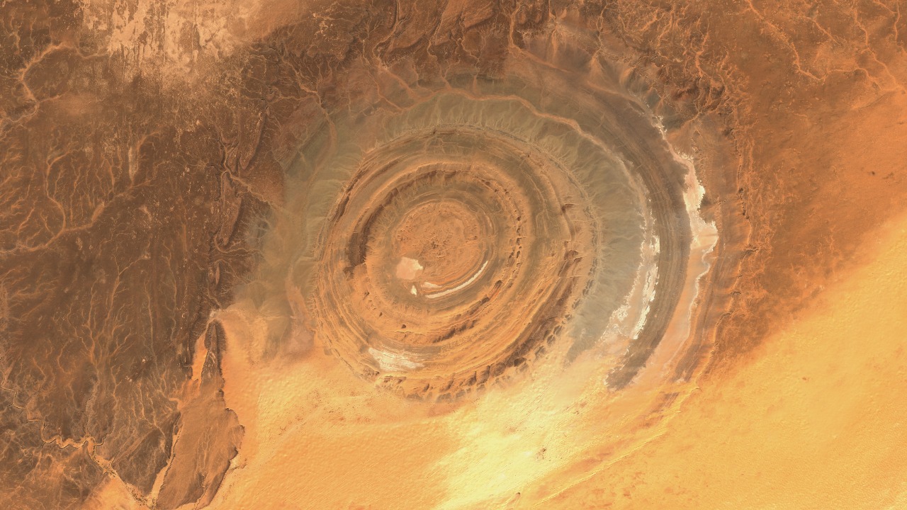
The Richat Structure in Mauritania forms a bull’s-eye almost 30 miles across and has caught astronauts’ attention since the earliest space missions. NASA notes it was initially interpreted as a meteorite impact because of its near-perfect circular shape.
Geologists now think it is merely a symmetrical uplift, a circular dome of rock layers that has been laid bare by erosion, with resistant quartzite beds outlining its rings. Some have described it as looking like a giant fossil ammonite lying in the desert, and it has become a landmark for shuttle crews.
4. Devils Tower: Still a Puzzle After 100 Years
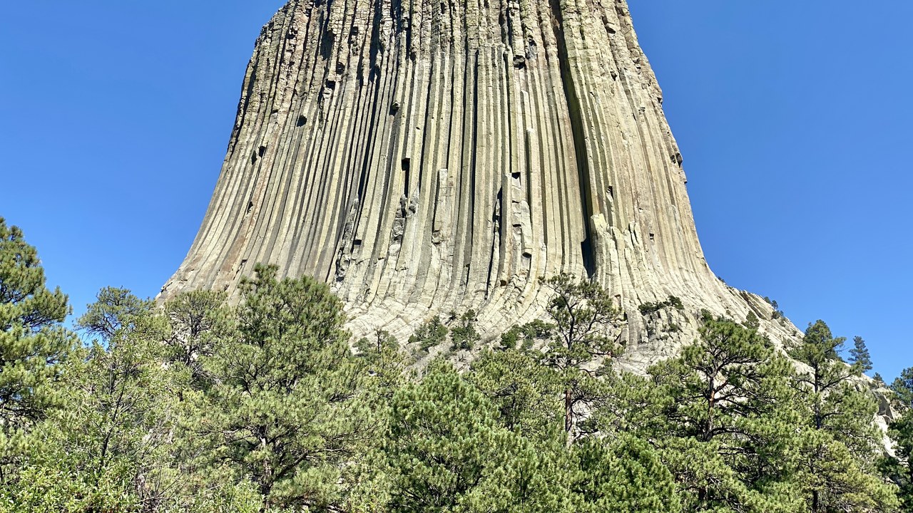
Devils Tower in Wyoming is the largest example of columnar jointing in the world, made of a rare igneous rock called phonolite porphyry. According to the National Park Service, geologists agree it began as magma, but they cannot agree on how that magma cooled or how the tower relates to the surrounding rocks.
Ideas include a stock, a small body of magma that cooled underground and was later exposed by erosion, and the eroded remnant of a laccolith, a mushroom-shaped intrusion. Geologists have studied the tower since the late 1800s, and it was protected in 1906 for its scientific value.
5. Giant’s Causeway: Forty Thousand Stone Columns
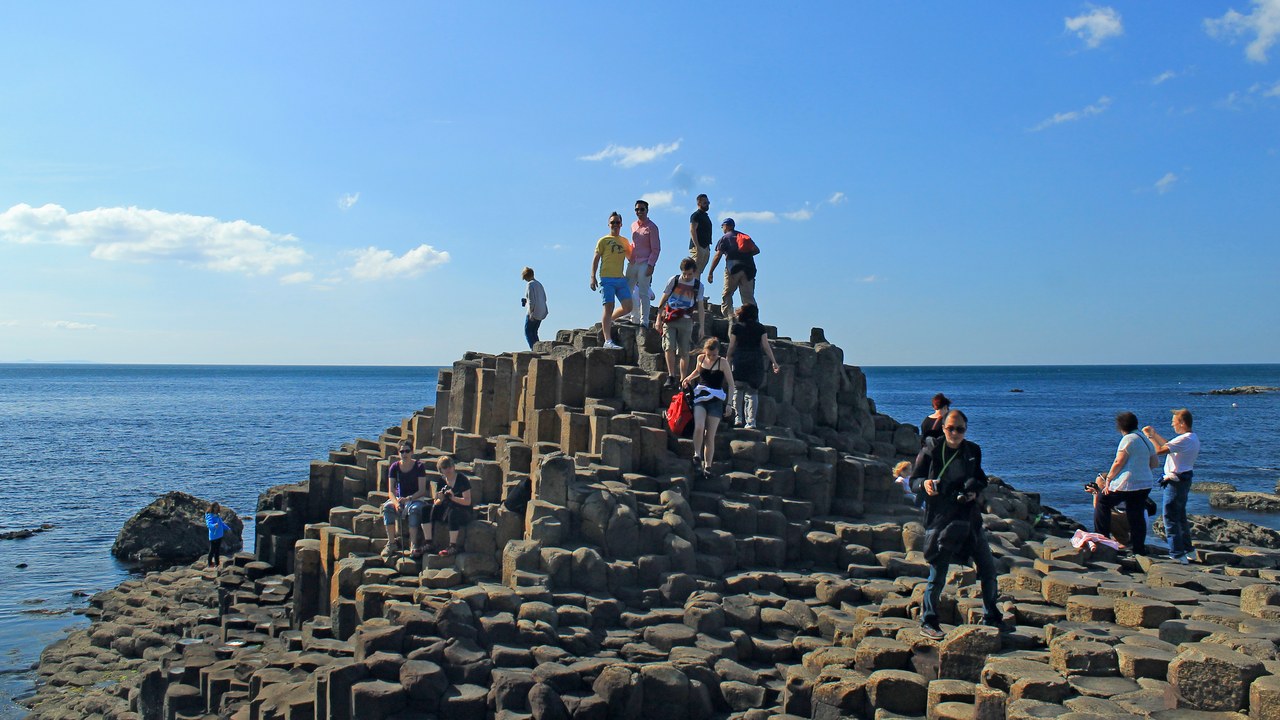
Northern Ireland’s Giant’s Causeway is made up of some 40,000 massive black basalt columns sticking out of the sea at the foot of the Antrim plateau. UNESCO says that 300 years of geological study here greatly contributed to the development of the earth sciences.
The striking landscape was created by volcanic activity some 50 to 60 million years ago. Its neat, columnar shapes inspired legends of giants striding across the sea to Scotland, and the site’s long scientific history helped shape how geologists understand volcanic rock.
6. Fingal’s Cave: The Cave That Drew a Naturalist
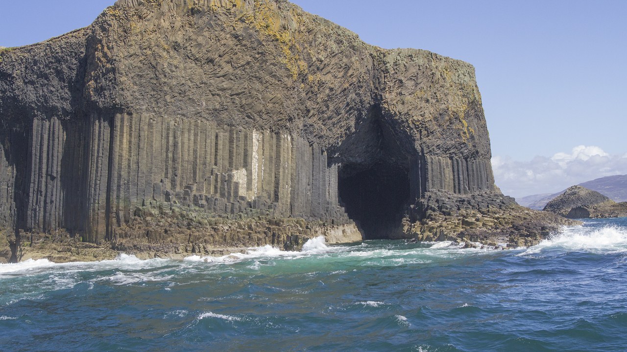
Fingal’s Cave on the Scottish island of Staffa is carved from basalt columns much like the Giant’s Causeway. According to the Linda Hall Library, the first outsider to take notice of Staffa’s striking formations was Sir Joseph Banks, who visited in 1772, fresh from Captain Cook’s first voyage.
Banks was especially taken with the large basalt cavern the locals called Fingal’s Cave, and he brought along an artist to draw it. Banks never published his own account, but he let Thomas Pennant use five of the drawings in a 1774 travel book, so his description of the cave survived in print.
7. Moeraki Boulders: Giant Stone Marbles on a Beach
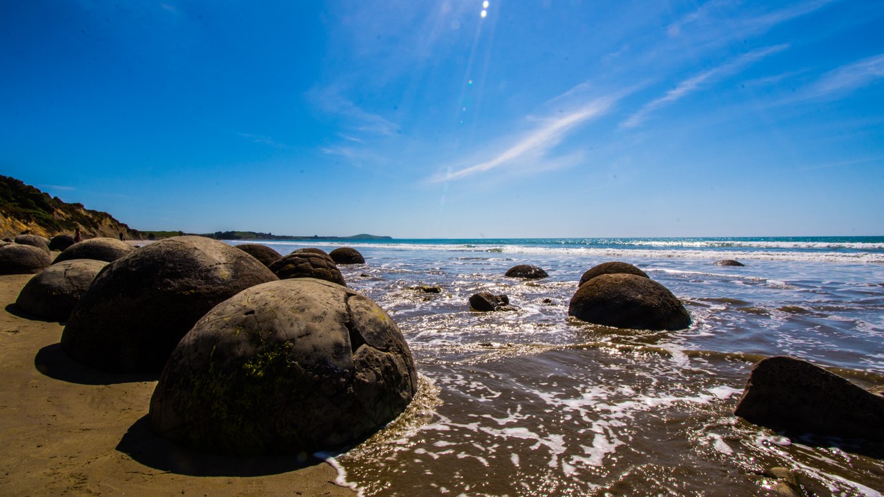
The Moeraki Boulders sit on Koekohe Beach on New Zealand’s South Island, and Maori legend says they are gourds washed ashore from a wrecked canoe. National Geographic explains that they are actually calcite concretions that formed more than 60 million years ago in seafloor sediment.
The spherical boulders grew in a pearl-like process that took as long as four million years, and wind and rain later exposed them as the soft mud around them eroded away. They reach up to 10 feet across and can weigh several tons each.
8. Fairy circles: Circles Nobody Can Fully Explain

Southern Africa’s fairy circles are barren, circular patches that freckle a 1,200-mile strip of land from Namibia to Angola. One Science paper blamed sand termites, but other researchers said the evidence fell short, with one accusing the author of confusing correlation with causation.
A later paper in Ecography found the circles are spread too evenly to match termite colonies, which tend to occur in random clumps. Its authors argue the circles are self-organizing patterns produced by plants competing for scarce water and resources in the arid Namib desert, rather than the work of insects.
9. Bryce Canyon hoodoos: Sea-Level Rock at 9,000 Feet
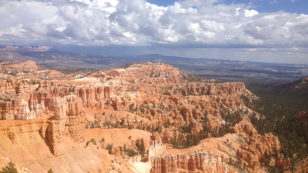
The rocks that form Bryce Canyon’s hoodoos were laid down about 50 million years ago in an ancient lake and floodplain near sea level. Yet the park now reaches 9,115 feet, and the National Park Service poses the obvious question: how did such large bodies of rock travel so far upward?
The answer is plate tectonics. The Farallon plate slid beneath the North American plate, and much of the region’s rise came in the last several million years as the Farallon plate broke apart. At that elevation, ice and rain work together to carve the soft rock into hoodoos.
10. Uluru: Only the Tip of the Rock
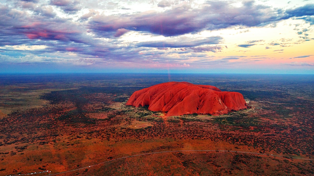
Uluru looks enormous from the desert floor, but it is only the tip. According to Uluru-Kata Tjuta National Park, Uluru and nearby Kata Tjuta are the tips of huge rock slabs that continue underground for up to 6 kilometers, so most of their mass lies hidden, like an iceberg.
Uluru began as a sandy fan washed off mountains that were once much taller. About 500 million years ago a sea covered the area and turned the fan to rock, and about 400 million years ago shifting plates tilted Uluru 90 degrees. Its red color comes from rusting iron in the rock, called arkose.
More from Morning Overview
- The Justice Department asked courts to undo approvals for three offshore wind farms, one already making power
- Over 20 trillion gallons of rain fell on the Four Corners states and Nevada in two weeks
- 11 engines built to run well past 200,000 miles
- Two Kentucky residents died when a small plane crashed at Missouri’s Lake of the Ozarks, and the NTSB is investigating
