
Natural wonders can look permanent even while their underlying systems change year by year. Warming water, rising seas, shifting rainfall, melting ice, and intensifying evaporation are altering landscapes already stressed by development and water use. These eight places reveal climate change through visible transformations that are difficult to ignore.
1. Great Barrier Reef: Marine Heat Waves Drain Coral Color
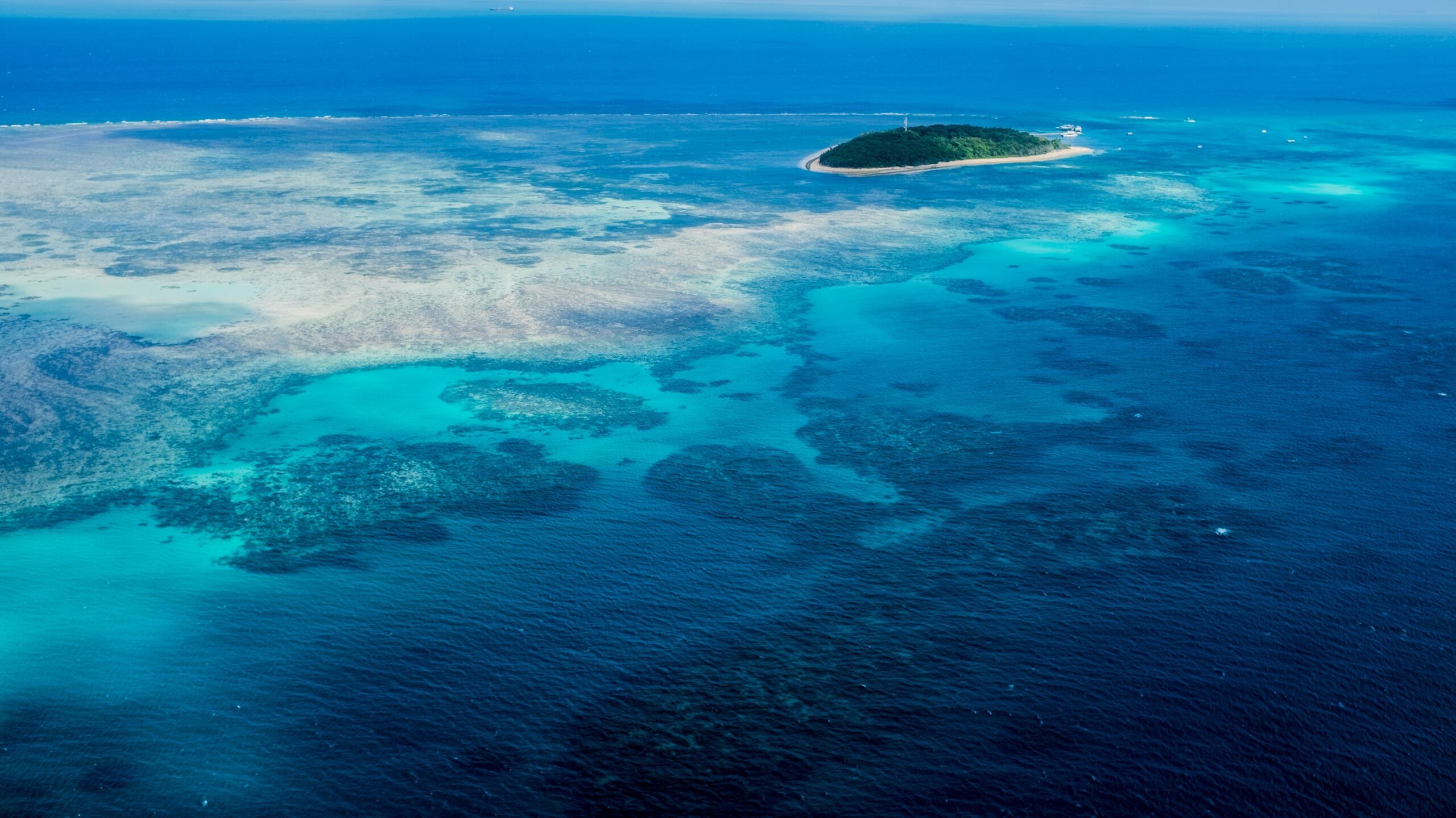
The Great Barrier Reef extends for more than 1,250 miles along Australia’s northeastern coast, forming the world’s largest coral reef system. Its living structure depends on tiny coral animals and the algae that supply much of their energy. During prolonged heat stress, corals expel those algae and the reef turns visibly white in a process called bleaching.
Bleached coral is not automatically dead, and cooler conditions can permit recovery. Repeated marine heat waves, however, leave less time to rebuild before another event arrives. Ocean acidification adds pressure by making it harder for reef-building organisms to form calcium carbonate skeletons. The result is not one uniform collapse but a shifting mosaic of mortality, recovery, and changing species across an immense ecosystem.
2. Glacier National Park: The Namesake Ice Is Retreating
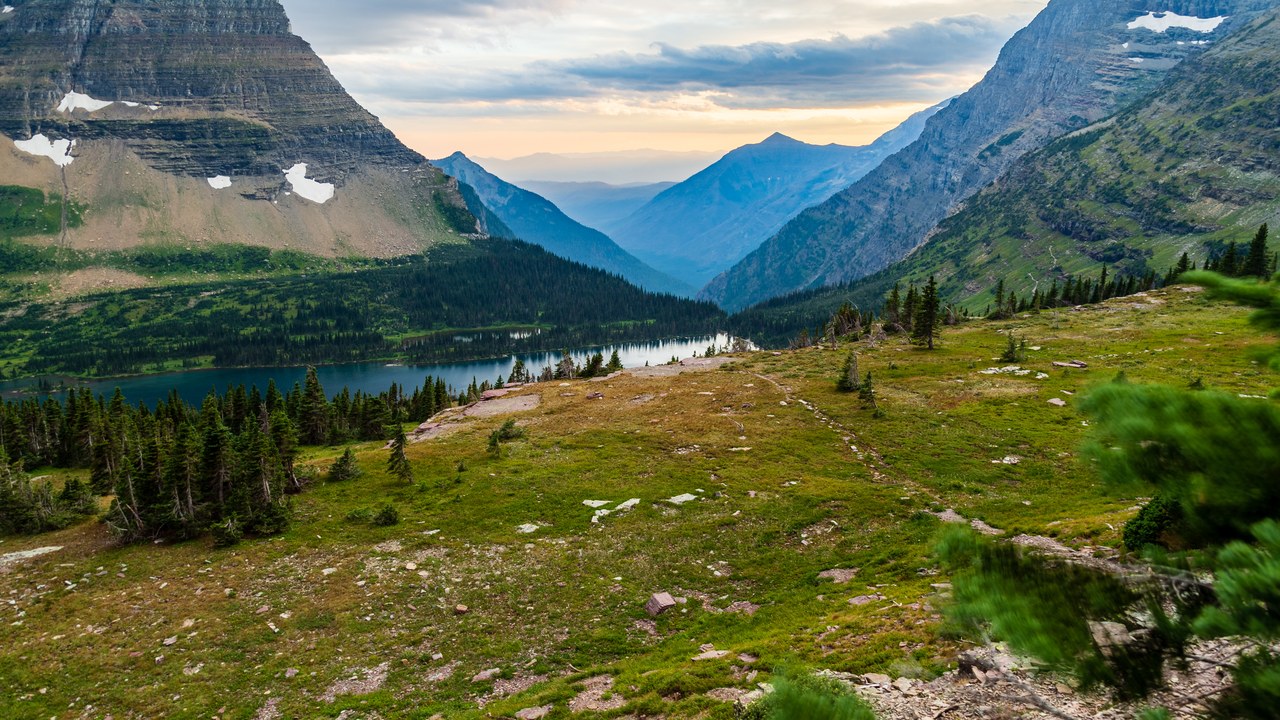
Glacier National Park protects a rugged section of the northern Rocky Mountains in Montana, where ice carved deep valleys and sharp peaks. The park’s remaining alpine glaciers are small compared with the ancient ice that shaped the terrain, and many have retreated substantially in the past century. The National Park Service monitors that changing mountain environment.
Warmer summers increase melting, while winter snowfall determines how much mass a glacier can regain. When losses repeatedly exceed accumulation, the ice thins and its edge moves uphill. Retreat changes more than a famous view: late-summer stream temperatures and flow timing can shift, affecting cold-water habitat downstream. Even after the glaciers shrink, the landforms they created will preserve evidence of a much icier park.
3. Venice: Higher Seas Raise the Flooding Baseline
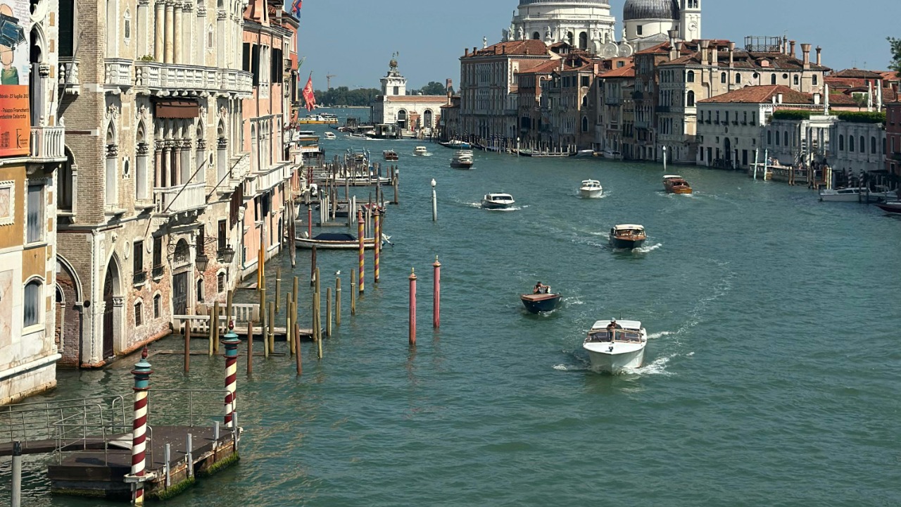
Venice was built across low islands in a shallow lagoon, making water its defining feature and hazard. Seasonal high tides known as acqua alta can flood squares, walkways, and ground floors. Because Venice sits within the Adriatic lagoon, rising sea level gives storm surges and tides a higher starting point.
Local subsidence has also lowered parts of the city relative to the water, compounding the global climate signal. The MOSE system can raise barriers at the lagoon inlets during exceptional tides, reducing some flood events. Barriers do not erase the long-term dilemma: frequent closures affect lagoon circulation and port access, while historic masonry remains vulnerable to salt. Protecting Venice increasingly means managing a moving boundary rather than holding water at one fixed level.
4. Dead Sea: A Famous Shoreline Pulls Away
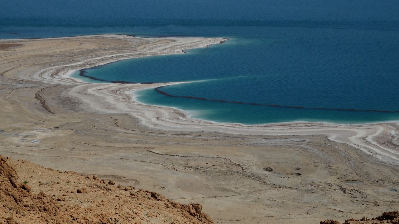
The Dead Sea occupies the lowest exposed land basin on Earth and has no outlet to the ocean. Its level has been falling rapidly, leaving abandoned beaches and sinkhole-prone ground behind the retreating shore. Water diversion from the Jordan River and mineral extraction are major causes, while intense evaporation from the Dead Sea completes the water imbalance.
A hotter, drier regional climate can deepen that deficit by increasing evaporation and reducing replenishment, but climate change is not the sole explanation. As fresh groundwater follows the falling shoreline, it dissolves buried salt layers and can open sudden cavities at the surface. Roads, farms, and tourism infrastructure must adapt to a coast that shifts almost visibly from year to year.
5. Mount Kilimanjaro: Tropical Summit Ice Is Fading
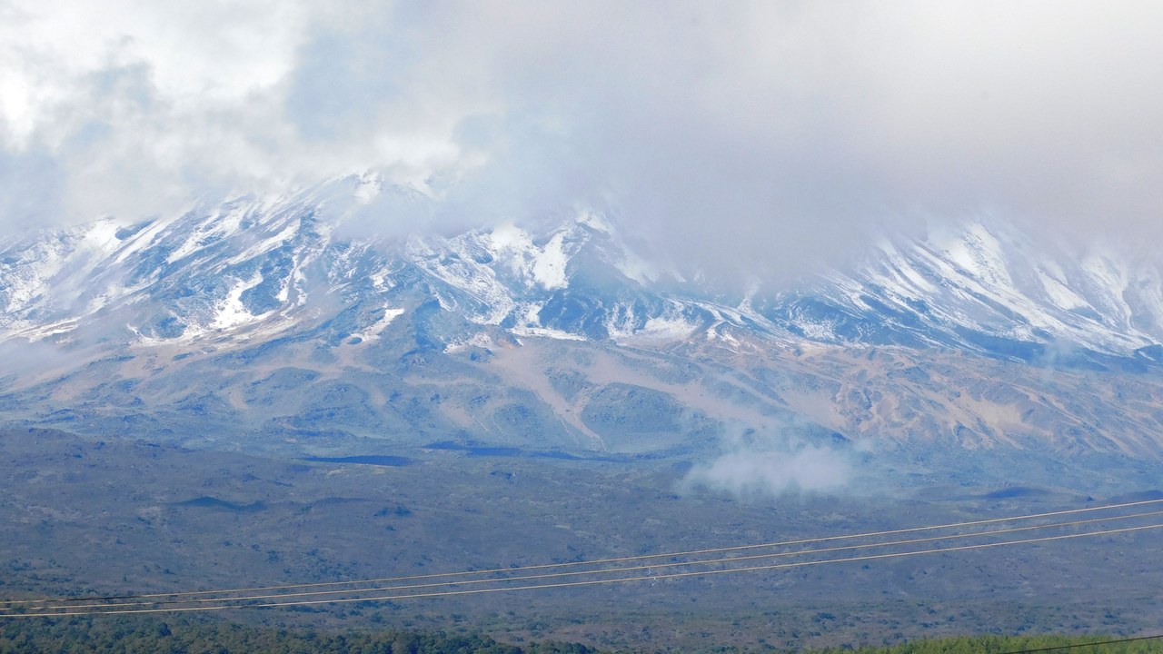
Mount Kilimanjaro rises from Tanzania to 19,340 feet, making it Africa’s highest mountain and one of the world’s most recognizable tropical peaks. Ice once covered much more of its summit plateau, but the remaining glaciers and ice fields have contracted dramatically since systematic observations began. Kilimanjaro’s snow and ice now occupy isolated patches near the summit.
The loss is more complicated than warm air simply melting the surface. Changes in humidity, snowfall, cloud cover, and solar radiation influence whether the high-altitude ice gains or loses mass, and sublimation can turn ice directly into vapor. Regional climate shifts alter that balance. The shrinking white cap has become an unusually visible symbol of environmental change because it sits above equatorial savanna rather than a polar landscape.
6. Great Salt Lake: A Shrinking Lake Exposes Dust
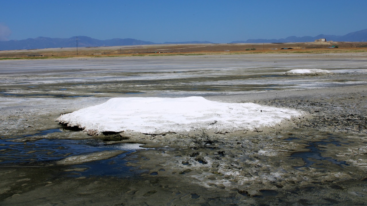
The Great Salt Lake is a terminal lake, so water leaves mainly through evaporation rather than a river flowing to the sea. Diversions from its tributaries for farms and cities have reduced inflow, while drought and warming intensify losses. The lake reached a record-low elevation in 2022 before recovering somewhat during wetter seasons.
When the shoreline retreats, dry lakebed becomes vulnerable to wind erosion. That dust can carry salts and naturally occurring contaminants toward communities along the Wasatch Front. Falling water also raises salinity, threatening brine shrimp and flies that support millions of migrating birds. Climate change operates alongside direct water use here, which means human decisions about upstream withdrawals can still materially change the lake’s future.
7. Everglades: Saltwater Presses Into Fresh Marsh
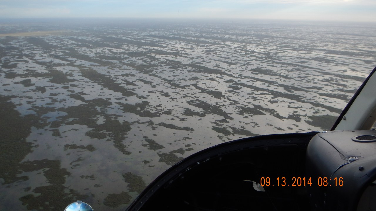
The Everglades is a vast, shallow sheet-flow wetland connecting central Florida’s watershed with Florida Bay. Canals, levees, and development already altered the amount and timing of freshwater moving south. Rising seas now push saltwater farther inland, challenging the freshwater marshes protected within Everglades National Park and changing where mangroves can grow.
Salt intrusion can stress sawgrass, alter soils, and threaten underground drinking-water supplies near the coast. Stronger storm surges may carry marine water across areas that previously remained fresh. Restoration projects that deliver more freshwater can build resilience by maintaining pressure against the salt, but they cannot stop sea-level rise. The future Everglades will depend on how climate adaptation and decades of water-management repair interact.
8. Thwaites Glacier: Warm Water Undercuts a Polar Giant
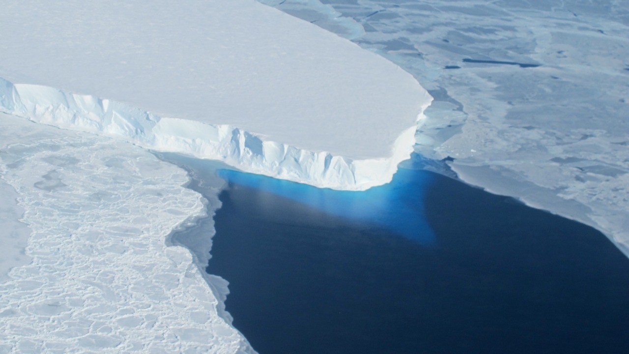
Thwaites Glacier drains a huge section of West Antarctica into the Amundsen Sea and is already contributing to global sea-level rise. Much of the ice rests on bedrock below sea level, and the ground slopes downward farther inland. That geometry makes Thwaites Glacier vulnerable if its grounding line retreats beyond stabilizing ridges.
Relatively warm ocean water reaches beneath floating ice, melting it from below and weakening the shelf that restrains the glacier behind it. A complete loss of Thwaites would add roughly two feet to sea level over time, and its retreat could destabilize neighboring ice. The nickname Doomsday Glacier compresses a complex, decades-to-centuries process into a phrase, but the stakes for coastlines are genuinely global.
More from Morning Overview
