
Dams are among the largest structures built in the United States, shaping rivers, power grids and the lives of those downstream. Some stand as records of engineering ambition, while others became warnings about what can go wrong. Here are eight American dams, from Hoover to a failed Idaho giant.
Save more, waste less: The Cool Down’s newsletter sends smart, simple changes that help you and the planet in your everyday life.
We may earn a commission if you sign up.
1. Hoover Dam: Concrete And Sacrifice
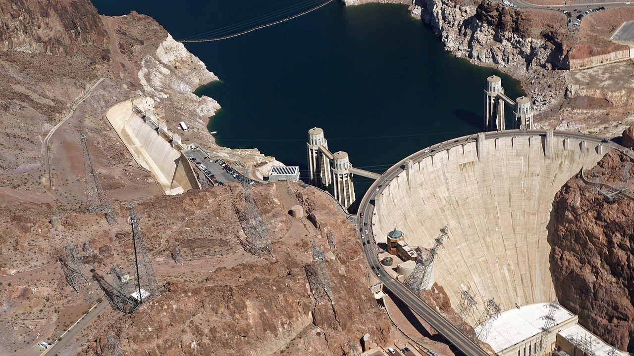
Standing on the Colorado River between Arizona and Nevada, Hoover Dam is among the best-known engineering works in the United States, and the a Reclamation fact sheet puts its height at 726.4 feet from foundation rock. That figure places the structure among the great concrete dams of the world, and it continues to hold back Lake Mead for water supply and hydroelectric power across the desert Southwest.
A plaque at the site honors the 96 men who died building it, a reminder that the project carried a heavy human cost. Visitors who tour the canyon walls and intake towers often come away with a sense of scale that photographs rarely capture, and the structure remains a symbol of large federal water projects.
2. Glen Canyon Dam: Lake Powell’s Keeper
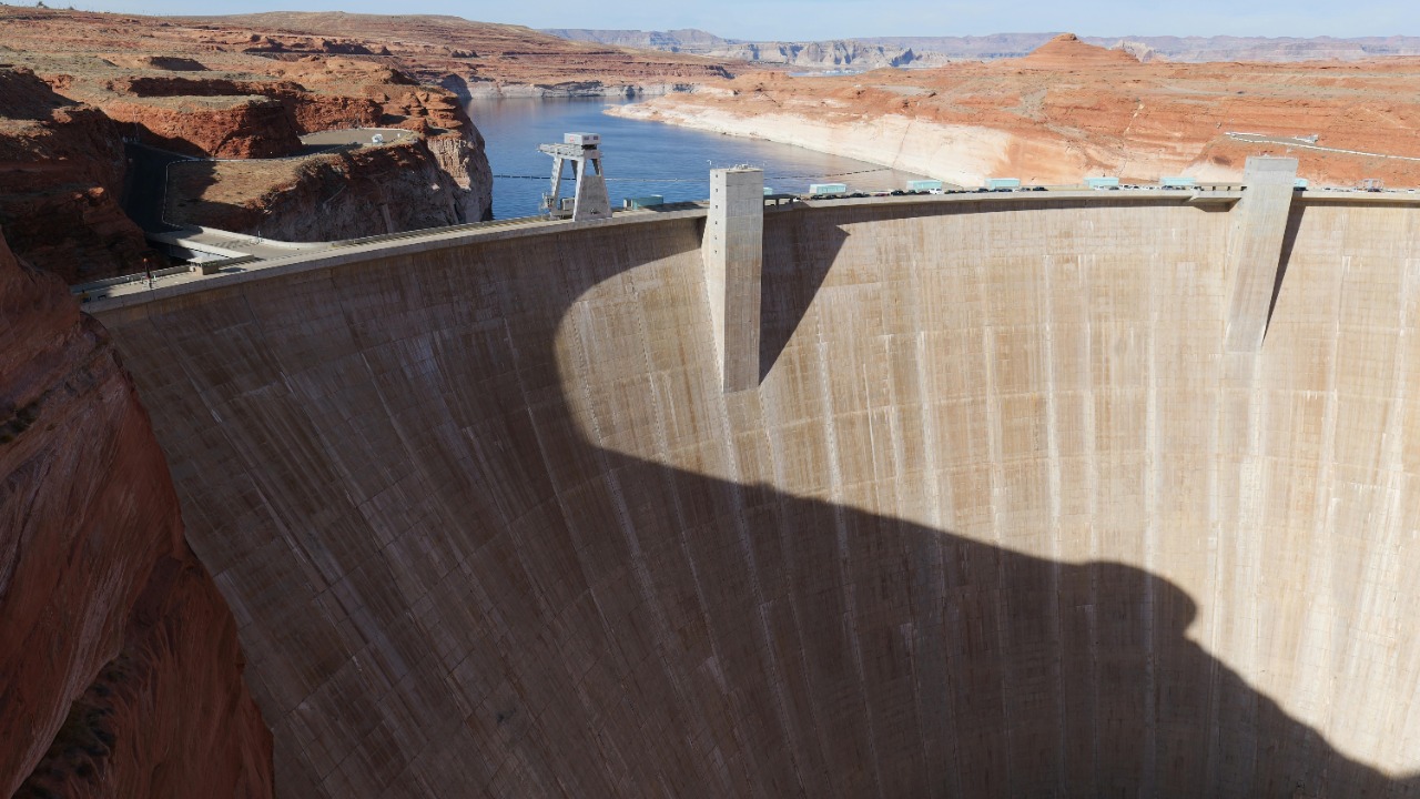
Glen Canyon Dam closes off the Colorado River in northern Arizona, and the Reclamation project page lists its height at 710 feet above bedrock. Behind the curved concrete wall sits Lake Powell, described as the second-largest reservoir in the country at 25,160,000 acre-feet.
The powerplant has a total capacity of 1,320 megawatts, supplying electricity to a wide network of communities across the interior West. The reservoir it creates floods red sandstone canyons that were once a river corridor, so the project is admired for its engineering and debated for the landscape that lies beneath the water.
3. Grand Coulee Dam: A Concrete Giant
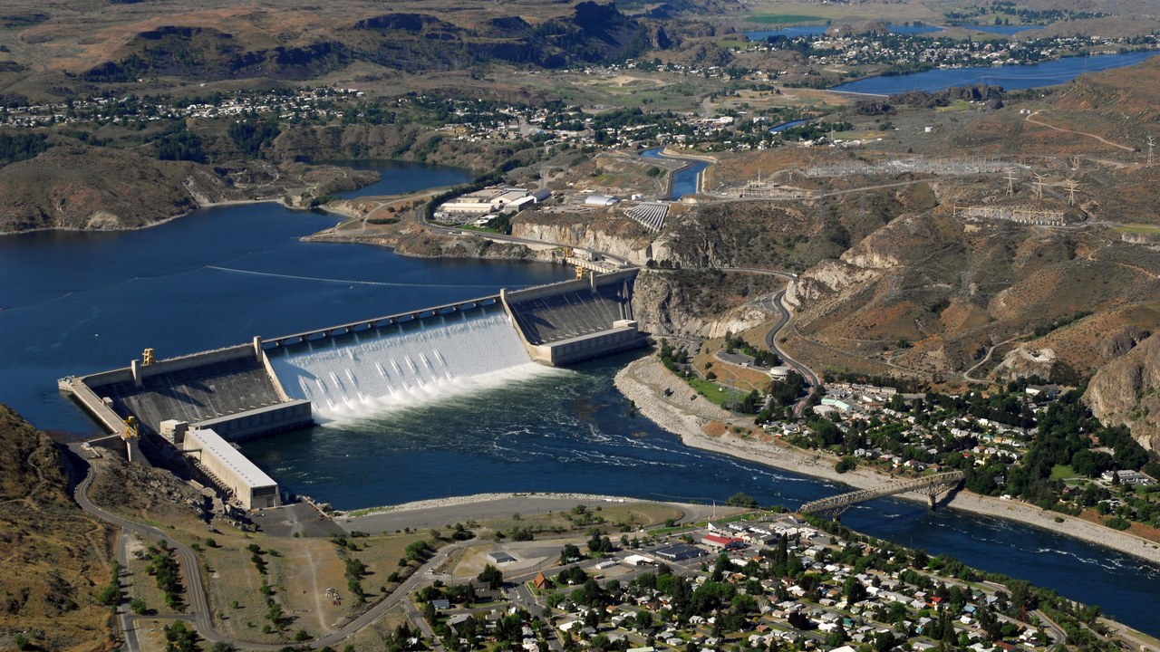
On the Columbia River in Washington State, Grand Coulee Dam is described in a Bureau of Reclamation fact sheet as one of the largest concrete structures in the world. The numbers behind that claim are large: the dam is 550 feet high and 5,223 feet long, and it contains nearly 12 million cubic yards of concrete.
The structure forms Franklin D. Roosevelt Lake and anchors a major hydroelectric and irrigation complex in the Pacific Northwest. Its broad spillway face, which spills water in a sheet during high flows, makes the dam one of the most recognizable sights along the river, and it continues to shape the region’s power supply.
4. Oroville Dam: Tallest In America
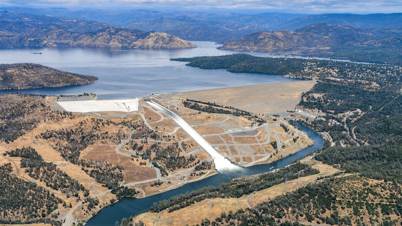
Oroville Dam, on the Feather River in Northern California, is described by a contemporary news report as the tallest U.S. dam at 770 feet. Its size did not prevent trouble in February 2017, when its spillway failed and nearly 200,000 people were ordered to evacuate from communities downstream.
The episode drew national attention to the safety of aging water infrastructure, since a structure built to protect people briefly became a threat to them. Oroville is an earthfill embankment that supports water supply, flood control and power generation, and the spillway incident is now a standard case study for engineers and emergency planners.
5. Teton Dam: The Day It Broke
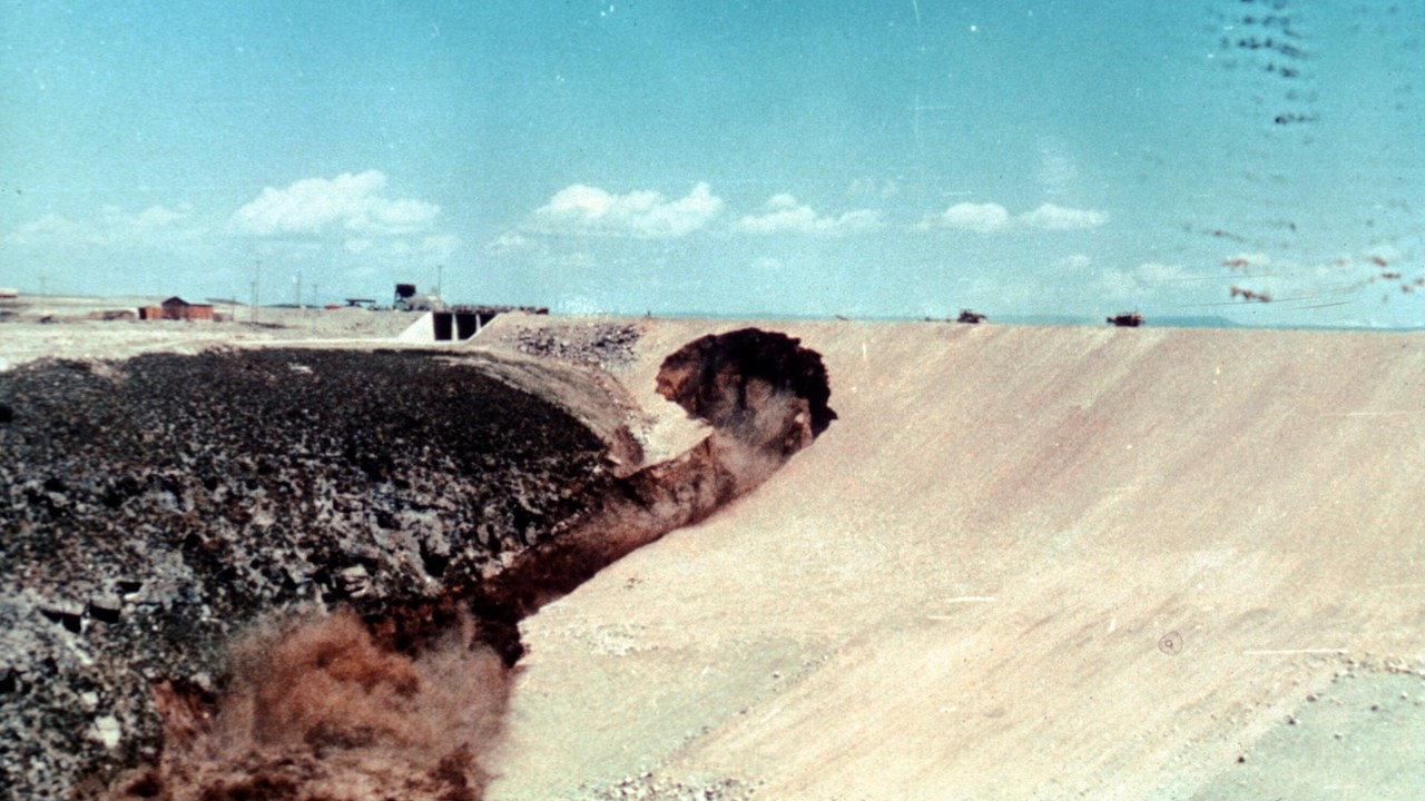
Idaho’s Teton Dam catastrophically failed on June 5, 1976, according to the Reclamation history page, and the loss of 11 lives is part of the official record. The breach sent water rushing across the Snake River plain at a rate of one million cubic feet per second.
The dam was a Bureau of Reclamation earthfill structure on the Teton River, and the collapse occurred while the reservoir was still filling for the first time. The disaster became a landmark in dam engineering, prompting closer attention to foundation conditions, seepage and inspection practices at large embankment dams across the country.
6. Wolf Creek Dam: A High-Risk Rating
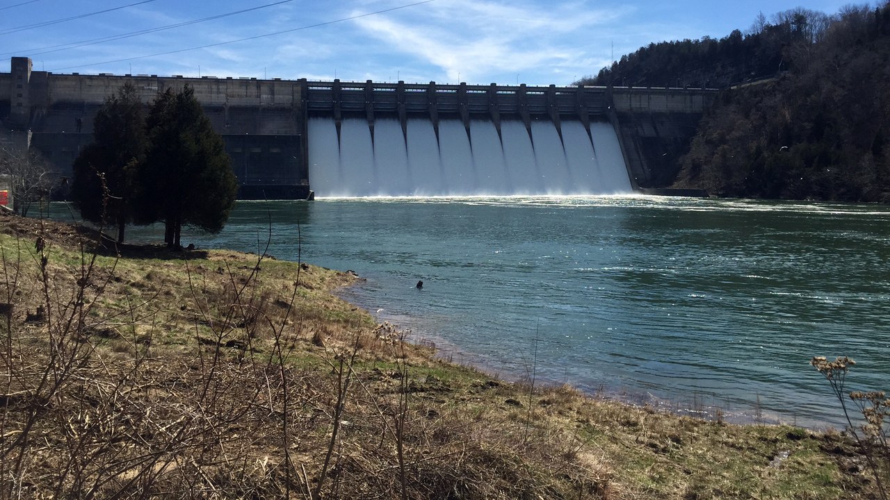
Kentucky’s Wolf Creek Dam holds back Lake Cumberland on the Cumberland River, and the Wikipedia entry notes that the U.S. Army Corps of Engineers placed the structure under a “high risk” for failure designation in 2007. The label put the dam among the most closely watched in the country.
Wolf Creek combines a long earthen embankment with a concrete section, and the Corps operates it for flood control, hydropower and recreation. Because the lake is one of the largest east of the Mississippi River, any concern about the structure carries weight for communities and businesses that depend on the water well downstream.
7. Isabella Dam: Among The Riskiest
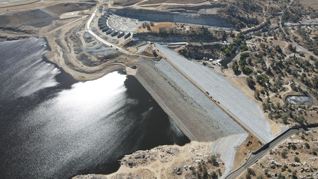
Isabella Dam, on the Kern River in California, appears in a Wikipedia article as one of the six highest-risk and highest-priority dams in America, a ranking made in 2007. The dam sits above the Kern Valley and forms Lake Isabella, a popular reservoir in the southern Sierra Nevada.
The Army Corps of Engineers operates the structure, which includes a main dam and an auxiliary dam, for flood control and irrigation storage. The rating reflects how many people and how much property lie downstream, and it explains why the site has been a focus of long-term safety work.
8. Herbert Hoover Dike: Okeechobee’s Embankment
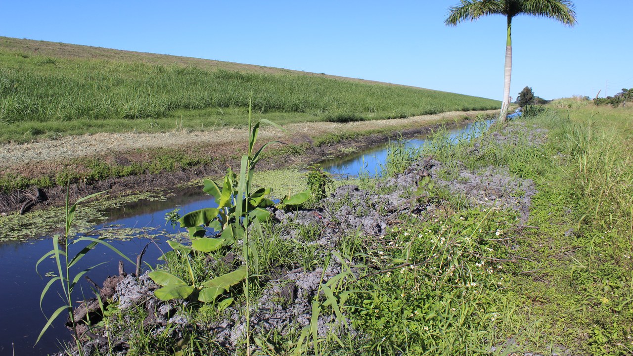
The Herbert Hoover Dike encircles Lake Okeechobee in Florida, and the Wikipedia page ties the structure to the 1928 hurricane, which it puts at over 3,000 deaths. The storm pushed lake water over low earthen levees and flooded nearby farm communities.
The dike was built afterward as a federal flood-control measure, and the Army Corps of Engineers now manages and repairs the embankment. It looks unremarkable, a grassy rise beside a canal, yet it protects towns and agricultural land around the lake, and its upkeep remains a long-running Florida concern.
Save more, waste less: Subscribe to The Cool Down →
We may earn a commission if you sign up.
More from Morning Overview
- Two passengers died at an Ohio toll plaza, and the NTSB now wants the cash lanes shut
- Long use of a common prostate pill is tied to a higher chance of glaucoma
- Ford is recalling 223,472 F-150 pickups because the fuel tank can leak or detach
- Hybrids have 15% fewer problems than gas cars, while EVs and plug-in hybrids have about 80% more, Consumer Reports finds
