
Volcanoes rank among the most closely tracked natural features on the planet, watched by scientists who study seismic tremors, ground deformation, and gas emissions for clues about what lies beneath. Some are shield volcanoes that ooze slow-moving lava for decades, while others are steep stratovolcanoes capable of violent, ash-choked blasts. Here are eight volcanoes that illustrate the range of eruptive styles and monitoring challenges scientists face around the world.
1. Kilauea: Decades of Flowing Lava
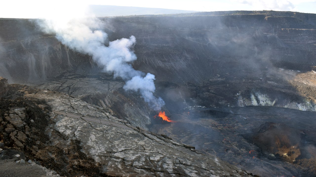
Kilauea is a shield volcano on Hawaii’s Big Island, built from countless thin lava flows rather than explosive blasts. Its 1983–2018 eruption at Puu Oo ran for 35 years, one of the longest-lived eruptions ever documented, before a 2018 event drained the summit lava lake and collapsed part of the caldera floor. The Hawaiian Volcano Observatory has tracked its behavior continuously for more than a century.
Lava output at Kilauea can shift from vigorous fountaining to quiet dormancy within weeks, so researchers rely on tiltmeters and gas sensors rather than visible activity alone to judge what the volcano is doing. Current conditions are published directly by the observatory rather than fixed in any static account.
2. Mount Etna: Sicily’s Nonstop Eruption Cycle
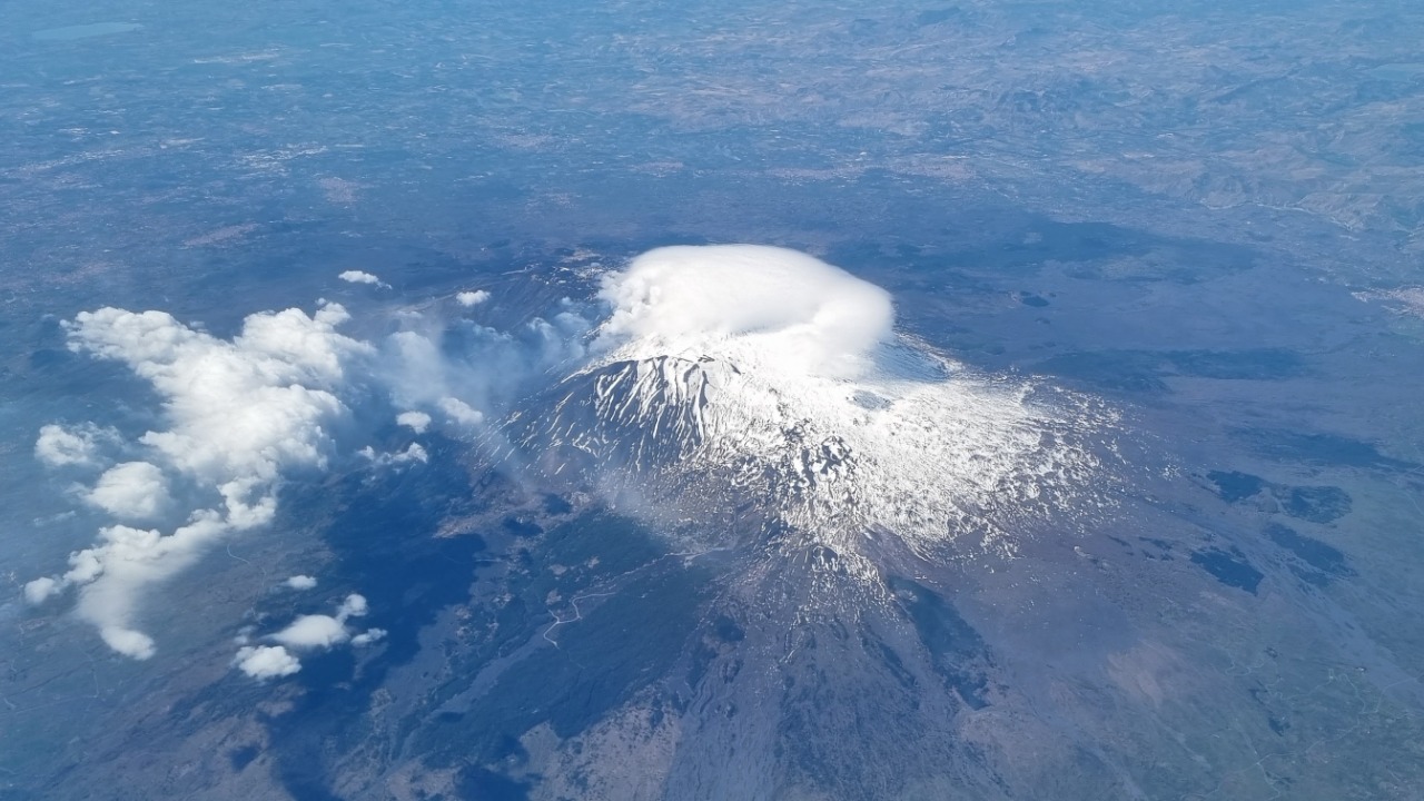
Mount Etna rises above eastern Sicily as Europe’s tallest and most active volcano, with written accounts of its eruptions stretching back roughly 2,700 years. Its activity ranges from lava fountains at summit craters to flank eruptions that send flows toward nearby towns, a pattern that has repeated dozens of times over the past few decades alone. A detailed eruption record documents that long history in full.
Because Etna sits close to Catania and its suburbs, volcanologists monitor it with seismic networks, satellite radar, and gas sampling to track magma movement well before flows reach populated ground. The observatory responsible for the mountain publishes updated activity reports rather than relying on any single fixed description.
3. Mount Rainier: The Ice-Capped Hazard Nearby
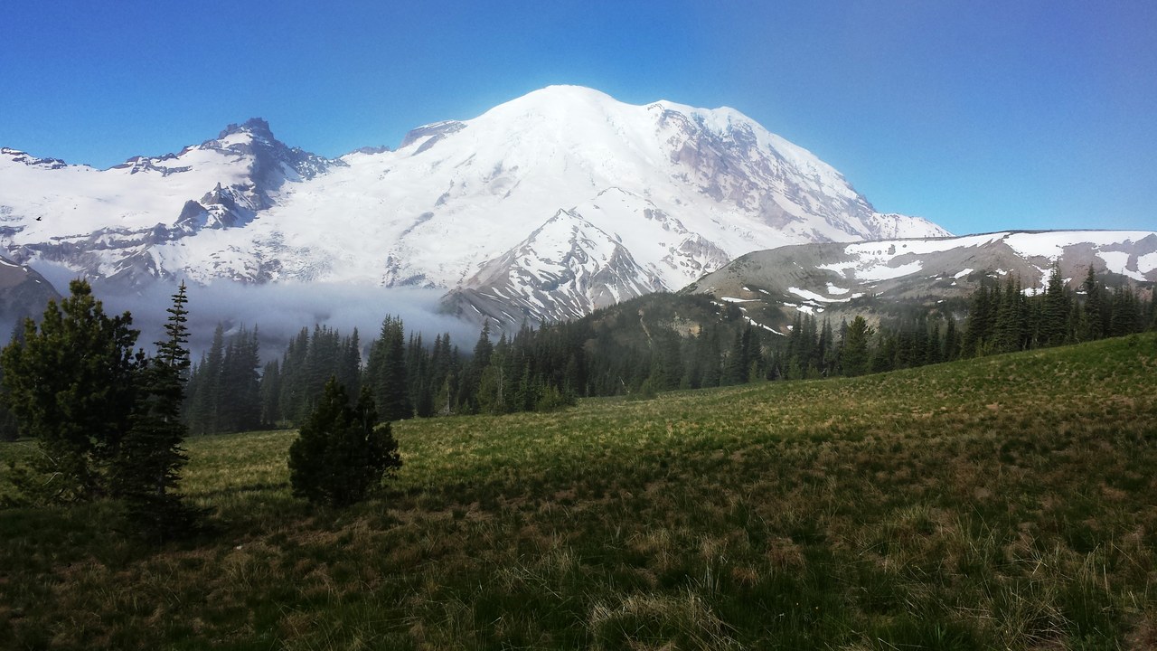
Mount Rainier is the most heavily glaciated peak in the contiguous United States, its slopes packed with more than 25 glaciers sitting atop loose volcanic rock. That mix makes lahars, fast-moving flows of mud, rock, and meltwater, the volcano’s defining hazard, able to reach towns like Orting and Puyallup even without a major eruption. The Cascades Volcano Observatory runs a seismic and lahar-detection network across its flanks.
Rainier has not produced a large eruption in roughly a thousand years, yet its glaciers and steep, weak rock make it a hazard independent of eruptive timing, which is why monitoring runs continuously. The observatory publishes current conditions on its own site rather than any fixed summary.
4. Popocatepetl: Mexico’s Smoking Mountain
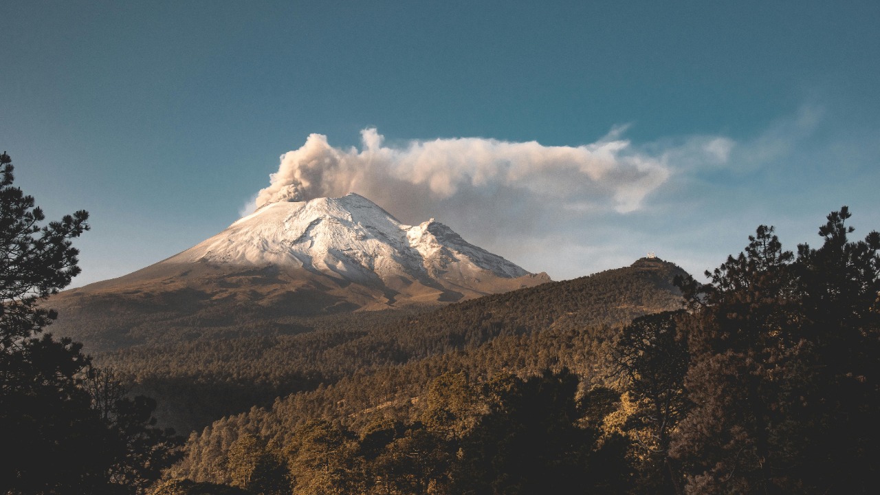
Popocatepetl rises between Mexico City and Puebla, close enough that roughly 25 million people live within sight of its summit. Its Nahuatl name translates to smoking mountain, a reference to centuries of steam and ash emissions recorded since before the Spanish conquest, including a major explosive eruption around 800 CE. A detailed eruption history overview documents its centuries of activity in depth.
Ash falls from Popocatepetl occasionally reach Mexico City and Puebla, disrupting flights and dusting rooftops even during periods of otherwise modest activity. The disaster agency posts its own updated hazard assessments rather than any account holding a fixed status.
5. Mount St. Helens: The Mountain That Lost Its Top
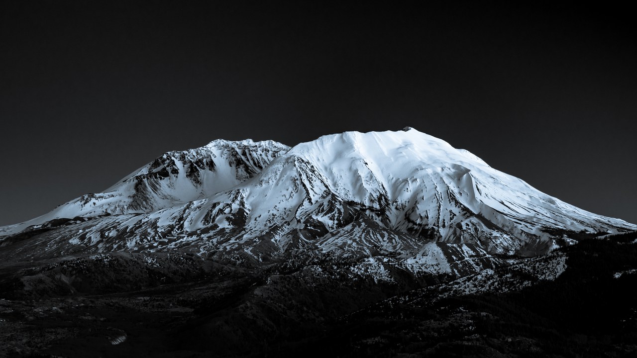
Mount St. Helens lost roughly 1,300 feet of elevation on May 18, 1980, when a magnitude 5.1 earthquake triggered the largest landslide in recorded history and a lateral blast that flattened forest for miles. The eruption killed 57 people and buried the surrounding valleys under ash and debris, remaking the mountain’s north face into the horseshoe-shaped crater seen today. The USGS observatory built near the crater grew directly out of that event.
Since 1980 the volcano has rebuilt a lava dome inside its crater through smaller eruptive episodes, most recently between 2004 and 2008. Scientists keep instruments trained on the crater because a system that produced one of the country’s most destructive eruptions is still capable of dramatic change.
6. Sakurajima: Kagoshima’s Constant Ashfall
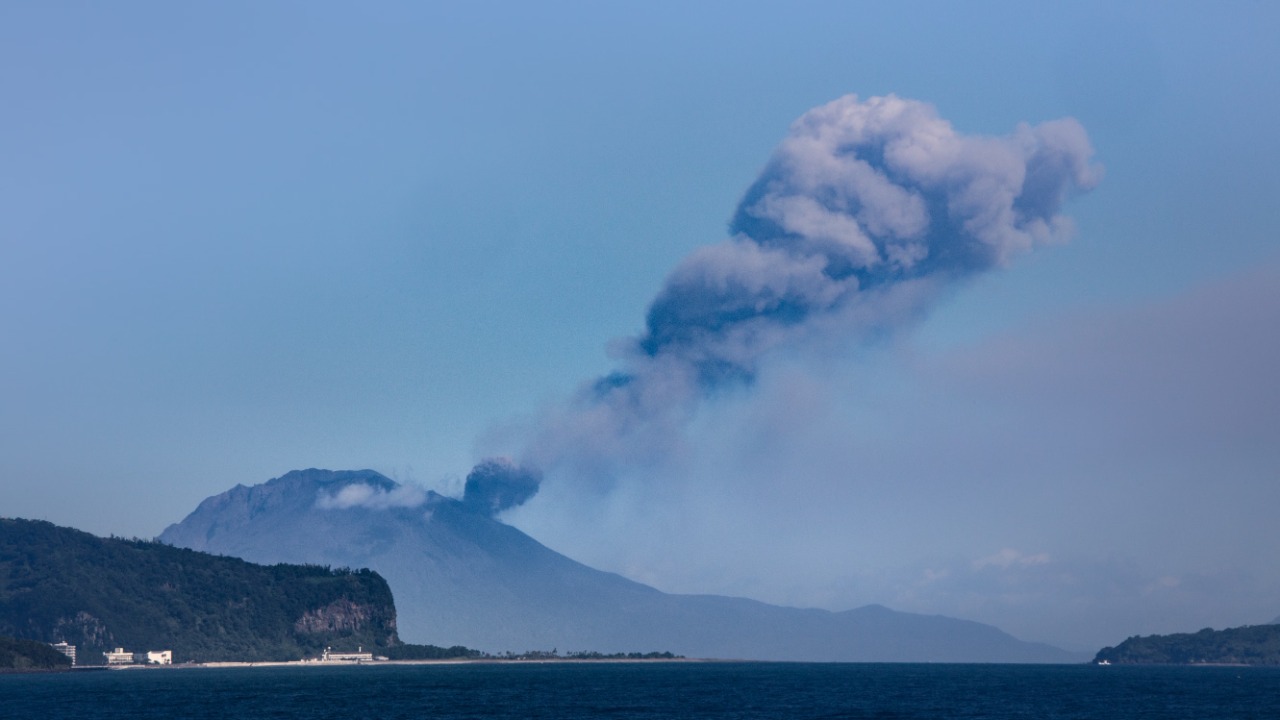
Sakurajima sits in Kagoshima Bay barely two and a half miles from a city of roughly 600,000 people, and it produces small explosive eruptions of ash and volcanic bombs on a near-daily basis. A massive 1914 eruption sent enough lava flowing to connect the once-separate volcanic island to the mainland peninsula it now forms part of. A detailed volcanic record documents its near-daily eruptions in full.
Residents routinely sweep ash off streets and cars, and schoolchildren wear hard hats during drills, evidence of how normalized the volcano’s frequent small eruptions have become. The agency responsible for Sakurajima issues its own current advisories rather than any fixed account of activity.
7. Phlegraean Fields: The Caldera Beneath Naples
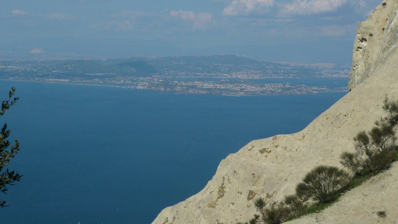
The Phlegraean Fields form a wide volcanic caldera on the western edge of Naples, home to roughly half a million people living directly inside its rim. Unlike a single cone, the system is a cluster of craters, calderas, and hot springs shaped by an eruption around 39,000 years ago that ranks among the largest in Europe’s history. A detailed caldera history tracks decades of ground movement there.
The caldera floor has risen and fallen for decades in a process called bradyseism, a slow breathing of the ground driven by heat and gas rather than magma nearing the surface. The observatory that studies it publishes its own current readings instead of any static description.
8. Mauna Loa: The Planet’s Largest Volcano
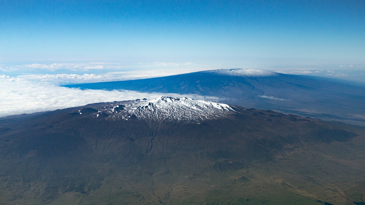
Mauna Loa is the largest active volcano on Earth by volume, a shield volcano so massive its bulk depresses the ocean floor beneath it by several miles. It last erupted in November 2022, sending lava flows toward the Daniel K. Inouye Highway on Hawaii’s Big Island after 38 years of quiet. The island’s volcano observatory tracks it alongside its neighbor Kilauea.
Mauna Loa’s eruptions are typically less explosive than those of a steep stratovolcano, but its enormous size means even modest activity can send flows over a wide area within hours. The observatory publishes current conditions on its own site rather than in any fixed summary.
More from Morning Overview
- A handful of car transmissions are so tough that mechanics say they almost never die
- Card skimmers hidden on gas pumps are draining accounts, and there’s a quick way to spot them
- The NSA warns one messaging setting can clone your texts to a stranger
- Security experts still urge phone owners to switch off one location-tracking setting
