
A landscape can preserve a warning more durable than any sign, recording rupture, sudden subsidence, or an impact in its shape. Geologists read those scars to reconstruct past catastrophes and identify processes that remain active, even when the next event cannot be dated. These five places turn the ground beneath them into a threat archive.
1. The Cascadia coast: A Subduction Zone Written on Shore
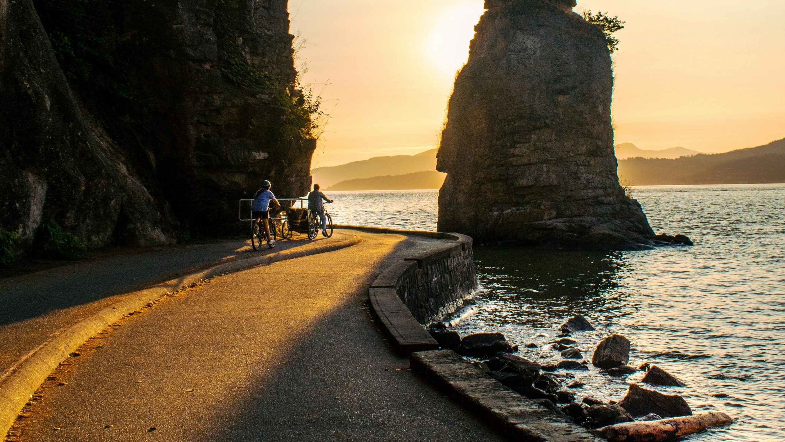
The Cascadia coast sits above a boundary where one tectonic plate descends beneath another, storing strain across a long offshore fault. The region’s earthquake and tsunami hazards come from the possibility that a large section could rupture together. Coastal sediments, drowned forests, and abrupt changes in elevation preserve evidence that powerful earthquakes and fast-moving water have transformed this shoreline before. The landscape is therefore both scenery and a physical record of past displacement.
No forecast can assign a precise date to the next major rupture; calling the fault overdue implies a schedule geology does not provide. Preparedness rests on consequences documented in the ground and in hazard models. Low coastal areas may have little time between shaking and tsunami arrival, making evacuation routes and immediate action critical. Cascadia’s warning is direct: quiet centuries do not erase plate motion offshore or evidence of earlier events along the coast.
2. Southern California: Strain Along a Visible Fault
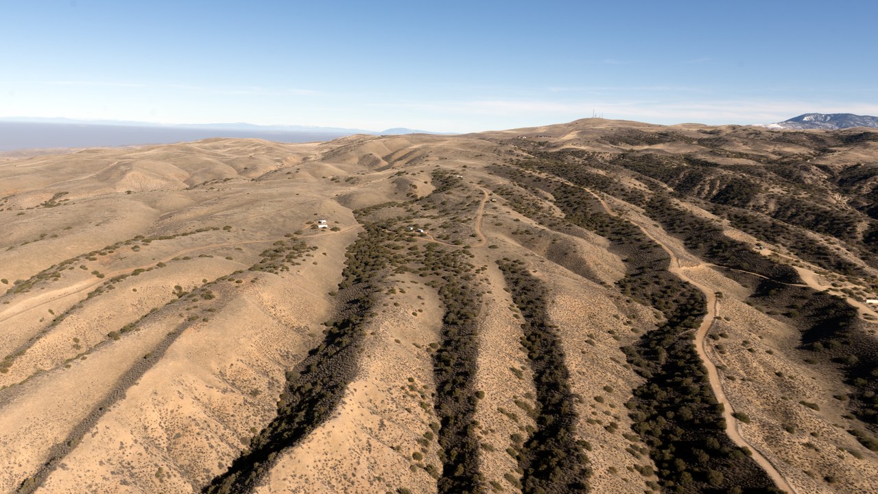
Southern California contains fault-controlled valleys, offset landforms, and linear features that reveal where the crust has moved. The San Andreas fault system marks a major plate boundary, and portions that remain locked can accumulate strain between earthquakes. Its surface expression turns tectonics into geography: ridges, drainage patterns, and basins follow structures capable of producing damaging shaking. The threat comes from active motion, not from a dramatic countdown to one predetermined day.
Scientists can estimate probabilities and map shaking, but they cannot predict an earthquake’s exact time, location, and magnitude. That limitation makes the landscape record important because displacement reveals what the fault has done over long intervals. Buildings, water systems, and transportation corridors cross this moving terrain, so resilience depends on engineering for uncertainty. Southern California is not merely waiting for one mythical Big One; it documents faults whose future earthquakes will vary in size and consequence.
3. The New Madrid zone: Midwestern Ground That Rang a Continent
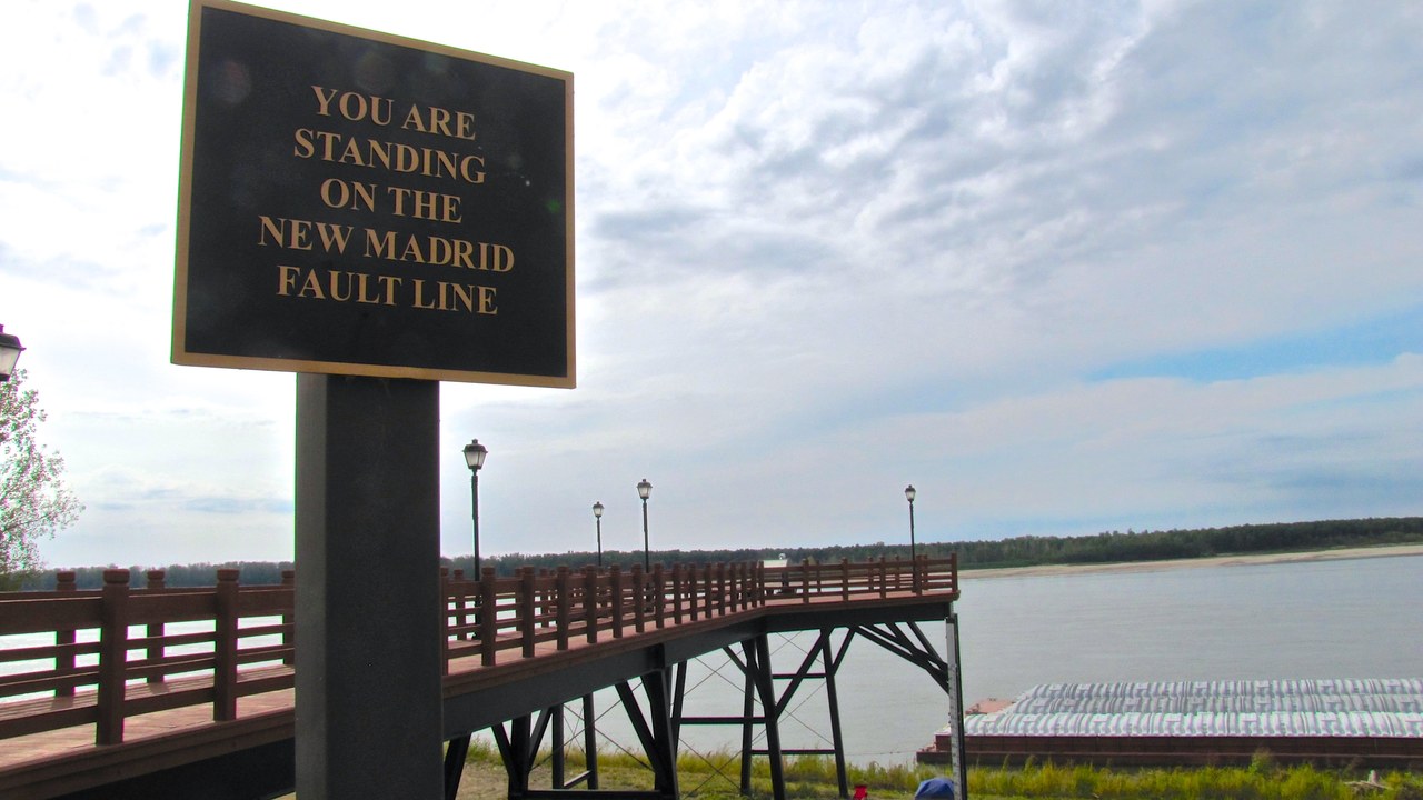
The New Madrid zone lies beneath the central Mississippi Valley, far from the plate edges that make western earthquakes more familiar. A sequence of powerful earthquakes in 1811 and 1812 reshaped parts of the region and sent shaking across an enormous area. The central seismic zone remains active, while river features, disturbed sediments, and fault-related landforms preserve traces of earlier rupture. Soft regional geology can carry seismic waves efficiently, widening the footprint of strong shaking.
Risk differs from the early nineteenth century because cities, bridges, pipelines, levees, and power networks now span the region. The fault lacks a dramatic mountain front, so an ordinary river landscape can hide a consequential hazard. Researchers use instruments, trenches, and historical records to estimate what future events may do without claiming a timetable. New Madrid shows that quiet ground in a continental interior can hold both an extraordinary record and an unresolved engineering problem.
4. Meteor Crater: An Impact Frozen in Arizona
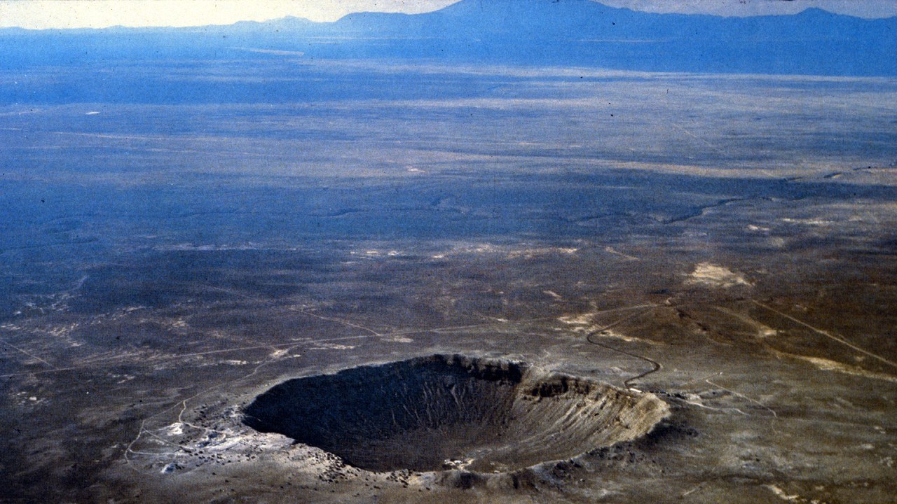
Meteor Crater is a clean, visible demonstration of what happens when a fast-moving object reaches the ground. The Arizona bowl was blasted out by an iron asteroid, leaving a raised rim and excavated basin where relatively flat terrain once stood. Its geometry records the sudden release of kinetic energy more clearly than an eroded or buried impact site. The crater turns an event lasting seconds into a landform that survives for thousands of years.
That scar does not indicate another asteroid will strike the same location, but it gives planetary defense a reference. Impact risk is global, and objects differ in size, composition, speed, and angle. Scientists combine surveys of near-Earth objects with models rather than treating one crater as a forecast. Meteor Crater’s value is honesty: the ground shows that a comparatively small cosmic body can reorganize a landscape instantly, making a low-frequency hazard impossible to dismiss as theoretical.
5. Vredefort crater: The World’s Largest Confirmed Impact Scar
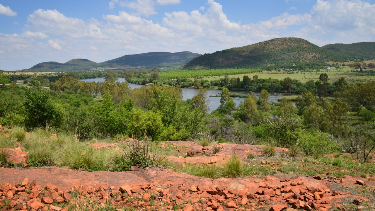
Vredefort records an impact so immense that erosion can hide its full form from an observer inside it. The South African site is the largest confirmed impact structure on Earth, with exposed rocks preserving deformation from a distant collision. Unlike a crisp young crater, Vredefort appears as a broad geological pattern across hills, river bends, and damaged crust. Its scale must be reconstructed from the landscape rather than captured in one rim.
Weathering and tectonic change removed much of the original crater, but those losses reveal deeper parts of the impact structure. Geologists study minerals, fractures, and uplifted rock to understand pressures no ordinary surface process creates. Vredefort does not forecast the next strike; it records the upper range of impact consequences. The site complements Meteor Crater by showing the other end of the scale, where a collision becomes a regional geological event whose signature outlasts its original topography.
This article was produced with the assistance of AI and reviewed by Morning Overview editors prior to publication.
More from Morning Overview
- A Colorado wildfire has exploded past 87,000 acres with no containment
- A wildfire near Ouray swelled past 18,000 acres, putting Colorado towns on alert
- The Pentagon’s newest UFO files describe a fish-scaled, potato-shaped object on camera
- Scientists spotted a rare tusked whale alive at sea for the first time, then fired a crossbow at it.
More from Morning Overview
