
The United States is home to dozens of active volcanoes, and several sit close enough to major cities and towns that scientists monitor them around the clock. From the glacier-capped giants of the Cascade Range to the ever-erupting shields of Hawaii and the supervolcano beneath Yellowstone, these peaks carry real, well-documented hazards for the communities nearby. This list profiles nine volcanoes that geologists rank among the most consequential to watch.
1. Mount Rainier: Mudflow Risk Above Puyallup
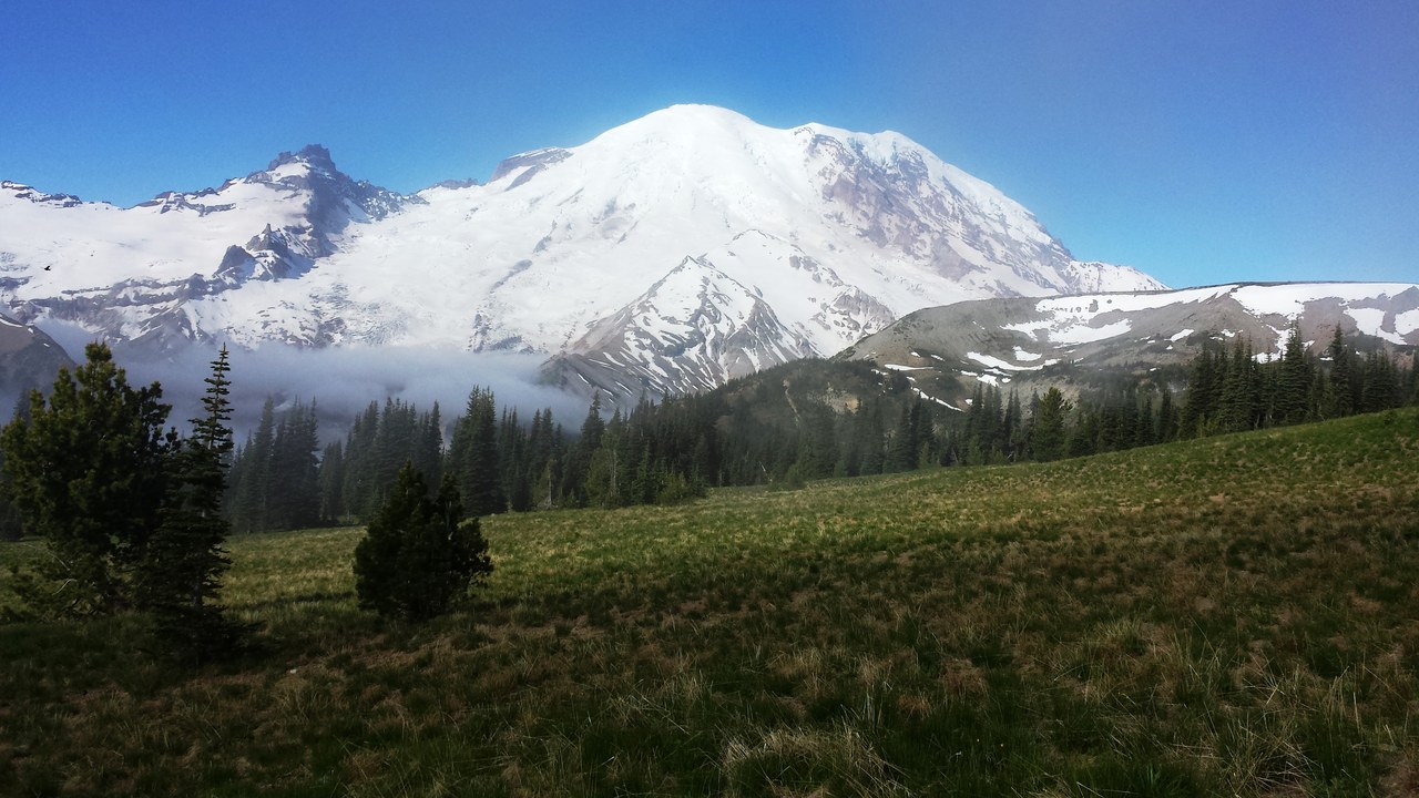
Rising more than 14,000 feet southeast of Seattle, the volcano carries a thick mantle of glacial ice that gives it the greatest hazard rating of any Cascade peak. A moderate eruption or a large landslide could melt enough ice to send volcanic mudflows, known as lahars, racing down river valleys toward Puyallup, Orting, and other towns built on centuries-old mudflow deposits. Ancient lahars from the mountain reached Puget Sound itself, burying ground where tens of thousands of people now live.
The Cascades Volcano Observatory tracks the peak with seismometers, tiltmeters, and a lahar early-warning system, and evacuation routes are marked throughout the Puyallup River valley, though officials note a fast-moving lahar could give some towns only minutes of warning.
2. Mount St. Helens: The 1980 Blast Reshaped Landscapes
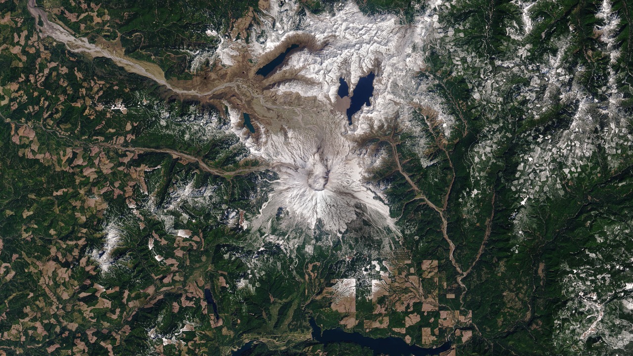
On May 18, 1980, the volcano’s north flank collapsed in the largest landslide in recorded history, triggering a lateral blast that flattened forests for miles and reduced the peak’s elevation by more than 1,300 feet. The eruption killed 57 people, destroyed hundreds of homes, and buried river valleys in ash and debris, leaving a horseshoe-shaped crater that still vents steam today. Communities in southwest Washington, including towns along the Toutle and Cowlitz Rivers, sit downstream of drainages the mountain reshaped.
The U.S. Geological Survey ranks the mountain among the nation’s highest-threat volcanoes because renewed dome growth in its crater shows it remains active, and monitoring instruments continue to watch for the kind of bulging that preceded the 1980 eruption.
3. Mount Shasta: A Sleeping Giant Over Siskiyou
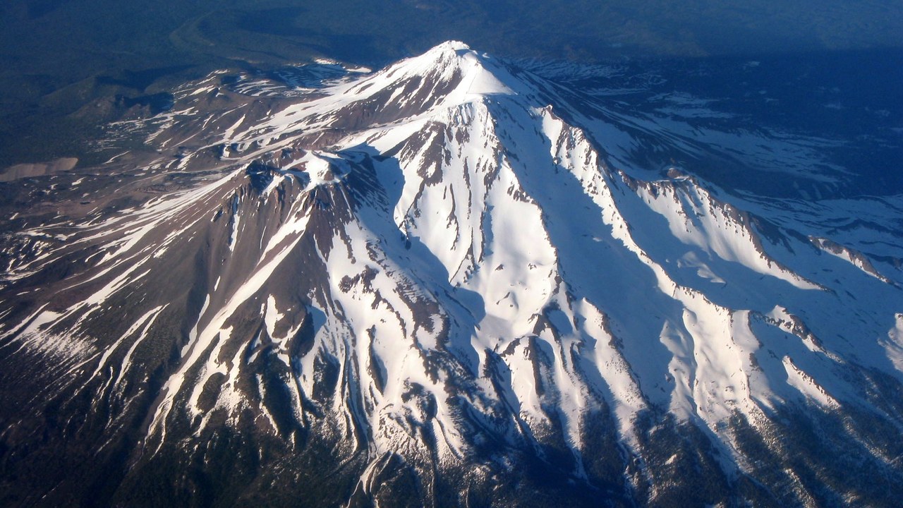
Towering over Siskiyou County in Northern California, the volcano last erupted around 1786 and could produce lava flows, ash fall, and volcanic mudflows reaching towns such as Mount Shasta City, Weed, and McCloud, all built on the mountain’s lower slopes and old debris-flow deposits. Scientists have found evidence of massive prehistoric collapses on its flanks that sent debris avalanches for dozens of miles, a reminder that even a long-quiet volcano can shed enormous amounts of material without warning.
The U.S. Geological Survey lists the mountain among the higher-threat volcanoes in the Cascade Range, and seismic monitors track the shallow earthquakes that would signal magma on the move beneath the resort communities and highway corridors that ring its base.
4. Mount Hood: Portland’s Closest Restless Peak
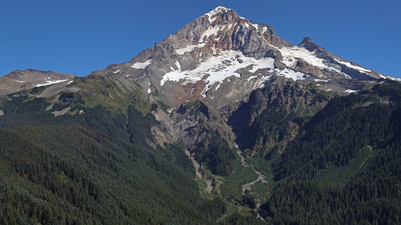
Standing just 50 miles east of Portland, the volcano ranks among the most closely watched peaks in the country because so many people live within reach of its potential lahars and ashfall. Its last major eruptive period ended in the mid-1800s, and geologists have mapped volcanic mudflow deposits reaching down the Sandy and Hood River valleys into towns including Sandy, Government Camp, and the Hood River Valley’s orchard communities. Steam still rises from vents near the summit, evidence the magma system beneath the peak remains warm.
The Cascades Volcano Observatory maintains seismic and gas-monitoring stations on the peak, and Oregon planners have built lahar-warning systems into the Sandy River corridor given how many residents and highway travelers pass through below.
5. Kilauea: Hawaii’s Ever-Erupting Shield Volcano
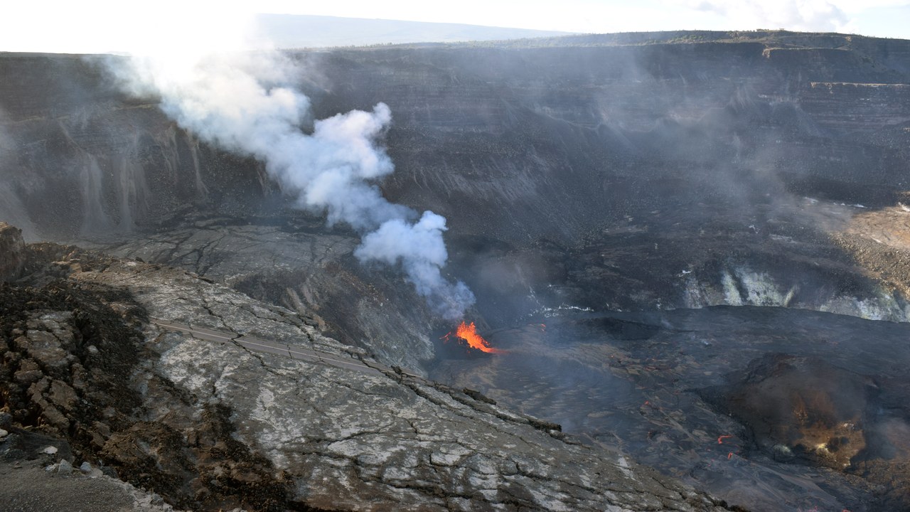
On the Big Island of Hawaii, the volcano has erupted almost continuously for decades, sending lava flows that have repeatedly overrun neighborhoods in the Puna district and forced thousands of residents from towns such as Pahoa and Kalapana. Its summit caldera, within Hawaii Volcanoes National Park, periodically collapses and refills as magma rises and drains through the volcano’s rift zones, sometimes triggering ground cracks and toxic volcanic gas that reach communities well outside the park boundaries.
The U.S. Geological Survey’s Hawaiian Volcano Observatory monitors the volcano around the clock with seismometers, gas sensors, and ground-deformation instruments, and Hawaii County maintains evacuation plans for the lower Puna communities that sit closest to its active rift zones.
6. Mauna Loa: Earth’s Largest Active Volcano
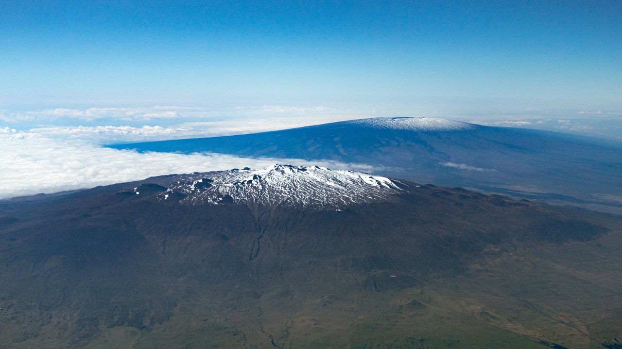
Covering half of the Big Island of Hawaii, the volcano is the largest active volcano on Earth by volume, and its most recent eruption in late 2022 sent lava flows within a few miles of the Daniel K. Inouye Highway, the main route connecting Hilo and Kona. Earlier eruptions in 1950 and 1984 have shown that lava can reach the outskirts of Hilo within hours once a fissure opens on the volcano’s flanks, giving downhill communities time to prepare.
The Hawaiian Volcano Observatory tracks inflation and seismic swarms beneath the summit as early indicators of new activity, and Hawaii County has mapped lava-flow hazard zones that guide evacuation planning for the tens of thousands of residents on its lower slopes.
7. Yellowstone Caldera: A Supervolcano Watched Nonstop
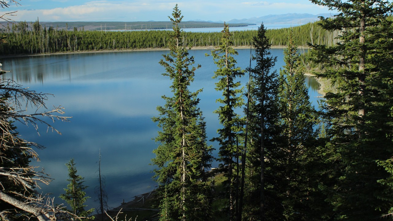
Beneath Yellowstone National Park lies one of the largest volcanic systems on Earth, a caldera formed by eruptions so massive that the most recent, roughly 631,000 years ago, blanketed much of North America in ash. Towns near the park’s edges, including West Yellowstone, Montana, and Cody, Wyoming, sit atop a landscape shaped by geysers, hot springs, and earthquake swarms linked to the shallow magma system below. No eruption on that scale has occurred in human history, and most activity today is hydrothermal, not volcanic.
The Yellowstone Volcano Observatory runs seismometers and GPS stations that would detect the ground swelling and earthquake swarms that precede major eruptions, and officials rank an eruption among the least likely disasters the region could face.
8. Mount Baker: A Steaming Peak Near Bellingham
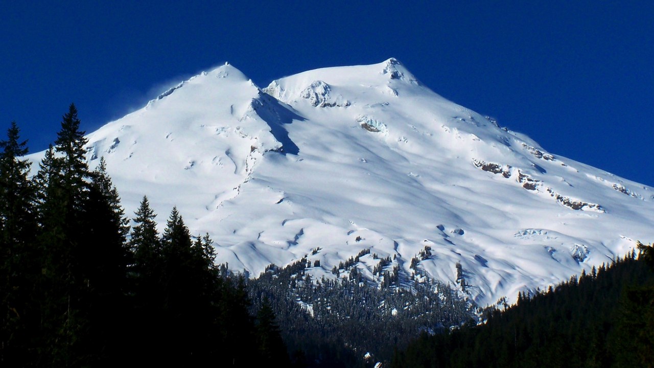
Located in the North Cascades near Bellingham, Washington, the volcano has the most active fumarole field of any peak in the range, with steam and gas venting continuously from its Sherman Crater. Though it last erupted in the mid-1800s, its heavy glacial cover means an eruption or a landslide could send volcanic mudflows down the Baker River toward the town of Concrete and other Skagit Valley communities. A burst of steam and ash in 1975 raised enough concern that officials closed nearby recreation areas for a time.
The Cascades Volcano Observatory monitors the mountain’s gas emissions and seismic activity, and Skagit County has mapped lahar-hazard zones along the Baker and Skagit Rivers that guide evacuation planning for downstream residents.
9. Lassen Peak: The Cascades’ Last Major Eruption
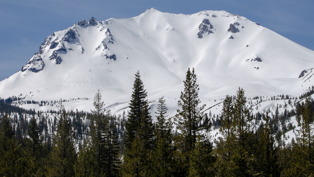
Rising above Lassen Volcanic National Park in far Northern California, the peak erupted repeatedly between 1914 and 1917, including a major explosion in May 1915 that sent a mudflow down its slopes and flattened forests for miles, the most significant Cascade eruption before Mount St. Helens in 1980. Towns such as Mineral, Old Station, and the larger city of Redding sit within the region geologists watch for renewed activity.
The U.S. Geological Survey monitors the peak with seismic and gas-sensing instruments, and park officials track the hydrothermal areas, boiling mud pots, and steam vents that show its magma system remains active below the surface.
More from Morning Overview
- A handful of SUVs keep hitting 300,000 miles, and they share one engine trait
- Supplements now rank as the fifth-leading cause of death from liver disease.
- A study names the one SUV most likely to reach 250,000 miles
- More than 60,000 people flee the Spokane area as complex fires overrun 600 structures
