
Seismographs have been measuring the planet’s largest ruptures for barely a century, yet that short record already holds events that moved coastlines and crossed entire oceans. Each quake below released energy on a scale that instruments, rather than eyewitnesses, had to quantify. Eight of the strongest ever recorded are gathered here, ordered by measured magnitude rather than by human cost.
1. 1960 Valdivia earthquake: The Highest Number On The Scale
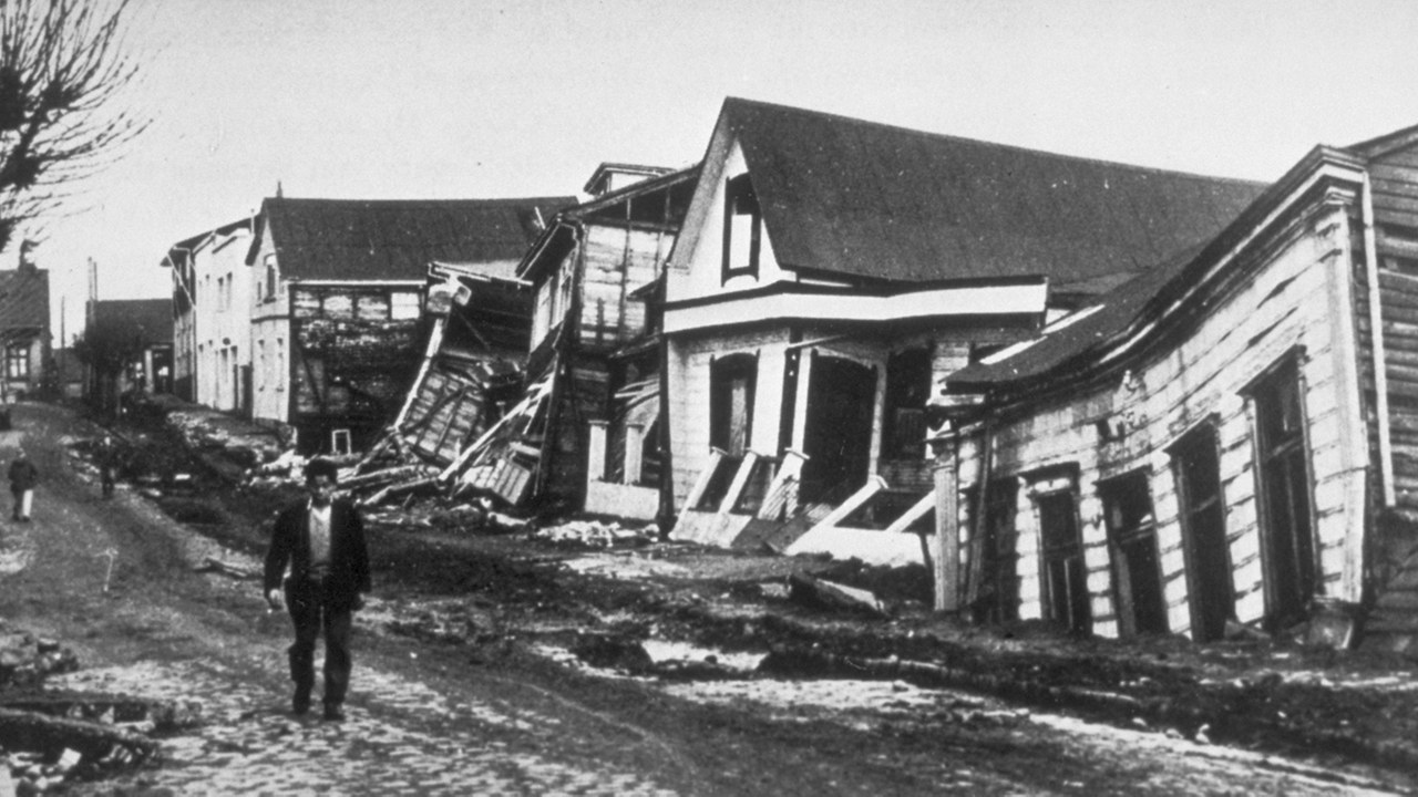
Southern Chile broke on May 22, 1960 in a rupture later assigned magnitude 9.5, the largest figure ever given to an earthquake. Roughly 600 miles of the boundary between the Nazca and South American plates gave way, and the tsunami from the Great Chilean earthquake crossed the Pacific to Hawaii, Japan and the Philippines. Tolls compiled afterward vary widely, with published estimates running from about 1,000 to several thousand across every country the waves reached.
No instrument has recorded anything larger since, and the 1960 figure still marks the practical ceiling of the moment magnitude scale. The event also showed that a subduction zone can fail along nearly its entire length at once, a pattern seismologists would later recognize in Alaska, Sumatra and Japan.
2. 1964 Alaska earthquake: Four Minutes That Moved A Coast
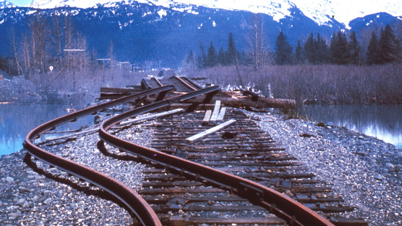
Beneath Prince William Sound on March 27, 1964, a magnitude 9.2 rupture shook south-central Alaska for roughly four and a half minutes, the strongest quake ever measured in North America. Land rose in some districts and dropped in others, submarine landslides tore away the waterfronts at Seward and Valdez, and the Good Friday earthquake sent tsunamis down the coast as far as California. About 130 deaths were attributed to the disaster, most of them caused by water rather than shaking.
Field mapping of that uplift by geologist George Plafker became early evidence that the Pacific plate was thrusting under Alaska, strengthening the then-contested case for plate tectonics. Tsunami warning coverage was extended to Alaska and the West Coast soon afterward.
3. 2004 Indian Ocean earthquake: When A Whole Basin Had No Warning

The megathrust off northern Sumatra failed on December 26, 2004 at a magnitude estimated between 9.1 and 9.3, tearing open close to 1,000 miles of seafloor. Waves from the Indian Ocean tsunami struck fourteen countries, some coasts within half an hour and others several hours later in Sri Lanka, India, Thailand and East Africa. Counts still differ between agencies, with widely cited totals of roughly 230,000 dead or missing.
Almost no detection network existed in the basin at the time, and there was no established channel for passing an alert to shoreline communities. The Indian Ocean Tsunami Warning System, built around deep-ocean sensors, tide gauges and national alert links, began operating in 2006 as a direct answer to that gap.
4. 2011 Tohoku earthquake: The Quake That Flooded A Reactor

Off northeastern Honshu on March 11, 2011, a rupture measured at magnitude 9.0 to 9.1 lifted the seafloor so sharply that run-up heights near 130 feet were surveyed along the Iwate coast and water pushed miles inland across the Sendai plain. Japanese police figures put the toll at about 19,700 dead and roughly 2,500 still missing. The Tohoku earthquake and tsunami also swamped the backup generators at Fukushima Daiichi, leading to meltdowns in three reactors.
That nuclear failure reshaped siting and emergency-power rules well beyond Japan, and several governments paused or reviewed their own reactor programs. Coastal defenses were rebuilt around an uncomfortable lesson: seawalls sized for the historical record had simply been overtopped.
5. 2010 Chile earthquake: Strict Codes Meet A Weak Warning
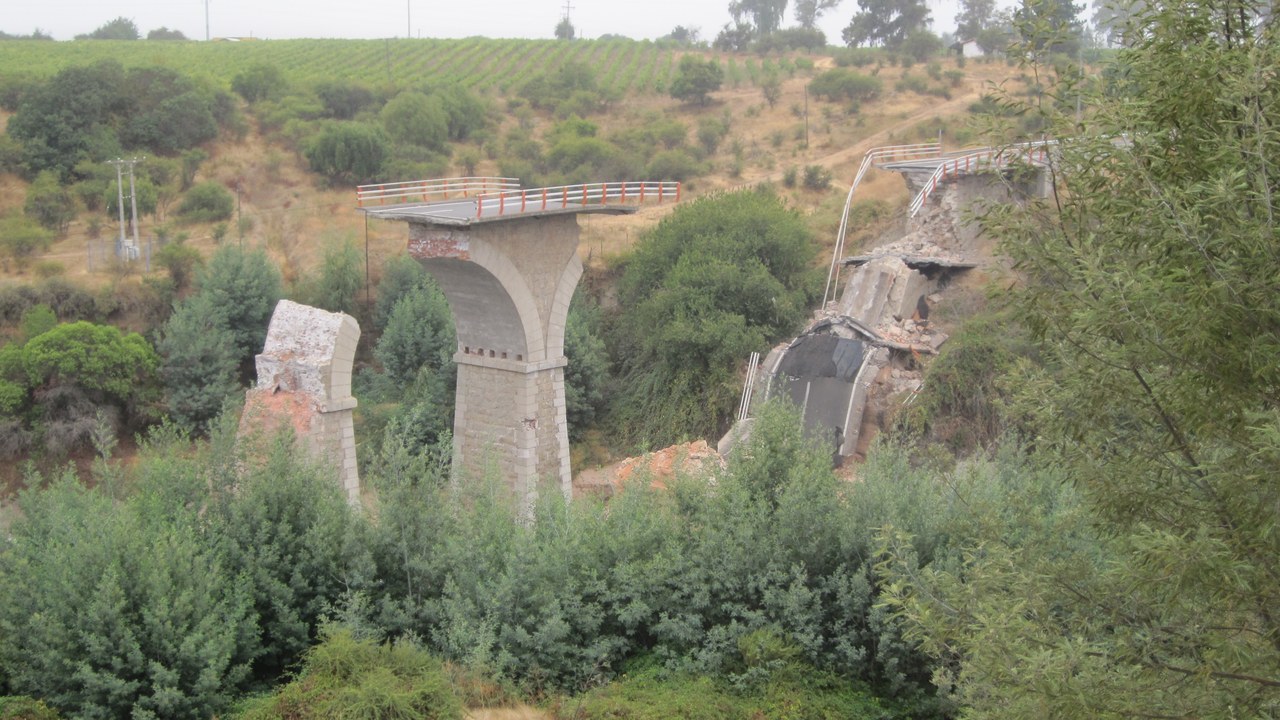
Central Chile was struck before dawn on February 27, 2010 by a magnitude 8.8 quake centered offshore of the Maule region, among the largest ever instrumentally recorded. Shaking lasted more than a minute across a densely populated stretch of the country, and the tsunami that followed the Maule earthquake hit coastal towns including Constitucion and Talcahuano. Chilean authorities recorded roughly 525 deaths, far fewer than the magnitude alone would suggest.
Much of that outcome traces to the strict seismic building code adopted after the 1960 catastrophe, which kept most modern structures upright. The clearest failure was in the warning chain, where a tsunami alert was issued and then withdrawn, and that breakdown forced a rebuild of the national emergency system.
6. 1952 Kamchatka earthquake: A Disaster Kept Off The Record
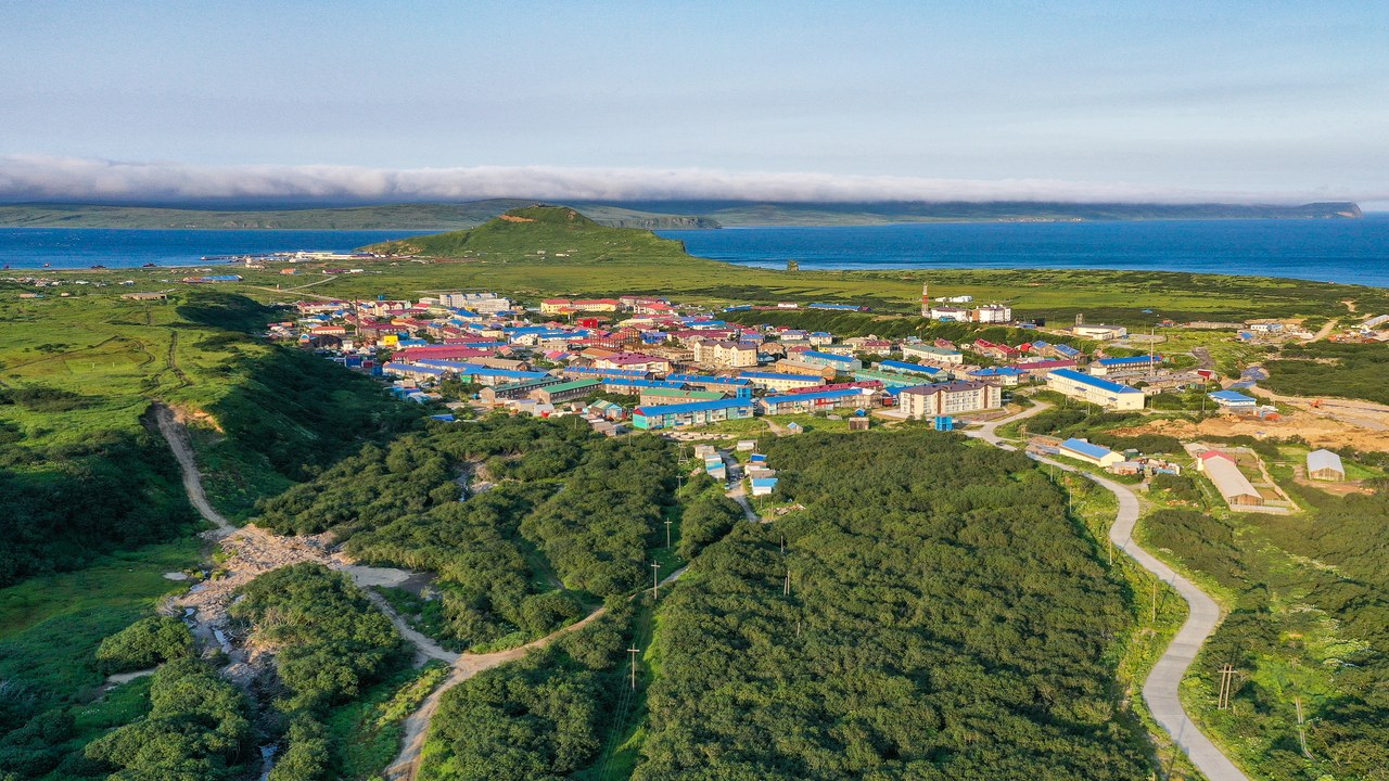
A magnitude 9.0 rupture off the Kamchatka Peninsula on November 4, 1952 drove waves into the Kuril Islands within minutes, and the town of Severo-Kurilsk on Paramushir was largely destroyed by the Severo-Kurilsk tsunami. Soviet authorities never announced the event, and no toll was published for decades; the figure eventually released was about 2,336, though other estimates run higher. The same waves reached Hawaii, where they damaged property without causing reported deaths.
How far that energy traveled strengthened the argument for a Pacific-wide alert network instead of scattered local watches. Because the records stayed closed, seismologists outside the Soviet Union worked mainly from distant instrument traces, an early lesson in how much a closed state can conceal about a natural disaster.
7. 1957 Andreanof Islands earthquake: An Aleutian Rupture Few Remember
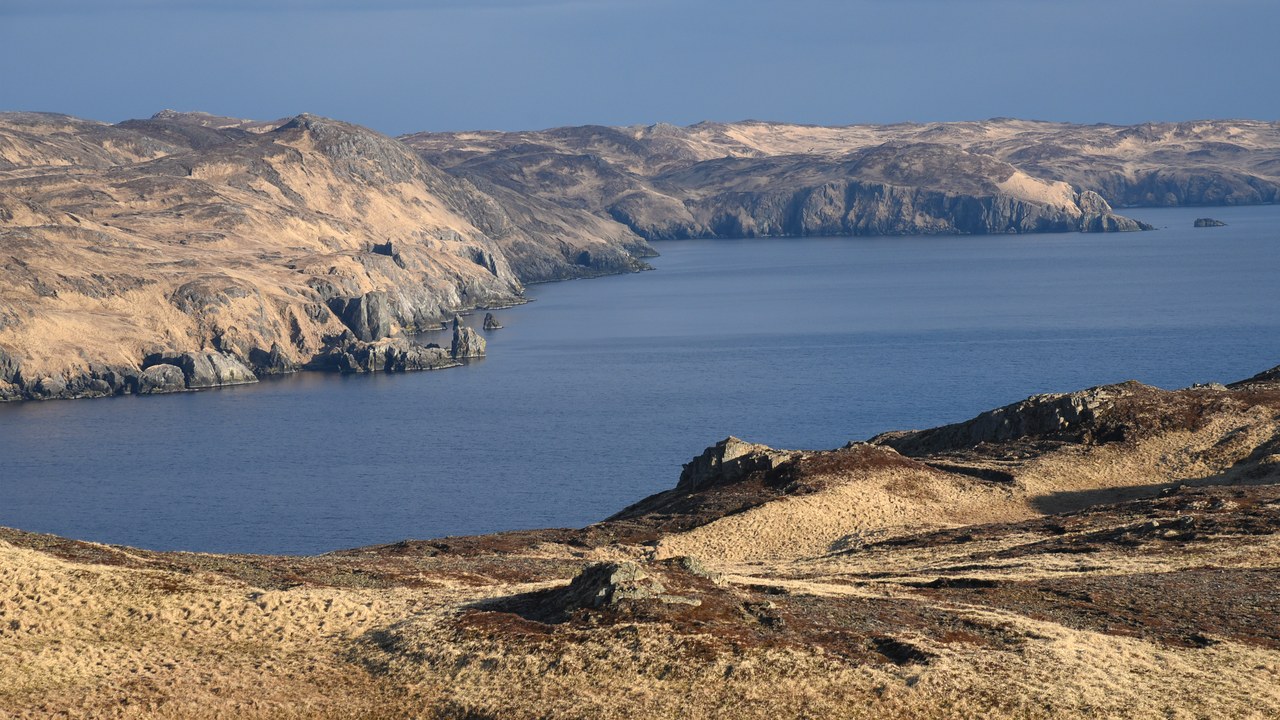
The Aleutian arc tore open on March 9, 1957 in a magnitude 8.6 event whose rupture zone ran for hundreds of miles along the Andreanof Islands. Because that chain is almost uninhabited, the Andreanof Islands earthquake caused no reported deaths locally, yet its tsunami wrecked buildings on Adak and Umnak and traveled to Hawaii, where waves destroyed homes near Hilo and on the north shore of Oahu. Mount Vsevidof erupted days later after two quiet centuries.
The sequence made the Aleutians a permanent concern for Hawaii and the West Coast, since a rupture there can be destructive thousands of miles away while barely registering on land nearby. Modelers still use 1957 to estimate how far an Aleutian source can throw energy across open water.
8. 2005 Nias-Simeulue earthquake: An Aftershock Big Enough To Rank
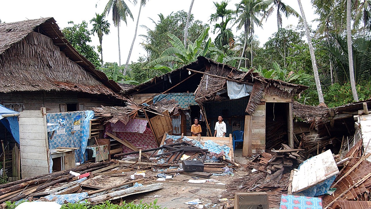
Three months after the 2004 catastrophe, the same fault system slipped again on March 28, 2005 in a magnitude 8.6 event beneath the islands of Nias and Simeulue. The Nias-Simeulue earthquake collapsed buildings in the town of Gunungsitoli and killed somewhere between roughly 900 and 1,300 people by published counts, with damage concentrated on the islands rather than the Sumatran mainland. The tsunami it raised stayed comparatively small.
Researchers tied the rupture to stress transferred along the fault by the 2004 event, one of the clearest field cases of a great earthquake loading its neighbor. Coral heads lifted clear of the water around Simeulue also left a physical record of uplift that could be measured directly instead of inferred from distant instruments.
More from Morning Overview
