
Island rankings run on a convention: any landmass bigger than Greenland is treated as a continent, which is why Australia never appears. What remains is a list dominated by places most people rarely picture, built from Arctic ice sheets, equatorial rainforest and volcanic ridges rather than tropical resorts. Here are eight of the largest islands on Earth.
1. Greenland: Three Times The Runner-Up
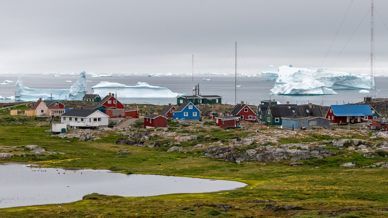
Greenland spans about 836,000 square miles, more than three times the area of the next island on this list, and an ice sheet up to two miles thick covers roughly four-fifths of it. The weight of that ice has pressed the bedrock into a basin, leaving much of the island’s interior below sea level.
Only a narrow ice-free coastal fringe supports settlement, which is where nearly all of the roughly 56,000 residents live. Size is not what excludes Greenland from continent status either; the convention that anything larger counts as a continent is precisely what keeps it first among islands rather than off the list entirely.
2. New Guinea: A Cordillera Above The Equator
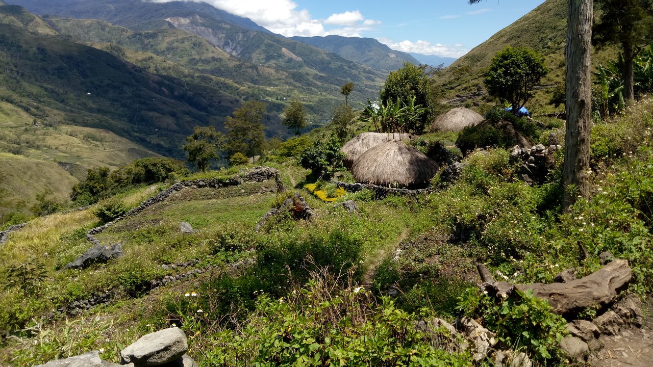
A central cordillera runs the length of New Guinea, reaching 16,024 feet at Puncak Jaya, the highest summit between the Himalayas and the Andes. Small glaciers still cling to those equatorial peaks, though they have shrunk for decades. That rugged interior terrain isolated valley after valley, leaving the island with more than 800 languages.
Roughly 303,000 square miles make it second only to Greenland, yet a political line splits it down the middle: Indonesia holds the western half, Papua New Guinea the east. Two capitals, two legal systems and two conservation regimes now govern one ecosystem, which complicates everything from road building to logging enforcement.
3. Borneo: Three Flags, One Rainforest
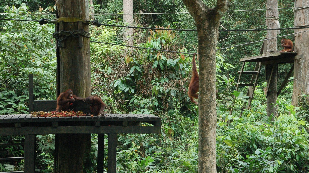
Three countries divide Borneo’s roughly 287,000 square miles. Indonesia administers about three-quarters of it as Kalimantan, Malaysia governs Sabah and Sarawak along the north, and Brunei occupies a small coastal enclave. Above the island’s ancient lowland rainforest, Mount Kinabalu rises to 13,435 feet, the highest point between the Himalayas and New Guinea.
Logging and oil palm plantations have cut deeply into those lowland forests, fragmenting habitat for Bornean orangutans and pygmy elephants. Because protection depends on which side of a border a stand of trees happens to fall, enforcement can change abruptly at a line drawn through otherwise unbroken jungle. More than 20 million people live on the island, concentrated along its rivers and coasts rather than in the highland interior.
4. Madagascar: Eighty-Eight Million Years Alone
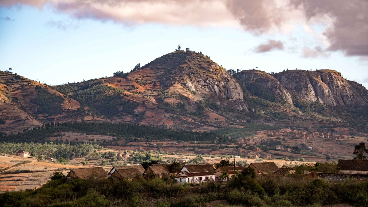
Madagascar separated from the Indian landmass roughly 88 million years ago, and the isolation that followed produced a biology found nowhere else, with close to 90 percent of its species endemic. More than 100 kinds of lemur, several baobab species and an outsized share of the world’s chameleons evolved on this one island.
At about 226,000 square miles it ranks fourth by area, but rarity rather than size defines it. Slash-and-burn clearing has removed much of the original forest, and species confined to a single island have nowhere to retreat, which is why an unusually large fraction of them sit on threatened lists.
5. Baffin Island: Canada’s Empty Arctic Giant
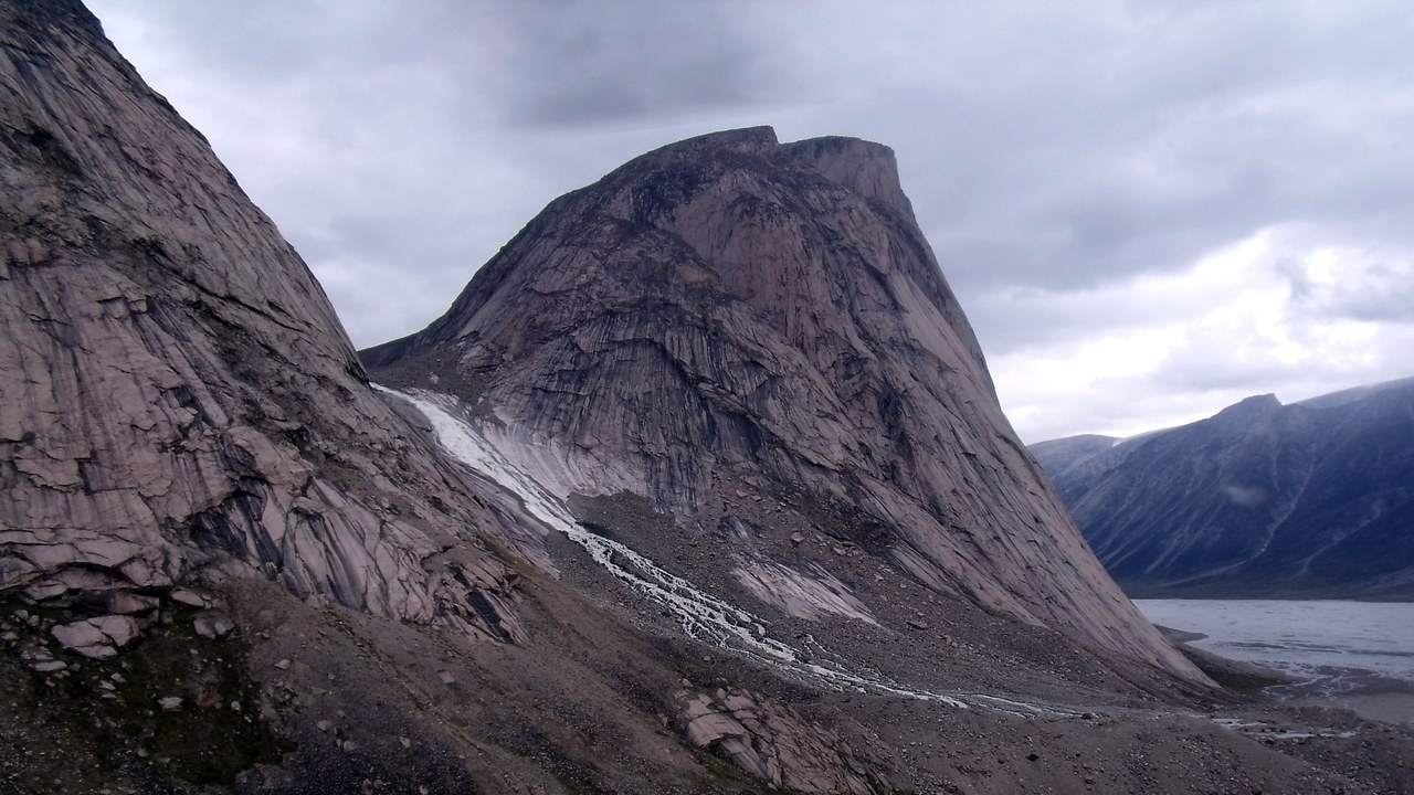
Fewer than 14,000 people occupy Baffin Island, a landmass of roughly 196,000 square miles that is larger than Spain and the biggest in Canada. Iqaluit, the capital of Nunavut, sits near its southeastern shore. Its interior holds the Barnes Ice Cap, a thinning remnant of the Laurentide Ice Sheet that once buried most of the continent.
Fjords slice the eastern coast into granite walls, among them Mount Thor, whose 4,101-foot face is often described as the longest purely vertical drop anywhere. With no road network linking the island’s communities, movement between them depends on aircraft year-round and on sea ice during the coldest months.
6. Sumatra: Built Along A Subduction Zone
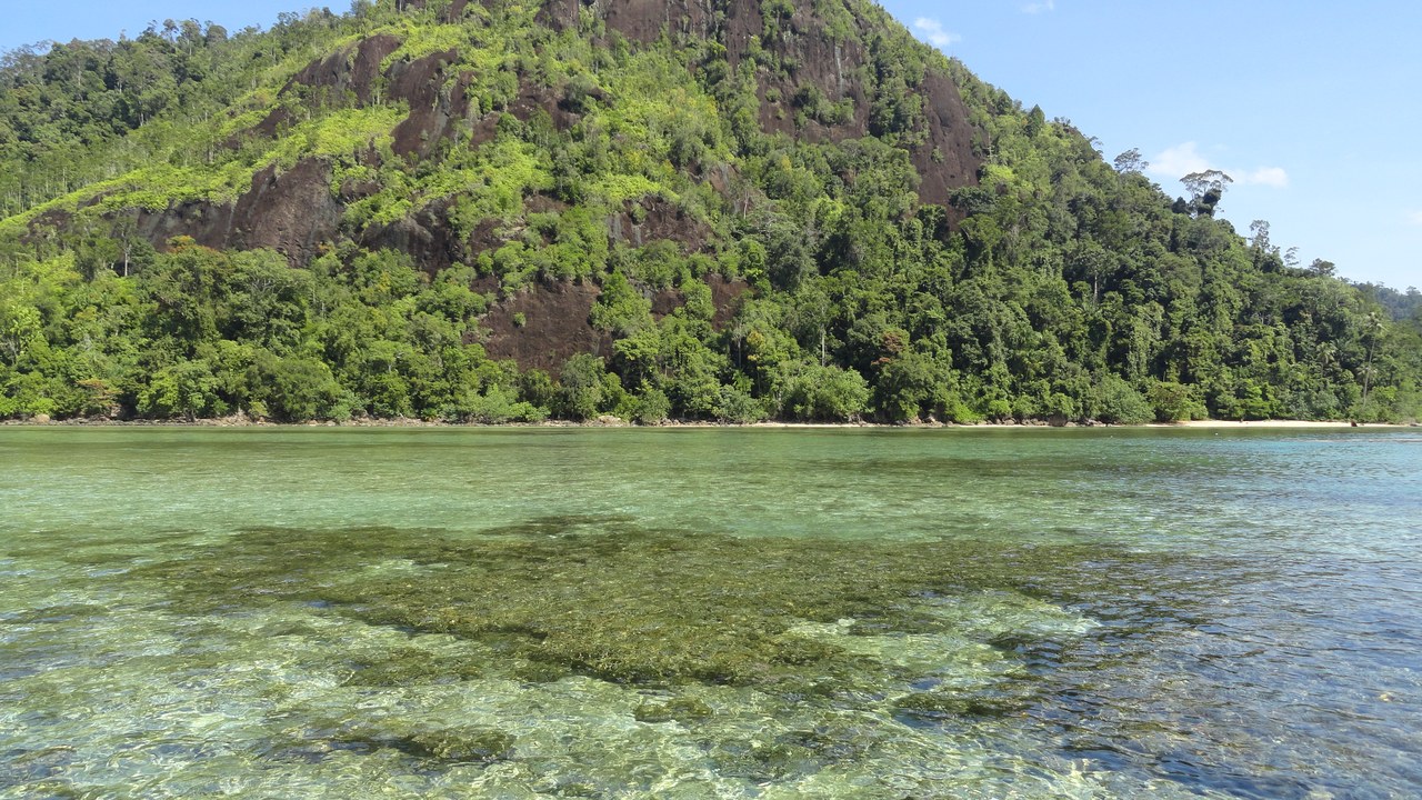
Sumatra lies directly along the Sunda subduction zone, and the Barisan Mountains down its western spine carry dozens of active volcanoes. Lake Toba fills the caldera left by a supervolcanic eruption about 74,000 years ago, the largest known in two million years, and the same fault system generated the magnitude 9.1 earthquake of 2004.
Volcanic soil is the other side of that ledger, feeding the coffee, rubber and palm estates that anchor the island’s economy. Nearly 60 million people live with the trade-off, on an island where major eruptions and destructive earthquakes are recurring features of the geology rather than rare accidents.
7. Honshu: The Most Populous Island On Earth
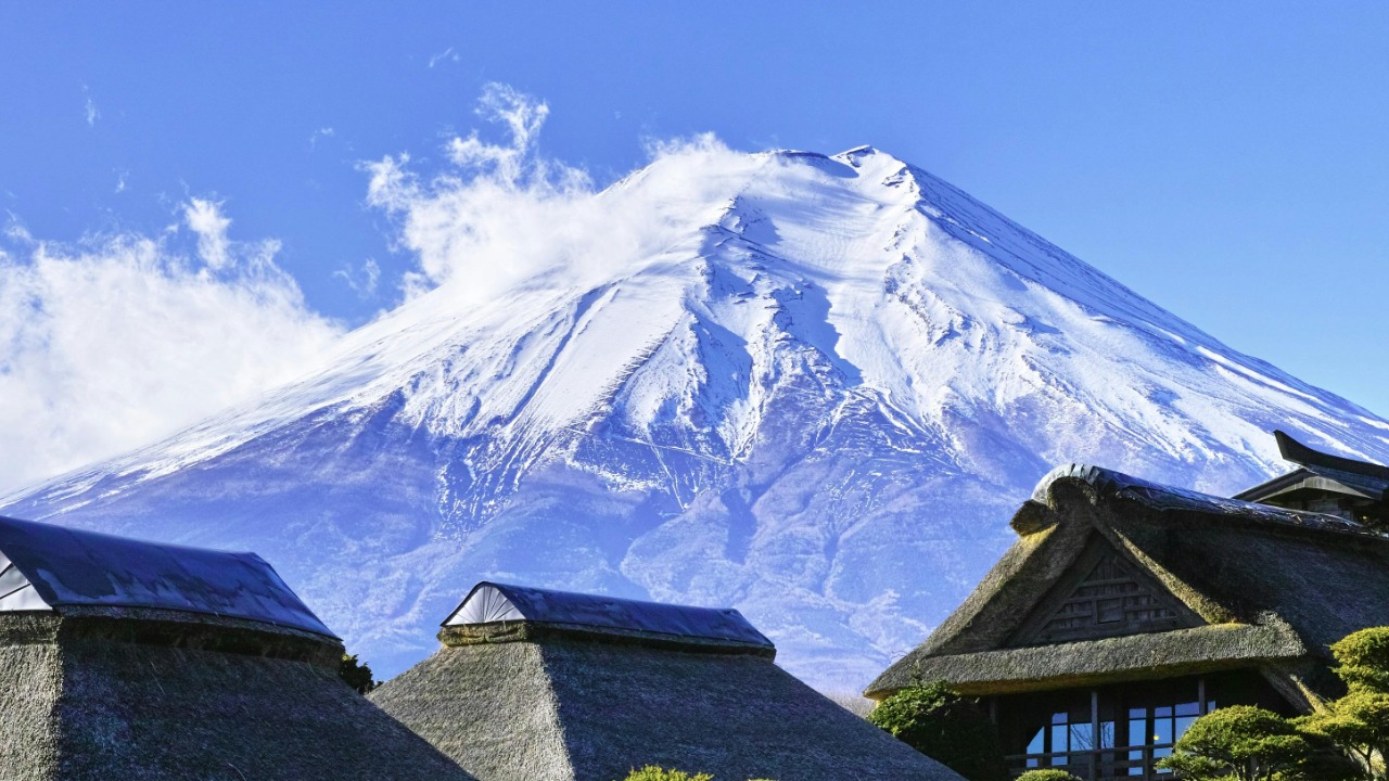
No island on Earth carries more people than Honshu, where more than 100 million residents share about 88,000 square miles. Tokyo, Osaka, Nagoya and Kyoto all sit on it. Its central mountain ranges, crowned by 12,388-foot Mount Fuji, force nearly all of that population onto narrow coastal plains.
The result is extreme unevenness, with close to a third of Japan’s population inside the Greater Tokyo area alone. The Kanto plain around Tokyo holds one of the densest urban regions anywhere, while inland valleys empty out year after year as Japan’s population declines. Depopulation arrives in the mountain towns long before it registers along the corridor running from Tokyo to Osaka.
8. Great Britain: Europe’s Largest, By Some Margin
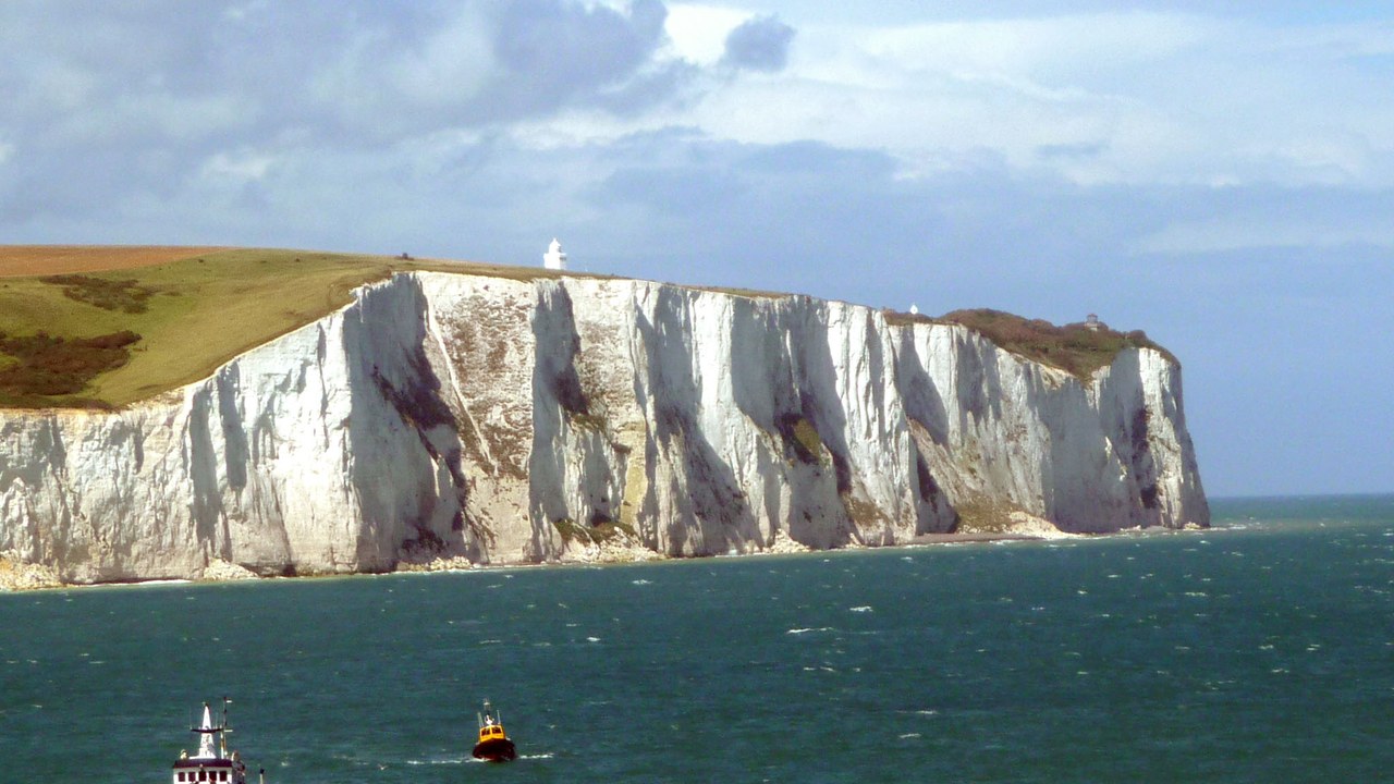
England, Scotland and Wales share one landmass of roughly 80,800 square miles, the largest island in Europe and the ninth largest in the world. Its deeply indented coastline means no point sits much more than 70 miles from tidal water, a geography that pushed centuries of trade, fishing and naval power outward from the shore.
About 65 million people live there, packed densely across southern England and thinly across the Scottish Highlands. The island is also narrower than the state it anchors: the United Kingdom additionally includes Northern Ireland and hundreds of smaller offshore islands that Great Britain proper does not.
