Image Credit: Ahmet KAYNARPUNAR - CC BY-SA 3.0/Wiki Commons
Beneath some of the world’s most familiar landmarks, entire architectures run in the opposite direction, cut downward into rock, salt and old quarry stone. Some were carved for refuge, others for water, burial, war or plain relief from the heat. Here are eight underground worlds hollowed out beneath famous places that still draw visitors above them.
1. Derinkuyu: The Refuge Eighty-Five Metres Down
<p>Image Credit: Ahmet KAYNARPUNAR – CC BY-SA 3.0/Wiki Commons</p>
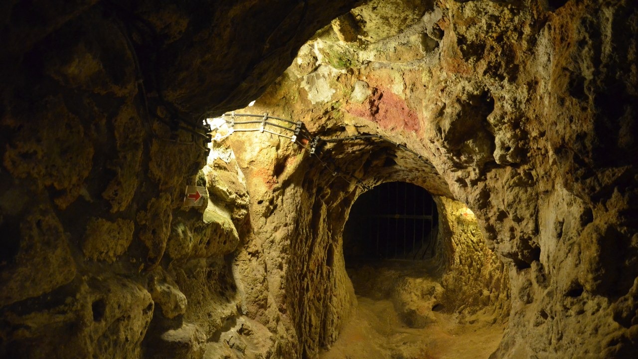
Cut into the soft volcanic tuff of Turkey’s Cappadocia region, Derinkuyu drops roughly 85 metres beneath the modern town that shares its name. Stables, storerooms, wells, wine and oil presses, chapels and living quarters fill its levels, and the Derinkuyu complex is estimated to have sheltered around 20,000 people along with their livestock and provisions.
Everything about the layout reads as refuge rather than residence. Heavy circular stone doors could be rolled shut from the inside to seal a level, ventilation shafts kept the deepest air breathable, and narrow passages forced anyone following to move in single file. Much of the network stayed unrecorded until 1963, when work on a house above exposed a sealed opening leading into it.
2. Catacombs of Paris: Six Million Residents Under the Streets
Image Credit: Shadowgate from Novara, ITALY – CC BY 2.0/Wiki Commons
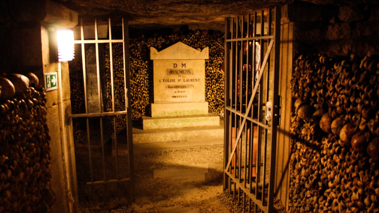
The ossuary under Paris began as limestone quarries that had quietly undermined the city, and it took on bones in 1786 after overflowing graveyards were emptied into the void. Skulls and femurs were later stacked into the decorative walls that visitors file past today, with the Paris ossuary holding the remains of an estimated six million people.
Only a short lit circuit of about a kilometre and a half is open to the public, a sliver of a quarry network that sprawls for hundreds of kilometres below street level. The rest is closed, mapped unevenly and patrolled by a dedicated police unit, which does not stop explorers from slipping in through shafts and manholes.
3. Wieliczka Salt Mine: Chapels Carved Out of Rock Salt
Image Credit: Bjoertvedt – CC BY-SA 4.0/Wiki Commons
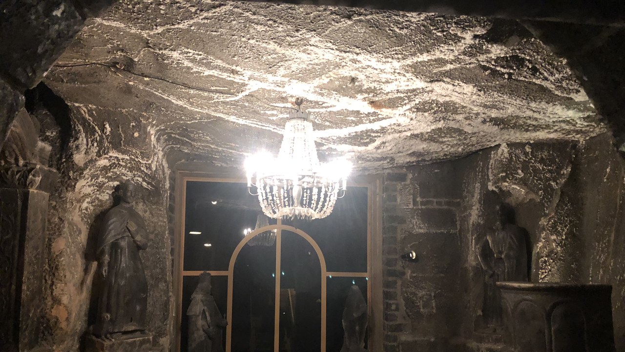
Salt came out of Wieliczka in southern Poland from the 13th century until commercial extraction ended in the 1990s, leaving nine levels and roughly 245 kilometres of galleries behind. Miners decorated the emptied chambers as they worked, and the best known room in the Wieliczka workings is the Chapel of St Kinga, about 100 metres down, where altars, floor reliefs and chandeliers are all cut or crystallised from rock salt.
Wieliczka joined the first UNESCO World Heritage list in 1978 and now runs as a museum and tourist route rather than a working mine. Preservation is a permanent job: damp air slowly dissolves the carvings and rock pressure squeezes the galleries closed, so ventilation, timbering and monitoring never stop.
4. Cu Chi tunnels: A War Fought Below the Fields
Image Credit: MinhVN123 – CC BY-SA 4.0/Wiki Commons
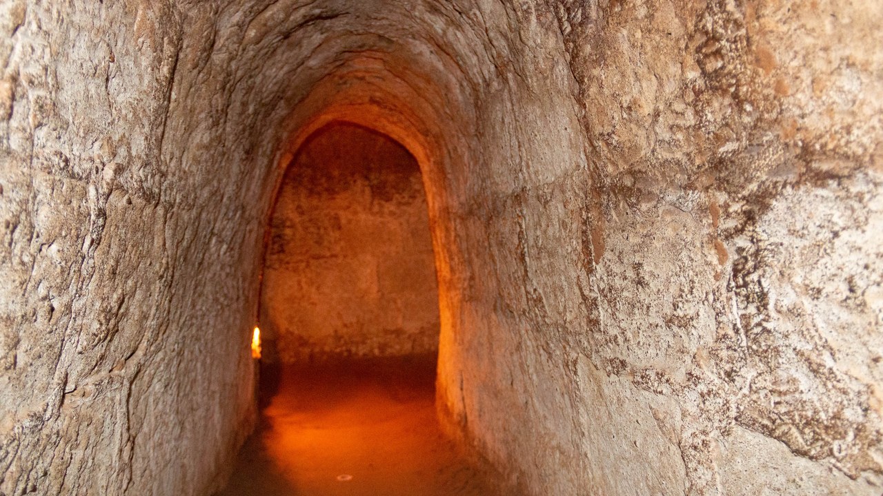
Northwest of Ho Chi Minh City, the Cu Chi network was dug by hand through laterite clay that sets hard when dry, and across decades of conflict it grew into a system measured in the region of 250 kilometres. Barracks, kitchens, field hospitals, storage and command posts were built into the Cu Chi tunnels, linked by crawlways often under a metre wide and hidden behind camouflaged trapdoors.
Life below ground meant heat, bad air, insects, snakes and flooding, and clearing the passages produced the specialist American teams nicknamed tunnel rats. Two stretches are open to visitors now, deliberately widened from the original bore because the passages as dug are too tight for most people to enter.
5. Coober Pedy: An Opal Town That Moved Downward
Image Credit: Pavel Špindler – CC BY 3.0/Wiki Commons
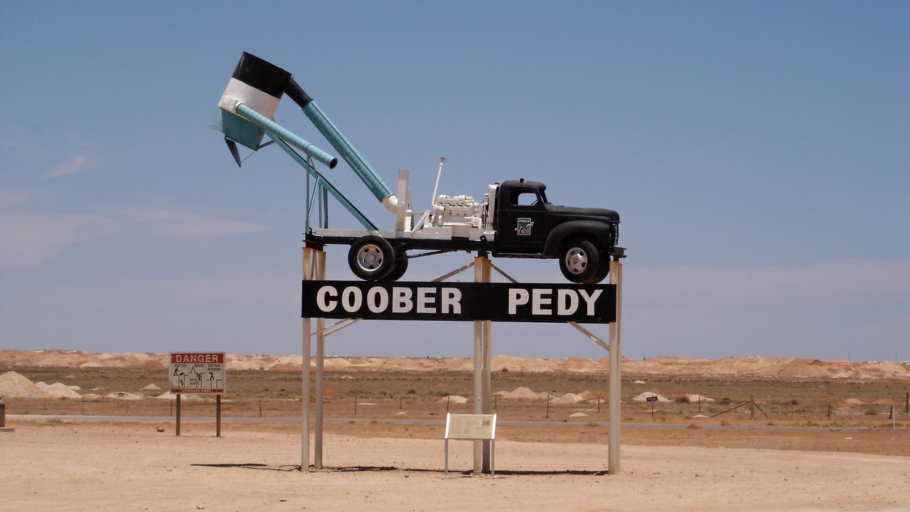
Opal was found at Coober Pedy in South Australia in 1915, and returning First World War veterans turned mining dugouts into houses to escape summer heat that regularly climbs past 40C. A large share of the residents of the opal-mining town still live below the surface in dugouts cut into low hillsides, where the surrounding rock holds a mild, steady temperature without any air conditioning.
Churches, a hotel, shops and galleries occupy the same excavated space, lit and ventilated through shafts driven to the surface. Adding a bedroom is a matter of cutting further into the sandstone, which is cheap enough that homes expand sideways over time rather than up.
6. Basilica Cistern: A Marble Forest Holding Water
Image Credit: Tcyagizefem – CC BY-SA 4.0/Wiki Commons
Built under the emperor Justinian I in the 6th century to supply the Great Palace, the Basilica Cistern occupies a hall the footprint of a cathedral beneath central Istanbul. Twelve rows of 28 columns, 336 in all, carry the brick vaults of the Byzantine reservoir, which was engineered to store on the order of 80,000 cubic metres of water.
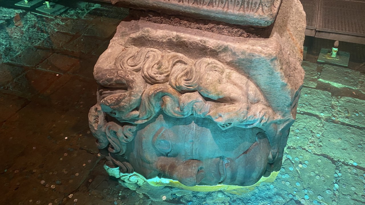
Many columns were salvaged from earlier Roman buildings, which is why two carved Medusa heads sit in one corner as plinths, one on its side and one inverted. Shallow water still covers the floor, and raised walkways carry visitors over the carp that circle between the shafts.
7. Puerto Princesa Subterranean River: A River Under a Mountain
Image Credit: Francisco M. Pajares, Jr. – CC BY-SA 4.0/Wiki Commons
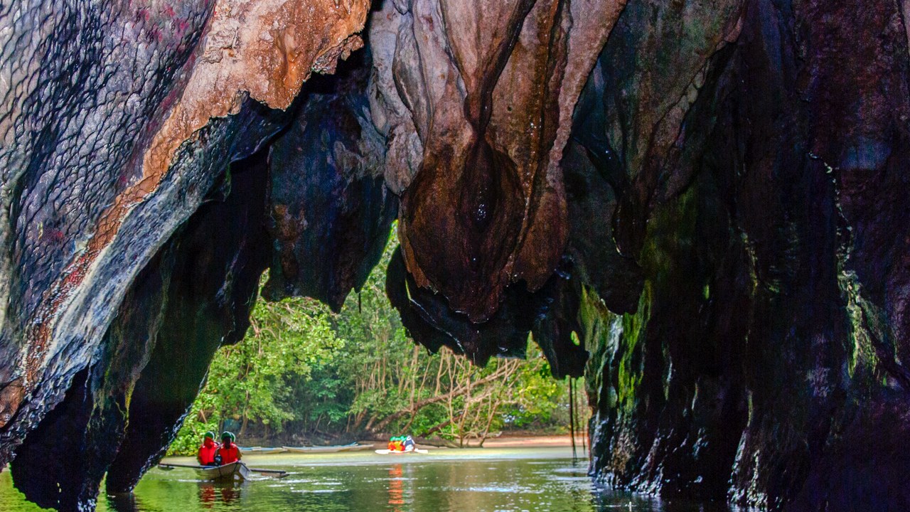
On the Philippine island of Palawan, a river runs for about 8 kilometres through a limestone cave under the St Paul mountain range before it reaches the sea. The lower reach of the subterranean river is tidal, so seawater pushes inland with the tide and paddled boats can follow the passage into domed chambers hung with stalactites.
The surrounding park entered the UNESCO World Heritage list in 1999 and protects forest, karst and coastline inside a single boundary. Access to the river is rationed by permit and daily quota, which keeps boat traffic away from the swiftlet and bat colonies roosting in the darker chambers.
8. Kaymakli: Eight Levels Under a Village
Image Credit: Nevit Dilmen – CC BY-SA 3.0/Wiki Commons
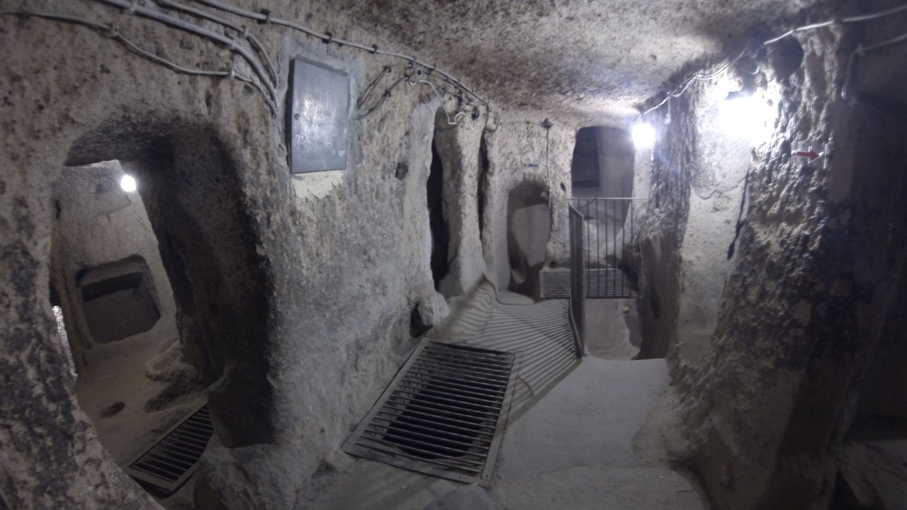
Kaymakli sits beneath a village on the Nevsehir plain, closely enough tied to the houses above that some families still use the upper rooms for storage. Passages in the Kaymakli underground city are lower and narrower than at Derinkuyu, sloping steeply between eight excavated levels, of which four are open, past stables, chapels, storage rooms and a press cut from the rock.
Ventilation shafts run down through the floors and millstone doors could close a level off from within, the same defensive grammar used across Cappadocia. The site is often described as joined to Derinkuyu by a tunnel several kilometres long, a link that rests on local accounts rather than on any passage open to walk today.
More from Morning Overview
Morning Overview is reader-supported. Some links in our articles are affiliate links, and we may earn a commission at no extra cost to you. As an Amazon Associate I earn from qualifying purchases. Full disclosure.