
Some of the oldest settlements on record were not built upward but cut inward, into tuff, chalk, sandstone and packed desert soil. Refuge from raiders, siege or heat drove the digging, and the results survive because rock outlasts brick. Here are eight ancient underground cities carved into solid rock, from Cappadocia to the Australian opal fields.
1. Derinkuyu underground city: Eighteen Storeys Beneath Cappadocia
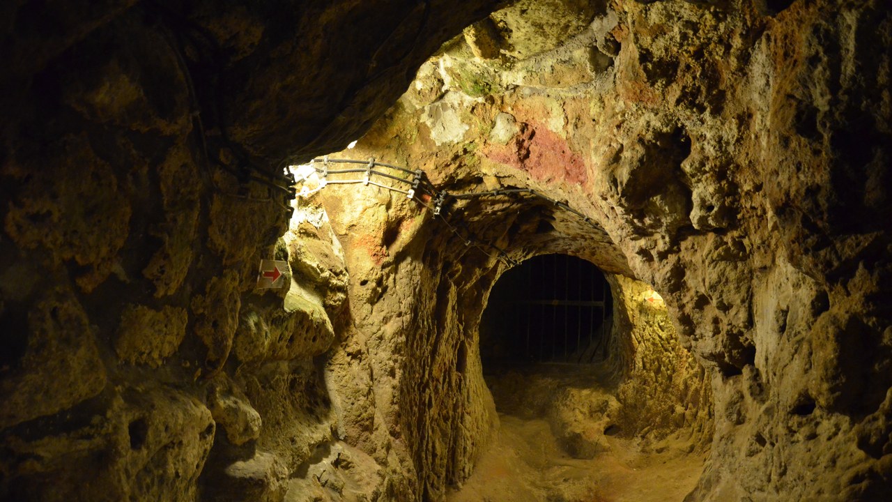
Beneath a plateau in central Anatolia, Derinkuyu drops roughly 85 metres through soft volcanic tuff, and the multi-level city at Derinkuyu is estimated to have sheltered as many as 20,000 people along with their livestock and food stores. Circular stone doors, some more than a metre across, could be rolled shut from the inside only. Ventilation shafts run the full height of the complex, keeping the deepest chambers breathable.
The full scale was rediscovered by accident in 1963, when a resident knocking through a wall of his house opened onto a forgotten tunnel. Only part of the network is accessible today; the rest stays closed on safety grounds.
2. Kaymaklı Underground City: Four Open Levels, Eight Known
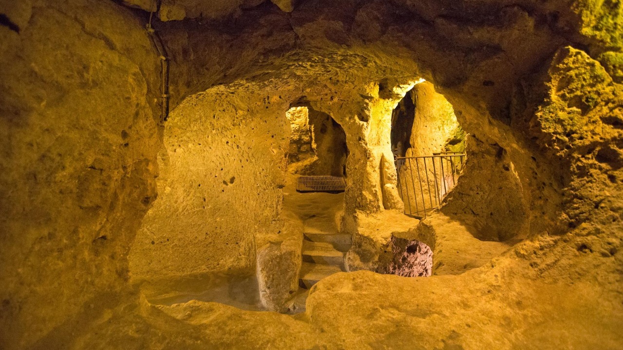
Dug beneath the castle mound of the village that shares its name, the underground city at Kaymakli spreads outward rather than plunging straight down, its wide, low passages forcing adults to stoop. Eight levels have been identified and four are open to the public. Storage rooms, stables, wine and oil presses and a church fill the tiers, and more than a hundred tunnels branch off the main galleries.
Villagers above ground still use upper chambers as cellars and stables, which makes the place feel less like a ruin than a basement in continuous service. The cramped, sloping corridors also make the deeper levels hard going for anyone with limited mobility.
3. Petra: Carved From The Top Down
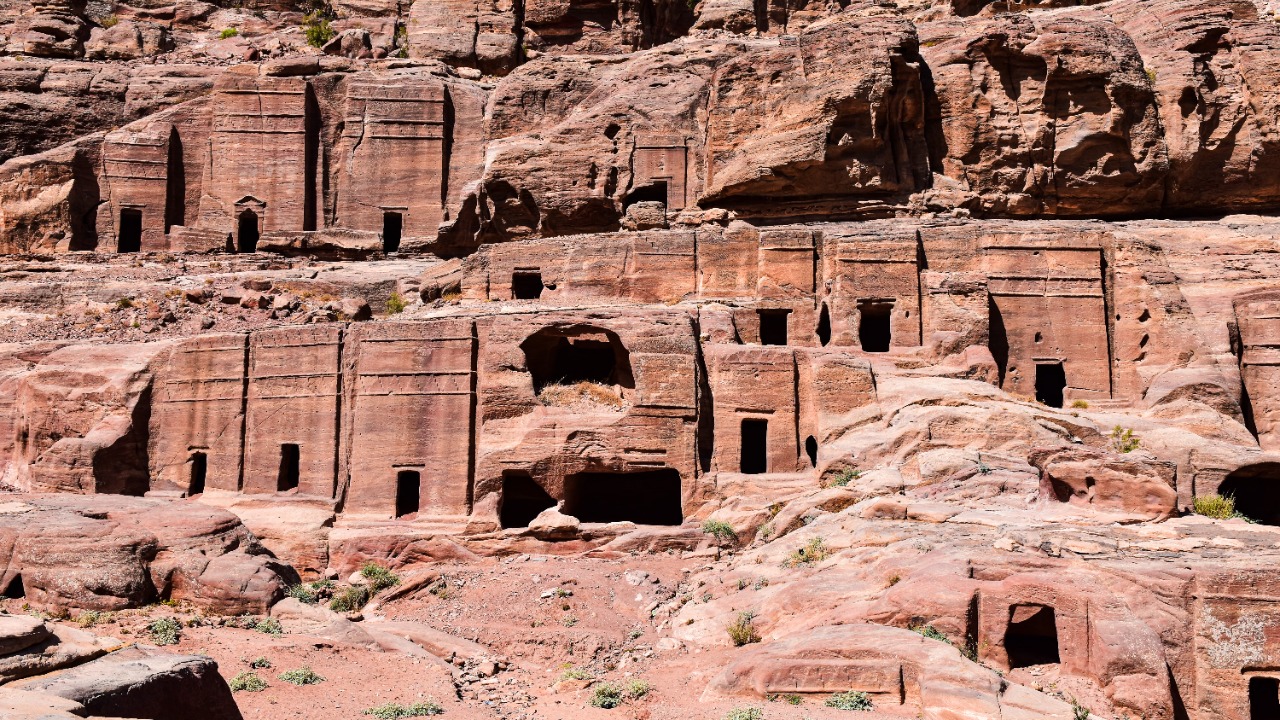
Nabataean masons cut Petra’s monuments into sandstone from the top down, chiselling facades such as Al-Khazneh straight out of the cliff wall. The approach runs through the Siq, a gorge more than a kilometre long that opens without warning on the carved front. The rock-cut architecture of Petra was paired with dams, cisterns and conduits that captured flash floods in a desert basin.
One caveat separates Petra from a true subterranean town: most of the carved chambers are tombs and temples, while ordinary Nabataeans lived in freestanding houses on the valley floor. The ruins were inscribed as a UNESCO World Heritage Site in 1985.
4. Longyou Caves: Twenty-Four Caverns, No Records
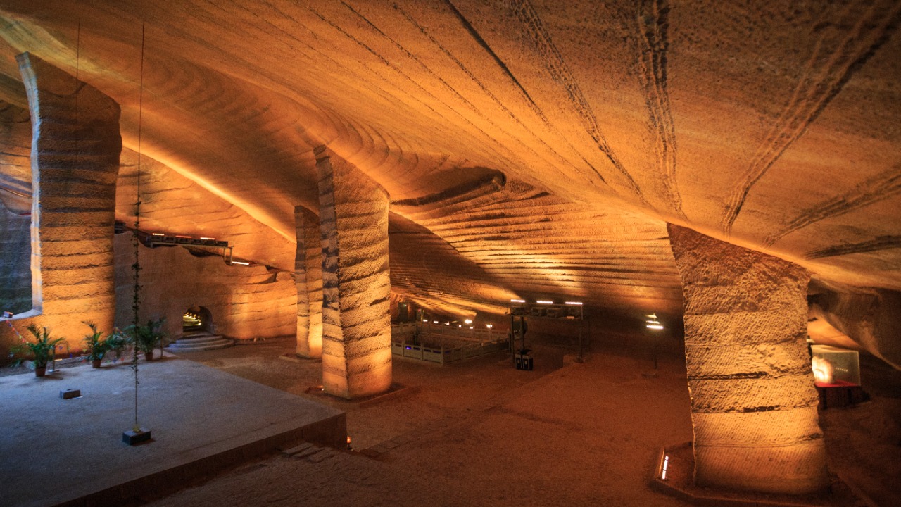
Villagers in Shiyan Beicun, Zhejiang, drained ponds they had assumed were bottomless in 1992 and found caverns underneath. Twenty-four have been counted, their walls and ceilings covered in regular parallel chisel bands, their roofs carried by rock pillars the diggers left standing. No surviving Chinese text describes the cutting of the Longyou caverns, and no spoil heap from the excavated stone has been located.
Proposed explanations run from imperial quarrying to grain storage or troop shelter, none of them confirmed. Several caverns now have walkways and lighting for visitors, while others remain flooded and largely unexamined.
5. Naours: Three Hundred Chalk Chambers

Under a chalk hill in the Somme, the muches of the underground town at Naours hold roughly 300 chambers linked by about two kilometres of galleries, with carved chimneys venting smoke through the hillside above. Local families sheltered there during medieval raids and later wars, driving livestock down with them. A parish priest reopened the sealed network in the 1880s and turned it into an attraction.
The walls carry a second layer of history: thousands of names and dates were scratched into the chalk by soldiers, many of them Australian and British, who came down during the First World War. Researchers have been cataloguing that graffiti since 2014.
6. Nushabad: Three Levels Under A Desert Town

Diggers near Kashan cut Ouyi, the hand-dug city beneath the desert town of Nushabad, out of dense soil on three levels reaching some 18 metres down. Corridors were kept narrow enough that a single defender could block them, and benches, air ducts and water channels were carved along the route. The uppermost level sits only a few metres under the streets, close enough for hatches inside houses.
The complex is usually attributed to the Sassanid period, which would make it around 1,500 years old, and it stayed in use through later invasions. Modern Nushabad stands directly on top, so excavation is constrained by the buildings overhead.
7. Coober Pedy: Dugouts Against Forty-Degree Heat

Summer heat in the South Australian opal fields regularly pushes past 40 degrees Celsius, and residents of the mining town of Coober Pedy answered it by moving underground. Homes, churches, a hotel and shops are cut into the hillsides as dugouts, where the temperature holds steady around the low twenties all year without air conditioning. Ventilation shafts pierce the surface, studding the ground with pale chimneys.
Adding a room is comparatively cheap, because the sandstone cuts easily and holds its own ceiling without framing. Beyond the built-up area the ground is riddled with old mine shafts, and warning signs ask people not to walk backwards while taking photographs.
8. Vardzia: Thirteen Tiers In A Cliff

Masons working for Giorgi III and Queen Tamar in the 12th century hollowed the cave monastery of Vardzia into the flank of Erusheti Mountain above the Mtkvari River in southern Georgia. The warren ran deep into the rock across as many as thirteen tiers, with chapels, wine cellars, bakeries and a piped spring. Frescoes in the Church of the Dormition still show the queen among the donors.
An earthquake in 1283 sheared away the outer wall of rock that had hidden the settlement, leaving the chambers exposed in cross-section as they appear now. Monks have since returned to part of the complex, and those sections are closed to visitors.
More from Morning Overview
