
Volcano monitoring is not a prediction that disaster is imminent. Scientists watch deformation, earthquakes, gas, heat, and water because changes can reveal magma moving through complex systems, sometimes long before an eruption and sometimes without one occurring at all. These eight United States volcanoes combine active geology with consequences that make close observation essential.
1. Yellowstone: A Vast Caldera Under Constant Scrutiny
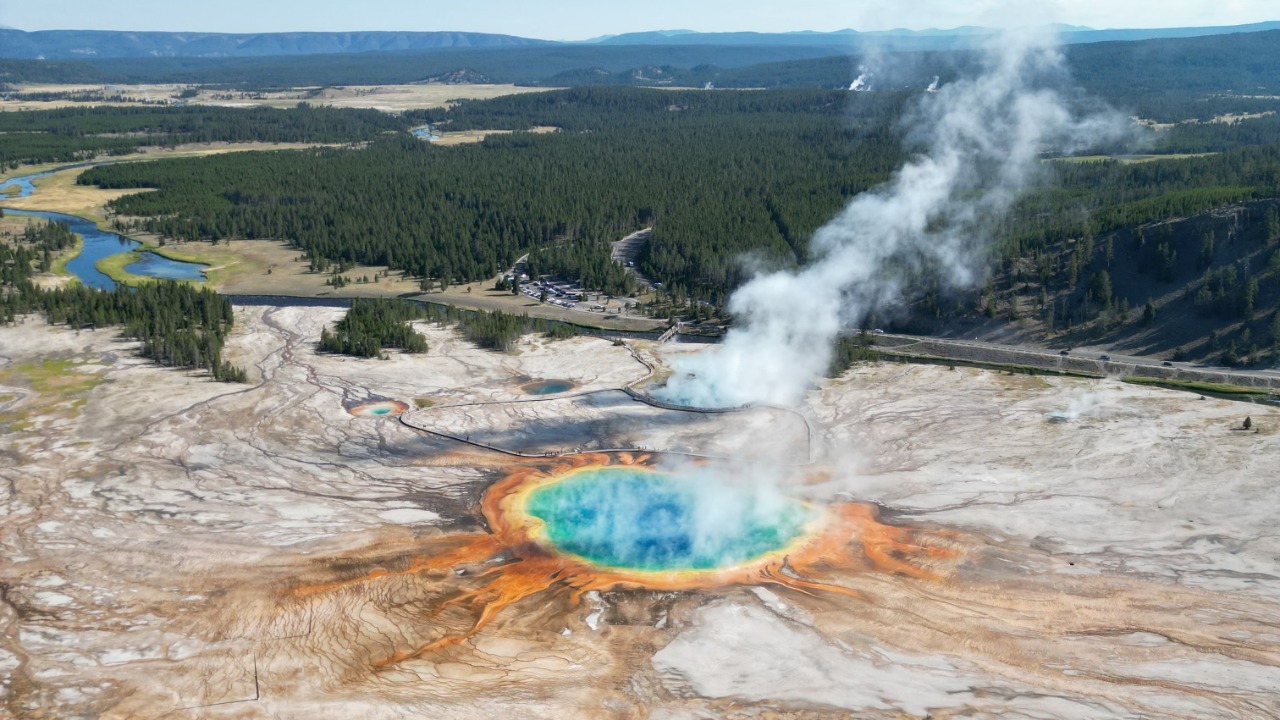
Yellowstone’s famous geysers and hot springs are surface expressions of heat beneath a huge volcanic system. The Yellowstone Volcano Observatory tracks earthquakes, ground deformation, thermal features, and gas across the caldera and surrounding region. Its prehistoric explosive eruptions were immense enough to spread ash across large areas, which explains the intense scientific and public attention.
Close monitoring does not mean a supereruption is expected soon. Yellowstone commonly experiences earthquake swarms, uplift, subsidence, and hydrothermal changes that reflect an active system without leading to a major magmatic event. Smaller hazards, including steam explosions and dangerous thermal areas, are more immediate. Long records help scientists distinguish ordinary unrest from changes that might require a different assessment.
2. Mount Rainier: Ice Turns Eruptions Into Lahars
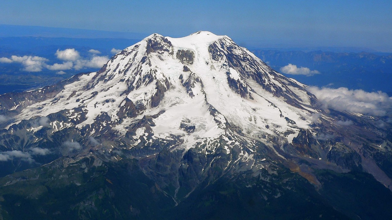
Mount Rainier rises above heavily populated valleys in western Washington with extensive snow and glacier ice covering its slopes. The USGS volcano program emphasizes lahars, fast-moving mixtures of water, rock, and debris that can race far beyond the mountain. Some communities occupy deposits left by earlier flows, making warning time and evacuation planning central to the hazard.
Scientists monitor earthquakes, deformation, gas, and hydrology while communities maintain sirens, routes, and drills. A lahar can be triggered by eruptive melting, but weakened rock and water also complicate the threat. Rainier’s danger therefore depends on more than whether lava reaches a town. The combination of steep terrain, ice, altered rock, and downstream development is what keeps the volcano under close watch.
3. Mount St. Helens: The 1980 Eruption Rewrote Hazard Science
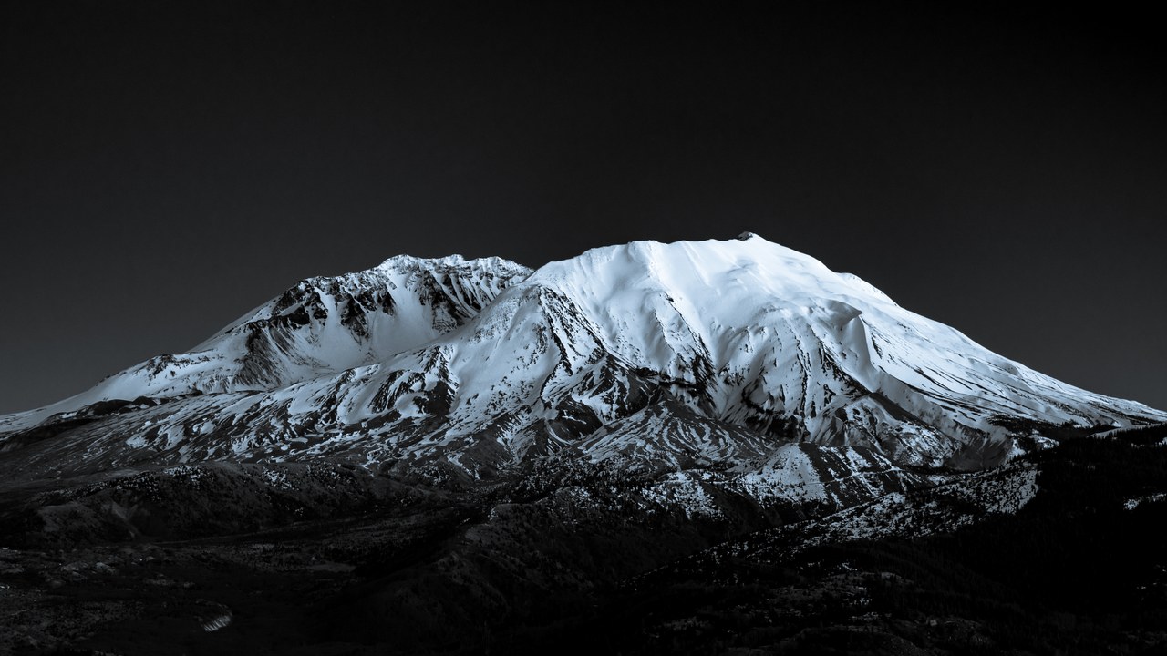
Mount St. Helens demonstrated how quickly a familiar mountain can change. The catastrophic May 18, 1980, eruption followed weeks of earthquakes and deformation before a landslide uncorked a devastating lateral blast. The USGS monitoring record now covers continuing seismicity, gas, deformation, and changes inside the open crater, where new lava domes have grown during later activity.
The volcano remains a natural laboratory for eruptions, landslides, ecosystem recovery, and warning systems. Its 1980 behavior also taught a broader lesson: danger may move sideways rather than only upward, and a collapsing flank can rapidly change pressure inside a magma system. Monitoring supports both local decisions and scientific understanding that applies to similar volcanoes throughout the Cascade Range.
4. Kilauea: Frequent Eruptions Meet Growing Communities
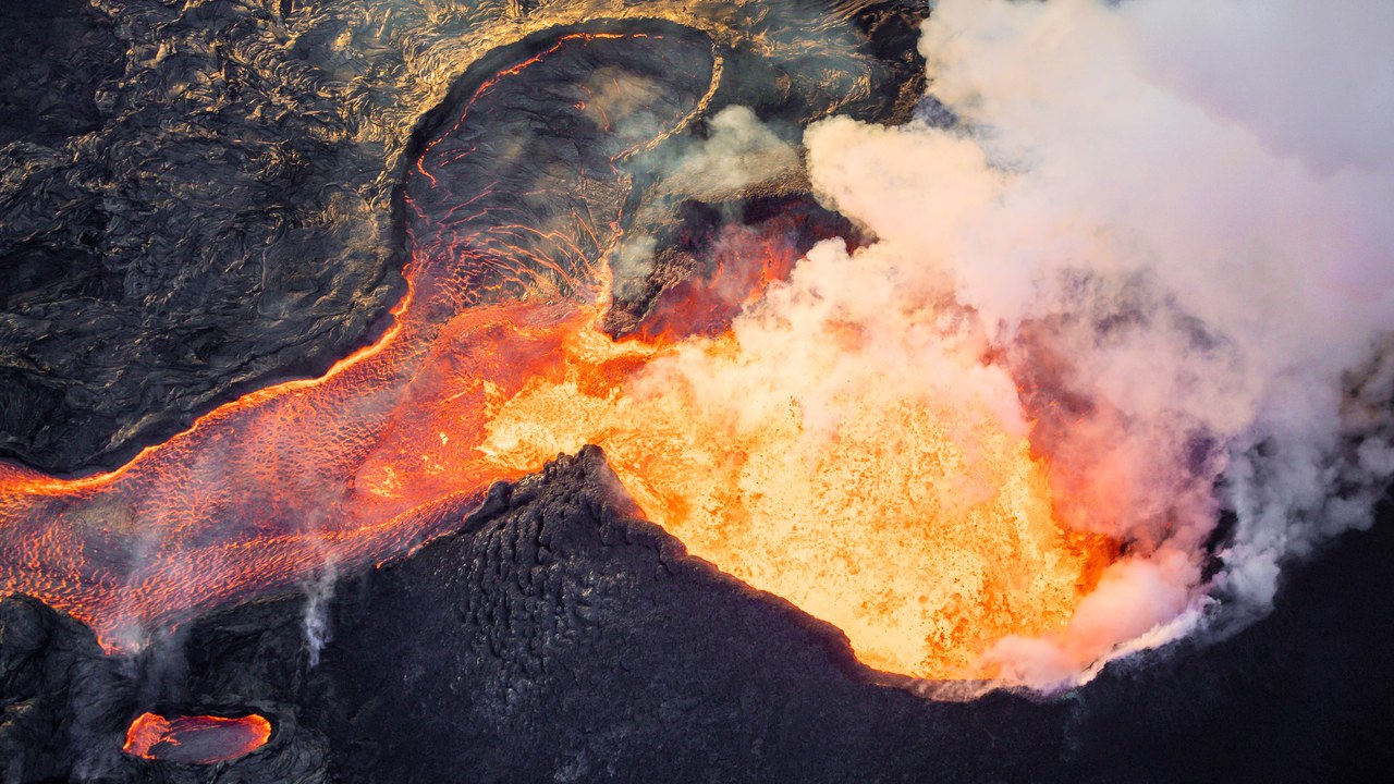
Kilauea is among the world’s most active volcanoes, and its eruptions can shift between summit craters and long rift zones. The Hawaiian Volcano Observatory tracks earthquakes, deformation, gas, lava, and thermal changes to understand where magma is moving. The 2018 lower East Rift Zone eruption destroyed neighborhoods and dramatically altered the summit, showing how quickly conditions can escalate.
Hawaiian basaltic lava often advances more slowly than explosive pyroclastic flows, but that does not make it harmless. Flows can cut roads and utilities, gases can degrade air quality, and crater instability can generate additional hazards. Kilauea’s frequent activity also creates a dense scientific record, allowing researchers to test monitoring tools against real changes in a living volcanic system.
5. Mauna Loa: Immense Slopes Can Feed Fast Flows
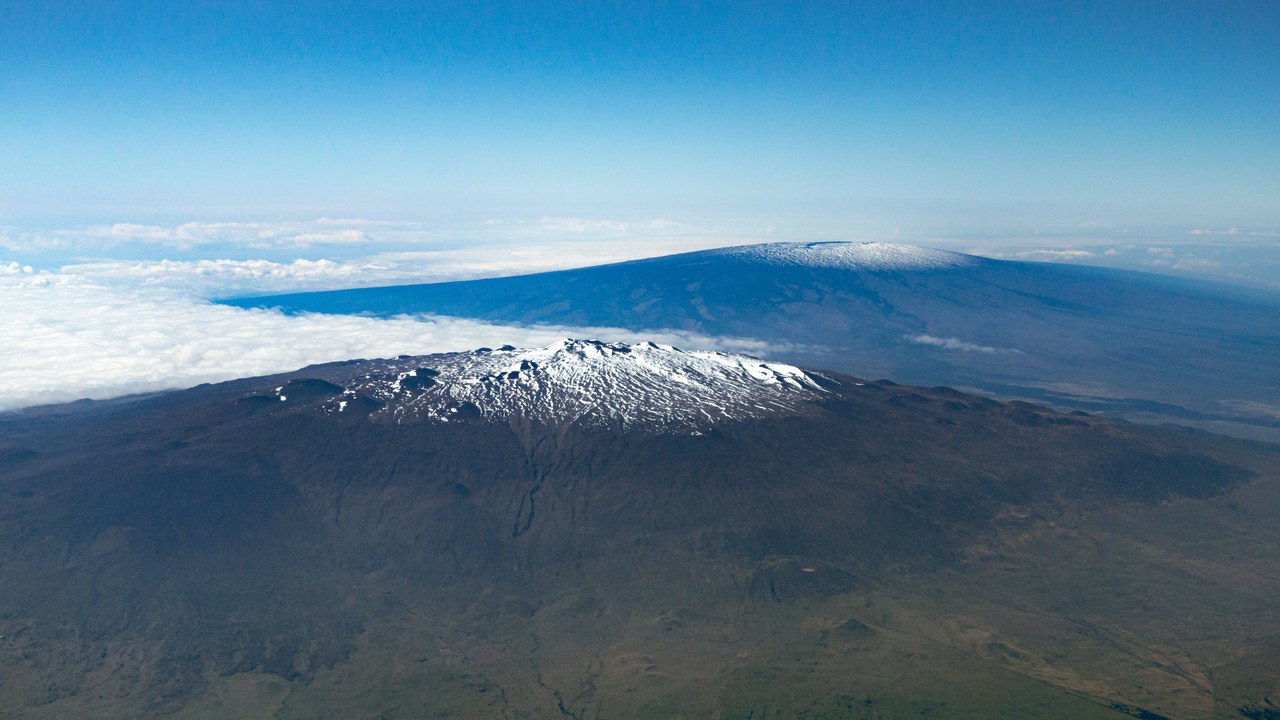
Mauna Loa is the largest active volcano on Earth by volume, covering more than half of Hawaii Island with long, broad slopes. The USGS observatory page describes monitoring of earthquakes, ground movement, gas, and eruption signals across the summit and rift zones. Its great elevation and steep upper flanks can send fluid lava toward lower communities faster than the volcano’s gentle outline suggests.
The 2022 eruption ended a quiet interval and reinforced the value of continuous instruments. Different rift zones direct lava toward different districts, so location matters as much as eruption size. Scientists use seismic and deformation patterns to identify magma movement, while emergency planners translate those observations into road, infrastructure, and public-warning decisions. The system remains active even during calm years.
6. Mount Hood: A Cascade Volcano Near Portland
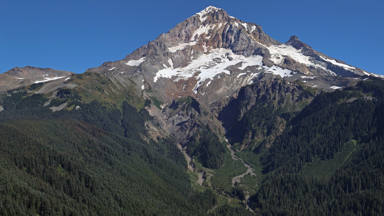
Mount Hood dominates the skyline east of Portland and sits near highways, recreation areas, rivers, and communities. The USGS hazard picture includes lahars, debris avalanches, ash, and pyroclastic activity rather than lava alone. River valleys can channel volcanic debris far from the summit, placing infrastructure downstream within the broader risk zone.
Hood has not produced a major modern eruption, which makes long-term geology and sensitive instruments especially important. Earthquake clusters and geothermal areas can occur without an eruption, so scientists need background patterns for comparison. Monitoring seismicity, deformation, gas, and heat helps identify meaningful departures from normal behavior while hazard maps show where future flows would most likely travel.
7. Mount Shasta: A Massive Peak With Many Hazards
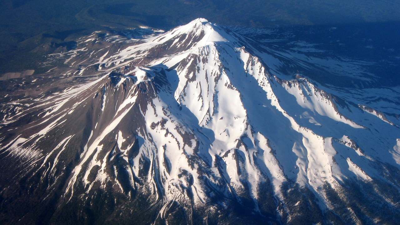
Mount Shasta rises sharply above northern California with a complex structure built from overlapping volcanic cones. The USGS assessment considers lava, pyroclastic flows, ash, lahars, and debris avalanches across a broad surrounding area. Snow and ice add water to potential debris flows, while highways, rail lines, towns, and reservoirs make even a localized event consequential.
Its long eruptive history is reconstructed from deposits rather than from frequent witnessed events. That creates uncertainty about recurrence intervals and the behavior of future eruptions, but it does not prevent preparation. Seismic stations, deformation measurements, geologic mapping, and hazard models establish a baseline. The mountain’s size and multiple vents require scientists to watch more than one simple summit crater.
8. Long Valley Caldera: Unrest Beneath an Inhabited Caldera
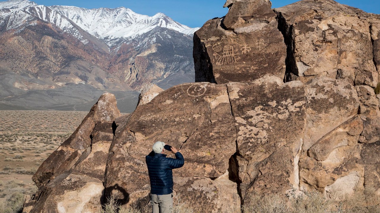
Long Valley Caldera occupies a wide basin east of California’s Sierra Nevada near Mammoth Lakes. The USGS monitoring program follows earthquake swarms, ground deformation, gas, and hydrothermal activity across the caldera and nearby volcanic centers. Episodes of uplift and seismic unrest since 1980 have shown that the system remains dynamic even without a new eruption.
Unrest can reflect fluids and pressure changes without magma reaching the surface, which is why years of continuous measurements matter. The region also contains geothermal activity and steep terrain where earthquakes, gas, or hydrothermal changes can produce local effects. Scientists compare multiple data streams rather than treating one swarm or uplift episode as proof that an eruption is imminent.
More from Morning Overview
