
The United States is home to more active and potentially hazardous volcanoes than most residents realize, from Pacific island shields to isolated Cascade peaks. Federal and state geologists rank certain volcanoes above others based on how often they show unrest, how many people live in their shadow, and how difficult they are to evacuate. Here are eight volcanoes that keep scientists watching closest.
1. Kilauea: Hawaii’s Restless Giant
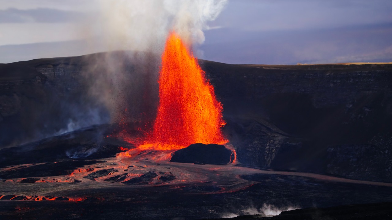
Kilauea sits within Hawaii Volcanoes National Park on the Big Island and ranks among the most consistently active volcanoes anywhere on the planet, with a summit caldera and long rift zones that have produced eruption after eruption in recent decades. The U.S. Geological Survey’s volcano program tracks the mountain around the clock, reading seismic swarms, ground swelling, and gas output that typically build before lava reaches the surface.
That density of instrumentation exists because Kilauea’s eruptions, while rarely deadly, can still cut off roads, blanket neighborhoods in volcanic haze, and force evacuations with little warning. Residents near the volcano’s rift zones have learned to treat any uptick in tremors as a cue to review escape routes rather than wait for an official alert.
2. Mauna Loa: Earth’s Largest Volcano
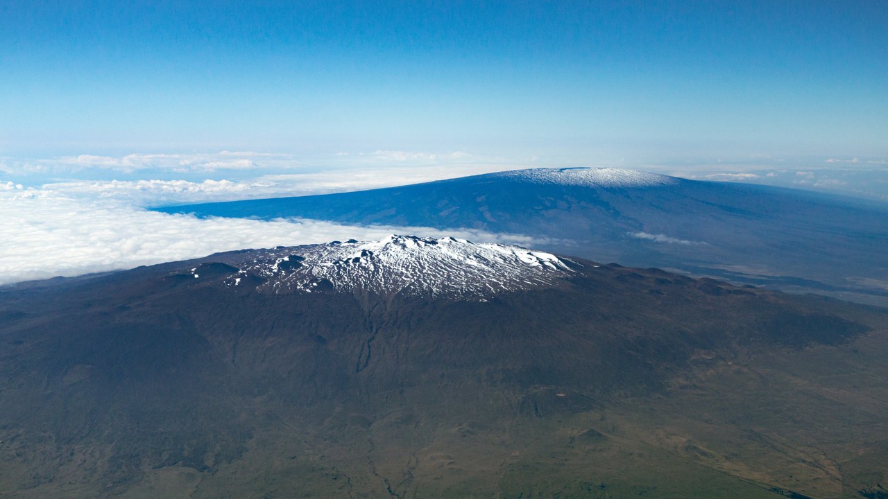
Mauna Loa forms most of the visible mass of Hawaii Island, its broad shield rising directly out of the Pacific without the steep flanks that define most volcanoes elsewhere in the world. Because its footprint reaches from shoreline to summit in one continuous slope, the Hawaiian Volcano Observatory watches it as closely as its more frequently erupting neighbor, Kilauea, tracking subtle inflation of the summit as magma accumulates underground.
Mauna Loa can sit quiet for years before swelling again, and when it does erupt, lava can travel fast down its long, gently sloped flanks toward coastal towns. That combination of size, reach, and unpredictable timing keeps it near the top of any list of volcanoes capable of threatening a large population with little notice.
3. Mount St. Helens: The Cascades’ Wounded Peak
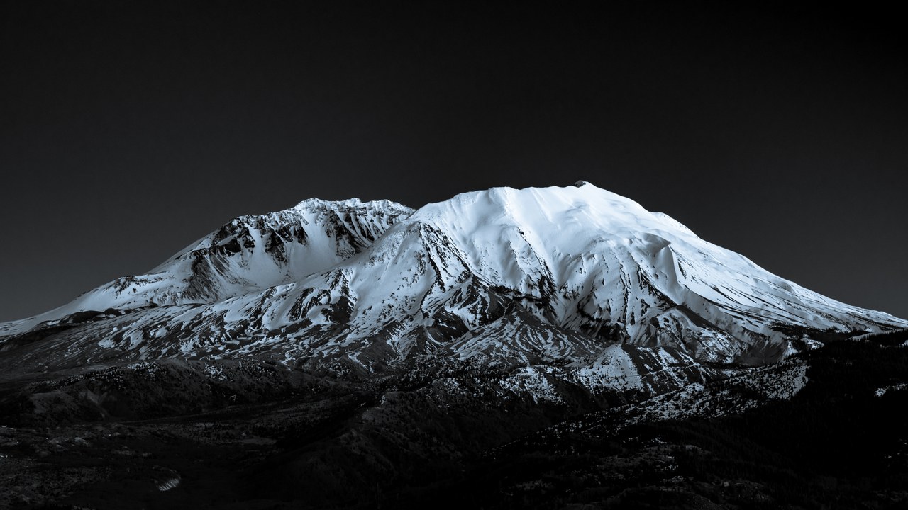
Mount St. Helens lost a large share of its summit and much of its north flank during the 1980 eruption that reshaped how the country thinks about volcanic risk, leaving behind a horseshoe-shaped crater that still steams on quiet days. The federal volcano monitoring network has recorded repeated swarms of small earthquakes and periods of new dome growth inside that crater in the decades since.
Those swarms don’t mean another blast is imminent, but they show the volcanic system beneath the mountain is still active rather than settled. Scientists treat every new cluster of tremors as data worth studying, since the 1980 eruption itself was preceded by weeks of warning signs that were only fully understood in hindsight.
4. Mount Rainier: The Lahar Threat Above Seattle
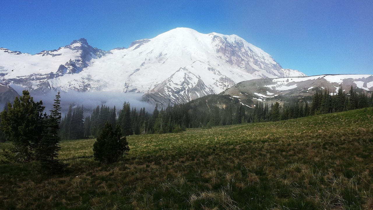
Mount Rainier’s danger has less to do with lava than with the thick glacial ice mantling its summit and upper slopes, ice capable of mixing with rock and ash to form volcanic mudflows known as lahars. If an eruption or a flank collapse mobilizes that ice, the flow could travel down valleys that now hold housing and highways, which is why the mountain’s hazard record draws close attention from planners south of Seattle.
Unlike a distant eruption plume, a lahar can reach populated valleys within hours, leaving little time for a slow evacuation. Local agencies have installed warning sirens and marked routes through some valleys specifically because Rainier’s ice, not its magma, is considered the more immediate hazard to nearby suburbs.
5. Mount Shasta: A Solitary Cascade Sentinel
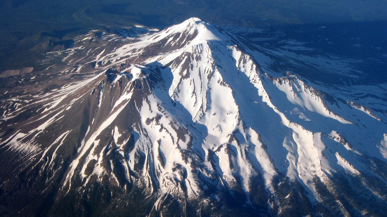
Mount Shasta rises alone above the surrounding valleys of far northern California, with no neighboring peaks to soften its profile or its potential reach if it were to erupt again. That isolation, combined with towns and farmland spread across the valleys at its base, is part of why its volcanic history gets ongoing scrutiny even though the mountain has been quiet for generations.
Like Rainier, Shasta carries a heavy load of snow and ice that could mix with ash or debris during any future activity and move downhill toward the communities that depend on its slopes for water and recreation. Its long dormancy is not treated as proof the system underneath has gone cold.
6. Long Valley Caldera: The Valley That Keeps Rising
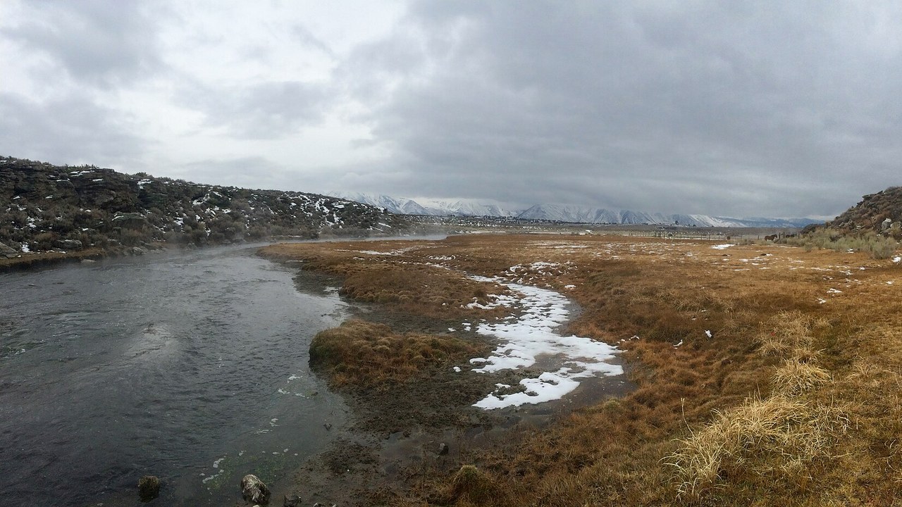
Long Valley Caldera formed when a colossal eruption emptied a massive underground magma chamber and caused the ground above it to collapse, leaving behind a huge oval basin east of the Sierra Nevada. Rather than a single peak, the site is a landscape of hot springs, steaming ground, and a resurgent dome that has periodically swelled upward, prompting the caldera’s monitoring history to run continuously for decades.
Swarms of small earthquakes and episodes of ground uplift have repeatedly drawn scientific attention back to the caldera, even though there is no indication another eruption is close at hand. The site’s mix of geothermal activity and seismic restlessness makes it one of the more closely tracked volcanic systems in the continental United States.
7. Mount Hood: Oregon’s Watched Landmark
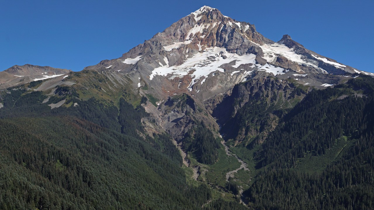
Mount Hood anchors the skyline above Portland and the surrounding valley, its symmetrical, snow-covered summit doubling as one of the most photographed peaks in the Pacific Northwest and as a volcano still capable of erupting. Steam and volcanic gas continue to vent from openings near its summit, a quiet but steady reminder that the peak’s classification as active rather than extinct is not just historical caution.
Its popularity with climbers and skiers only raises the stakes of that classification, since any renewed unrest would unfold above trails and lodges that draw crowds year-round. Scientists weigh that proximity to visitors as heavily as the mountain’s geology when deciding how closely to watch it.
8. Glacier Peak: The Cascades’ Hidden Risk
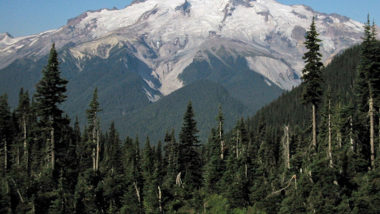
Glacier Peak sits deep in the North Cascades, far from major roads or towns, which is part of why it is less familiar to most people than Rainier or Hood despite a history of some of the region’s most explosive eruptions. Its remoteness makes it harder to instrument and observe, so the volcano’s monitoring network relies on stations placed at a distance from the summit itself.
Past eruptions here have sent ash and debris flows down valleys that, while sparsely populated today, could still affect water systems and roads far from the mountain’s base. That gap between the volcano’s low profile and its explosive record is exactly why it remains on the list of closely watched U.S. volcanoes.
More from Morning Overview
- The NSA is again telling phone owners to switch off one location setting
- A handful of car transmissions are so tough mechanics say they almost never fail
- A handful of SUVs keep hitting 300,000 miles, and they share one engine trait
- Supplements now rank as the fifth-leading cause of death from liver disease.
