
The USGS ranks the nation’s most hazardous peaks by threat potential, tracking seismic swings, gas emissions and ground swelling in real time. Some sit quiet for centuries between outbursts while one in Hawaii is erupting at this very moment. Here are twelve volcanoes the agency rates Very High threat and monitors around the clock.
1. Kilauea: America’s Highest-Threat Volcano
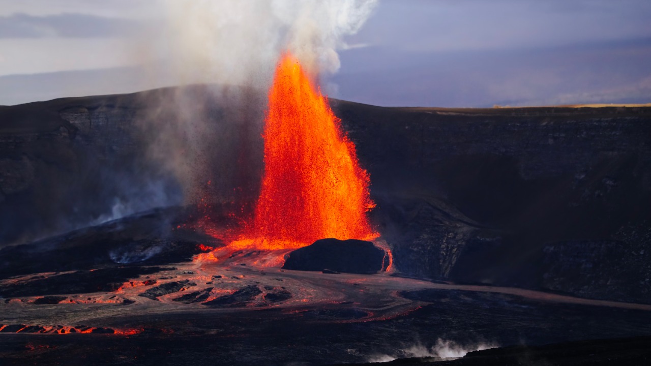
Kilauea tops the U.S. Geological Survey’s national threat assessment, and it is the only Very High-ranked volcano still putting on a show. Since December 23, 2024, episodic lava fountaining has continued inside Halemaumau crater on the shield volcano’s 1,222-meter summit, and the agency’s page carried an orange Watch alert as of June 27, 2026.
The volcano last built a full eruptive episode in June 2024, part of an on-and-off pattern that has kept monitoring crews stationed on the Big Island for years. Basaltic shield volcanoes like Kilauea tend to erupt effusively rather than explosively, but the ongoing fountaining still prompts periodic air-quality and ashfall advisories nearby.
2. Mauna Loa: The Planet’s Largest Active Volcano
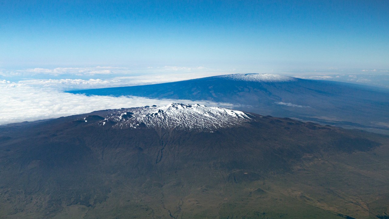
Mauna Loa carries the title of the largest active volcano on the planet, a shield volcano that rises 4,169 meters above Hawaii Island. It has erupted 34 times since 1843, most recently in November 2022, when lava flows advanced to within 7.2 kilometers, or 4.5 miles, of Hilo.
That close call reminded residents how fast lava can travel down Mauna Loa’s flanks once an eruption starts. The U.S. Geological Survey keeps the volcano rated Very High threat, monitoring it alongside neighboring Kilauea for the seismic and deformation signals that typically precede a new outbreak.
3. Mount St. Helens: The Mountain That Lost Its Top
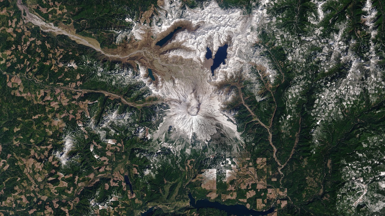
The 1980 eruption of Mount St. Helens stripped roughly 400 meters, or 1,300 feet, off the Washington stratovolcano’s summit in a single debris avalanche. That collapse carved the 2-by-3.5-kilometer horseshoe-shaped crater still visible from the surrounding forest today.
Activity returned between 2004 and 2008, when a slow dome-building eruption refilled part of the crater with new lava. The U.S. Geological Survey continues to classify Mount St. Helens as a Very High threat volcano, the same tier as its Cascade neighbors to the north and south.
4. Mount Rainier: A Mudflow Threat, Not a Lava One
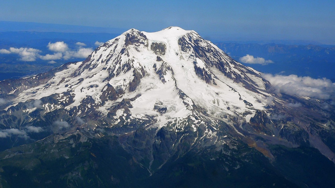
At 4,392 meters (14,410 feet), Mount Rainier is the tallest peak in the Cascade Range, but its greatest danger is not molten rock. According to USGS hazard analysis, massive lahars, fast-moving mixtures of volcanic debris and water, have already reached the Puget Sound lowlands in past eruptions.
Roughly a thousand years have passed since the volcano’s most recent eruption, but its heavy glacial ice cap means renewed activity could trigger a lahar with little warning. That combination keeps Rainier on the Very High threat list alongside far more frequently active peaks.
5. Mount Hood: Oregon’s Tallest Peak Has Erupted Before
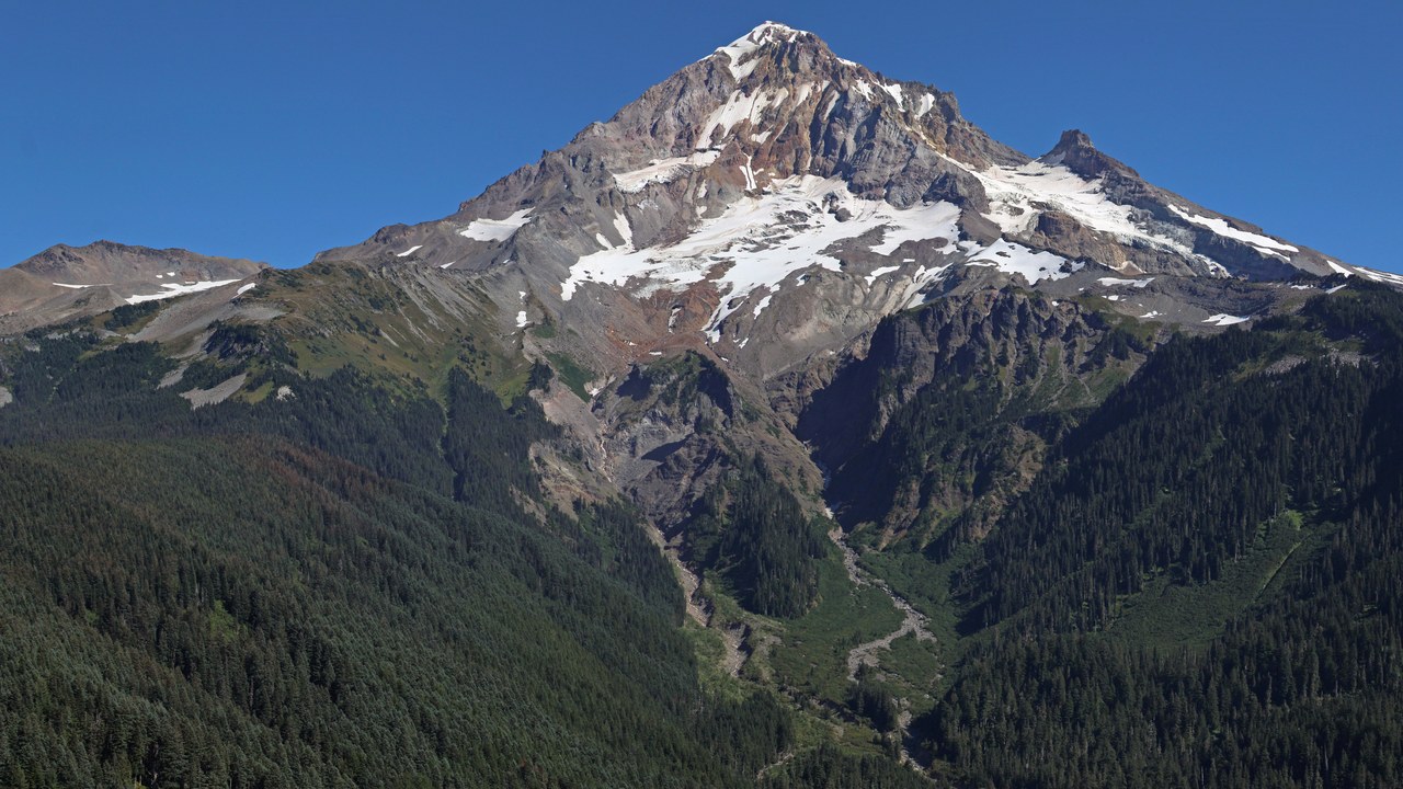
Mount Hood, Oregon’s highest point at 3,426 meters (11,240 feet), last erupted in 1865. An earlier eruptive period beginning in 1781 sent lahars pouring down the Sandy and White River valleys, and the volcano’s USGS profile names lahars as its greatest hazard risk.
Because the Sandy River drainage leads toward populated areas west of the mountain, scientists watch Hood’s slopes for the same debris-flow warning signs that preceded its past eruptions. It remains rated Very High threat, the top tier the agency assigns.
6. Mount Baker: The Northernmost Volcano in the Lower 48
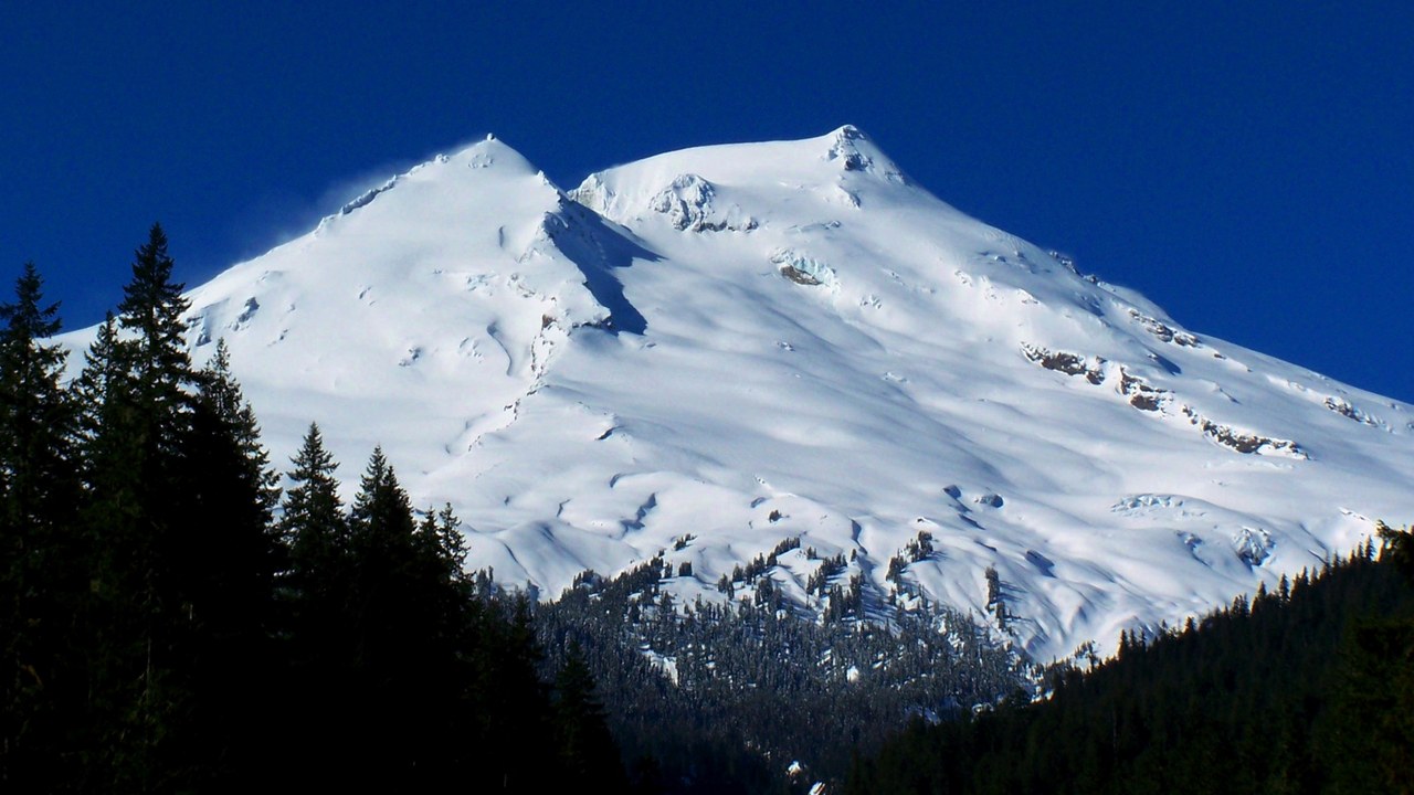
Mount Baker rises 3,286 meters (10,781 feet) above Whatcom County, Washington, making it both the highest peak in the North Cascades and, per the USGS volcano record, the northernmost volcano in the continental United States. Its last eruption, roughly 6,700 years ago, triggered a flank collapse and lahars down the Middle Fork and Nooksack Rivers.
The mountain does not need a full eruption to draw attention. A surge of steam and heat at Sherman Crater in 1975 and 1976 briefly raised concern, a reminder that hydrothermal activity alone can signal a volcano is far from dormant.
7. Glacier Peak: Washington’s Most Remote Volcano
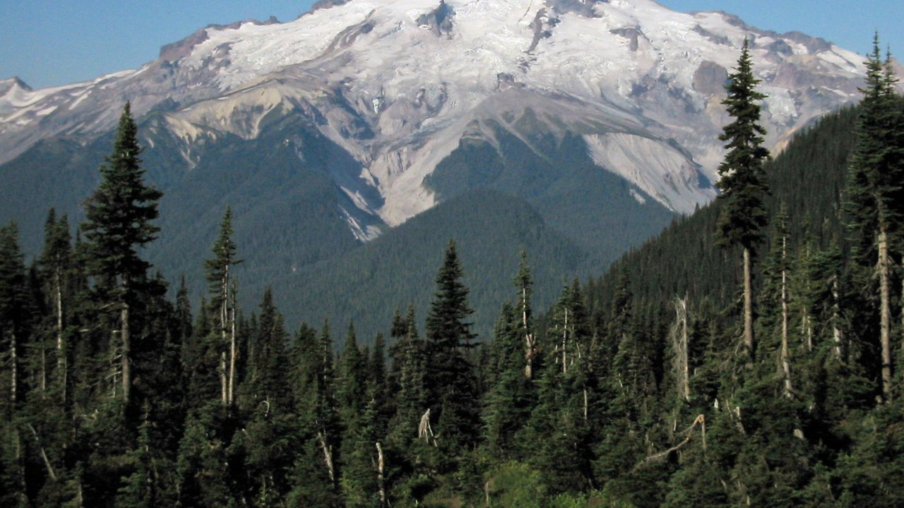
Glacier Peak, a 3,213-meter (10,541-foot) dacite stratovolcano in Snohomish County, is, according to the U.S. Geological Survey, the most remote of Washington’s five active volcanoes. It last erupted about 1,100 years ago.
Its remoteness has not spared it a top-tier ranking. Glacier Peak and Mount St. Helens are the only two Washington volcanoes to have produced a very large explosive eruption in the past 15,000 years, a history that keeps Glacier Peak rated Very High threat despite its isolation.
8. Three Sisters, Oregon: Ground Rising Near South Sister
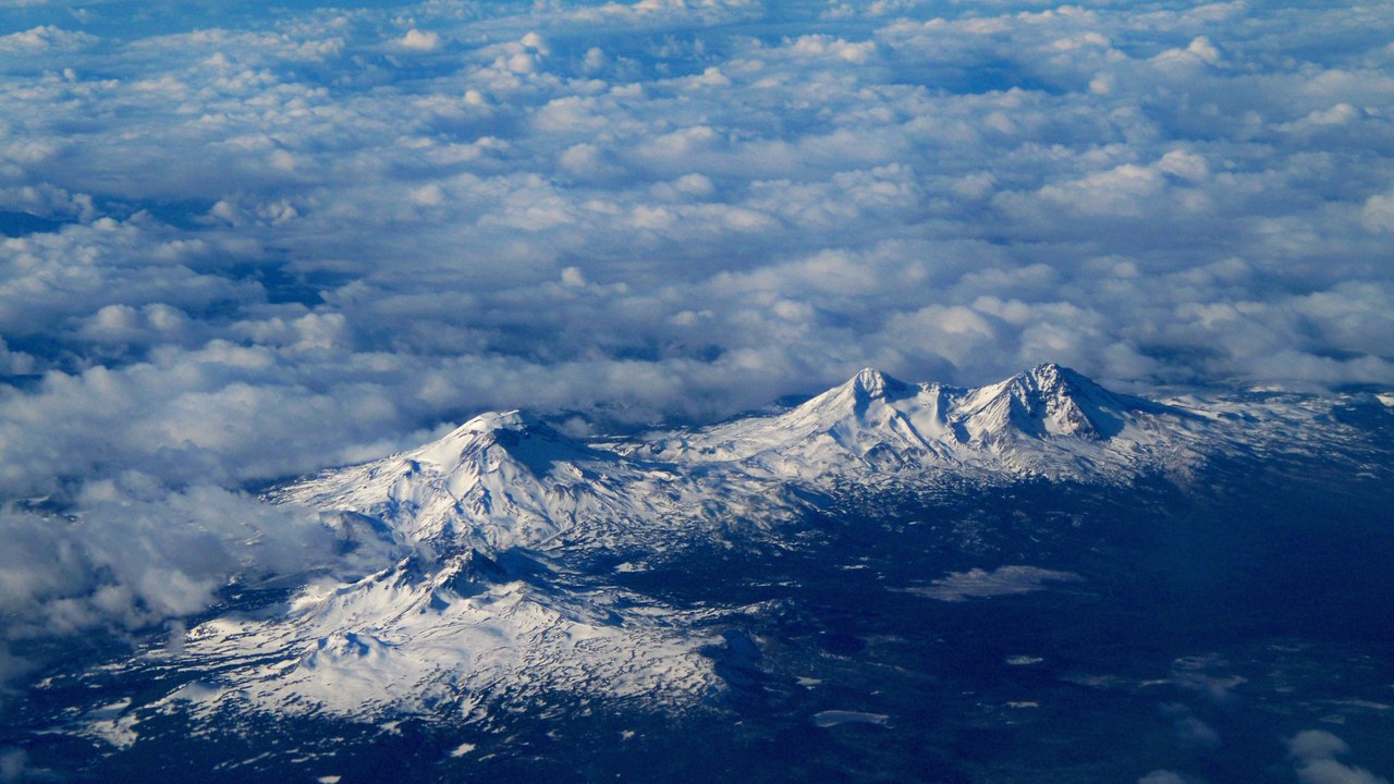
The Three Sisters, a complex of andesite-to-rhyolite peaks in Lane County, Oregon, reach 3,157 meters (10,358 feet) and last erupted roughly 2,000 years ago near South Sister. Scientists first recognized ground uplift about 6 kilometers west of South Sister in 2001, though USGS deformation data shows the swelling actually began in 1997.
That slow-motion inflation has continued for decades without triggering an eruption, but it is exactly the kind of signal monitoring networks are built to catch early. The Three Sisters carry a Very High threat rating from the agency.
9. Newberry Volcano: A Volcano the Size of Rhode Island
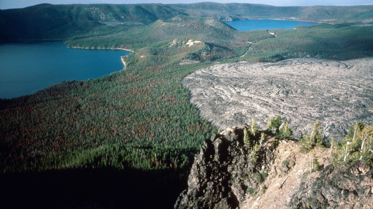
Newberry Volcano sprawls across roughly 3,100 square kilometers (1,200 square miles) of central Oregon, making it, per the USGS volcano summary, the largest volcano in the entire Cascades volcanic arc. It last erupted about 1,300 years ago.
A far older explosive eruption and collapse roughly 75,000 years ago carved out the summit caldera that now holds two lakes. That sheer footprint, spread across Deschutes, Klamath and Lake Counties, is part of why Newberry still carries a Very High threat rating today.
10. Crater Lake: The Nation’s Deepest Lake, Inside a Volcano
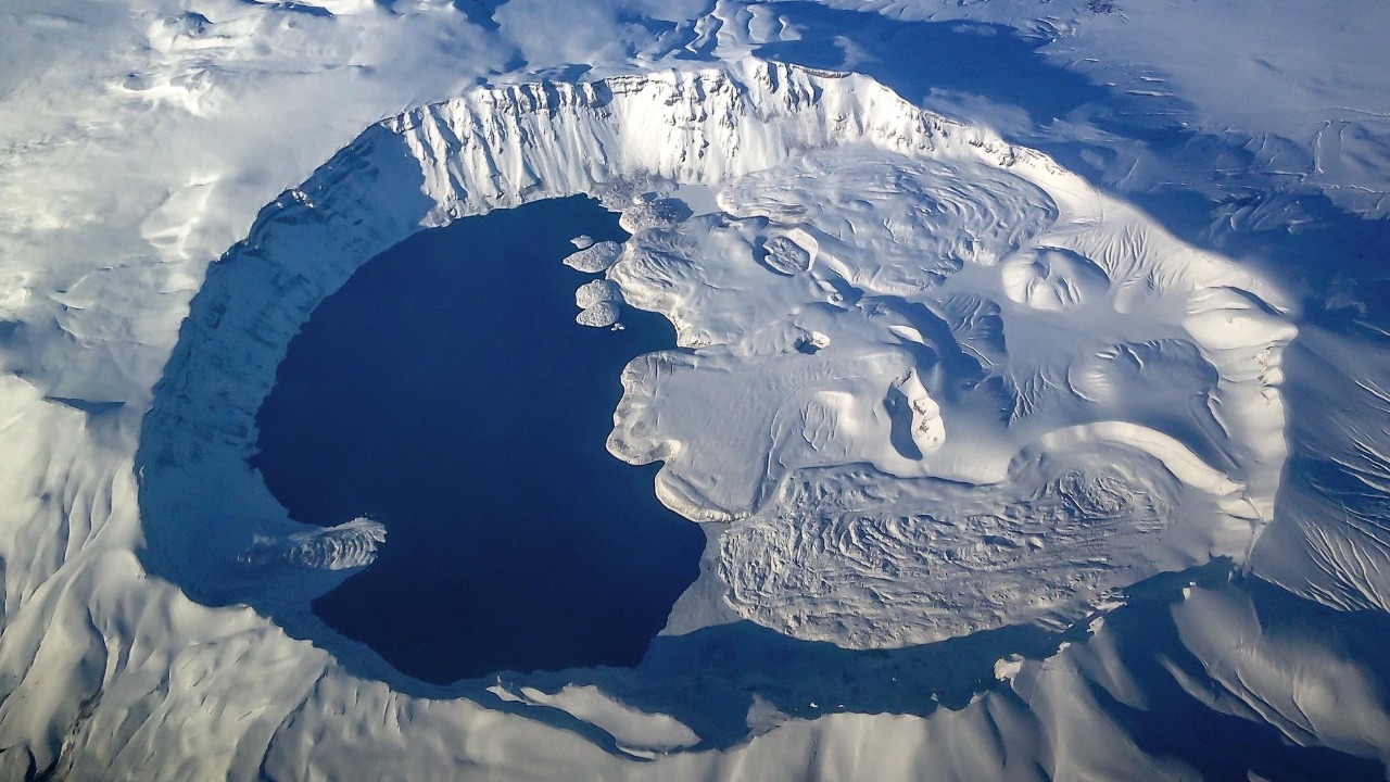
Crater Lake fills an 8-by-10-kilometer caldera formed when Mount Mazama collapsed about 7,700 years ago, and at 594 meters (1,949 feet) deep it is, according to USGS records, the deepest lake in the United States.
The volcano beneath that famously blue water has not stayed entirely silent since; its most recent eruption came around 6,600 years ago. Klamath County’s 2,487-meter (8,159-foot) caldera rim still earns Crater Lake a Very High threat designation.
11. Mount Shasta: Seventy Mudflows in a Thousand Years
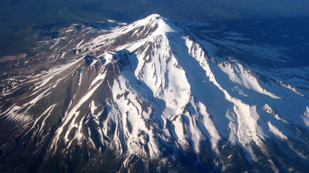
Mount Shasta, standing 4,317 meters (14,163 feet) over Siskiyou County, California, is described by the U.S. Geological Survey as the most voluminous of all the Cascade Range volcanoes. Its youngest dated eruption, about 3,200 years ago, sent block-and-ash flows down its north flank.
Lava has not been the mountain’s main hazard lately. In just the past 1,000 years, more than 70 mudflows have poured down Shasta’s slopes and inundated stream channels below, a frequency that keeps the peak on the Very High threat list.
12. Lassen Peak: An Ash Column That Reached Nevada
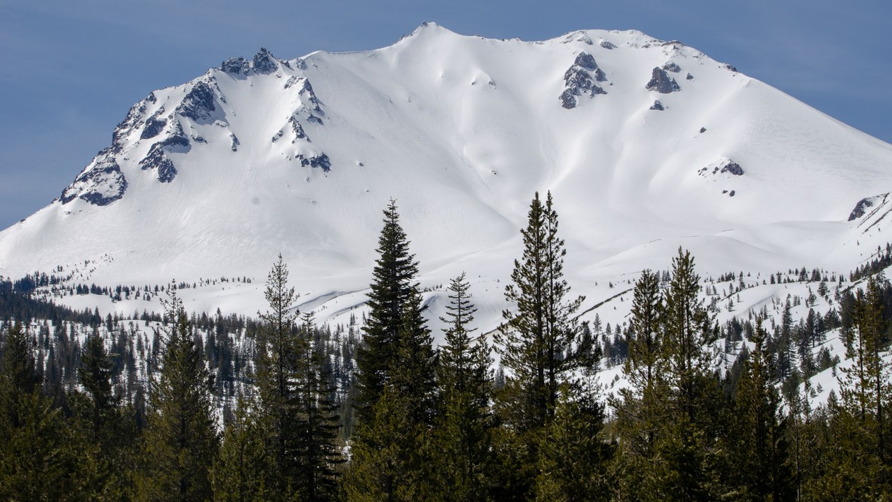
Lassen Peak, the centerpiece of the Lassen Volcanic Center in Shasta County, California, last erupted between 1914 and 1917. On May 22, 1915, its ash column climbed to 30,000 feet, and according to the USGS eruption record, ash drifted 200 miles east to Winnemucca, Nevada.
Earlier activity at nearby Chaos Crags about 1,100 years ago and at Cinder Cone in 1666 shows the surrounding volcanic center has repeatedly produced eruptions beyond Lassen Peak itself. The 3,187-meter (10,456-foot) center remains rated Very High threat today.
