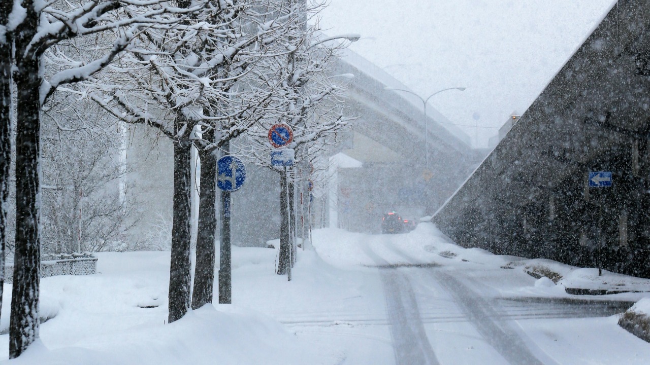
Forecasters are warning that the coming season will redraw the snow map of North America, with some regions buried under repeated storms while others watch the flakes pass them by. The snow line is expected to wobble sharply, creating clear winners and surprise losers as cold air collides with lingering warmth across the continent. I see a winter shaped less by gentle trends and more by sharp contrasts, where a few hundred miles could separate bare ground from a brutal, shovel-breaking stretch of weather.
Behind that shifting line is a complicated mix of ocean patterns, stratospheric twists, and regional storm tracks that will decide who gets the deep drifts and who gets cold rain. From ski towns banking on powder to cities budgeting for plowing and potholes, the stakes are high, and the early signals suggest that some traditionally snow-reliable areas may be left on the wrong side of the line.
Why the snow line is about to swing wildly
The backbone of this winter’s setup is a tug of war between large-scale climate drivers that favor sharp gradients instead of smooth, predictable patterns. Seasonal outlooks point to a configuration where the jet stream repeatedly buckles, dropping frigid air south in some corridors while leaving others under milder Pacific or Gulf influence. In practical terms, that means the snow line will not sit still, it will lurch north and south, turning one storm into a blizzard for one metro area and a slushy mess for another only a few hours down the highway.
Several long-range discussions highlight how an easterly-phase QBO, the Quasi Biennial Oscillation in the stratosphere, is acting as a key “secondary” player that can favor more disruptive cold outbreaks when it lines up with other signals. One detailed seasonal breakdown notes that this easterly QBO, combined with other background patterns, is part of the reason forecasters expect a more dynamic winter, with particular regions flagged as likely “winners” for snow if the setup holds. That same analysis also leaves room for a potential sudden stratospheric warming, or SSW, which can dramatically dislodge Arctic air and shove the snow line far to the south in a matter of weeks, a risk that is already being watched closely in specialized winter weather circles.
The big winners: interior cold and conflict zones
When I look across the various outlooks, a clear theme emerges: interior regions that sit under the main storm track, rather than right on the coasts, are favored for frequent snow. One national forecast for the 2025 to 2026 season highlights a “snowy” setup for parts of the United States, with early-season cold helping some areas get off to a solid start. That same guidance notes that winter may lock in quickly in certain corridors, giving places that are used to waiting until deep into Jan for consistent snow a more aggressive ramp-up instead, especially where cold air can anchor and undercut passing systems.
Video briefings on the seasonal pattern describe The Central United States and Ohio Valley as zones of “dynamic conflict,” where clashing air masses are likely to fuel repeated storms. In those discussions, the corridor from the Plains into the Midwest is singled out as a battleground where the snow line may frequently sit just south of major population centers, turning marginal events into plowable snow. Another long-form outlook that walks through the winter month by month suggests that, regionally, the likely winners are interior ranges and highlands that can squeeze extra snowfall out of each passing disturbance, especially if a sudden stratospheric warming materializes and reinforces the cold.
Surprise losers: classic snow belts on the wrong side of the line
The flip side of that interior jackpot is that some of the country’s most famous snow belts may find themselves on the milder side of the line more often than they would like. A detailed Winter Snowfall Outlook notes increased odds of below-normal snowfall Across the West, with California singled out as particularly vulnerable to coming up short. For ski areas that rely on consistent storms off the Pacific, that kind of pattern can mean more reliance on snowmaking and a season that feels stop-and-go rather than steadily building a deep base.
Another broad Winter Snowfall Forecast for Every US State underscores how uneven the season could be, with some coastal and southern-tier states more likely to see varied weather patterns instead of sustained cold. In practical terms, that means places that occasionally cash in on a big nor’easter or Gulf-fed winter storm may instead see more cold rain or mixed precipitation if the snow line sets up just inland. For residents who remember classic blockbuster winters, the disappointment may not be a lack of storms, but the frustrating sense that the real snow is falling just out of reach, a few counties away.
Storm tracks, SSW risk, and the brutal edge of the snow line
What could turn this winter from merely volatile to truly brutal for some communities is the way storm tracks interact with any major stratospheric disruption. In a widely shared discussion among weather enthusiasts, forecasters point out that an SSW can take a few weeks to work its magic and for those impacts to reach the surface, but when it does, the downstream effect can be a locked-in pattern of deep cold. That same conversation notes that SSWs occur about 6 to 7 times a decade, which means they are not rare curiosities, they are recurring wildcards that can flip a season on its head if they line up with the right jet stream configuration.
Another focused update on the transition from fall to winter stresses that if a significant SSW event unfolds, it could reinforce blocking patterns that keep Arctic air parked over central and eastern North America. In that scenario, the snow line can crash south and stay there, turning what might have been a mixed-precipitation winter into a stretch of frequent snow and dangerous cold. For cities that sit near the climatological boundary between rain and snow, that kind of shift is exactly what turns an ordinary season into a brutal one, with repeated plow operations, school closures, and infrastructure stress.
Canada, coastal cities, and the broader North American picture
Any discussion of the snow line has to zoom out beyond the United States, because the broader North American pattern helps set the stage. On December, Environment Canada released its winter outlook for January and February as part of a wider seasonal briefing, outlining expectations for temperature and precipitation across the country. That guidance, which also referenced intense localized snow rates of up to 3.0 inches, or 7.6 cm, an hour in certain lake-effect and coastal setups, underscores how Canadian cold can feed south into the United States and sharpen the gradient between snow and rain along the border and into the Great Lakes.
Regional breakdowns for the U.S. echo that cross-border linkage, with one national winter forecast highlighting how early in the season, winter may get off to a solid start in parts of the Northeast and Mid-Atlantic, including cities like Towson in Maryland, where a man shoveling outside his home has already become a familiar image in recent cold seasons. Another long-range video analysis notes that for central and eastern regions, including stretches from the Texas and Gulf Coasts up into the Ohio Valley, the season is predicted to be one of dynamic conflict, with the snow line often draped near major interstates. When I put those pieces together, I see a winter where the brutality is not just about how much snow falls, but about how sharply it divides neighbors, leaving one town digging out while the next watches the flakes melt on contact.
For skiers, commuters, and city planners alike, the message is clear: this will not be a gentle, evenly distributed winter. The snow line is poised to be a moving target, and being on the right or wrong side of it could define the season far more than any single storm.
More from Morning Overview