Across south-east Australia, the kind of heat that once defined outlier summers is now settling in like an unwelcome season of its own. Temperatures are surging toward 50 °C, fire danger is spiking and emergency warnings are stacking up as a powerful heat dome rebuilds over the continent. Forecasters are not just tracking another hot spell, they are watching a pattern that is becoming more entrenched in a world where each year is warmer than the last.
The return of this intense high pressure system is colliding with parched landscapes, volatile winds and a climate baseline that scientists say is already supercharged. The result is a dangerous mix of record-challenging temperatures, catastrophic fire risk and a growing sense among meteorologists that these extremes are no longer rare events but recurring features of a rapidly heating planet.
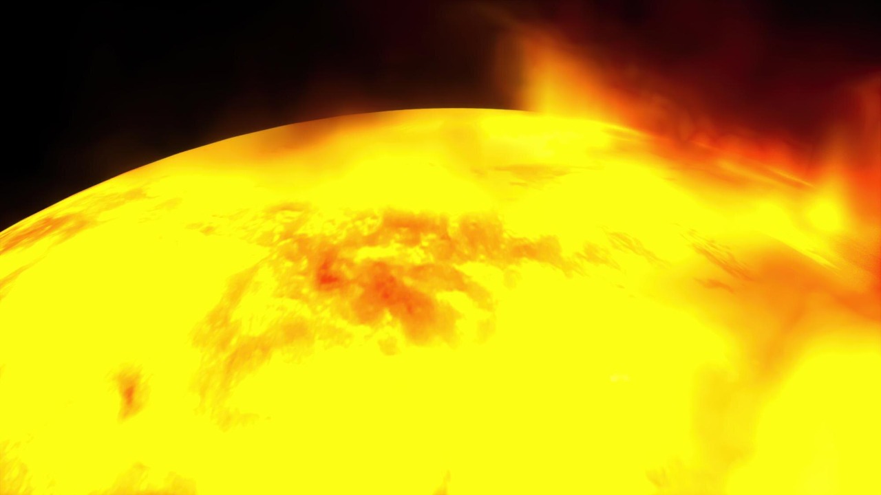
How a heat dome turned south‑east Australia into a furnace
At the core of the current crisis is a sprawling cap of high pressure that has parked over the continent and trapped hot air near the surface. As that air sinks, it compresses and warms, baking the land beneath and setting up a feedback loop where dry soils heat even faster. In this case, forecasters describe a tropical reinforcement feeding into the pattern, with There helping to funnel additional heat and moisture into the system before that moisture is stripped away and the ground dries further. The result is a dome that is not only intense but stubborn, resisting the usual cool changes that would normally break a heatwave.
What makes this episode particularly alarming is how close the mercury is edging to the upper limits of what forecasters have seen in Australia. Detailed modelling points to temperatures surging toward a scorching 50 °C as the heat dome peaks, with Tropical Cyclone Luana identified as a unique factor feeding energy into the broader pattern. When a tropical system like that interacts with entrenched high pressure, it can help lock in the heat over land instead of allowing it to disperse over the ocean, which is exactly what forecasters are seeing now.
Record-challenging temperatures and a moving bullseye
On the ground, the heat is not static. Meteorologists tracking the event say the region of maximums in the high 40s is rotating anti clockwise across the interior, shifting the bullseye of extreme temperatures from one community to the next. That rotation is expected to carry the worst of the heat into north west NSW on Wednesday, with towns such as Wilcannia bracing for temperatures in the high 40s. For residents, that means the worst of the heat does not simply arrive and depart, it sweeps through in waves that can be just as dangerous for emergency planning.
Authorities have been warning for days that this pattern could smash temperature records across south east Australia, with catastrophic fire danger flagged in advance. Forecast discussions have urged people to Follow live updates for Australia, Get breaking alerts and understand how much of this spike is likely due to global heating, which the same analysis describes as Supported by the long term trend in rising temperatures.
Fire danger, emergency warnings and the human toll
Heat on this scale is not just a number on a forecast map, it is a direct threat to people, infrastructure and ecosystems. In a recent Severe Weather Update, forecasters described a severe heatwave situation with fire danger ratings being assessed each day and heatwave warnings current across multiple states at once. A later Severe Weather Update focused on Record breaking heat and an Extreme Fire Danger, current as of 1pm AEDT, urging communities to Know their weather risks and fire plans.
Those warnings are already colliding with reality. Live coverage of the heatwave and bushfires across Victoria, There described empty streets in towns where residents stayed indoors to avoid the worst of the heat, and emergency warnings for fast moving fires. Forecasters have stressed that gusty southwesterly winds are expected to persist in some regions, and Jan commentary in the same briefing warned that community impacts from these high temperatures will be felt well beyond the firegrounds, from heat stress in vulnerable people to strain on power networks.
Why forecasters are linking this to a hotter climate
For meteorologists and climate scientists, the current heat dome is not an isolated freak event, it is part of a pattern that has been building for years. Global temperature records show that Scientists Confirm 2025 Was Third on the list of the Hottest Year, Trailing only 2024 and 2023. Last year’s ranking is part of a broader escalation that has pushed global average temperatures to new highs three years in a row.
Looking ahead, climate specialists at ECCC say There is a >99% chance that 2026 will be hotter than every year on record prior to 2023, with projections pointing to a global mean temperature anomaly of about 1.55 °C above pre industrial levels. In that context, the current Australian heat dome is not an outlier but a preview of the kind of extremes that become more likely as the baseline warms, especially when natural variability stacks on top of long term trends.
Global extremes: from Australian heat to U.S. trackers and polar shocks
While south east Australia swelters, other parts of the world are grappling with their own climate amplified extremes. In the United States, an interactive tool is Tracking Dangerous Heat across counties, highlighting where heat index values are expected to reach levels that threaten health. The same tracker notes that Monday, Tuesday, Wednesday, Thursday, Friday and Saturday are all mapped so residents can see when their area might tip into the highest risk categories, even when a particular week, as the tool notes, does not have Updated Jan alerts for Dangerous heat in every region.
At the same time, parts of the central and eastern U.S. are dealing with a very different but related phenomenon, where a disrupted polar vortex and unusually warm oceans are intensifying a major winter storm. Forecasters explain that Under the right conditions, energy from the stratosphere can bounce off the polar vortex back down into the troposphere, exaggerating the north south temperature contrasts that drive powerful storms. The same analysis notes that this interaction is helping to intensify impacts across the central and eastern U.S., a reminder that a hotter planet does not mean an end to cold extremes, but rather more volatile swings between them.
More from Morning Overview