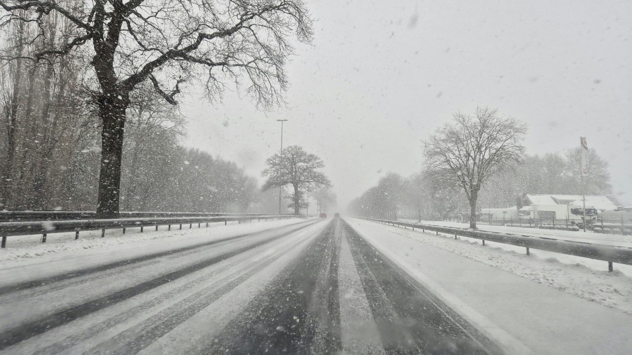
A sprawling winter storm is organizing over the central United States and is on track to slam the South and Southeast late this week with a messy mix of snow, sleet, and freezing rain. Forecasters are unusually confident that cold air and Gulf moisture will overlap, setting the stage for hazardous travel, power disruptions, and dangerous wind chills from Texas to the Southeast coast. The exact placement of the heaviest ice and snow is still shifting, but guidance already points to a high‑impact event for communities that are not built for prolonged winter weather.
The setup is unfolding against a backdrop of “brutal” cold that has already locked in across a large swath of the nation, with forecasters warning that the coming days will bring the coldest air of the season so far. As this Arctic air presses south, a developing low pressure system will ride along the boundary, turning what might have been a chilly rain into a potentially crippling wintry mix for millions.
Cold pattern primes the South for trouble
The first ingredient in this late‑week threat is the entrenched cold pattern that has settled over the central and eastern United States. Earlier this week, meteorologists highlighted that Mid January was living up to its reputation, with Arctic air spilling south and setting the stage for a broad area of subfreezing temperatures. Forecast discussions point to wind chills that could plunge to as low as 30 below zero in some northern locations, a sign of just how deep and expansive this cold dome has become across a large swath of the nation.
That chill is not staying locked in the Midwest. Guidance cited in a separate outlook notes that the cold temperatures heading into the weekend will likely be the coldest air of the season so far and may ultimately be the coldest air of the year, a key factor in determining where the ice line sets up. In the Carolinas, the Hazardous Weather Outlook from the National Weather Service Wilmington NC explicitly flags the potential for winter weather in zones such as NCZ087 and NCZ096, underscoring that even coastal and near‑coastal areas are now within the envelope of concern as the cold air deepens.
Storm track: from Texas Panhandle to the Southeast coast
With the cold air locked in, attention turns to the storm track that will carry moisture from the Gulf of Mexico into the South. Forecasts for late week indicate that by Friday, Snowfall could begin from the Texas Panhandle to Kansas as the system organizes, with precipitation spreading into southwestern Missouri and northern Arkansas. As the low strengthens and shifts east, rain is expected to develop farther south while colder air on the northern flank turns that moisture into snow and ice.
Farther downstream, forecasters are already flagging a SOUTHERN WINTER STORM THREAT that could deliver snow and ice from Texas to the Southeast Coast later this week, a corridor that rarely sees such widespread winter impacts in a single event. One detailed forecast video describes a “Late Week Storm System To Bring Wintry Mix To South, Southeast,” noting that models are suggesting a blend of rain, sleet, freezing rain, and snow as the system tracks east, with the exact mix varying sharply over short distances as the low moves off the coast and colder air undercuts the moisture shield.
Ice corridor and snow zones: where the worst may hit
While the precise placement of the heaviest snow and ice will shift as new data arrives, several signals are already emerging about the most at‑risk zones. Along the Interstate 20 corridor, one regional analysis notes that the ice accumulation numbers from the latest Euro model are “quite bullish,” with even a quarter‑inch of glaze capable of causing tree damage, power outages, and very slick roads. That same guidance highlights a widespread, high‑impact snow and ice swath stretching from Texas and Oklahoma through the Carolinas, a footprint that would encompass several major metro areas and long stretches of interstate highway.
Closer to the Gulf Coast and Southeast coast, forecasters are warning that the storm will not be a typical light dusting. One meteorologist bluntly framed it as a Highly Disruptive Cross, emphasizing that a Deep South Ice Storm appears likely, with the main question now how far north the worst icing will extend. Another regional forecaster cautioned residents to “Remember.. this will not be your average Southern Winter Storm..this will be a really COLD storm,” underscoring that temperatures in the teens and 20s will make any ice that forms slow to melt and more likely to cause prolonged disruptions.
Timing: late‑week onset and weekend impacts
For residents trying to plan travel and work schedules, the timing of the worst conditions is coming into sharper focus. Forecast discussions indicate that the main wave of wintry weather will begin to push south late in the workweek, with snow and ice expanding from the Plains into the Deep South by Friday and Friday night. One detailed breakdown notes that by Saturday night and into Sunday, a new surface low is expected to develop near the southeast U.S. coast, resulting in a second area of enhanced precipitation that could bring additional snow and ice to parts of the Carolinas and Georgia if the cold air holds in place.
Along the Southeast coast itself, forecasters are already warning that communities from the coastal Carolinas to northeast Florida should brace for a powerful winter storm that will bring snow and ice, with the FOX Forecast Center monitored by Julian Atienza at FOX Weather highlighting the potential for rare back‑to‑back winter seasons in the region. Another veteran broadcaster summed up the mood with a simple “Yikes. BIG Winter Storm for the Southeast this weekend,” noting that it is rare to have such high confidence this far out that a significant winter event will impact the region and that cold air will be firmly in place as moisture arrives.
What forecasters and residents should watch next
As the storm approaches, the key uncertainties revolve around the exact placement of the rain‑snow‑ice line and the intensity of the freezing rain band. National guidance stresses that confidence is higher than usual that an impactful winter storm will occur, but that the exact details will change as new data comes in. One video briefing on the Late Week Storm underscores that it is still a ways off, yet models are already converging on a scenario where rain, snow, and ice overlap across the Deep South. At the same time, broader national coverage of the wintry week ahead notes that wind chills this weekend are forecast to be as cold as 30 below zero in some areas, reinforcing that any power outages in the storm’s wake could quickly become life‑threatening in exposed or poorly heated homes as Wind combines with Arctic air.
Behind the scenes, meteorologists are leaning heavily on model guidance and National Weather Service tools to refine the forecast. One update from a western office notes, “Here is the latest from the National Weather Service,” sharing a look at forecast rain and snow amounts for an incoming storm system and reminding residents to “Look” for updated graphics as multiple systems track through. Another national briefing describes the next system as a “NEXT BIG WEATHER MAKER,” with model guidance zeroing in on a dual‑threat storm that brings severe weather on the warm side and a significant winter storm, possibly with blizzard conditions, on the cold side, a scenario that Storm Mapping says it will continue to monitor daily. In the Southeast, a dedicated video labeled “❄️SOUTHERN WINTER STORM THREAT” reinforces that a powerful winter storm could deliver snow and ice from Texas to the Southeast Coast later this week, a message that aligns with the broader national pattern and underscores the need for residents to prepare now rather than waiting for flakes or ice pellets to start falling.
More from Morning Overview