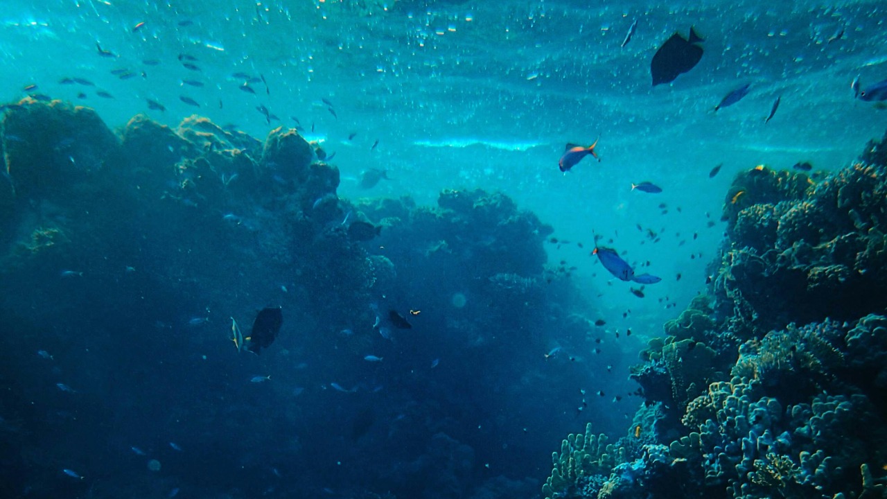
Far below the waves of the Pacific, scientists are mapping clusters of dense, towering formations that do not fit neatly into existing models of how Earth’s interior behaves. These strange structures, buried hundreds of kilometers beneath the seafloor, are forcing researchers to revisit basic assumptions about how the planet recycles its crust, stores heat and shapes the oceans above. As new data accumulates, the mystery is no longer whether these features exist, but what they are and why they seem to defy straightforward explanation.
From the vantage point of a satellite or a research vessel, the Pacific can look like a uniform blue expanse, yet the latest seismic readings reveal a hidden landscape that is anything but simple. I am watching geophysicists, oceanographers and data scientists converge on the same puzzle, each discipline bringing its own tools and biases to a debate that now stretches from deep Earth physics to the politics of who controls the knowledge gathered from the seafloor.
What scientists are actually seeing beneath the Pacific
When researchers talk about “structures” under the Pacific, they are not describing ruins or machines, but zones of rock that behave very differently from their surroundings. Seismic waves slow down or speed up as they pass through these regions, hinting at pockets of unusually hot, dense or chemically distinct material that sit near the boundary between the mantle and the core. In several surveys, these anomalies appear as vast, irregular blobs that rise like submerged mountain ranges from the deep interior, forming a kind of hidden relief beneath the ocean basin that is only visible through careful analysis of earthquake data and acoustic echoes collected by deep-ocean instruments and underwater mapping campaigns.
What makes the Pacific anomalies so striking is their apparent coherence across large distances and their sharp contrast with the surrounding mantle. Instead of fading gradually into the background, some of these zones show abrupt boundaries, as if carved out or assembled by a process that is still poorly understood. I see geophysicists comparing these features with similar structures under Africa and the Atlantic, yet the Pacific examples often appear more extensive and more intricately shaped, which is why several teams now treat them as a distinct class of deep Earth formations rather than just another wrinkle in the mantle’s slow convection.
The leading theories, and why none fully fit
The most conservative explanation is that these structures are piles of ancient oceanic crust that have sunk into the mantle and accumulated over hundreds of millions of years. In this view, the Pacific anomalies are graveyards of old seafloor, compressed and heated until they became chemically distinct from the rock around them. That idea fits with plate tectonic models that show the Pacific plate subducting along long arcs, feeding slabs into the deep interior where they could pool and form dense, irregular masses that seismic instruments now pick up as anomalous zones beneath the basin and its surrounding trenches, a pattern that recent deep Pacific surveys have reinforced.
Yet the subducted-crust theory struggles to explain why some of these structures appear hotter and more buoyant than expected, or why their boundaries can be so sharp. Other researchers argue that the anomalies might be reservoirs of primordial material left over from Earth’s formation, insulated from mixing for billions of years and now exposed by improved imaging. A third camp sees them as hybrid features, shaped by both sinking slabs and upwelling plumes, a messy compromise that acknowledges the data without fully resolving it, as highlighted in several recent briefings on unexplained deep-ocean structures.
How seismic data turns the deep Earth into a map
To move beyond speculation, scientists rely on a global network of seismometers that record how waves from earthquakes travel through the planet. By comparing the arrival times and amplitudes of different wave types at stations scattered around the Pacific, they can infer where the interior is hotter, colder, denser or more elastic, then invert that information into three-dimensional models. The process is computationally intense and depends on carefully curated datasets, including specialized dictionaries and parameter tables that help standardize how signals are labeled and interpreted, such as the structured seismic and geophysical vocabularies compiled in resources like the dic2010 data dictionary.
In practice, the resulting images are less like photographs and more like probability fields, with each pixel representing a best guess about the properties of rock at a given depth. I see teams constantly revising these models as new earthquakes occur, new ocean-bottom seismometers come online and new inversion algorithms are tested. The strange Pacific structures emerge not from a single dramatic discovery, but from the gradual sharpening of these maps, as overlapping datasets converge on the same clusters of anomalies that refuse to disappear when methods or assumptions change.
Why the Pacific basin is such a special laboratory
The Pacific is the world’s largest and deepest ocean basin, and that scale matters for what scientists can see below. Its vast plate has been subducting along long arcs for tens of millions of years, feeding a steady stream of cold, dense slabs into the mantle that can interact with hotter upwellings from below. This geometry creates a natural laboratory where the full cycle of plate creation, motion and destruction plays out on a grand stage, making it more likely that unusual accumulations of material will form at depth and show up as coherent structures in seismic images that span the basin and its margins, a pattern that recent geopolitical and geoscientific assessments of Pacific infrastructure have noted when discussing undersea cables and resource mapping.
The Pacific is also ringed by densely populated coastlines and critical trade routes, which means there is strong economic and strategic pressure to understand its hazards and resources. That pressure has driven investment in seafloor observatories, cable-based sensors and research cruises that collect high-resolution data not only on earthquakes and tsunamis, but also on the crust and upper mantle beneath key regions. I see a feedback loop in which security and commerce motivate better monitoring, which in turn reveals deeper anomalies that were invisible to earlier generations of instruments, gradually filling in the picture of the hidden structures that now preoccupy deep Earth specialists.
From raw signals to machine-assisted interpretation
As the volume of seismic and oceanographic data grows, researchers are turning to machine learning to help spot patterns that might otherwise be missed. Neural networks trained on labeled waveforms can flag subtle anomalies, cluster similar events and suggest where existing models might be underestimating complexity. To make that work, teams borrow tools originally built for language processing, treating sequences of seismic readings like strings of characters or words, and using large vocabularies of signal “tokens” in a way that echoes how models rely on extensive lists such as the CharacterBERT vocabulary to parse text.
I see this convergence of geophysics and AI as more than a technical curiosity. It changes who can participate in the hunt for deep structures, since open-source code and shared datasets let smaller teams run sophisticated analyses that once required national supercomputing centers. At the same time, it raises familiar questions about bias and interpretability, because an algorithm that misclassifies noise as signal can conjure phantom structures as easily as it can reveal real ones. The Pacific anomalies that survive multiple methods and cross-checks are therefore treated with particular caution, precisely because they have persisted through this new wave of machine-assisted scrutiny.
How scientists talk about mystery without losing rigor
Communicating the strangeness of these deep structures to a broader public is its own challenge. The language of mantle plumes, velocity anomalies and thermochemical piles is not exactly intuitive, yet the stakes are high enough that researchers cannot retreat into jargon. I notice that many of the most effective explanations borrow techniques from narrative nonfiction and reflective essays, using metaphor and carefully chosen imagery to make abstract processes feel concrete, a style that echoes the contemplative, scientifically informed tone found in long-form pieces like recent musings on complex systems.
At the same time, there is a line scientists are reluctant to cross. They know that any hint of overstatement can be seized upon by those eager to spin tales of lost civilizations or hidden technologies beneath the Pacific. I see them walking a tightrope, acknowledging that the structures are genuinely puzzling while insisting that “unexplained” does not mean “unexplainable,” and that the most likely answers will still be rooted in physics, chemistry and the slow churn of plate tectonics rather than in speculative narratives that cannot be tested.
The politics and power behind deep-ocean knowledge
What lies beneath the Pacific is not just a scientific question, it is also a geopolitical one. Mapping the seafloor and the deep interior can reveal potential mineral deposits, inform submarine routes and influence where undersea cables are laid, all of which carry strategic implications. I see governments and corporations funding surveys that serve multiple purposes at once, from hazard assessment to resource exploration, in ways that mirror broader debates about who controls critical infrastructure and data, debates that are analyzed in detail in handbooks on how institutions frame and interpret complex information.
This political layer shapes how findings about deep structures are shared. Some datasets remain proprietary for years, while others are released quickly to support international collaborations on tsunami warning or climate modeling. I find that the most robust interpretations of the Pacific anomalies tend to come from projects that lean toward openness, because independent teams can test each other’s models and challenge assumptions. Yet the tension between transparency and strategic secrecy is unlikely to disappear, especially as undersea mining and military competition intensify across the basin.
Living with uncertainty: why open questions matter
For all the sophisticated instruments and models, the truth is that scientists are still working with partial information about what these deep structures are made of and how they formed. That uncertainty can be uncomfortable, particularly when public expectations are shaped by tidy narratives and definitive answers. I see value in treating the Pacific anomalies as a case study in how to live with open questions, a mindset that resonates with broader discussions of risk and resilience in volatile systems, such as the emphasis on flexibility and “optionality” in works like Richard Meadows’ exploration of thriving amid uncertainty.
In practice, that means building models that can accommodate multiple plausible explanations and updating them as new data arrives, rather than locking into a single grand theory too early. It also means being explicit about what is known, what is inferred and what remains speculative, so that policymakers and the public can calibrate their expectations. The Pacific structures are a reminder that even in an age of satellites and supercomputers, some parts of the planet still resist easy classification, and that this resistance can be a productive driver of new ideas rather than a failure of existing science.
Why words and metaphors shape the science itself
The way researchers describe the deep Earth does more than inform outsiders, it also shapes how scientists think about the problem. Terms like “blobs,” “piles” or “mountains” beneath the Pacific carry different mental images, each nudging interpretation in subtle ways. I notice that teams who favor mechanical metaphors tend to emphasize convection and flow, while those who reach for architectural language lean toward ideas of stacking, layering and long-lived structures, a pattern that mirrors how shared vocabularies, such as the widely replicated word lists cataloged in resources like compilations of frequently reused terms, can channel collective attention.
This linguistic feedback loop matters because the anomalies themselves are not directly visible. They exist as patterns in data, filtered through algorithms and human judgment, then named and debated in papers and conferences. I see a growing awareness among geoscientists that they must choose their words carefully, not only to avoid sensationalism, but also to prevent their own metaphors from hardening into unexamined assumptions. In that sense, the mystery under the Pacific is as much about how we construct knowledge as it is about the rocks and heat hidden far below the ocean floor.
More from MorningOverview