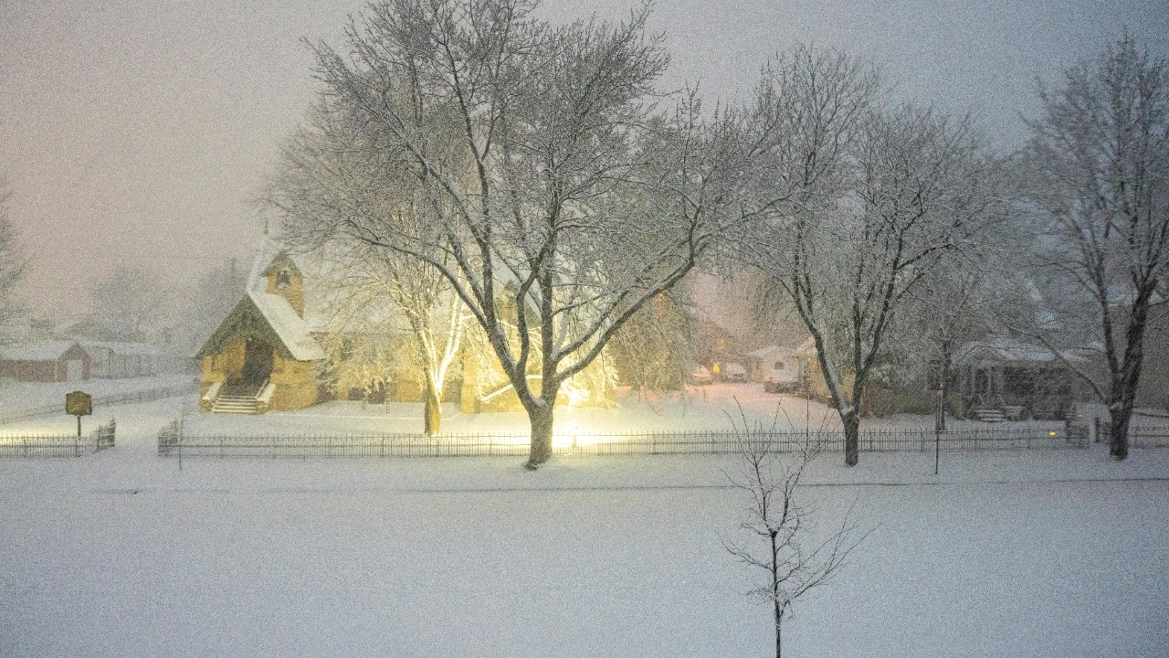
Bitter Arctic air and a sprawling winter storm have plunged a huge swath of the country into life-threatening cold, with officials placing roughly 105 million people under freeze and winter weather alerts as blizzard conditions lock down communities across 11 states. The same system that buried parts of the Plains and Midwest in snow is now driving dangerous wind chills into the Northeast and even brushing the Deep South, turning routine commutes and flights into high‑risk gambles. I see a pattern that is less about a single “monster” event and more about how a colder, stormier atmosphere is testing the country’s basic infrastructure all at once.
South Dakota, Nebraska and Iowa: Blizzard core in the northern Plains
The heart of the blizzard has been churning over the northern and central Plains, where whiteout conditions and brutal wind chills have combined to make travel nearly impossible. In South Dakota, long stretches of interstate have been periodically shut as plows struggle to keep up with drifts piling several feet high along open prairie. Neighboring Nebraska has seen similar conditions, with state troopers warning that stranded vehicles can become deadly traps in subzero wind chills before help arrives.
Farther east, Iowa sits squarely in the storm’s deformation zone, where heavy snow bands and gusts topping 70 MPH have produced true blizzard criteria across open farmland. Forecast discussions describe “wind gusts over 70 MPH” ripping across the northern and central Plains, a setup that turns even modest snowfall into a ground blizzard that can shut down rural communities for days. With the National Weather Service highlighting life‑threatening wind chills on top of blowing snow, residents have been urged to stay off the roads and prepare for potential power interruptions.
Missouri, Kansas, Illinois and Indiana: Midwest transport at a standstill
South of the blizzard’s bull’s‑eye, a broad corridor from Missouri through Kansas, Illinois and Indiana has been hammered by heavy snow and fierce winds that have crippled ground and air travel. Forecasts earlier in Jan warned that Eight Midwest states would see up to 8 inches of snow with winds above 70 MPH, a combination that creates “dangerous driving” and frequent whiteouts across interstates linking the central Plains to the Great Lakes, according to detailed Key Points. That forecast has largely verified, with jackknifed semis and multi‑car pileups reported along major freight corridors.
The ripple effects are national. As snow and ice spread east from the Nebraska and Kansas plains into the industrial Midwest, airlines have preemptively scrubbed flights to avoid stranding aircraft and crews. Earlier in a similar Arctic blast, More than 1,100 flights were canceled as a Dangerous Arctic outbreak swept across central states, a reminder of how quickly a regional storm can snarl the entire aviation network. Travel advisers now urge passengers to Stay Updated through airline apps and to Monitor real‑time tools like FlightAware.com as this latest blizzard ripples through hub airports.
Michigan, Minnesota and North Dakota: Great Lakes and Upper Midwest locked in
North of Chicago, the storm’s snow shield has wrapped around the Great Lakes, locking in communities from Michigan to Minnesota and North Dakota. In the Upper Midwest, forecasters have warned that a Cold air mass will keep Temperatures in the single digits and teens across the Rockies, Plains, Northeast parts of the South, a setup that turns any power outage into an immediate emergency for households without backup heat. Lake‑effect bands have added localized bursts of snow on top of the synoptic storm, burying some communities while others just a few miles away see lighter totals.
Within Michigan itself, local chasers describe Scattered to widespread travel impacts as a fast‑moving clipper reinforces the main storm’s snowpack. One forecast for Monday warned that Scattered bands would make roads treacherous across lower Michigan, with the worst conditions expected on Monday morning commutes. That local picture fits into a broader national snapshot in which Bitter cold and blinding snow are affecting more than half of the United States, with 18 million Americans already under winter alerts even before the latest surge of Arctic air.
Maine, Massachusetts and Connecticut: Northeast braces for the deep freeze
As the core of the storm shifts east, major cities from Massachusetts to Connecticut and up into Maine are preparing for a one‑two punch of snow and dangerous wind chills. Forecasters say this frigid air will move east over the next 48 hours, and By Tuesday morning single‑digit wind chills will grip the Northeast, even in coastal cities more accustomed to slushy mix than powder. Major Northeastern cities are expected to pick up a few inches of snow, enough to snarl traffic and expose gaps in snow‑removal budgets that have been squeezed by recent mild winters.
Farther north, Heavier snowfall is forecast to slam New England, where Three to five inches of afternoon and evening snow could quickly turn untreated roads hazardous and possibly life‑threatening. The same storm system that has already caused significant damage in the Midwest, with blizzard conditions and tornadoes affecting several states, is now marching toward New England and the Northeast, prompting officials to warn of more closed roads due to dangerous conditions and the risk of additional infrastructure strain, according to detailed reports on the Midwest.
Florida and Alabama: Southern states feel the shock
Perhaps the most jarring images from this cold wave have come from the Deep South, where snow has dusted communities that rarely see flakes. In the Florida Panhandle, a Small part of the Sunshine State briefly became a Snowy State as light snow coated cars and lawns for the second year in a row, according to accounts By Associated reporters who described flakes falling around Pensacola and nearby towns before melting away, as detailed in coverage of the Sunshine State. Snowfall created a rare scene in Holt, Fla, on Sunday, with residents sharing photos of white‑topped pine trees and dusted highways while officials reminded drivers that even a thin coating can be treacherous on untreated bridges, according to vivid descriptions of Snowfall there.
To the west, parts of Alabama have also been swept into the storm’s southern fringe, with flurries and freezing rain reported as far south as the Gulf Coast. National outlooks earlier this week highlighted how Snow would impact the Midwest, Northeast and even the South, including southern Georgia, underscoring how unusual it is to see wintry precipitation stretch from the Dakotas to the Gulf in a single event, as mapped in a broad forecast that urged readers to See where the worst impacts would land. For southern communities with little snow‑removal equipment, even a light glaze can close schools and highways, a vulnerability that becomes more glaring as Arctic outbreaks reach farther south.
More from Morning Overview