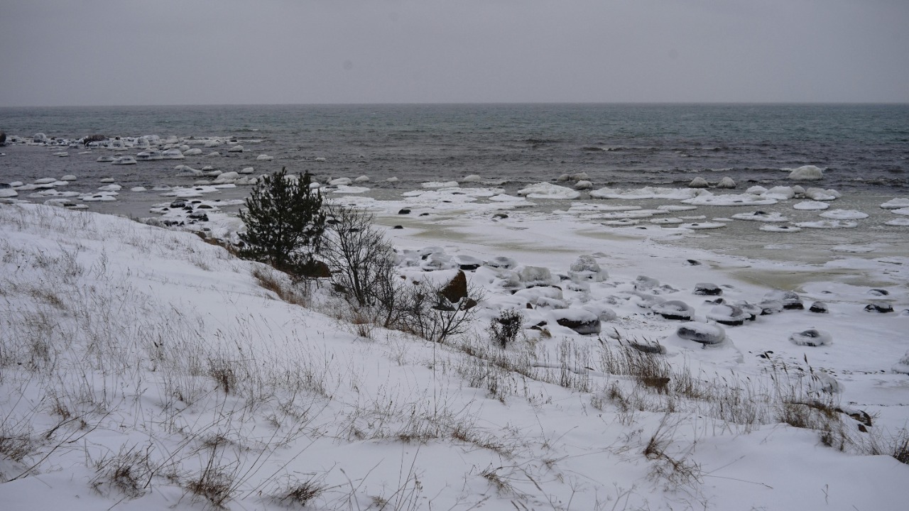
For years, a core set of satellite measurements has shaped how scientists, policymakers and modelers understand the Arctic’s seasonal snow blanket. Now a new analysis of those records suggests that a major technical mistake has been distorting the apparent pace of snow loss, and with it, key assumptions about how quickly the region is changing. The finding does not erase the reality of a warming Arctic, but it does force a careful rethink of one of the most widely used indicators of that change.
At the center of the story is a long running dataset of Arctic snow cover that has been treated as a benchmark for everything from climate models to infrastructure planning. By uncovering a structural error in how those observations were stitched together across decades, researchers have shown that the Arctic’s snow cover is shrinking, but in a different way than the headline numbers long suggested.
How a benchmark Arctic record went wrong
The Arctic has been monitored from space since the 1960s, with satellites tracking the seasonal spread and retreat of snow across high northern latitudes. Those observations were gradually combined into a single record that many researchers treated as a seamless time series, even as the underlying instruments and processing methods evolved. According to work led by atmospheric physicist Elias Chereque, that assumption of seamlessness turned out to be wrong, because the transitions between generations of sensors and algorithms introduced hidden shifts in the apparent extent of snow cover.
Chereque and her colleagues focused on a widely cited set of Arctic snow cover observations that had been used to argue for a particular rate of decline. They found that as satellite technology saw major Improvements, the way snow was detected and classified also changed, yet the resulting discontinuities were not fully corrected in the long term product. That oversight meant that part of what looked like a climatic trend was actually an artifact of shifting measurement systems layered on top of one another.
What the new analysis actually shows
To separate real climate signals from technical noise, the team carried out a detailed analysis of the snow cover record, comparing overlapping satellite periods and reprocessing the data to account for instrument changes. Rather than simply accepting the original trend, they reconstructed how the Arctic’s snow cover would look if all the measurements had been taken with a consistent observing system. The result was a revised estimate of how quickly snow is disappearing from the region’s land and sea ice.
In the original dataset, the Arctic appeared to be losing snow cover at a rate that implied a dramatic acceleration in seasonal melt. But the new analysis by Chereque and her colleagues shows that snow cover actually decreases by about half a million square kilometres per decade, a figure that is still substantial but different from the earlier, error skewed estimate. In other words, the Arctic is indeed losing snow, yet part of the previously reported decline was not a reflection of the atmosphere at all, but of how the satellites were counting white pixels on the ground.
The role of changing instruments and NOAA data
One of the most consequential findings in this work is that the error did not stem from a single faulty sensor, but from a series of incremental changes in how snow was observed and archived. Over time, the National Oceanic and Atmospheric Administration, or NOAA, updated its satellites, refined its retrieval algorithms and adjusted its data collection practices. Each of those steps made sense in isolation, but together they introduced subtle shifts in how much of the Arctic was classified as snow covered in any given year.
Elias Chereque and her collaborators showed that these evolving methods in the NOAA dataset created artificial jumps in the long term record that could easily be mistaken for climate driven changes. By carefully aligning periods when old and new instruments overlapped, and by testing how different processing choices affected the apparent snow fraction, they were able to isolate the measurement induced component of the trend. The work underscores how even well intentioned upgrades to observing systems can complicate long term climate indicators if they are not rigorously harmonized.
Why snow cover accuracy matters for climate risk
Snow is not just a pretty seasonal feature in the Arctic, it is a powerful regulator of the planet’s energy balance. Fresh snow reflects about 80 per cent of incoming sunlight back into space, so changes in snow cover can strongly influence how much solar energy is absorbed by land and ocean surfaces. When snow retreats earlier in the year, darker ground and water are exposed for longer, amplifying regional warming and feeding back into the broader climate system.
That is why the precision of snow measurements matters so much for climate projections. According to According to Elias Chereque, snow loss is influenced by anthropogenic warming and that loss also creates more potential for additional heating, which in turn affects how models simulate future temperature and precipitation patterns. If the baseline record of Arctic snow cover is biased, then the feedback strength built into those models can be miscalibrated, leading to either overestimates or underestimates of future risk for everything from permafrost thaw to midlatitude weather extremes.
Lessons from broader snow measurement research
The Arctic snow cover correction fits into a wider body of work that has been probing the reliability of satellite based snow products. One recent study examined measurement error in remotely sensed fractional snow cover, focusing on how well satellite estimates match conditions on the ground. That research evaluated whether the measurement error and bias altered conclusions about the relationship between the timing of snow melt and other environmental variables, and it found that the impact of those biases could be significant for certain applications.
In particular, the study highlighted how early validations of the Visible Infrared Imaging Radiometer Suite, or VIIRS, snow product showed that errors in fractional snow cover tended to be largest at intermediate levels of coverage, where the landscape is a patchwork of snow and bare ground. A more detailed look at those datasets concluded that the fractional snow cover, or FSC, was often underestimated by between 0 per cent and 5 per cent during periods of intermediate snow cover. That might sound small, but when aggregated across large regions and long time spans, such biases can reshape apparent trends and correlations.
Rebuilding trust in Arctic climate indicators
Correcting the Arctic snow record is not just an academic exercise, it is a test of how the climate science community handles uncertainty and self correction. The fact that a long trusted dataset contained a structural error is uncomfortable, but the process of uncovering and fixing that error is exactly how a mature field should function. By revisiting the assumptions baked into the original product and applying a more rigorous analysis, researchers have produced a clearer picture of how the Arctic’s snow cover is actually changing.
That clearer picture will now feed back into climate models, risk assessments and policy debates. The updated trend, in which snow cover declines by roughly half a million square kilometres per decade rather than the steeper drop implied by the flawed record, still points to a rapidly warming region that is losing its reflective shield. At the same time, it reminds decision makers that every number they rely on, from satellite snow maps to long term climate indices, is the product of specific instruments and methods that must be scrutinized. As new Arctic observing systems come online and existing ones are upgraded, the lesson from this episode is clear: improvements in technology must be matched by equally careful work to keep long term climate records consistent.
For researchers like Chereque, that means continuing to refine the analysis techniques used to merge different generations of satellite data, and for agencies like NOAA, it means documenting and sharing every change in instrumentation and processing so that downstream users can adjust accordingly. It also means recognizing that snow cover is not just a passive indicator of climate change, but an active player in the system, one that reflects about 80 per cent of incoming sunlight and helps control how quickly the Arctic warms. As I see it, the discovery of this major error is less a setback than a reminder that climate science is a living process, one that improves as its tools and assumptions are challenged, tested and rebuilt.
That process is already visible in the way researchers are integrating new satellite capabilities with ground based observations and advanced modeling. By combining detailed analysis of snow’s reflective properties with better measurements of how much of the planet’s surface is actually covered at any given time, they are building a more robust foundation for future climate projections. The Arctic’s snow cover record, once taken for granted, is now a case study in how critical it is to get the details right when the stakes include not just scientific understanding, but the policies and investments that depend on it.
More from Morning Overview