Across the world’s continental shelves, scientists are racing to reconstruct an ancient landscape that once stretched where waves now roll. Vast plains, rivers, and settlements that flourished thousands of years ago are buried beneath coastal seas, holding clues to how people adapted to dramatic climate shifts and rising oceans. As new discoveries surface from the North Sea to Japan’s largest lake, the submerged past is starting to look less like a fringe curiosity and more like a missing chapter in human history.
I see this underwater world as both a time capsule and a warning. The same forces that drowned prehistoric coasts are reshaping shorelines again, and the tools researchers are using to map lost lands are increasingly the same ones planners need to protect modern cities. The race to unlock these secrets is no longer just about understanding who lived there, but about learning how societies survive when the sea comes for their homes.
Reconstructing a drowned continent
For much of the last ice age, sea levels were far lower, and what is now the North Sea was a broad expanse of dry ground that connected Britain to mainland Europe. Twenty thousand years ago, the global ocean sat so far below today’s shoreline that entire regions now under water were habitable, with rivers, wetlands, and fertile soils that would have drawn early communities. As the ice sheets melted and the water rose, those coasts were gradually inundated, leaving behind a patchwork of submerged valleys and plateaus that researchers are now trying to piece together as a coherent prehistoric landscape.
One of the most ambitious efforts to do this is a multinational project focused on ancient northern European shelves, often described under the umbrella of initiatives like SUBNORDICA, which aims to map and model these lost terrains in detail. Teams are using advanced seabed mapping and computer simulations to trace former river channels, floodplains, and shorelines that once supported human life, work that is especially focused on areas such as Doggerland in the North Sea. By treating the seafloor as a buried topographic map rather than a blank blue void, scientists are turning sonar traces and sediment cores into a three dimensional reconstruction of a continent that vanished beneath the waves.
Doggerland, “the most attractive land” that disappeared
Doggerland has become the emblem of this drowned world, a reminder that what looks like open sea today once held forests, lakes, and perhaps some of the best hunting grounds in Europe. Researchers describe this region as “the most attractive land for prehistoric settlement anywhere in the continent,” a superlative that reflects its mix of rich ecosystems and strategic location between what are now Britain, Denmark, and the Netherlands. Around 8,000 years ago, as sea levels climbed, this landscape fragmented into islands and shoals before finally disappearing, taking with it the settlements and stories of the people who lived there.
Today, that lost land largely makes up the shallow banks and shipping lanes of the North Sea, but its archaeological potential is only beginning to be tapped. Fishing trawlers have hauled up worked bone and stone tools, while seismic surveys for energy projects have revealed buried river systems and lake basins that match the profile of a densely settled region. In parallel, Researchers are using these data to model how communities might have responded as their homeland shrank, from shifting camps inland to building new technologies for fishing and seafaring, before their civilizations were eventually vanquished by the encroaching sea.
Why scientists are racing the clock
The urgency around Doggerland and similar sites is not just academic. Coastal shelves are becoming crowded with offshore wind farms, pipelines, and undersea cables, and each new project risks disturbing or destroying fragile archaeological layers before they are documented. Scientists involved in these surveys often describe a race against time, as industrial development accelerates in the same shallow waters that once hosted prehistoric villages. The more infrastructure goes in without detailed mapping, the more likely it is that evidence of early human life will be scattered or lost.
That tension is especially visible where Scientists are exploring Doggerland and other Submerged lands in parallel with plans for large scale renewable energy projects such as offshore wind farms. I see a growing push to integrate archaeological surveys into the early stages of marine planning, so that sonar sweeps and core samples can identify sensitive areas before turbines or cables are installed. The same high resolution mapping that helps engineers design foundations can also reveal buried shorelines and peat beds, turning commercial surveys into a powerful tool for reconstructing the ancient coast.
A 7,000-year-old wall off Brittany
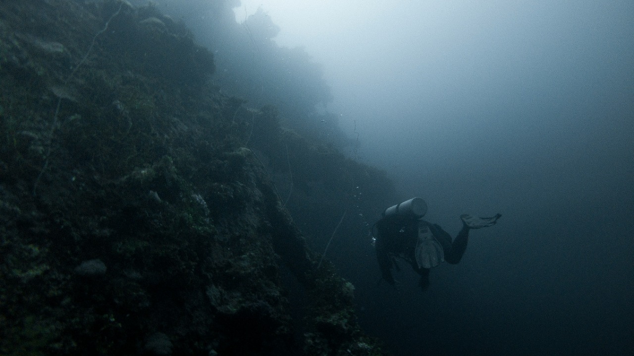
While much of the work on submerged landscapes happens through remote sensing, some of the most striking evidence is now being found by divers in shallow coastal waters. Off the coast of Brittany, Divers recently documented a 7,000-year-old stone wall that runs for hundreds of meters along the seabed. The structure, built from granite blocks, appears to have been carefully aligned and stacked, suggesting deliberate construction rather than a natural rock formation. Its age places it in the early Neolithic, when farming communities were spreading across western Europe and experimenting with new ways to manage animals and landscapes.
Subsequent analysis has reinforced the idea that this is not an isolated curiosity but part of a broader pattern of coastal activity that was later drowned. Divers explored the site between 2022 and 2024 and confirmed the presence of granite structures that archaeologists interpret as a kind of drive line or barrier used to funnel animals, possibly for hunting along a former shoreline. According to the team, these features may have helped preserve “memories” of how people organized their environment before the sea advanced, a claim supported by detailed documentation of the Divers and Archaeologists who studied the wall. For me, the Brittany discovery shows how even a single submerged structure can illuminate the practical ingenuity of communities living on the edge of a changing ocean.
France’s mysterious 7,000-Year-Old barrier
The Brittany wall is part of a growing cluster of finds that suggest early Europeans invested significant labor in coastal infrastructure that is now underwater. New Research on the site describes how Archaeologists Discover Mysterious 7,000-Year-Old Stone Wall Beneath the Waves Off the Coast of France, with segments that stand roughly 7 feet tall on average. The scale of the construction implies coordinated effort and planning, which in turn hints at social structures capable of organizing large communal projects. That kind of investment makes little sense unless the builders expected the wall to serve a critical purpose in their daily lives, whether for hunting, herding, or managing tidal flows.
What I find striking is how these underwater walls echo other monumental structures from the same broad period, from causeways to megalithic alignments, yet they remained hidden simply because the sea rose over them. The French site underscores how much of early European engineering may still be out of sight, preserved in low oxygen sediments that protect wood, bone, and stone. As more teams apply systematic survey methods to coastal shelves, I expect additional features like the Archaeologists documented barrier to emerge, forcing a reassessment of how sophisticated these communities were in shaping their watery frontiers.
Lake Biwa’s 10,000-year story
The search for ancient underwater worlds is not limited to saltwater coasts. In Japan, a quiet revolution in understanding early pottery and settlement is unfolding beneath the surface of the country’s largest freshwater basin. A Nearly Perfect Vase From 10,000 Years Ago Found in Japan’s Largest Lake Is Rewriting History, because it shows a level of craftsmanship and preservation that challenges assumptions about how and where complex ceramics were produced. The object, recovered from Lake Biwa, survived millennia in a low light, low oxygen environment that shielded it from the decay that usually destroys such fragile artifacts.
Further work at the same site has revealed that this was not an isolated deposit but part of a broader pattern of activity linked to the Jomon culture. Pottery from Japan’s Jomon Period Discovered in Lake Biwa, Perfectly Preserved for 10,000 Years, was found in a bowl like depression beneath the lake, suggesting deliberate placement or use of the basin as a kind of repository. I see Lake Biwa as a freshwater counterpart to Doggerland, a place where rising water levels and shifting shorelines have sealed away evidence of early innovation, only now accessible through careful underwater excavation.
From medieval shipwrecks to asteroid brine
Not every underwater discovery reaches back to the Stone Age, but even younger finds are reshaping how I think about the continuity of maritime history. Archaeologists just found the largest and most advanced Medieval cargo ship ever, a vessel that lay hidden for centuries before modern survey techniques revealed its outline. The ship, documented by Archaeologists and reported through India Shipping News, shows how trade networks and shipbuilding technology had reached a high level of sophistication long before the age of global empires. Its preservation on the seafloor offers a rare chance to study construction methods, cargo handling, and even daily life on board in extraordinary detail.
These maritime finds sit alongside other breakthroughs in paleoscience that, while not always underwater, rely on similar analytical tools and cross disciplinary collaboration. Work highlighted in a review of A New Pterosaur, Ancient Asteroid Brine and More Discoveries from the National Museum of Natural History shows how scientists are extracting chemical and biological signals from tiny samples, whether they come from fossil bones, asteroid fragments, or marine sediments. The same geochemical techniques that decode “ancient asteroid brine” are now being applied to cores taken from submerged landscapes, helping to reconstruct past climates, vegetation, and even pollution levels. In that sense, the medieval ship and the asteroid brine are part of a single toolkit for reading the deep past.
Mapping 43,000 seamounts and the deep frontier
While coastal shelves and lakes hold the most direct evidence of human activity, the broader ocean floor is also being charted at an unprecedented pace. Scientists have mapped and studied a little over 43,000 underwater seamounts in recent years, a figure that hints at how much of the planet’s geology remains poorly understood. Expeditions organized through programs like the Schmidt Ocean Institute’s 2026 voyages are using multibeam sonar, remotely operated vehicles, and autonomous platforms to fill in the blank spaces on bathymetric maps. Each newly mapped seamount adds to a global picture of plate tectonics, ocean circulation, and deep sea ecosystems that ultimately shape coastal environments too.
Although these deep features are far from the drowned plains of Doggerland or the shores of Lake Biwa, I see them as part of the same scientific push to treat the seafloor as a dynamic, information rich landscape. The data gathered by Scientists on these cruises feed into global models of sea level, currents, and biodiversity that help explain why certain coastal shelves were so attractive to prehistoric settlers. As mapping becomes more comprehensive, it will be easier to identify not only where ancient people might have lived, but also how tectonic uplift, subsidence, and sedimentation have altered those sites over thousands of years.
From ancient coasts to future shorelines
What ties these discoveries together is a growing recognition that submerged landscapes are not marginal to human history, but central to it. Around Around 8,000 years ago, many civilizations that had flourished on low lying coasts were forced to adapt or move as sea levels rose, a pattern that echoes in the challenges facing modern coastal cities. The same processes that drowned Doggerland and the stone walls off Brittany are now eroding deltas, flooding island nations, and pushing saltwater into freshwater aquifers. By studying how ancient communities responded, from building barriers to shifting their economies toward marine resources, I believe we gain a longer view of what resilience can look like.
At the same time, the technologies developed to explore these underwater worlds are feeding directly into contemporary planning. Advanced seabed mapping, computer modeling of flood scenarios, and integrated surveys that combine archaeology with engineering are already being used to guide the placement of offshore wind farms, shipping routes, and coastal defenses. Even tools originally designed for other purposes, such as the viewer platforms that allow detailed inspection of geographic data, are helping specialists and the public alike visualize how much land has been lost to the sea. As more of these datasets become accessible, the ancient underwater world stops being an abstract idea and becomes a tangible part of the story of where we come from, and where rising water might take us next.
Supporting sources: Scientists Are Racing to Unearth the Secrets of an Ancient … – Yahoo.
More from MorningOverview