Scientists have recently unveiled the first comprehensive map of Zealandia, Earth’s eighth continent, which is mostly submerged beneath the Pacific Ocean. This breakthrough, achieved through advanced geophysical surveys, reveals intricate details of Zealandia’s geology and supports long-standing theories about its existence as a distinct continental fragment separated from Australia around 80 million years ago. Geologists leading the effort emphasize that Zealandia qualifies as a continent due to its distinct crust and elevation compared to oceanic plates, marking a pivotal moment in understanding global tectonics.
Defining Zealandia as a Continent
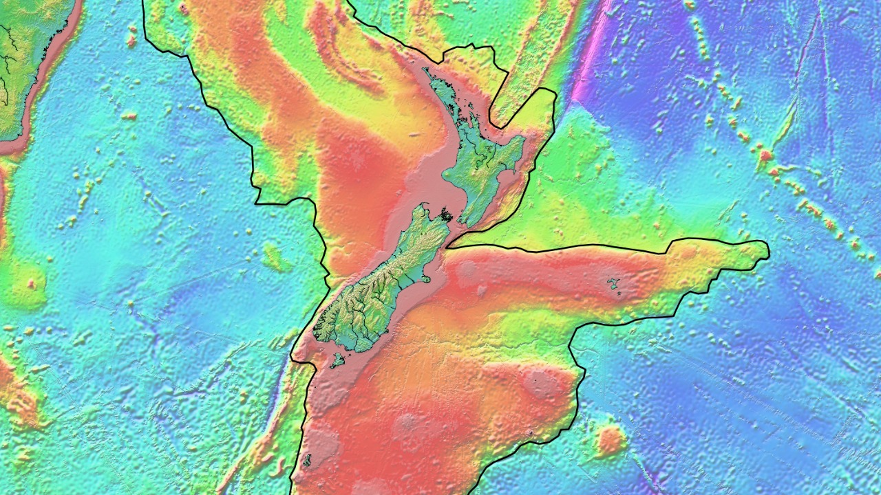
Zealandia meets the geological criteria for a continent due to its thicker continental crust, which averages 20-40 kilometers deep, and its separation from surrounding oceanic basins. Unlike typical ocean floors, Zealandia spans an area of about 4.9 million square kilometers, with 94% of its territory underwater. The visible landmasses include New Zealand, New Caledonia, and Lord Howe Island, distinguishing it from the surrounding oceanic basins.
In 2017, the Geological Society of America officially recognized Zealandia as Earth’s eighth continent. Key proponents like geophysicist Nick Mortimer argued that its size and composition meet continental standards, a view now supported by the comprehensive mapping of Zealandia’s geology (source).
Historical Context of Zealandia’s Discovery
Early hints of Zealandia’s existence emerged from 19th-century surveys that noted unusual bathymetry around New Zealand. This led to Bruce Luyendyk’s 1995 proposal of the “Zealandia” name in a scientific paper. Further evidence supporting Zealandia’s continental nature came from seismic and gravity data collected during the 1990s and 2000s, which confirmed its rifting from the Gondwana supercontinent about 80-100 million years ago.
International expeditions, such as those by GNS Science in New Zealand, played a crucial role in gathering preliminary data that paved the way for the recent comprehensive mapping of Zealandia (source).
The Mapping Technology and Methods
The mapping of Zealandia involved the use of multibeam sonar and satellite gravimetry to create high-resolution bathymetric maps. These maps cover Zealandia’s full extent from the Lord Howe Rise to the Challenger Plateau. In addition, rock core samples and seismic reflection profiles were integrated to model subsurface structures, revealing fault lines and sedimentary basins.
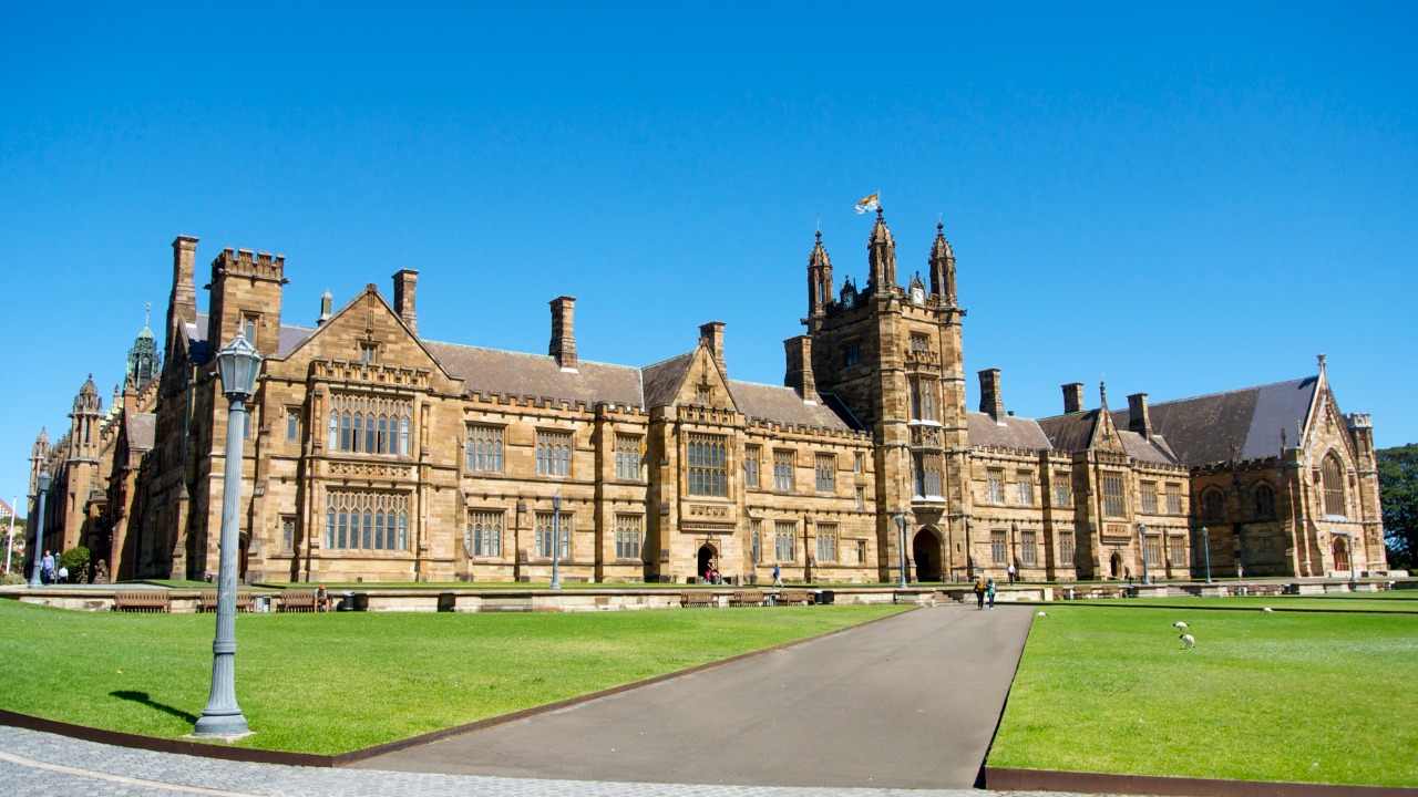
This effort was a collaborative one, involving over 50 scientists from institutions like the University of Sydney and Japan’s JAMSTEC. The project spanned five years of data compilation, demonstrating the extensive work required to map a submerged continent (source).
Key Geological Features Revealed
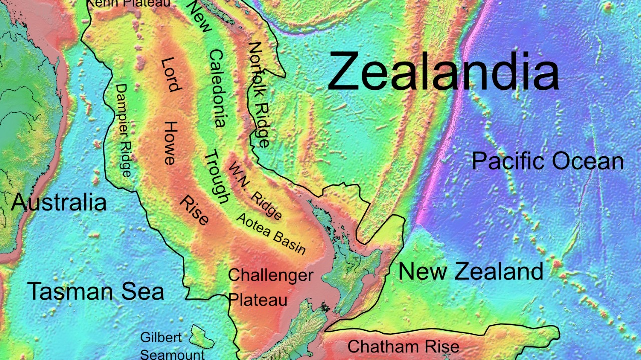
The comprehensive map of Zealandia reveals major landforms like the sunken Norfolk Ridge and the Reinga Basin. These features show how Zealandia’s geology connects to that of New Zealand’s South Island. The map also suggests the presence of mineral resources, including potential gold and rare earth deposits inferred from exposed onshore analogs in New Zealand.
Zealandia’s volcanic history is also evident in the map, with evidence of ancient hotspots that formed the continent’s basaltic plateaus around 25-50 million years ago (source).
Implications for Plate Tectonics
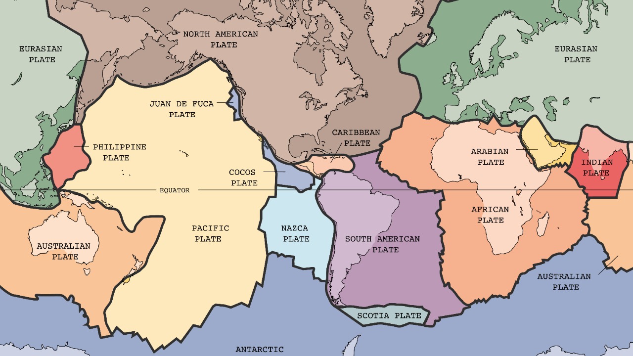
The map of Zealandia refines models of the Pacific Ring of Fire, illustrating subduction zones where Zealandia’s edges interact with the Australian and Pacific plates. This provides valuable insights into the dynamics of plate tectonics. Furthermore, the detailed tectonics of Zealandia show slow subsidence rather than catastrophic sinking, contributing to our understanding of supercontinent breakup.
The map also has implications for biodiversity, as Zealandia’s submerged ecosystems could potentially host unique deep-sea species adapted to continental shelf conditions (source).
Challenges in Mapping Submerged Continents

Mapping a submerged continent like Zealandia presents several challenges. These include logistical hurdles such as deep-water access (up to 2,000 meters) and harsh weather in the southwest Pacific during surveys. There were also data integration issues arising from varying global datasets, which were resolved through standardized GIS modeling.
Funding for the project was provided by bodies like the National Geographic Society, which supported vessel time for key transects (source).
Future Research and Exploration
With the comprehensive map of Zealandia now available, future research and exploration can be planned more effectively. Upcoming drilling projects under the International Ocean Discovery Program aim to sample Zealandia’s core rocks directly. The map also informs economic prospects, such as offshore mining regulations.
Moreover, the map is available via open-access platforms, providing a valuable resource for educational outreach and advancing global geoscience curricula (source).