Strip away Antarctica’s ice and the familiar white disc at the bottom of the map dissolves into something far stranger: a broken ring of mountains, deep basins and flooded valleys that would redraw the outline of the Southern Hemisphere. Instead of a single frozen continent, much of the land would sit below sea level, turning large areas into shallow seas and leaving only the highest ridges as scattered islands. I want to walk through what that hidden landscape actually looks like, and what it would mean for the rest of the planet if the ice that conceals it were somehow gone.
The hidden continent beneath the ice
Under today’s ice sheet, Antarctica is not the smooth, featureless plate it appears to be on classroom globes. Radar and gravity surveys reveal a rugged bedrock surface carved by ancient tectonics and erosion, with mountain chains, plateaus and trenches that rival anything in the Northern Hemisphere. Scientists have mapped this buried terrain in increasing detail, showing that the white cap we see from space is draped over a continent that is geologically complex and, in many places, dramatically uneven.
When researchers combined those measurements into a continent-wide digital model, they found that the naked land beneath the Antarctic ice sheet is a rugged land, covered in mountain ranges, gorges and broad depressions that would fill with water if exposed. Visualizations based on this work show steep coastal escarpments, deep interior basins and narrow ridgelines that would stand as peninsulas or islands once the ice and overlying weight were removed, a picture that matches the description that, as the map shows, the naked land beneath the Antarctic ice sheet is a rugged land, covered in mountain ranges, gorges and other sharp relief features documented in Oct visualizations.
From single landmass to fractured archipelago
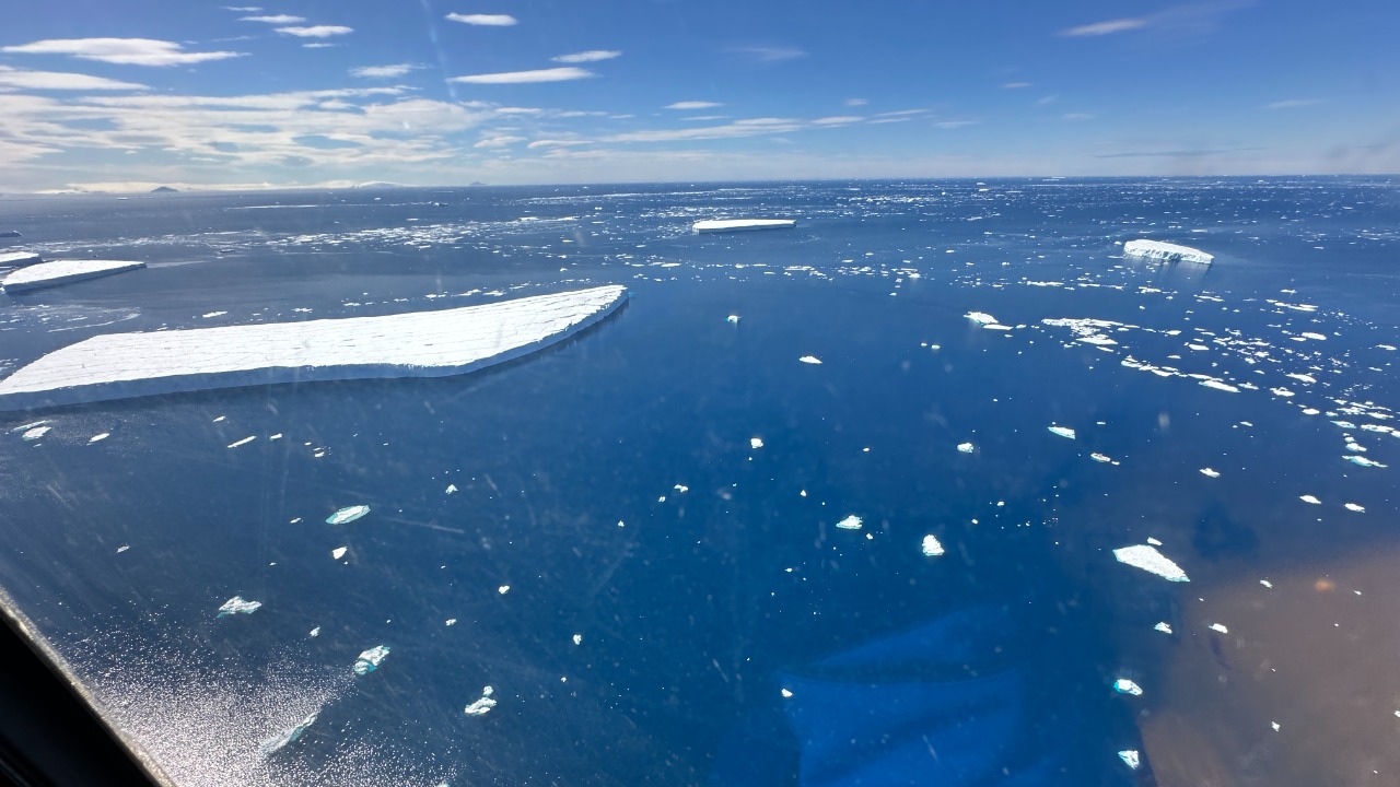
If all that ice vanished and global sea level rose to meet the new shoreline, Antarctica would not remain a single, solid landmass. Large portions of the bedrock, especially in West Antarctica, already sit far below the current ocean surface, held dry only by the vertical walls of ice that rest on them. Once those ice walls disappeared, seawater would rush in through existing coastal troughs and low passes, flooding the interior and turning what is now a continuous continent into a patchwork of islands and semi-enclosed seas.
In that scenario, the white continent would resemble a vast archipelago of mountainous islands rather than the compact oval we are used to seeing at the bottom of maps. Reconstructions that remove the ice and then let the ocean fill to its new level show high coastal ranges and central plateaus standing as island backbones, while lower basins become broad, shallow embayments. One such reconstruction notes that without the ice sheets, the land would be transformed into an archipelago of mountainous islands, a description that matches the way Antarctica Without Ice would look once the up-to-three-kilometer-thick cover is gone.
How scientists mapped an invisible landscape
The picture of ice-free Antarctica is not guesswork sketched on a blank canvas. It comes from decades of airborne radar flights, satellite measurements and ship-based surveys that have traced the thickness of the ice and the shape of the rock below it. Aircraft send radio waves through the ice, measure the echoes that bounce off the bedrock and convert those signals into elevation data, while satellites track tiny variations in gravity that reveal where dense rock rises or deep basins sink beneath the surface.
Earlier this year, researchers pulled those strands together into a new, high resolution map that shows what the continent would look like without its ice cover. The project combined radar soundings, ice thickness records and coastal bathymetry to produce a seamless view of the bed, then adjusted that surface for how the crust would rebound if the enormous weight of the ice were removed. Reporting on that work describes how a new map has answers for anyone who has ever wondered what Antarctica looks like without ice, crediting the British Antarctic Survey, which produced the map, and highlighting how the visualization lets the public see the hidden topography that scientists have been piecing together for decades, as detailed in Mar coverage of the new map.
Mountains, gorges and drowned basins
Once I focus on the details of that map, the most striking features are the mountain belts that run through both East and West Antarctica. Some of these ranges, like the Transantarctic Mountains, are already partly visible where they poke through the ice as nunataks, but the full bedrock model shows them as continuous chains with steep flanks and high passes. Between them lie deep gorges and troughs that were carved by ancient rivers and later by glaciers, now hidden under hundreds or thousands of meters of ice.
Many of the lowest areas are not just below the current sea surface, they are far beneath it, forming basins that would become inland seas if exposed to the ocean. The map reveals long, narrow depressions that would likely turn into fjords, as well as broad, flat-floored basins that would resemble the shallow continental shelves off places like the North Sea. Descriptions of the naked land emphasize that it is covered in mountain ranges and gorges, with some of the deepest points lying more than a kilometer below sea level, a pattern that matches the rugged land, covered in mountain ranges, gorges and other sharp relief that appears in the As the map shows analysis of the continent’s bed.
How much ice, and what happens if it melts
To understand what an ice-free Antarctica would mean for the rest of the world, I have to start with how much frozen water is locked up there now. Currently 98 percent of Antarctica is covered in ice, a sheet that in places reaches up to three kilometers thick and stores the vast majority of the planet’s freshwater ice. If all of that ice were to melt and drain into the ocean, the added volume would raise global sea level by a very large amount, enough to redraw coastlines on every continent and inundate many of the world’s major cities.
Climate scientists treat that full melt scenario as a theoretical extreme rather than a near term forecast, but it is still a useful way to grasp the scale of what is at stake. One analysis of Antarctic What Ifs describes how, although such a complete melt almost definitely will not happen on human timescales, the physics is straightforward: the ice that now covers 98 percent of the land would eventually become liquid water, and the resulting sea level rise would be very large, with estimates typically in the tens of meters, as laid out in the Antarctic What Ifs discussion of what would happen if all the ice melted in Antarctica.
A new coastline for the Southern Ocean
On a world with no Antarctic ice, the Southern Ocean would push much farther inland, and the familiar circular coastline at the bottom of the map would be replaced by a jagged, intricate boundary. Low lying coastal plains that are now buried under ice would be drowned, while higher ridges would become peninsulas and islands separated by narrow channels. The result would be a coastline more reminiscent of the fractured margins of Norway or the Canadian Arctic Archipelago than the smooth outline that appears on most schoolroom maps.
That new shoreline would not just be a cartographic curiosity, it would reshape ocean circulation and marine ecosystems. Deep basins that are now isolated under ice would become connected to the open sea, altering how cold, dense water forms and sinks around the continent, a process that helps drive global currents. Visualizations of the ice-free bed show how the Southern Ocean would flood into interior basins and around mountain blocks, creating an archipelago of mountainous islands and semi-enclosed seas that would change the way currents flow and how nutrients and heat are exchanged between the polar ocean and the rest of the world, a pattern highlighted in reconstructions of What the white continent would look like without its ice sheet.
Global sea level and faraway cities
For people living far from the Southern Ocean, the most immediate consequence of an ice-free Antarctica would be the height of the water at their own coasts. A sea level rise of tens of meters would drown large parts of low lying countries and coastal megacities, from the river deltas of Bangladesh and the Netherlands to the waterfronts of New York, Shanghai and Lagos. Critical infrastructure built at today’s shoreline, including ports, power plants and transport hubs, would be underwater or forced to retreat inland.
Even partial loss of the Antarctic ice sheet has serious implications, because the continent holds enough frozen water that small percentage changes translate into centimeters or meters of global sea level rise. Analyses that explore what if all the ice melted in Antarctica emphasize that while the complete melt is an almost definitely will not happen scenario, the underlying calculation is straightforward: the ice volume is so large that any sustained acceleration in melting or ice flow into the ocean would have profound consequences for coastal communities worldwide, a point underscored in the Almost definitely will not happens section that still spells out the scale of the potential rise.
Antarctica’s place on the world map
Seeing Antarctica without ice also changes how I think about its place on the globe. On many standard projections, the continent is stretched and distorted at the bottom of the page, a blank white space that looks more like an afterthought than a central piece of Earth’s geology. In reality, the bedrock continent is stitched into the same tectonic fabric as South America, Africa and Australia, with mountain belts and crustal blocks that record the breakup of ancient supercontinents and the long drift of landmasses across the planet.
Digital tools now let anyone zoom in on that hidden terrain and see how it fits into the broader geography of the Southern Hemisphere. One such viewer, which uses satellite data and mapping overlays, allows users to explore the Antarctic region in detail, placing the continent in context with the surrounding Southern Ocean and nearby landmasses. By panning and zooming through that interface, it becomes clear that Antarctica is not an isolated white disc but a complex region of mountains, basins and shelves that anchors the bottom of the world map, a perspective that comes through in the viewer for the Antarctic place identified by the mid code /m/0jfx.
Why an ice-free Antarctica is still a warning
In practical terms, no one alive today will see Antarctica completely stripped of ice, and the full melt scenario belongs in the realm of long term thought experiments rather than near term forecasts. The continent’s ice sheet is vast and, in many places, sits in climates that remain far below freezing even in a warming world. Yet the maps of an ice-free bed are not just academic curiosities, they are tools that help scientists understand which parts of the ice sheet are most vulnerable and how the underlying topography might guide future changes.
By revealing where the bedrock lies below sea level and how deep the interior basins are, these reconstructions show where warm ocean water could reach the grounding lines of glaciers and where retreat might accelerate once it starts. That knowledge feeds into models that project how much sea level could rise under different emissions scenarios and over what timescales. When I look at the rugged, flooded landscape of a hypothetical ice-free Antarctica, I see less a literal future and more a stark reminder of how much water is locked up at the bottom of the world and how profoundly it would reshape the planet if we allowed enough warming for large parts of that ice to disappear, a message that runs through the recent New map has answers coverage of the continent’s hidden face.
More from MorningOverview