Alaska is confronting a volatile mix of deep snow, warm rain and fierce wind that is turning steep slopes and swollen rivers into a twin threat. From the capital to Southcentral communities, avalanche danger is colliding with flood risk as storms stack up and the snowpack struggles to hold. I see a state that is not just digging out from one event, but bracing for a season where cascading hazards are becoming the new baseline.
Juneau’s avalanche emergency collides with flood risk
In Juneau, the crisis began with snow piling up faster than crews could move it, then escalated when heavy rain arrived on top of that fragile base. City officials have described an Avalanche in Juneau, that unfolded as an atmospheric river began to pound the region, with accumulating snow reaching 82 inches in some areas. Over the course of a week, the city reported removing about 3 million pounds of snow, a staggering figure that hints at the stress on infrastructure and the sheer scale of the slopes looming above downtown neighborhoods.
As the snowpack destabilized, the danger did not stop at the ridgelines. Governor Mike Dunleavy issued a disaster declaration for both avalanches and flooding, a recognition that melting snow and intense rain can turn avalanche debris into fast-moving water and ice that surge through low-lying streets. The same atmospheric river that loaded the mountains with snow also brought forecast rainfall of up to 8 inches, a combination that left Juneau under an ongoing avalanche threat even as crews tried to clear drains and culverts before runoff overwhelmed them.
Evacuations and the human cost in Alaska’s capital
The most visible sign of how serious conditions became was the decision by The City and Borough of Juneau to issue an avalanche evacuation advisory for all residents in slide zones. That advisory, highlighted in a local Newscast, underscored that the biggest concern was not just snow burying homes, but what would happen if debris blocked the channel where floodwaters would spread after an avalanche. Hundreds of people in downtown Juneau were warned that staying put meant accepting the risk of being cut off or inundated if the mountain above them finally let go.
Reporter Claire Stremple captured the scale of that disruption, noting that Hundreds of residents in Juneau’s downtown avalanche zones were urged to leave their homes as risk levels climbed. In her coverage for the Alaska Beacon, Claire Stremple detailed how people living in mapped hazard areas were told they were in a risk zone, not just for snow but for the complex chain reaction that could follow a major slide. For families, that meant hurriedly packing bags, finding space in shelters or with friends, and weighing the emotional cost of leaving behind homes that suddenly felt exposed to forces far beyond their control.
“When the Mountain Let Go”: avalanches made visible
For many Alaskans, the danger became real not through forecasts but through video. A clip titled When the Mountain circulated on social media, showing what witnesses described as a massive wet-snow avalanche ripping down the mountainside. This was not just falling snow, but a dense, fast-moving wall that illustrated why officials were so alarmed about the potential for similar slides on other known paths. Watching that footage, I am struck by how quickly a familiar landscape can transform into a torrent of snow, ice and debris.
City avalanche advisor John Bressette has been blunt about the stakes. In interviews, John Bressette, the city’s new avalanche advisor, explained that multiple avalanches have already occurred on Mount Juneau on known slide paths, each one carrying a cost in resources and damages. His assessment is that the community is dealing with a pattern, not a one-off event, and that every new storm adds weight to slopes that have already proven they can fail. That perspective helps explain why local leaders are treating each new forecast as a potential trigger rather than a routine winter storm.
Atmospheric river, rain-on-snow and a widening hazard zone
What is driving this surge in risk is not just cold and snow, but the collision of winter and warm, moisture-laden air. Meteorologists have tracked an Atmospheric river slamming into Alaska, bringing powerful wind gusts and more rain to the panhandle. Officials have cautioned that there is still a significant avalanche threat as this system continues to pound the region, because each pulse of rain on top of deep snow weakens the bonds within the snowpack and lubricates the ground beneath it.
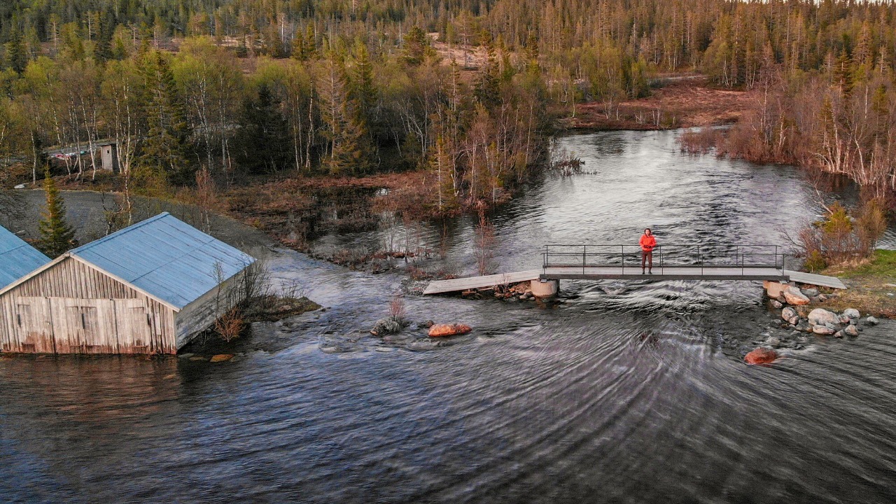
That rain-on-snow setup is particularly dangerous in Juneau, where more than 30 inches of snow already covered the ground after back-to-back storms before the latest deluge arrived. As Teams of workers and volunteers scrambled to clear storm drains and dig channels for runoff, local leaders requested state assistance through a disaster declaration, warning that more heavy rain was heading toward an already saturated landscape. The result is a widening hazard zone where slopes, rivers and urban drainage systems are all under stress at the same time, leaving little margin for error if another major storm arrives.
Southcentral on alert: Anchorage and beyond
The danger is not confined to Southeast. In Anchorage and across Southcentral, forecasters issued a First Alert Avalanche Warning as heavy snow spread from Southcentral to the Interior. That warning made clear that both human-triggered and natural large avalanches were likely, a sign that the snowpack across a broad swath of Alaska was reaching a tipping point. For drivers on mountain passes and backcountry users near Anchorage, the message was that familiar terrain could behave very differently under the weight of new snow and shifting temperatures.
Experts with the Chugach National Forest have responded by pushing out safety tips as avalanche warnings spread across Southcentral Alaska. Their guidance emphasizes conservative route choices, carrying rescue gear and recognizing that even low-angle slopes can be threatened by larger paths above. I read their advice as a reminder that in a year like this, the line between routine recreation and high-consequence exposure is thinner than many people realize, especially when storms keep refreshing the hazard faster than it can stabilize.
Storm damage, shelters and the flood layer of the crisis
While avalanches capture dramatic images, the quieter but equally serious story is the damage from wind, rain and rising water. Following record rainfall, rapid snowmelt and extreme wind, communities across Southeast have reported storm damage to roads, power lines and waterfront infrastructure. In Juneau, a shelter remains open as evacuations and avalanche concerns continue, providing a temporary refuge for people who cannot safely return home while slopes and rivers remain unstable. That shelter is more than a warm room; it is a symbol of how intertwined the avalanche and flood emergencies have become.
Statewide, forecasters have pointed out that flood alerts are in effect not only because of rain in the forecast, but because there has already been significant rain on top of deep snow. A short briefing in Jan laid out how saturated snowpacks and frozen ground can funnel water into channels faster than they can handle, raising the risk of ice jams and sudden rises. In that context, avalanches are not just a mountain hazard; they can act as temporary dams that redirect or concentrate floodwaters, turning a slope failure into a downstream emergency minutes or hours later.
Warnings, communication and what comes next
Managing this kind of compound risk depends on clear, timely warnings, and Alaska’s avalanche community has been working to keep pace. The Friends of the Chugach National Forest Avalanche Information Center announced an AVALANCHE WARNING Jan. 10, 2026, explaining that they had issued an Avalanche Warning through the National Weather Service effective at 6 AM that day. That kind of coordination between local experts and federal forecasters is crucial when conditions are changing by the hour and people are making decisions about travel, work and school based on the latest updates.
In Juneau, communication has also meant spelling out exactly who is at risk. Local coverage has stressed that Alaska‘s capital city advised downtown residents in avalanche zones to evacuate, and that those who are in a risk zone need to understand both the snow and flood dimensions of that label. As I look across the state, from Juneau’s steep streets to Anchorage’s trailheads, I see a common thread: a winter where explosive avalanche and flood threats are no longer isolated events, but overlapping pressures that demand faster decisions, better information and a deeper respect for how quickly Alaska’s landscape can shift.
More from Morning Overview