Far below the waves off western France, divers have mapped a massive stone barrier that has been hidden since long before recorded history. The structure, dated to roughly 5000 BC, appears to be a carefully engineered wall built by Neolithic communities that lived along a very different shoreline from the one we see on maps today. Its age, scale, and preservation are forcing archaeologists to rethink how early coastal societies organized labor, managed resources, and responded to a changing environment.
The newly documented feature, often described as a 7,000-year-old wall, stretches for hundreds of feet across the seabed and is accompanied by smaller stone constructions that hint at a broader landscape of human activity. As researchers analyze its layout and context, they are weighing whether it served as a sophisticated fish trap, a defensive barrier against rising seas, or some combination of both. Whatever its precise purpose, the discovery adds a striking new chapter to the story of how people adapted to shorelines that were already shifting under the pressure of climate and sea level change.
The wall beneath the waves
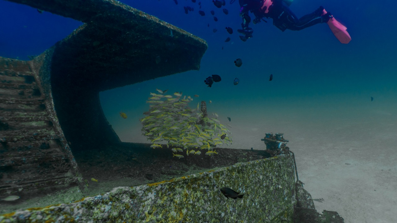
The structure lies off the coast of Brittany, near the low-lying island of Ile de Sein, in waters that would once have been part of a broad coastal plain. Divers surveying the area identified a continuous alignment of granite blocks that runs for nearly 400 feet, with stones that appear to have been deliberately extracted, shaped, and positioned. The wall’s orientation and regularity stand out sharply from the surrounding seabed, which is otherwise dominated by natural rock outcrops and sediment, signaling that this is not a random geological formation.
Archaeologists working on the project describe the feature as a Massive 7,000-Year-Old Wall Found Underwater Off French Coast, emphasizing both its antiquity and its scale. The main barrier is accompanied by at least a dozen smaller manmade structures, suggesting a complex built environment rather than a single isolated construction. Reporting on the find notes that this 7,000-Year-Old configuration of stones, now fully submerged, was once part of a coastal landscape that Neolithic communities exploited intensively for food and shelter, a context that helps explain why such a large Old Wall Found could have been worth the enormous effort it required to build in the first place.
How archaeologists pieced the structure together
The wall did not reveal itself in a single dramatic moment, but through a methodical campaign of dives, mapping, and cross-checking with older bathymetric data. Teams of divers explored the site repeatedly, documenting each segment of the barrier and the associated features on the seafloor. According to one detailed account, the divers explored the site between multiple survey seasons, gradually confirming that the stones formed a continuous, human-made alignment rather than scattered debris. This careful process allowed Researchers to distinguish the engineered wall from natural rock formations and to trace its full extent across the submerged landscape.
Once the physical layout was understood, specialists turned to dating and interpretation. Sediment cores and the depth of submergence pointed to an origin around 5000 BC, placing the structure firmly in the Neolithic period. In that context, the wall fits into a broader pattern of coastal engineering that includes fish traps, causeways, and early sea defenses. One synthesis of the work notes that the structure is now considered part of a cluster of 7,000-Year-Old underwater features Old Wall Found Off Coast of France that are reshaping how I think about the technical skills and social organization of communities living along the Atlantic façade at the dawn of agriculture.
Fish traps, sea defenses, or something else?
Interpreting a stone wall that has been underwater for millennia is not straightforward, and the debate over its purpose is part of what makes this discovery so compelling. One leading hypothesis is that the barrier functioned as a large-scale fish trap, designed to corral marine life as the tide retreated across the foreshore. In this reading, the wall would have stood on a gently sloping intertidal zone, guiding fish into enclosures or pockets where they could be harvested with nets, baskets, or spears. Archaeologists point to similar tidal fishing systems in other parts of the world, and one analysis explicitly describes how such walls could have been used to trap fish as the tide retreated, a scenario that fits well with the structure’s length and position relative to the ancient shoreline.
Another possibility is that the wall was built, at least in part, to slow or deflect encroaching water as sea levels rose over the Neolithic period. Some researchers argue that the barrier’s mass and orientation could have helped protect low-lying settlements or fields from storm surges and gradual inundation. This interpretation gains weight when I compare the French structure with other early coastal defenses, including examples where stone alignments were clearly intended to hold back the sea. The fact that the wall is now fully submerged does not rule out a defensive role; instead, it underlines how quickly shorelines can migrate, and how even substantial human interventions can be overtaken by environmental change.
A feat of Neolithic engineering
Whatever its primary function, the wall is a striking demonstration of technical skill in an era often caricatured as simple or static. The stones are granite, a hard rock that requires planning and effort to extract, cut, and transport in large quantities. According to Pailler, there could have been a transmission of know-how on extracting, cutting and transporting the stone that underpins the entire project, implying not just local experimentation but a shared body of techniques circulating among coastal communities. The regularity of the blocks and the precision of their placement suggest that builders understood how to create stable structures that could withstand both water movement and the weight of the stones themselves.
From my perspective, the most revealing aspect is the coordination implied by such a project. Moving and setting hundreds of heavy stones would have required organized labor, agreed plans, and some form of leadership or communal decision making. One detailed study of the site frames it as part of a broader Neolithic Cultural Revolutio in which people along this coast were investing in permanent infrastructure to manage resources and shape their environment. When I consider that this 7,000-Year-Old undertaking predates many iconic monuments on land, it becomes harder to see early farmers and fishers as marginal or unsophisticated; instead, they emerge as innovators who were already thinking at landscape scale.
Part of a wider underwater world
The French wall is not an isolated curiosity, but one node in a growing map of submerged Neolithic infrastructure across Europe and the Mediterranean. Earlier this year, archaeologists reported a 7,000-year-old road built at the bottom of the Mediterranean Sea, connecting a once-coastal settlement to nearby islands. According to an official statement on Facebook, the sunken landmass was the Neolithic site of Soline, a Hvar culture settlement, and the stone-paved route that linked it to the surrounding landscape is now preserved beneath several meters of water. That discovery, like the wall off Brittany, only came into focus when divers and marine archaeologists combined underwater survey with careful reconstruction of ancient shorelines.
Other teams have documented what may be the oldest known seawall along submerged Mediterranean villages, where a long line of stones was built parallel to the coast to blunt the impact of waves. The find was described today in the journal PLOS ONE and has been interpreted as a deliberate response to rising sea levels that threatened low-lying homes and fields. When I place the French wall alongside this Mediterranean seawall and the Soline road, a pattern emerges: Neolithic communities were not simply retreating from the sea, they were experimenting with ways to live with it, to channel its energy, and to hold it at bay when necessary. The underwater landscape begins to look less like a graveyard of lost worlds and more like an archive of early engineering.
Reconstructing a drowned coastline
To understand what the wall meant to its builders, archaeologists have to reconstruct a coastline that no longer exists. Sea levels have risen significantly since 5000 BC, inundating wide tracts of what were once habitable lowlands. In the case of Brittany, that means imagining a landscape where the present-day seabed off Ile de Sein was dry ground or shallow foreshore, dotted with camps, fields, and pathways. A groundbreaking discovery off the coast of Brittany, France, is rewriting the timeline of human innovation in this region by anchoring that imagined landscape to a tangible, measurable structure. The wall’s depth, orientation, and relationship to submerged channels all help refine models of where the shoreline lay and how quickly it moved.
Researchers working on the site have also identified additional stone features that may represent smaller traps, markers, or property boundaries. One synthesis of the evidence notes that these 7,000-year-old underwater structures discovered off French coast are arranged in ways that suggest repeated use and adaptation over time, rather than a single construction event. As I see it, this points to a dynamic coastal zone where people were constantly adjusting to shifting sands, changing fish migrations, and the slow but relentless rise of the sea. The wall is not just a static monument; it is a snapshot of a living system in flux.
Global echoes of ancient coastal defenses
The story of the French wall resonates strongly with other early attempts to manage the sea, including some that have been studied in detail. In one widely discussed case, Benjamin and his co-authors claim, in a study published in PLOS One on Wednesday, that a stone barrier off the Mediterranean coast is the “oldest known coastal defense worldwide,” built specifically to hold back rising oceans 7,000 years ago. That structure, like the one off Brittany, now lies underwater, a reminder that even the most ambitious human efforts can be overtaken by environmental forces over long timescales. When I compare these sites, I see not isolated experiments but a shared problem set: how to protect homes, fields, and food sources from a sea that was steadily encroaching.
These parallels matter because they suggest that Neolithic communities across different regions were independently converging on similar solutions. In the Mediterranean example, the defensive function is clearer, while in Brittany the balance between fishing infrastructure and sea defense is still being debated. Yet both cases involve large stone constructions, coordinated labor, and a willingness to reshape the shoreline. The discovery of the French wall therefore strengthens the argument that early coastal societies were already thinking in terms of risk management and long-term planning, even if their tools and materials were very different from the concrete and steel of modern seawalls.
What the wall reveals about Neolithic society
Beyond its technical aspects, the wall offers a rare window into the social world of the people who built it. A 400-foot-long granite structure does not appear by accident; it implies agreements about who will work, who will benefit, and how the labor will be organized. One detailed analysis describes the feature as part of a broader pattern in which Prehistoric Underwater Wall Hints at Sophisticated Human Engineering 7,000 Years Ago, highlighting the planning and coordination required to quarry, move, and align so many heavy stones. From my vantage point, that sophistication suggests communities with shared goals and mechanisms for resolving conflicts, whether through kinship, ritual, or emerging forms of leadership.
The wall also hints at how these societies understood territory and resources. Some researchers have proposed that such structures could have doubled as boundary lines or territorial markers, signaling control over particularly productive fishing grounds or safe landing spots. One recent synthesis notes that the structure that this latest discovery revealed dates back about 7,000 years, according to the researchers, and may have served not only as a practical tool but also as a visible statement about who belonged where along the coast. Even if the exact social rules remain out of reach, the scale and permanence of the wall make it hard to imagine a purely ad hoc or informal arrangement; something about this place mattered enough to be written in stone.
Why a 7,000-year-old wall matters now
It is tempting to treat a Neolithic wall on the seafloor as a curiosity, interesting but remote from present concerns. I think that would be a mistake. The people who built this barrier were grappling with challenges that feel uncomfortably familiar: shifting coastlines, changing ecosystems, and the need to secure reliable food sources in an unpredictable environment. One detailed report on the French site frames it as part of a Massive 7,000-Year-Old Wall Found Underwater Off French Coast that speaks directly to how communities adapt, or fail to adapt, to long-term environmental change. When I look at the wall through that lens, it becomes less an artifact of a vanished world and more a mirror held up to our own coastal cities and infrastructure.
The broader pattern of submerged structures reinforces that message. From the Soline road to the oldest known seawall in the Mediterranean, and from the French barrier to other 7,000-Year-Old Underwater Wall Found off French Coast May Be One of the Largest Ever Found, the archaeological record is full of examples where human ingenuity met the rising sea with stone, labor, and planning. Some of those efforts bought time; none of them stopped the water entirely. As modern societies invest in levees, storm barriers, and managed retreat, the lessons embedded in these ancient constructions feel increasingly relevant. They remind me that adaptation is possible, that communities can mobilize around shared threats, but also that the sea ultimately sets the terms of the conversation.
More from MorningOverview