Mount Rainier has rattled through thousands of tiny earthquakes this year, a reminder that America’s most lethal volcano is very much alive beneath its ice. Those quakes, and a burst of viral alarmism, have collided with the reality that more than 200,000 people live in the paths of potential volcanic mudflows racing off its flanks.
Instead of signaling an imminent eruption, the swarm has exposed a different fault line: the gap between what scientists see in the data and what the public absorbs through social media, siren-like headlines, and hazy memories of past disasters.
America’s “deadliest” volcano and the valley in the crosshairs
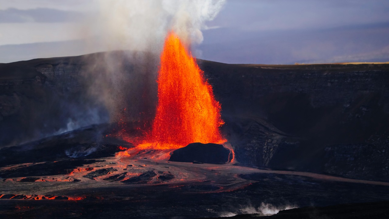
When people call Mount Rainier America’s deadliest volcano, they are not talking about lava fountains or ash columns blotting out the sun. The real danger is water and rock, locked today in glaciers and loose debris, that can be unleashed as fast moving lahars racing down river valleys where suburbs, warehouses, and highways now sit. Local planners in the Puyallup valley have long warned that a Mount Rainier eruption could send a volcanic mudflow surging toward communities at speeds of up to 50 miles per hour, a scenario that puts tens of thousands of residents and workers directly in harm’s way.
City officials in Puyallup explicitly frame their risk planning around that lahar threat, noting that a Mount Rainier eruption will place the valley at risk of catastrophe from a mudflow that can barrel downstream for dozens of miles. That local assessment dovetails with federal hazard maps that show broad swaths of low lying land, now filled with homes and logistics hubs, sitting on top of ancient lahar deposits. The “deadliest” label is less about how often Rainier erupts and more about how much modern life has been built in the wrong place if it does.
Inside the 10,834 quake swarm that grabbed the world’s attention
The recent tally of 10,834 earthquakes at Mount Rainier sounds apocalyptic, but in scientific terms it describes a swarm of mostly tiny events that instruments, not people, can feel. Earlier this year, Scientists documented the largest earthquake swarm at Mount Rainier since 2009, a cluster that stood out because of its sheer count rather than the strength of individual shocks. The U.S. Geolo based monitoring network reported that these quakes were small magnitude events, concentrated beneath the volcano, and recorded across multiple stations, a pattern that points to real seismic activity rather than instrument noise.
In coverage of this activity, Scientists emphasized that Mount Rainier in Washington typically sees only a few hundred earthquakes a year, so a jump into the five figure range is notable even if each jolt is too small to crack a window. The same reporting underscored that the swarm’s depth and character were consistent with past unrest that did not lead to an eruption, a reminder that restless volcanoes often rumble for years without crossing the line into full scale disaster.
How a humming signal turned into a viral “eruption threat”
While seismologists parsed the swarm, a different drama played out online as a strange humming pattern on public data feeds was misread as a sign that Mount Rainier was entering a dangerous tremor phase. To viewers monitoring the public data feed, the readings looked like volcanic tremor, a continuous vibration that can occur when magma or hot fluids move through cracks in rock, and screenshots of the signal spread quickly across social platforms. Within hours, posts were warning that America’s deadliest volcano was on the verge of erupting, even though the underlying instruments were never designed to be interpreted in real time by untrained eyes.
Scientists who work with the Pacific Northwest Seismic Network stepped in to explain that the apparent tremor was far more likely to be a non volcanic disturbance, such as wind buffeting a tower or ice building up on an antenna, than a sign of magma on the move. One detailed account noted that to viewers monitoring the public data feed, the pattern resembled classic tremor, but that the same period did not show the kind of small magnitude earthquakes that typically accompany real volcanic unrest at Rainier, let alone the largest earthquake swarm ever recorded there. That clarification, captured in a Nov report, underscored how easy it is for raw seismic plots to be misread once they escape the context of a lab.
Scientists debunk the alarm: what the data actually shows
As the viral posts multiplied, professional monitoring networks moved quickly to separate signal from noise. Experts with the Pacific Northwest Seismic Network and the U.S. Geological Survey stressed that there had been no increase in volcanic earthquakes beyond the already documented swarm, no ground swelling that would hint at rising magma, and no change in the official alert level for Mount Rainier. In other words, the volcano was behaving like a restless but stable system, not one on the brink of eruption, even as social media feeds filled with ominous graphics.
One detailed breakdown of the episode highlighted how the NOW PLAYING ABOVE banner on a local station’s VIDEO segment, featuring Scientists explaining the situation, became part of the effort to tamp down panic by walking viewers through the difference between real tremor and instrument glitches. That same coverage noted that an antenna covered in ice or a faulty battery can generate patterns that look dramatic on a seismogram but have nothing to do with magma or gas. The debunking, captured in a NOW PLAYING ABOVE segment, became a case study in how quickly scientists now have to respond when raw monitoring data goes viral.
Why the official alert level never changed
For people living in the shadow of Mount Rainier, the most important fact in all of this is that the official alert level stayed put. Agencies that track volcanic hazards rely on a suite of indicators, not just earthquake counts, before raising alarms, and in this case those indicators did not line up in a way that suggested escalating danger. There was no sustained increase in seismic energy, no deformation of the volcano’s surface, and no unusual gas emissions that would justify moving from background status to a higher alert.
One detailed explanation of the episode spelled it out plainly: There had been no increase in volcanic earthquakes, no ground swelling, and no change in the official alert level, even as rumors of an eruption threat spread online. That assessment, linked to a There segment featuring a Forecast from Chief Meteorologist Rai, underscored how conservative scientists are when it comes to changing formal warnings. In practice, that means residents should treat official notices, not social media chatter, as the trigger for evacuation or other drastic steps.
How often Rainier really shakes, and why this swarm stands out
To understand why the 10,834 figure drew so much attention, it helps to know what a normal year looks like at Mount Rainier. How many earthquakes does Mount Rainier see in a year? Scientists typically detect a few hundred earthquakes at or near the volcano, most of them so small that only sensitive instruments can pick them up. Against that baseline, a swarm that climbs into the thousands is a clear outlier, even if each individual quake is minor.
Reporting on the recent activity noted that the U.S. Geological Survey’s network recorded the swarm across multiple stations, which helped confirm that the signals were real seismic events rather than local noise at a single site. The same coverage explained that the pattern of small magnitude earthquakes, clustered in time and space, is consistent with fluids or gases moving through cracks in the crust, a process that can occur without leading to an eruption. A follow up analysis, captured in a How section on Mount Rainier, stressed that while the swarm was the largest since 2009, it still fit within the range of behavior scientists have seen before at this volcano.
America’s deadliest volcano, explained in one mountain
Mount Rainier’s lethal reputation is rooted in its geography and history, not in any single recent tremor. The volcano towers over western Washington, close enough to major population centers that its hazards overlap with dense development in a way that more remote peaks like Mount St. Helens do not. A detailed hazard profile notes that its last major eruption occurred centuries ago, but that the mountain has produced multiple large lahars that raced down river valleys and left thick deposits where modern towns now stand.
One recent analysis of the false alarm described how Data showing what appeared to be tremors can also be a result of wind buffering a tower, rockfall, snow sloughing, and other non volcanic processes, a reminder that not every wiggle on a seismogram signals a looming catastrophe. That same report, which framed Rainier as America’s deadliest volcano because of the number of people in harm’s way, pointed back to its last major eruption and the scale of past lahars to explain why emergency managers treat even small changes in its behavior with heightened scrutiny. The context, laid out in a Nov account, helps explain why a technical glitch on a single station can still trigger global headlines when it happens on this particular mountain.
The networks watching Rainier around the clock
Behind the scenes of every viral scare is a quiet infrastructure of sensors, servers, and scientists that track Mount Rainier in real time. The Pacific Northwest Seismic Network, often shortened to PNSN, operates a dense array of instruments around the volcano that feed into regional and national monitoring systems. Those data streams are cross checked with satellite measurements, GPS receivers, and gas sensors to build a picture of what is happening beneath the ice, from small magnitude earthquakes to subtle shifts in the ground.
Federal agencies coordinate closely with PNSN to issue formal notices when something changes at Rainier. One recent bulletin explained that up to date information will be available at both the PNSN (Pacific Northwest Seismic Network) website for Mount Rain and the U.S. Geological Survey’s observatory pages, including a dedicated update on monitoring stations that detect small magnitude earthquakes at Mount Rainier. That coordination is spelled out in a PNSN notice that directs the public to official channels rather than social media feeds when they want to know whether a swarm is routine or something more.
From “Viral eruption threat” to teachable moment
The phrase Viral eruption threat at America’s deadliest volcano Mount Rainier not accurate, PNSN says, captured both the speed of the panic and the bluntness of the scientific response. In one widely shared breakdown, Shawn Garrett reported how a misinterpreted signal spiraled into global alarm before experts could weigh in. The piece described how PNSN staff traced the apparent tremor to a likely non volcanic source, such as a faulty battery or environmental interference, and then worked with local media to explain the error in plain language.
That episode, detailed in a Viral report that name checked America, Mount Rainier, PNSN, and Shawn Garrett, has since become a kind of teachable moment for both scientists and the public. For researchers, it underscored the need to communicate quickly and clearly whenever raw data starts circulating without context. For residents, it highlighted the importance of checking official updates before assuming that a screenshot or a trending hashtag reflects real world danger.
Living, working, and traveling in Rainier’s shadow
For the more than 200,000 people who live and work in Rainier’s lahar zones, the lesson is not to ignore the volcano, but to calibrate their concern to credible information. Local emergency managers in places like Puyallup have built detailed evacuation routes, siren systems, and public education campaigns around the lahar risk, treating a future eruption as a matter of “when” rather than “if.” Those plans assume that people may have only minutes to move uphill if a lahar is triggered by an eruption or a flank collapse, which is why drills and signage are as important as any seismic graph.
Visitors, too, are part of this equation. Families planning to hike or camp near Rainier are often encouraged to use kid friendly resources that explain how volcanoes work and where to find reliable updates. One travel oriented guide points parents toward the U.S. Geological Survey’s daily eruption updates and other official tools, noting that these resources should help make the most of a volcano expedition while keeping an eye on the daily eruption updates here. That advice, embedded in a family travel piece, reflects a broader shift toward treating volcano literacy as part of basic outdoor safety in the Pacific Northwest.
How to read the next scare: practical guidance for the public
Given how quickly the last false alarm spread, it is worth sketching out a simple playbook for the next time Mount Rainier trends. First, look for confirmation that the official alert level has changed, either through the U.S. Geological Survey’s volcano updates page or local emergency management channels. If the alert level is still at background, that is a strong sign that whatever is circulating online has not yet met the threshold that scientists use to warn of escalating danger.
Second, pay attention to whether multiple lines of evidence are being cited, not just a single screenshot of a seismogram. Real unrest at Rainier would likely show up as a combination of increased earthquakes, ground deformation, and gas changes, all of which are tracked in near real time. The U.S. Geological Survey’s volcano updates summarize those indicators in plain language, making it easier for non experts to see whether a swarm is part of the volcano’s normal background or something more unusual. Finally, remember that the same networks that monitor Rainier also watch dozens of other U.S. volcanoes, and that their job is not to downplay risk but to describe it as accurately as the data allows.
Why Rainier will keep shaking, and why that matters
Even if the current swarm fades, Mount Rainier will continue to generate small earthquakes as long as it remains an active volcano. Those quakes are a reminder that heat and fluids are still moving beneath the surface, slowly altering the mountain’s plumbing in ways that scientists are still working to understand. For researchers, each swarm is a chance to refine models of how Rainier behaves, to test instruments, and to improve the algorithms that distinguish real tremor from wind, ice, or hardware glitches.
For the public, the challenge is to live with that constant low level rumble without either tuning it out or panicking at every spike. Tools like the U.S. Geological Survey’s hazard maps, the PNSN’s real time feeds, and even general mapping platforms that show the volcano’s footprint, such as the Mount Rainier place view, make it easier than ever to see where the risks lie. Combined with regular USGS updates and local planning, they offer a path to coexist with America’s deadliest volcano in a way that is informed, alert, and grounded in evidence rather than fear.
More from MorningOverview