Scientists tracking the Pacific’s most volatile margins are watching a familiar pattern sharpen into something more urgent, as clusters of earthquakes and restless volcanoes hint at shifting stresses along the planet’s most dangerous seismic belt. The Ring of Fire has always been active, but the latest signals suggest a phase of heightened unrest that is testing how well monitoring networks, coastal cities, and emergency planners can keep pace with a moving target.
I see a story emerging that is less about a single looming catastrophe and more about a long, grinding escalation of risk, in which subtle changes in magma, plates, and pressure can translate into life‑or‑death stakes for millions of people who live and work on the edge of this vast tectonic horseshoe.
Mapping a 40,000‑kilometer arc of risk
Any discussion of rising unrest has to start with the scale of the system that is stirring. The Pacific Ring of Fire is not a single fault or volcano but a sweeping tectonic boundary that wraps around the ocean basin, concentrating some of the planet’s most powerful earthquakes, tsunamis, and eruptions into a single, interconnected zone. One report describes The Pacific Ring of Fire as a roughly 40,000-kilometer belt of intense geological activity, a figure that captures both its immensity and the difficulty of managing risk across so many borders and coastlines. When scientists talk about unrest along this arc, they are not pointing to a single hotspot but to a system where pressure can be redistributed thousands of kilometers away from where it is first released.
That sheer length means the Ring touches some of the world’s most densely populated and economically critical regions, from the Pacific Northwest and Alaska to Japan, Southeast Asia, and the west coasts of Central and South America. Coastal megacities, industrial ports, and fishing communities all sit within reach of tsunamis and ground shaking generated anywhere along this 40,000-kilometer corridor, and the same tectonic forces that build volcanic arcs also underpin vital resources such as geothermal energy and mineral deposits. When I describe unrest intensifying along the Ring, I am talking about a system whose every twitch can ripple through global trade, food security, and climate, not just local disaster statistics.
Why scientists say the Ring is “going weird”
Researchers who specialize in plate tectonics are increasingly focused on how the Pacific Plate is behaving along the Ring’s North American flank, where subtle shifts in motion can have outsized consequences for coastal communities. A recent discussion of North America UPDATE framed the Pacific Plate as “Going Weird Near Ring of Fire,” a phrase that captures the unease many geophysicists feel as they parse unusual patterns in seismicity and deformation. In that context, the shorthand reference to “Scientis” reflects a broader scientific community that is trying to understand whether these anomalies signal a temporary fluctuation or a longer term reorganization of stress along the plate boundary.
From my vantage point, the most important takeaway is not that the Pacific Plate has suddenly become unpredictable, but that the data now available are fine‑grained enough to reveal behavior that older instruments would have missed. Small swarms of earthquakes, subtle changes in plate speed, and shifts in how strain accumulates along faults can all feed into the impression that the system is “going weird,” especially when they cluster in regions already primed for large events. The language may sound dramatic, yet it reflects a genuine scientific effort to map how the Ring’s tectonic gears are meshing in real time, and whether that interaction is edging key segments closer to failure.
Volcanoes lighting up the Ring’s northern arc
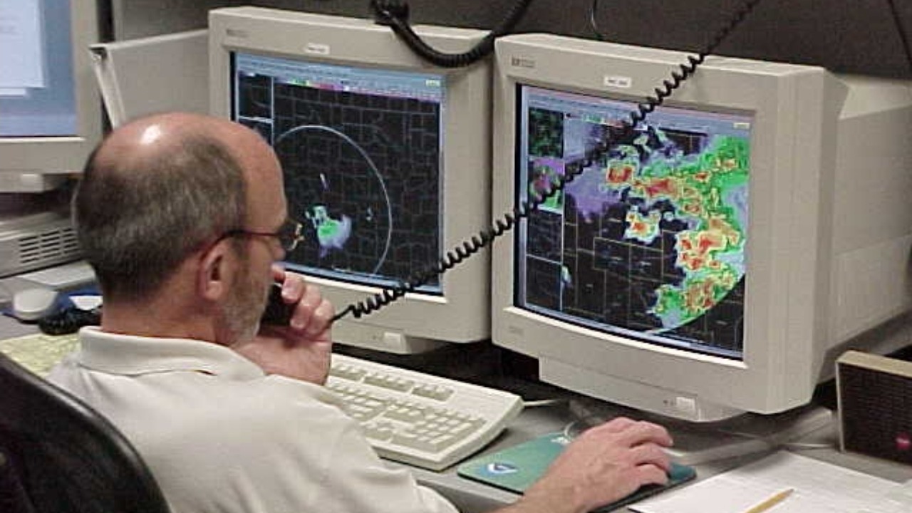
While tectonic plates grind past and beneath one another, the Ring’s most visible expression of unrest is volcanic. Along the northern arc, from the Aleutians to the Cascades, a chain of peaks is under constant watch as magma rises, cools, and occasionally breaks the surface in explosive fashion. The U.S. network that tracks these systems publishes regular volcano updates, detailing changes in seismicity, gas emissions, and deformation at dozens of sites. Those bulletins read like a running log of the Ring’s pulse, with color‑coded alert levels that can shift as new data arrive from seismometers, satellites, and gas sensors.
One of the most closely watched volcanoes in this northern chain is GREAT SITKIN, a stratovolcano identified with the code VNUM #311120, whose coordinates are listed as 52°4’35” N 176°6’39” W in official notices. A recent status report timestamped Monday, with times given in both AKST and UTC, underscores how precisely scientists track activity at this remote peak, from lava effusion to ash emissions, and how they compare current behavior with earlier episodes such as an event in May 2021. When I look at that level of detail, I see not just a single volcano under scrutiny but a template for how the entire Ring is monitored, with each restless summit feeding into a broader picture of regional unrest.
How scientists read the warning signs
Interpreting whether unrest will culminate in an eruption is one of the hardest problems in volcanology, and it is here that the Ring’s complexity becomes most apparent. Researchers rely on a suite of precursors that can hint at magma moving toward the surface, but no single signal is definitive. Official guidance highlights a set of Notable precursors, including increased seismicity, ground deformation, and changes in gas output, that can collectively raise concern. The same guidance points to Noticeable steaming or fumarolic activity and shifts in the relative abundances of fumarolic gases as key clues that magma is degassing at shallower depths.
In practice, I see scientists treating these indicators as pieces of a puzzle rather than a checklist that guarantees an outcome. A volcano might show intense seismic swarms without erupting, or it might transition from quiet to explosive with only subtle precursors, depending on the magma’s composition and the structure of the conduit. Along the Ring of Fire, where hundreds of volcanoes are active or potentially active, the challenge is to distinguish background “noise” from meaningful change, and to communicate that uncertainty to communities that need clear guidance. The emphasis on Notable and Noticeable changes reflects an effort to translate technical thresholds into language that can inform public alerts without overstating what the data can guarantee.
Why the Ring’s volatility matters for the United States
For the United States, the Ring of Fire is not a distant hazard but a defining feature of its western geography, shaping everything from Alaska’s island chains to California’s fault‑scarred valleys. Federal scientists describe how this tectonic belt poses a constant threat of earthquakes, tsunamis, and volcanic eruptions, even as it underpins vital ecosystems and energy resources. One explainer notes that, While posing a constant threat of natural disasters, the Ring is also the focus of intensive research and monitoring. That work is carried out through a Survey framework that includes the USGS, which deploys instruments and field teams to track seismic activity and volcanoes in order to enhance preparedness.
From my perspective, the key point is that the same tectonic forces that create risk also demand a sustained investment in science and infrastructure. Coastal communities in the Pacific Northwest, for example, rely on early warning systems that can detect strong shaking seconds before it arrives, while residents near Cascade volcanoes depend on hazard maps that show where lahars and ashfall are most likely. The reference to While, Survey, and USGS in that explainer is more than bureaucratic detail, it signals a recognition that managing unrest along the Ring requires coordinated, long term observation, not just emergency response when something goes wrong.
Millions living in the Ring’s shadow
The human stakes of rising unrest are starkest when you look at how many people live within reach of the Ring’s most dangerous outputs. Coastal populations across Asia, the Americas, and Oceania are exposed to tsunamis that can be triggered by undersea earthquakes or volcanic collapses, sometimes with little warning. Reporting on tsunami risk emphasizes that millions at risk live inside this deadly belt, where a single major event can displace communities, disrupt fisheries, and damage critical infrastructure. When I connect that reality to the 40,000-kilometer span of the Ring, the scale of potential impact becomes difficult to overstate.
Yet the vulnerability is not uniform. Wealthier cities may have seawalls, vertical evacuation structures, and robust communication networks, while smaller towns and rural villages often rely on local knowledge and limited resources. The same tsunami that a major port can partially absorb might devastate a low‑lying island with few escape routes. Rising unrest along the Ring, in other words, intersects with existing inequalities, amplifying risks for those who have the least capacity to adapt. When scientists warn that the Ring could trigger Earth’s next big disaster, they are implicitly pointing to this uneven landscape of exposure, where millions of lives hinge on whether early warnings, education, and infrastructure can keep pace with the hazards.
Worst‑case scenarios: when the Ring acts in concert
Most of the time, the Ring of Fire behaves as a series of loosely connected segments, each with its own rhythm of earthquakes and eruptions. But some analysts have begun to explore what might happen if multiple parts of the system were to flare up in close succession, or if a cluster of large eruptions were to inject vast amounts of ash and gas into the atmosphere. One scenario analysis notes that if something similar to past large eruptions happened along the Ring, millions of coastal residents would be in danger, and on the global scale, enough material could reach the stratosphere to block sunlight. That kind of event would not just be a regional disaster, it could alter climate patterns, disrupt agriculture, and strain international supply chains.
When I weigh those worst‑case possibilities, I see them less as predictions and more as stress tests for our preparedness systems. The reference to the Ring in that analysis underscores that the concern is not any single volcano erupting “all at once,” which is physically unlikely, but the cumulative effect of multiple hazards interacting over time. A major eruption that cools the climate slightly, for instance, could coincide with a large earthquake that damages ports and power grids, compounding the difficulty of recovery. Thinking through these layered scenarios is uncomfortable, yet it is precisely what emergency planners and scientists must do if they are to design systems resilient enough to handle the Ring’s most volatile moods.
From data to decisions: how monitoring shapes response
As unrest along the Ring of Fire intensifies in fits and starts, the gap between raw data and actionable decisions becomes a central concern. Seismometers, GPS stations, and gas sensors can generate torrents of information about how faults and volcanoes are behaving, but communities need clear, timely guidance on what that behavior means for their safety. The detailed bulletins on sites like GREAT SITKIN, with references to Monday observation times in AKST and UTC and precise coordinates such as 52°4’35” N 176°6’39” W, show how far monitoring has come in terms of precision. Yet the real test is whether that precision translates into evacuation orders, school closures, and infrastructure shutdowns that are neither too early nor too late.
In my view, the most promising developments are those that integrate scientific thresholds, such as the Notable and Noticeable precursors to eruption, into tiered alert systems that the public can understand. When agencies like the USGS and other Survey bodies issue color‑coded warnings for volcanoes or push out earthquake early alerts to smartphones, they are turning the Ring’s restless signals into practical tools. The challenge, especially as scientists describe the Pacific Plate as “Going Weird Near Ring of Fire,” is to maintain public trust in those tools even when forecasts are uncertain or when a much‑publicized episode of unrest subsides without a major event. Rising unrest does not always culminate in catastrophe, but it always offers a chance to refine how data, communication, and community preparedness fit together.
Living with a restless Ring
For people who call the Ring of Fire home, the current phase of heightened activity is a reminder that stability is often an illusion built on moving ground. Coastal residents in Alaska, Japan, Chile, and beyond live with evacuation routes etched into their daily routines, while farmers near volcanic slopes weigh the fertility of ash‑rich soils against the risk of future eruptions. The fact that scientists now track systems like GREAT SITKIN with VNUM identifiers and publish frequent status reports in AKST and UTC timeframes reflects a world in which living with the Ring means living with constant information as well as constant risk.
I see a paradox at the heart of this relationship. The more we learn about the Ring’s behavior, from the Pacific Plate “going weird” to the Notable precursors that hint at impending eruptions, the more we appreciate how much uncertainty remains. Yet that uncertainty does not negate the value of monitoring, it sharpens it. Rising unrest around the Ring of Fire is not a single headline event but an ongoing negotiation between a dynamic planet and the societies that have chosen to build on its edges. The outcome of that negotiation will depend on whether data, planning, and political will can keep pace with a tectonic system that never truly sleeps.
More from MorningOverview