The Cascadia Subduction Zone has been quiet for more than three centuries, yet its silence is exactly what alarms the scientists who study it. Along a 600 mile fault off the Pacific Northwest coast, researchers say the tectonic strain has been building toward an earthquake that could reach magnitude 9 and transform the region in a matter of minutes.
Instead of a sudden surprise, the warning is arriving in slow motion, through fieldwork, computer models, and historical sleuthing that all point to the same conclusion: the next great Cascadia rupture is inevitable, even if its timing is unknowable. I focus here on what scientists actually know, what remains uncertain, and how communities from northern California to British Columbia are trying to prepare for a disaster on a scale the modern Northwest has never experienced.
What scientists mean by a 600 mile Cascadia fault
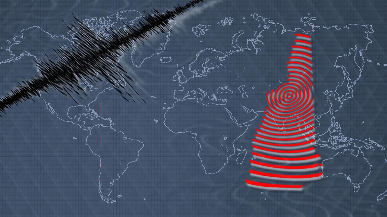
When geologists talk about the Cascadia Subduction Zone, they are describing a boundary where the Juan de Fuca Plate is sliding beneath the North American Plate along roughly 600 miles of seafloor from northern California to Vancouver Island. That length matters, because a rupture that tears along most or all of this boundary can release enough energy to produce a magnitude 9 earthquake, the kind of event that reshapes coastlines and infrastructure rather than just cracking a few buildings. Recent coverage of Cascadia has highlighted that this long, locked fault has been quiet for about 324 years, a span that matches the interval between past great earthquakes inferred from coastal geology and offshore cores, and that long silence is central to the current concern about a future magnitude 9 rupture.
In practical terms, a 600 mile fault does not behave like a single crack that fails all at once every time, and scientists emphasize that Cascadia can break in segments that produce smaller, though still damaging, earthquakes. However, the geological record shows repeated instances where the entire subduction interface appears to have slipped in one enormous event, leaving behind drowned forests, tsunami sand layers, and abrupt land level changes along the coast. That pattern, combined with modern GPS measurements that show the margin is currently locked and accumulating strain, underpins the warnings that the region is capable of a full length, magnitude 9 earthquake rather than only moderate events.
The 324 year silence and what the geologic record reveals
The idea that Cascadia has been quiet for 324 years is not a guess, it comes from a combination of tree ring analysis, coastal stratigraphy, and offshore sediment cores that together point to a major earthquake in the early eighteenth century. Along tidal estuaries in Washington and Oregon, scientists have mapped “ghost forests” where stands of trees died abruptly after the ground dropped and saltwater flooded their roots, and the final growth rings in those trees line up with tsunami deposits that date to the same period. Offshore, cores pulled from submarine canyons show thick layers of disturbed sediment that match the timing of this event, reinforcing the conclusion that a very large earthquake shook the entire margin rather than a local tremor.
Researchers involved in the regional M9 Project have used these clues to reconstruct a history of great Cascadia earthquakes stretching back thousands of years, identifying a series of large events that recur on timescales of centuries rather than decades. Their work shows that the last full margin rupture occurred in the winter of 1700, when a tsunami generated off the Pacific Northwest coast was recorded in Japan without any local shaking, a mystery that only made sense once scientists connected it to Cascadia. That synthesis, laid out in detail in the project’s historical overview of large earthquakes in Cascadia, is why the current 324 year interval is treated as a meaningful benchmark rather than a random number.
How a Cascadia megaquake would actually unfold
When seismologists model a magnitude 9 Cascadia event, they are not imagining a single jolt but a rupture that could last several minutes as the fault unzips from south to north or in the opposite direction. In those simulations, strong shaking spreads inland across western Washington, Oregon, and northern California, with coastal communities experiencing the most intense motion and the greatest ground deformation. The long duration of shaking is especially damaging for tall buildings, bridges, and port facilities, which can resonate with the seismic waves and suffer cumulative stress even if they survive the first few seconds.
Public facing explainers on the Cascadia Subduction Zone emphasize that the shaking is only the first phase of the disaster, because a full margin rupture would also displace the seafloor and send a tsunami racing toward shore. Educational guides that walk through “what to know” about a Cascadia megaquake describe how low lying coastal towns could see their first tsunami waves within minutes, leaving little time for evacuation once the shaking stops. Those guides, which synthesize seismology, tsunami modeling, and emergency planning, have become a key reference for residents trying to understand the cascading hazards associated with a Cascadia Subduction Zone megaquake.
Tsunami risk for Seattle, Portland, and coastal communities
The most dramatic images in Cascadia risk assessments come from tsunami models that show waves sweeping into harbors, river mouths, and low lying neighborhoods along the Pacific Northwest coast. While Seattle and Portland sit inland, new research has raised alarms about how a single large earthquake offshore could still send powerful waves into connected waterways and overwhelm protective infrastructure. Analysts have described scenarios in which tsunami surges reach major population centers within minutes, threatening port facilities, industrial zones, and vulnerable residential areas that were never designed with a magnitude 9 Cascadia event in mind.
Reporting on these models has framed the risk in stark terms, asking whether one offshore rupture could effectively drown parts of Seattle and Portland before emergency responders have time to react. The studies behind that coverage use detailed bathymetric data and high resolution simulations to estimate wave heights, arrival times, and inundation depths for different Cascadia rupture patterns, and they consistently show that even partial failures of the subduction zone can generate dangerous tsunamis. That is why regional planners now treat a Cascadia earthquake as a “mega tsunami” scenario for the Pacific Northwest, a framing reflected in recent analysis of whether a single earthquake could drown Seattle and Portland in a matter of minutes.
Inside the M9 Project and what it tells me about Cascadia
When I look at the scientific work behind the Cascadia warnings, the M9 Project stands out as a comprehensive effort to translate geologic history into practical risk estimates for the modern Northwest. Rather than treating the 1700 event as a one off catastrophe, the project’s researchers have compiled a sequence of great earthquakes over the last several thousand years, each identified through coastal subsidence records, tsunami deposits, and offshore turbidites. That catalog shows that Cascadia has produced multiple full margin ruptures comparable to a magnitude 9, as well as smaller events that broke only part of the fault, and it uses that pattern to estimate how often different sized earthquakes are likely to occur.
For policymakers and engineers, the value of this work lies in its ability to turn abstract probabilities into design targets for buildings, bridges, and lifeline infrastructure. By combining historical recurrence intervals with modern ground motion models, the M9 Project provides shaking scenarios that utilities can use to harden power grids, that transportation agencies can use to prioritize retrofits, and that emergency managers can use to plan for long term disruptions. The project’s detailed history of large Cascadia earthquakes has also become a touchstone for public outreach, helping residents understand that the risk is not hypothetical but rooted in a well documented geologic past.
How experts communicate the threat to the public
Scientific warnings only matter if people hear and trust them, so a significant part of Cascadia preparedness has focused on communication, from classroom lessons to community meetings and online videos. Seismologists and emergency planners have increasingly turned to visual storytelling to explain how a subduction zone works, why long intervals of quiet are not reassuring, and what individuals can do to prepare. In one widely shared presentation, a researcher walks viewers through the mechanics of a Cascadia rupture, the expected shaking patterns, and the tsunami timelines, using maps and animations to make complex models understandable to non specialists.
As I watch these efforts, what stands out is the balance between urgency and practicality, with experts trying to convey the scale of a magnitude 9 event without tipping into fatalism. They emphasize simple, actionable steps like securing heavy furniture, storing water, and knowing evacuation routes, while also pressing for systemic investments in schools, hospitals, and transportation networks. A detailed video explanation of the Cascadia Subduction Zone threat illustrates this approach, pairing sobering maps of inundation zones with clear guidance on how coastal residents can move to higher ground in the narrow window between shaking and the first tsunami waves.
Sorting science from speculation and fringe claims
Whenever a natural hazard captures public attention, it attracts not only rigorous research but also speculation, rumors, and outright misinformation, and Cascadia is no exception. Alongside peer reviewed studies and official risk assessments, there are online posts that mix scientific terms with unverified predictions, claims of secret government knowledge, or precise dates for the “next big one” that are not supported by any seismological evidence. For readers trying to understand their real risk, this noise can blur the line between what scientists actually know and what is simply conjecture.
I find it useful to compare such fringe narratives with the cautious language used by seismologists, who consistently stress that while a great Cascadia earthquake is inevitable over long timescales, its exact timing cannot be forecast. Posts that present detailed countdowns or tie the fault’s behavior to unrelated political or astronomical events are not grounded in the observational record or in established tectonic theory. One example of this contrast appears in a discussion thread that blends Cascadia concerns with broader conspiracy themes, a style of commentary typified by material shared on alternative forums that do not adhere to scientific standards of evidence.
Why precise language and data matter in earthquake communication
Clear communication about Cascadia depends not only on accurate science but also on the words and data used to describe it, because vague phrases can either understate the danger or inflate it beyond what the evidence supports. In technical settings, seismologists rely on carefully curated vocabularies and symbol lists to ensure that terms like “locked zone,” “recurrence interval,” and “peak ground acceleration” have consistent meanings across studies and hazard maps. That same discipline is valuable in public facing explanations, where using precise, well defined language helps people distinguish between a magnitude 7 crustal quake and a magnitude 9 subduction event, or between a local landslide risk and a basin wide tsunami threat.
Behind the scenes, many of the tools that process seismic data or generate automated alerts depend on structured wordlists and symbol tables that map technical concepts to machine readable formats. These resources, which can look like long lists of tokens and codes, are part of how modern systems turn raw sensor readings into intelligible warnings and reports. A representative example of such a resource is a compiled wordlist of symbols used in speech recognition, which illustrates the kind of structured vocabulary that underpins many automated communication tools, including those that might one day help deliver real time Cascadia alerts.
How modern language tools shape public understanding of Cascadia
As more people learn about Cascadia through search engines, social media, and AI driven summaries, the way language models handle scientific terms becomes part of the risk communication ecosystem. These systems are trained on large vocabularies that include technical words like “subduction,” “turbidite,” and “liquefaction,” and their ability to use those terms correctly can influence whether automated explanations clarify or confuse. When I see a concise, accurate description of a magnitude 9 Cascadia scenario generated on demand, I am effectively seeing the imprint of those training vocabularies and the underlying corpora that taught the model how experts talk about earthquakes.
The training materials for such models often include specialized token lists and frequency tables that help them prioritize common words while still recognizing rare but important scientific terms. For example, a machine learning vocabulary file used to train a character level language model can contain thousands of entries that encode how text is broken down and reassembled, a structure reflected in resources like a downloadable machine learning vocabulary. Complementing that, frequency statistics derived from large text collections, such as a table of Wikipedia document frequencies, guide models toward the terms that appear most often in reliable sources, which can include detailed entries on the Cascadia Subduction Zone and related hazards.
Why Cascadia’s warning window is both long and limited
One of the paradoxes of Cascadia is that the region has had centuries of quiet to prepare for a catastrophe that could arrive without more than a few minutes of immediate warning. On the long timescale, the 324 years since the last great earthquake have given scientists time to reconstruct the fault’s history, refine tsunami models, and push for building code upgrades and emergency drills. On the short timescale, however, the physical signals that precede a rupture are subtle and unreliable, and current technology cannot predict the exact day or year when the locked zone will finally fail, only provide seconds to tens of seconds of alert once the fault actually starts to slip.
That tension shapes how I think about Cascadia risk: the science is clear that a magnitude 9 scale event is part of the region’s geologic rhythm, but the practical challenge is turning that knowledge into sustained investment and personal preparedness before the next rupture. Early warning systems, vertical evacuation structures on the coast, and resilient lifelines for water, power, and transportation are all responses that treat the Cascadia Subduction Zone as a known, if unscheduled, threat. The detailed reconstructions of past earthquakes, the public education campaigns, and even the technical vocabularies that support automated alerts are all pieces of the same effort to use the long warning window wisely, because once the fault finally breaks, the time for preparation will be measured in heartbeats rather than in years.
More from MorningOverview