California’s new methane-hunting satellite has already exposed 10 of the state’s largest recent leaks, turning abstract climate pledges into concrete, measurable cuts in a matter of months. At the same time, the program is emerging just as federal climate monitoring capacity is eroding, leaving a single state to shoulder work that once depended on national infrastructure.
By pairing space-based detection with rapid on-the-ground response, California is testing whether a regional government can meaningfully police a global-warming gas that is far more potent than carbon dioxide over the short term. I see the early results as a proof of concept for climate accountability, but also as a warning about what happens when federal tracking systems falter.
California’s methane satellite steps into a federal vacuum
California’s decision to launch its own methane satellite is not just a flashy tech story, it is a direct response to a widening gap in federal climate surveillance. As national monitoring programs have been scaled back or left in limbo, the state has moved to build its own orbital watchdog so it can see, in near real time, where methane is pouring into the atmosphere. That shift has already produced a list of 10 major leaks that would have been difficult to pinpoint quickly with older, patchwork systems, according to state climate officials who describe the satellite as central to a new leak-response strategy anchored in high resolution data from space.
The stakes of that move are underscored by reporting that the satellite uncovered 10 large California plumes just as federal climate monitoring capacity has begun to crumble, a trend that has left regulators with fewer nationwide tools to track super-emitting sites and verify industry claims about emissions cuts. One detailed account of the program notes that the state’s satellite was able to identify these 10 major leaks even as national systems were weakened, highlighting how California is trying to fill a gap in federal climate monitoring that once would have been unthinkable for a single state to shoulder.
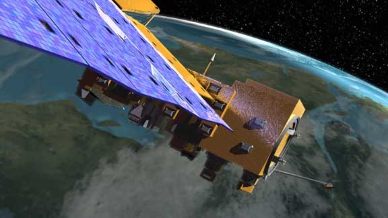
Ten big leaks, one small spacecraft
The core achievement so far is stark: a single satellite has already helped stop 10 large methane leaks across California, each one a concentrated burst of a greenhouse gas that traps far more heat than carbon dioxide over a couple of decades. State air regulators describe how the spacecraft’s measurements are fed into a rapid-response pipeline that flags unusually intense plumes, triggers outreach to the operators responsible for the infrastructure on the ground, and then confirms whether the leak has been fixed. In practice, that means the satellite is not just a scientific instrument but the first step in an enforcement workflow that can translate pixels into repaired valves, capped wells, or altered operating practices.
California’s Air Resources Board has framed those 10 stopped leaks as an early demonstration of how targeted methane cuts can deliver outsized climate benefits, especially when regulators can see specific facilities rather than relying on broad estimates. Officials say the satellite’s detections have already led to concrete mitigation actions at sites that were previously invisible to routine inspections, a claim backed up by the board’s own description of how the spacecraft has helped halt 10 large leaks that might otherwise have continued venting into the atmosphere for far longer.
From orbit to Yolo County: how detection turns into action
The satellite’s value becomes clearest when you follow a single leak from detection to repair, and one of the most vivid examples comes from Yolo County. Earlier this year, the spacecraft spotted a concentrated methane plume over an agricultural area, a signal strong enough to stand out from background emissions and trigger a closer look by state analysts. That orbital alert led investigators to a specific site on the ground, where they were able to confirm the leak and work with the operator to stop it, turning what could have been a long-running source of pollution into a short-lived incident.
Local coverage of the Yolo County case has described how the satellite’s data gave regulators a precise map of the plume, allowing them to narrow down the likely source and move quickly instead of waiting for complaints or chance inspections. The story of that single leak illustrates how a high-tech sensor in orbit can translate into very practical, local action, with one report detailing how the state’s new satellite system flagged a methane leak in Yolo County that might otherwise have gone unnoticed in a rural landscape dotted with farms and energy infrastructure.
Inside California’s methane-tracking playbook
Behind the headlines, the satellite is part of a broader strategy that treats methane as a fast-acting lever on climate risk, and the state has been unusually explicit about how it intends to use the new data. Officials describe a system in which orbital measurements are cross-checked with ground-based instruments, then fed into regulatory programs that can compel operators to fix leaks or face penalties. I see that as a shift from relying on self-reported emissions inventories to building an independent, observational record that can confirm or challenge what companies say they are emitting.
Technical briefings on the project emphasize that the satellite is designed to spot concentrated plumes from sources like landfills, oil and gas facilities, and large agricultural operations, then hand those coordinates to agencies that already have authority to act. That integration is what turns a science mission into a regulatory tool, and it is why state leaders have been eager to showcase the satellite as a cornerstone of their methane policy. One overview of the program explains how California has built a dedicated data pipeline and response framework around its new spacecraft, describing a system that uses orbital measurements to track methane gas leaks and then route that information to the agencies best positioned to intervene.
Governor’s office leans into climate contrast with Washington
Politically, the satellite has become a symbol of California’s decision to move ahead on climate policy even as the federal government under President Donald Trump has pulled back from science-driven monitoring. Governor Gavin Newsom’s office has framed the methane program as part of a broader effort to keep cutting emissions while Washington retreats, casting the satellite as both a practical tool and a statement about the state’s willingness to invest in data when national systems are undercut. That framing is not subtle, and it reflects a long-running tension between California’s climate ambitions and a White House that has often questioned or sidelined environmental science.
The governor’s team has been explicit about that contrast in official communications, highlighting how the state is using its own resources to track and cut methane even as the Trump administration scales back federal climate monitoring and research. In a recent statement, the Governor’s Office described how California is moving ahead with major methane reductions while the president “turns his back on science,” tying the satellite’s early success in stopping large leaks to a broader narrative about state-level leadership. That message is laid out in detail in an official update that describes how California has cut major methane leaks with its new satellite program while President Trump has turned his back on science, underscoring the political stakes around what might otherwise look like a purely technical project.
Public messaging, social media, and a new kind of climate bragging right
California’s leaders are not shy about promoting the satellite as a climate success story, and they have turned to social media to translate a complex monitoring system into a simple narrative: a state-built spacecraft is finding and stopping big methane leaks. Governor Newsom’s office has used platforms like Facebook to highlight the number of leaks detected and the speed with which they were addressed, presenting the satellite as proof that climate policy can be both high tech and highly practical. I see that messaging as an attempt to make emissions reductions feel tangible, with each leak fixed serving as a discrete, countable win rather than an abstract percentage in a long-term plan.
Those posts have emphasized that the satellite was launched earlier this year and has already delivered measurable results, with the governor’s team describing how California’s own orbital system is now catching major methane plumes that might otherwise have slipped through the cracks. One widely shared update from the Governor’s Office notes that since launching its methane-tracking satellite earlier this year, California has already used it to identify and stop large leaks, a claim laid out in a detailed social media update that turns the satellite’s technical achievements into a straightforward climate talking point.
How the satellite was built and why agriculture is watching
The satellite did not appear out of nowhere, and the path to orbit runs through years of planning that brought together state agencies, technical partners, and sectors that will be directly affected by more precise methane tracking. Early coverage of the project described how California was working with specialized space and data firms to design a spacecraft capable of spotting relatively small plumes from orbit, then integrating that data into existing regulatory systems. That planning phase also involved outreach to industries that are major methane sources, including oil and gas operators and large-scale agriculture, which now face a future in which their emissions can be seen from space rather than inferred from models.
For agriculture in particular, the satellite represents both a risk and an opportunity, since it can highlight leaks from manure management systems, digesters, and other infrastructure that might otherwise escape notice. Industry-focused reporting has noted that California’s launch of a methane-detecting satellite is being closely watched by livestock and dairy operators, who are under growing pressure to cut emissions but also stand to benefit if better data helps them target the most cost-effective fixes. One agribusiness outlet has detailed how the state’s new satellite project is designed to detect methane leaks from a range of sources, including agricultural operations, describing how California has launched a dedicated satellite project to detect methane leaks that will inevitably reshape how farms and feedlots think about their climate footprint.
Citizen scrutiny and climate community reaction
Outside official channels, the satellite has sparked intense interest among climate advocates and technically minded observers who see it as a test case for how transparent emissions data can change behavior. Online discussions have zeroed in on the fact that the spacecraft has already helped stop 10 large leaks, treating that figure as both a milestone and a baseline for what similar systems could achieve if adopted more widely. I read those reactions as a sign that the climate community is hungry for tools that move beyond pledges and into verifiable, facility-level accountability.
Some of the most detailed public conversations about the program have unfolded in climate-focused forums where users dissect the satellite’s capabilities, debate how quickly leaks are being fixed after detection, and ask whether other states or countries will follow California’s lead. In one such discussion, participants highlighted the state’s claim that its methane satellite has already helped stop 10 large leaks, using that number to argue that targeted monitoring can deliver rapid climate benefits if regulators are willing to act on the data. That debate is captured in a widely shared online climate thread that treats the satellite as both a promising model and a case study in how much more remains to be done.
Video briefings and technical transparency
California has also leaned on video briefings to explain how the satellite works, a choice that reflects both the complexity of the technology and the desire to build public trust in the data it produces. In these presentations, state officials and technical partners walk through how the spacecraft’s sensors detect methane, how analysts distinguish real leaks from noise, and how that information is turned into actionable reports for regulators and operators. I see that level of technical transparency as crucial, because the satellite’s credibility depends on convincing both industry and the public that its measurements are accurate enough to support enforcement and investment decisions.
One widely circulated video segment breaks down the satellite’s role in California’s broader climate strategy, using animations and real imagery to show how methane plumes appear from orbit and how quickly they can be traced back to specific facilities. The presentation underscores that the satellite is designed to complement, not replace, ground-based inspections, and that its greatest strength lies in its ability to scan large areas repeatedly and flag anomalies. That explanation is laid out in a detailed video briefing that walks viewers through the satellite’s detection process and the steps that follow once a significant plume is identified.
What comes next as tracking scales up and Washington steps back
The early success in finding and stopping 10 large leaks raises an obvious question: what happens as California scales up this kind of monitoring while federal systems continue to erode? If the state keeps investing in orbital and ground-based tools, it could end up with one of the most detailed methane maps in the world, giving regulators unprecedented leverage over high-emitting facilities. At the same time, the lack of a robust national framework means those gains will be uneven, with Californians benefiting from tighter oversight while communities in other states remain in the dark about nearby super-emitters.
State leaders appear intent on pushing ahead regardless, and they have used platforms like X to signal that the satellite is only the beginning of a broader push to track and cut methane with hard data. In one recent post, the Governor’s Office highlighted the satellite’s role in identifying major leaks and framed it as part of a larger effort to hold polluters accountable using independent measurements rather than self-reported figures. That message, shared in a prominent social media post, suggests that California will continue to expand its methane-tracking infrastructure even if Washington remains on a different trajectory, leaving a single state to pioneer a model of climate accountability that others may eventually feel compelled to follow.
More from MorningOverview