AI-driven mapping now captures daily global land changes, enabling unprecedented monitoring of Earth’s surface transformations on a daily basis. This advancement unlocks real-time global land cover mapping through the fusion of satellite and ground camera data, providing detailed insights into land use and environmental shifts worldwide. The integration of these technologies marks a significant leap forward in our ability to observe and respond to changes in the Earth’s landscape.
Advancements in AI-Driven Land Mapping
The core innovation of AI-driven mapping lies in its ability to process vast datasets for timely detection of alterations such as deforestation or urban expansion. By leveraging sophisticated machine learning algorithms, this technology represents a shift from periodic to continuous monitoring, allowing for more immediate and accurate assessments of land surface changes. According to Phys.org, these algorithms are capable of analyzing complex patterns in global-scale imagery, identifying even subtle land changes that might otherwise go unnoticed.
Machine learning plays a crucial role in this process, enabling the system to learn from historical data and improve its accuracy over time. This capability is particularly valuable in detecting gradual changes, such as the slow encroachment of urban areas into rural landscapes or the incremental loss of forest cover. The ability to monitor these changes on a daily basis provides stakeholders with the information needed to make informed decisions about land management and conservation efforts.
Examples of AI’s pattern recognition capabilities include its application in identifying shifts in vegetation patterns, which can indicate broader environmental changes. By analyzing satellite imagery, AI can detect variations in plant health and distribution, offering insights into the impacts of climate change and human activity on ecosystems. This level of detail is essential for developing effective strategies to mitigate environmental degradation and promote sustainable land use practices.
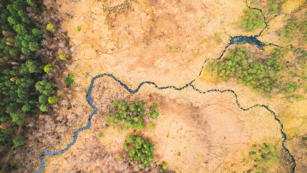
Fusion of Satellite and Ground Data Sources
The integration of satellite imagery with ground camera feeds is a key component of real-time global land cover mapping. This approach ensures higher accuracy by combining the broad perspective of satellites with the detailed, localized views provided by ground cameras. As reported by Token Ring, this fusion of data sources allows for a more comprehensive analysis of land cover, enhancing the reliability of the information gathered.
The technical process of data fusion involves synchronizing high-resolution satellite views with localized ground camera inputs. AI algorithms play a pivotal role in this synchronization, aligning the diverse data streams to create a cohesive picture of the land surface. This method not only improves the accuracy of land cover mapping but also enables the detection of changes that might be missed by relying on a single data source.
However, challenges remain in aligning these diverse data streams, such as dealing with varying resolutions or weather interference. AI mitigates these issues by employing advanced techniques to harmonize the data, ensuring that the final output is both accurate and actionable. This capability is crucial for applications that require precise and timely information, such as disaster response and environmental monitoring.
Applications for Daily Land Change Detection
Daily land change detection has numerous applications in environmental monitoring, urban planning, and disaster response. By tracking global land changes on a daily basis, AI-driven mapping provides valuable data for climate impact assessments. For instance, it can monitor seasonal vegetation shifts, offering insights into how climate change affects plant growth and distribution. This information is vital for developing strategies to adapt to changing environmental conditions and mitigate the impacts of climate change.
In urban planning, real-time mapping from fused data helps detect infrastructure developments or illegal land encroachments promptly. This capability allows city planners and policymakers to respond quickly to unauthorized activities, ensuring that urban growth is managed sustainably. The ability to monitor land use changes in real time also supports the development of more efficient transportation networks and public services, enhancing the quality of life for urban residents.
Disaster response is another area where AI-driven mapping offers significant benefits. By capturing immediate land alterations from events like floods or wildfires, AI provides emergency responders with the information needed to assess damage and allocate resources effectively. This capability is particularly valuable in regions prone to natural disasters, where timely and accurate information can save lives and reduce economic losses.
Implications for Global Environmental Policy
The ability to capture daily global land changes has profound implications for global environmental policy. By providing verifiable data on land use, AI-driven mapping can inform international treaties and agreements on sustainability. This data is essential for tracking progress toward environmental goals and holding countries accountable for their commitments. As noted by Phys.org, the insights gained from this technology can support efforts to promote sustainable land management practices worldwide.
Real-time land cover mapping also plays a crucial role in supporting biodiversity conservation efforts. By precisely tracking habitat losses through satellite-ground fusion, conservationists can identify areas at risk and prioritize interventions to protect endangered species. This capability is vital for maintaining the planet’s biodiversity and ensuring the health of ecosystems that provide essential services to humanity.
Beyond conservation, AI-driven insights into daily land dynamics have broader impacts on agriculture and resource management. By providing detailed information on land use changes, this technology enables proactive decision-making in areas such as crop management and water resource allocation. These insights are critical for ensuring food security and sustainable resource use in a rapidly changing world.